Rain, gusty winds, flood risk as what’s left of Ian arrives in DC region

High tide at the Chesapeake Bay

The D.C. area is starting to feel the impact of Ian, now a post-tropical cyclone, with rain and increasing winds being reported in the region. Here’s what you need to know.

  • Maryland Gov. Larry Hogan has activated an emergency management team, with the state  preparing for possible impact.
  • Virginia Gov. Glenn Youngkin declared a state of emergency, which allows the state to mobilize resources and equipment.
  • The D.C. area can expect steady rain though early Saturday morning.
  • Showers continue this weekend, bringing potential flooding and high winds.


Friday showers, gusty winds

In Maryland, Hogan said Friday that the state was “preparing on all fronts to deal with the remnants of the storm. As we always emphasize with potential flooding events, it is critical for drivers to avoid rising waters—‘turn around, don’t drown.’ We advise Marylanders to watch the forecast closely throughout the weekend and heed local warnings.”

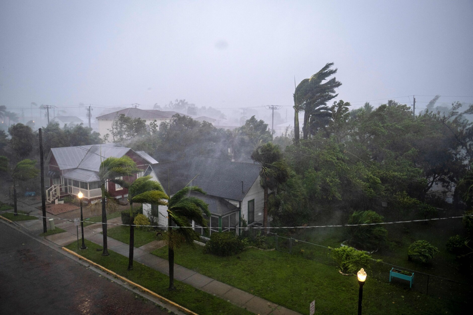
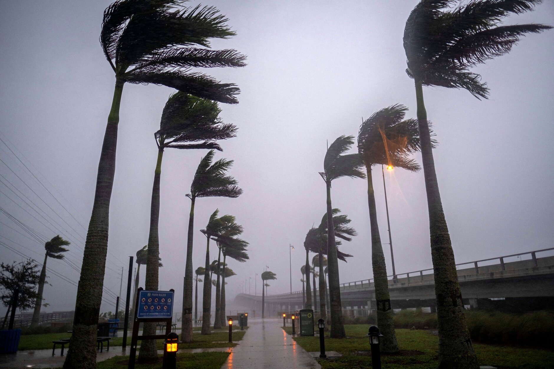
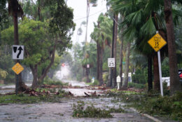
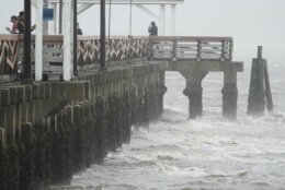
The first round of light to moderate rain arrived in the area late Friday afternoon. However, heavy will deluge the area through 5 a.m. Saturday, bringing with it winds between 15 to 20 mph and gusts of up to 35 mph.

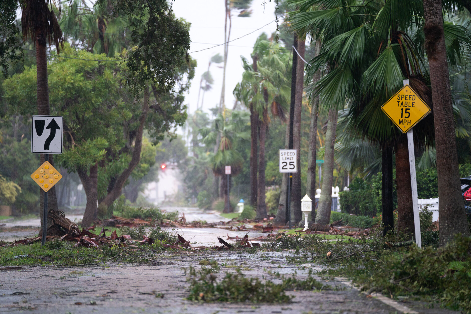
It will be enough to saturate the soil overnight, which might cause some sporadic tree damage.

The region could see light to moderate rain become heavy downpours over night, said Storm Team4 meteorologist Chad Merrill.

“The best risk for an isolated tornado, as is typical east of a tropical system’s circulation, will occur southeast of D.C. in southern Maryland overnight,” Merrill said. “Winds will increase out of the east and after the soil gets closer to saturation early Saturday, a few trees with weak root systems (mainly older, weaker trees) could collapse onto roadways.”

Wind gusts of about 35-40 mph are expected, with even stronger winds in Southern Maryland and along the Blue Ridge. People in those areas should prepare for possible power outages.

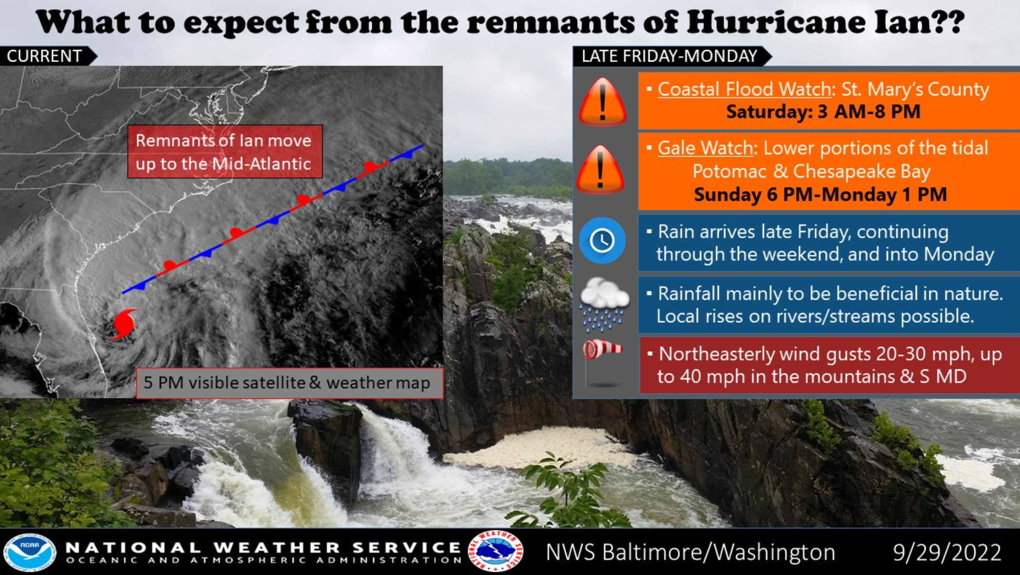
Calvert and St. Mary’s counties, in Southern Maryland, have issued wind advisories through 4 a.m. Saturday.

Saturday: More rain

On Saturday, Ian’s center is expected to move into West Virginia and stall.

Heavy rain may be seen Friday night into Saturday morning with a break in the afternoon.

“This means a prolonged period of rain will continue through Monday,” Merrill said. “The rain will be heaviest overnight and again on Sunday when isolated flash flooding could occur. The persistent easterly wind through the weekend will put those vulnerable spots along the Chesapeake Bay’s western coastline and the Lower Potomac at risk for flooding. The strongest winds will occur in southern Maryland where gusts could top 50 mph and on the Blue Ridge where gusts will reach 40 mph overnight.”

Overall, about 2 to 3 inches of rain are expected through Monday.

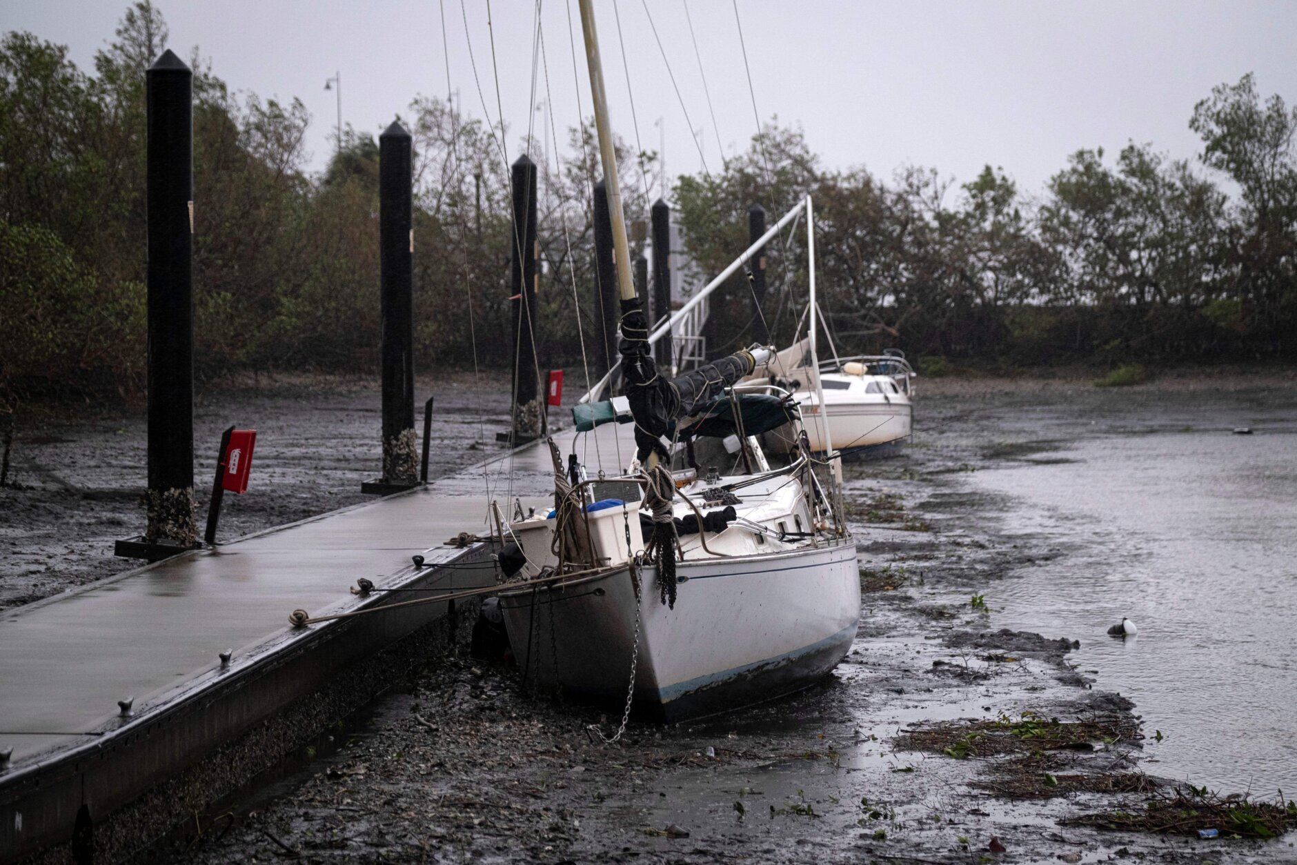
“While regionwide Flood Watches have not yet been issued, in this particular scenario, there is a good chance for minor river, creek and stream flooding late Sunday into Monday as the runoff takes time to empty into the river basins and trigger rising levels,” Merrill said. “Also note, the persistent easterly flow at the Mid-Atlantic beaches will produce flooding and coastal erosion this weekend.”

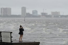
Worcester County, Maryland, which is home to Ocean City, is under a Tropical Storm Warning, according to the Maryland Department of Emergency Management.

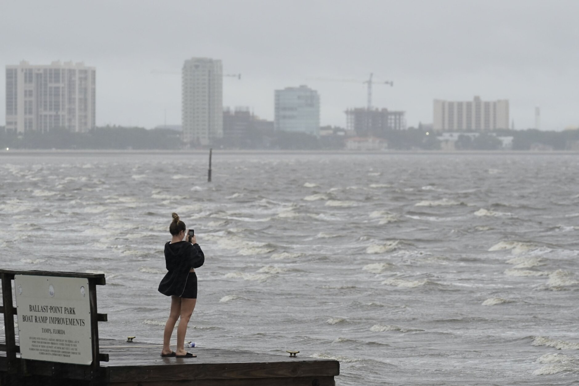
On Friday afternoon, a coastal flood watch went into effect for St. Mary’s County, and a gale watch is in effect for lower portions of the tidal Potomac and Chesapeake Bay.

Officials in Calvert County in Southern Maryland handed out sand and sandbags to county residents who needed them to prepare for possible flooding.

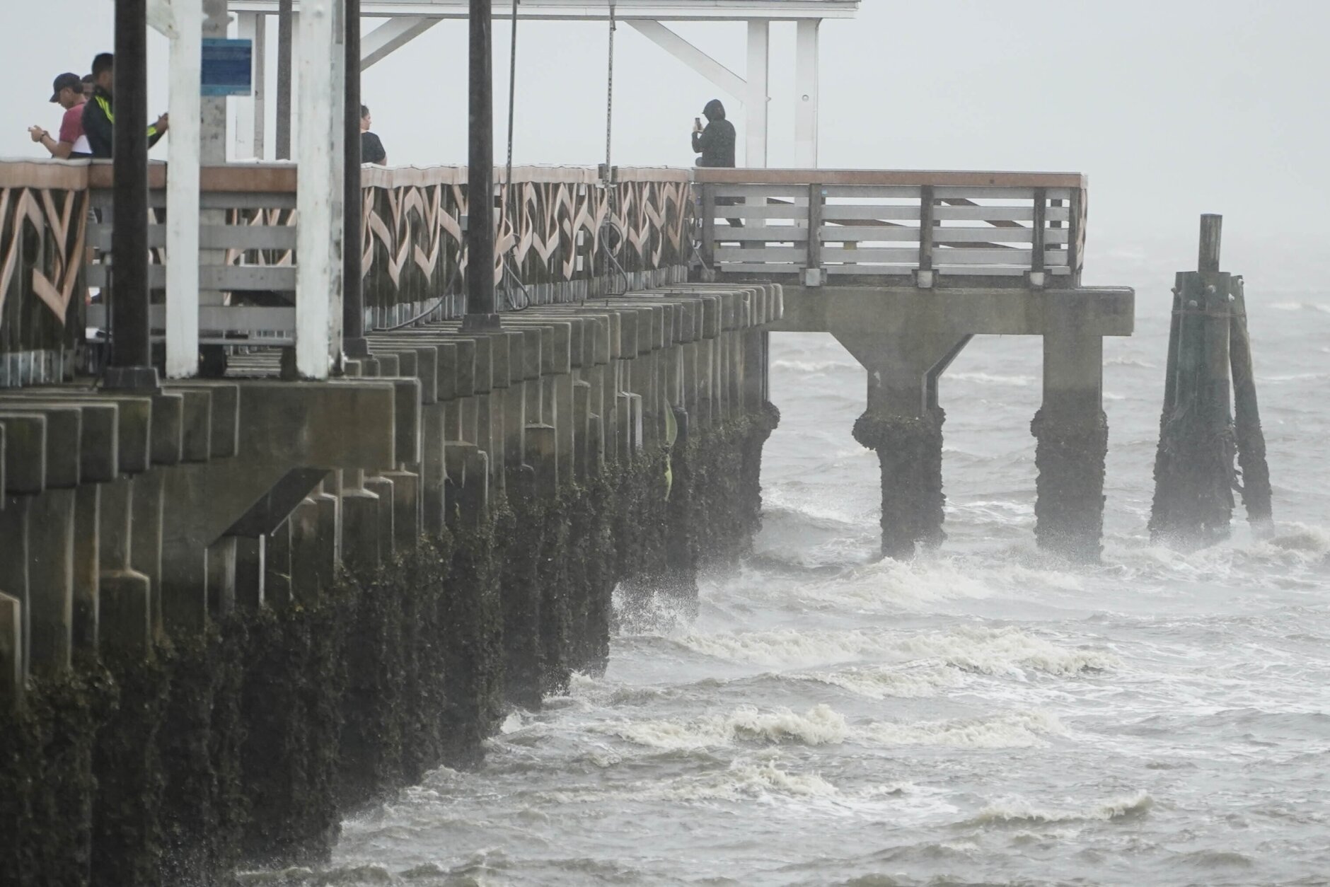
In D.C. a coastal flood advisory is in through 3 p.m. Saturday, with some flooding possible near the Tidal Basin and Jefferson Memorial.

Rain showers coming from the south will move north throughout the day, the National Weather Service reported.

Road crews in both Maryland and Virginia inspected and cleared drainage ditches to prepare for the storm.

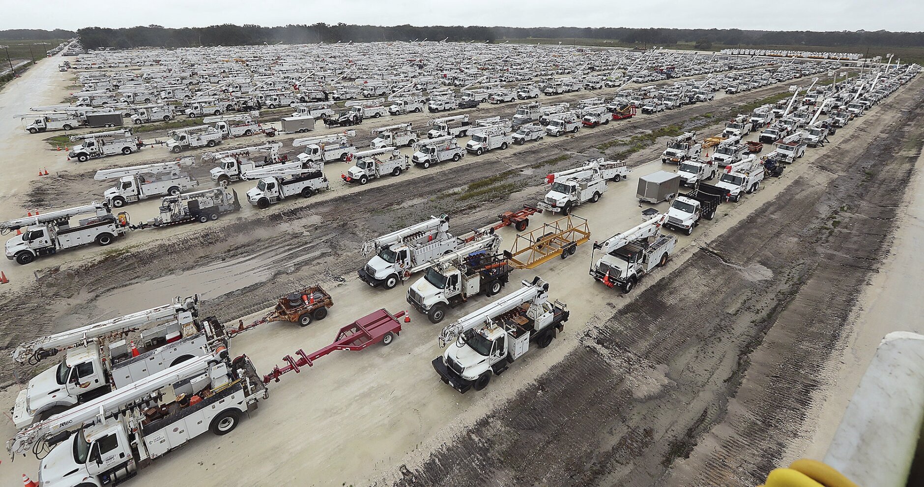
Representatives for Dominion Energy and Pepco said the power companies are preparing possible power outages.

“Dominion energy is preparing for strong gusty winds and the potential for power outages in central, eastern and southside Virginia later this evening and into early Saturday morning . We have more than 400 bucket trucks in position across all three regions. Our crews are prepared to work around the clock to restore any customer outages. We also have crews remaining in Northern Virginia to respond as needed.”

(Courtesy National Weather Service)

State of emergency in Virginia; canceled events in the DC area

Virginia Gov. Glenn Youngkin already declared a state of emergency in anticipation of possible effects from the storm.

“We want to ensure that our communities have the resources needed to respond to and recover from any potential effects from the storm,” Youngkin said.

“We’re planning for rainfall projections anywhere from about 2 to more than 6 inches,” said Lauren Opett, spokeswoman with the Virginia Department of Emergency Management.

The southern, central and eastern portions of the state are expected to get hit the hardest.

“It’s important to note that even when the storm exits, higher-than-normal tides could continue until Tuesday,” Opett said.

The expected severe weather has led to cancellations or postponements of events scheduled to take place through the weekend.

Forecast

The rain from the remnants of Ian may persist into Monday night or Tuesday.

  • Friday Night: Rainy and windy. Rain heavy at times. Lows 55 to 60.
  • Saturday: Rain. Windy. Rain moderate at times. Highs low to mid-60s.
  • Sunday: Some showers. Breezy. Highs mid to upper 60s.
  • Monday: Becoming partly sunny. Highs in the low to mid-60s.
  • Tuesday: Morning shower then partly sunny. Highs in the low to mid-60s.

Current Weather

WTOP’s Hugh Garbrick contributed to this report.

Abigail Constantino

Abigail Constantino started her journalism career writing for a local newspaper in Fairfax County, Virginia. She is a graduate of American University and The George Washington University.

Jack Moore

Jack Moore joined WTOP.com as a digital writer/editor in July 2016. Previous to his current role, he covered federal government management and technology as the news editor at Nextgov.com, part of Government Executive Media Group.

An Estero Island resident carries empty jerrycans as he walks to get off the island in search of gas, two days after the passage of Hurricane Ian, in Fort Myers Beach, Fla., Friday, Sept. 30, 2022. (AP Photo/Rebecca Blackwell)
Eduardo Tocuya carries a dog he recovered in hopes of reuniting it with its owners, two days after the passage of Hurricane Ian, in Fort Myers Beach, Fla., Friday, Sept. 30, 2022. (AP Photo/Rebecca Blackwell)
Police officers direct the traffic during a power outage after Hurricane Ian passed through the central Florida on September 29, 2022 in Bartow, Florida. The hurricane brought high winds, storm surge and rain to the area causing severe damage. (Photo by Gerardo Mora/Getty Images)
People clear a large tree off their home after Hurricane Ian passed through on September 29, 2022 in Fort Myers, Florida. The hurricane brought high winds, storm surge and rain to the area causing severe damage. (Photo by Joe Raedle/Getty Images)
A man looks at his cellphone while drives a motorcycle through a flooded area after being hit by Hurricane Ian on September 29, 2022 in Ponciana, Florida. The hurricane brought high winds, storm surges, and rain to the area causing severe damage. (Photo by Gerardo Mora/Getty Images)
People walk along the beach looking at property damaged by Hurricane Ian on September 29, 2022 in Bonita Springs, Florida. The storm made a U.S. landfall on Cayo Costa, Florida, and brought high winds, storm surges, and rain to the area causing severe damage. (Photo by Sean Rayford/Getty Images)
Norma Francisco mops the floor after about one foot of water inundated her home as Hurricane Ian passed through on September 29, 2022 in Fort Myers, Florida. The hurricane brought high winds, storm surge and rain to the area causing severe damage. (Photo by Joe Raedle/Getty Images)
A man inspects damage to a marina as boats are partially submerged in the aftermath of Hurricane Ian in Fort Myers, Florida, on September 29, 2022. – Hurricane Ian left much of coastal southwest Florida in darkness early on Thursday, bringing “catastrophic” flooding that left officials readying a huge emergency response to a storm of rare intensity. The National Hurricane Center said the eye of the “extremely dangerous” hurricane made landfall just after 3:00 pm (1900 GMT) on the barrier island of Cayo Costa, west of the city of Fort Myers. (Photo by Giorgio VIERA / AFP) (Photo by GIORGIO VIERA/AFP via Getty Images)
A mermaid statue is left stranded on the shore in the aftermath of Hurricane Ian in Fort Myers, Florida, on September 29, 2022. – Hurricane Ian left much of coastal southwest Florida in darkness early on Thursday, bringing “catastrophic” flooding that left officials readying a huge emergency response to a storm of rare intensity. The National Hurricane Center said the eye of the “extremely dangerous” hurricane made landfall just after 3:00 pm (1900 GMT) on the barrier island of Cayo Costa, west of the city of Fort Myers. (Photo by Giorgio VIERA / AFP) (Photo by GIORGIO VIERA/AFP via Getty Images)
Residents inspect damage to a marina as boats are partially submerged in the aftermath of Hurricane Ian in Fort Myers, Florida, on September 29, 2022. – Hurricane Ian left much of coastal southwest Florida in darkness early on Thursday, bringing “catastrophic” flooding that left officials readying a huge emergency response to a storm of rare intensity. The National Hurricane Center said the eye of the “extremely dangerous” hurricane made landfall just after 3:00 pm (1900 GMT) on the barrier island of Cayo Costa, west of the city of Fort Myers. (Photo by Giorgio VIERA / AFP) (Photo by GIORGIO VIERA/AFP via Getty Images)
Carol Nies (L) and Heidi Smith survey the damage after Hurricane Ian passed through the area on September 29, 2022 in Fort Myers, Florida. The hurricane brought high winds, storm surge and rain to the area causing severe damage. (Photo by Joe Raedle/Getty Images)
Brenda Brennan sits next to a boat that pushed against her apartment when Hurricane Ian passed through the area on September 29, 2022 in Fort Myers, Florida. Mrs. Brennan said the boat floated in around 7pm. The hurricane brought high winds, storm surge and rain to the area causing severe damage. (Photo by Joe Raedle/Getty Images)
Brianna Renas, 17, inspects a fallen palm tree outside her home in Cape Coral after riding out Hurricane Ian with her family on Wednesday, Sept. 28, 2022, in Cape Coral. (Douglas R. Clifford/Tampa Bay Times via AP)
Just before the Sanibel Causeway, a spiral staircase was deposited in the brush next to a white pickup as Hurricane Ian passed the area Thursday, Sept. 29, 2022 in Sanibel, Fla.  Hurricane Ian has left a path of destruction in southwest Florida, trapping people in flooded homes, damaging the roof of a hospital intensive care unit and knocking out power to 2.5 million people. (Douglas R. Clifford/Tampa Bay Times via AP)
Just before the Sanibel Causeway, a spiral staircase was deposited in the brush next to a white pickup as Hurricane Ian passed the area Thursday, Sept. 29, 2022 in Sanibel, Fla. Hurricane Ian has left a path of destruction in southwest Florida, trapping people in flooded homes, damaging the roof of a hospital intensive care unit and knocking out power to 2.5 million people. (Douglas R. Clifford/Tampa Bay Times via AP)
This photo provided by Orange County Fire Rescue’s Public Information Office, Orange County firefighters help people stranded by Hurricane Ian early Thursday, Sept. 29, 2022 in Orange County, Fla. Ian marched across central Florida on Thursday as a tropical storm after battering the state’s southwest coast, dropping heavy rains that caused flooding and led to inland rescues and evacuations. (Orange County Fire Rescue’s Public Information Office via AP)
Businesses in downtown Fort Myers, Fla., suffered damage from Hurricane Ian Thursday, Sept. 29, 2022 in Fort Myers, Fla., Hurricane Ian has left a path of destruction in southwest Florida, trapping people in flooded homes, damaging the roof of a hospital intensive care unit and knocking out power to 2.5 million people. (Douglas R. Clifford/Tampa Bay Times via AP)
A section of the causeway leading to Sanibel, Fla., in Lee County was knocked out by Hurricane Ian Thursday, Sept. 29, 2022. Hurricane Ian has left a path of destruction in southwest Florida, trapping people in flooded homes, damaging the roof of a hospital intensive care unit and knocking out power to 2.5 million people.  (Douglas R. Clifford/Tampa Bay Times via AP)
A section of the causeway leading to Sanibel, Fla., in Lee County was knocked out by Hurricane Ian Thursday, Sept. 29, 2022. Hurricane Ian has left a path of destruction in southwest Florida, trapping people in flooded homes, damaging the roof of a hospital intensive care unit and knocking out power to 2.5 million people. (Douglas R. Clifford/Tampa Bay Times via AP)
A blown down street sign is seen as the eye of Hurricane Ian passes by in Punta Gorda, Florida on September 28, 2022. – Hurricane Ian slammed into Florida September 28, 2022, with the National Hurricane Center saying the eye of the storm made landfall at 1905 GMT as high winds and heavy rain pounded the coast. (Photo by Ricardo ARDUENGO / AFP) (Photo by RICARDO ARDUENGO/AFP via Getty Images)
A foutain inside a condominium blows almost horizontal as residents tape their windows for alleged security, south of Orlando, Florida on September 28, 2022. – Hurricane Ian slammed into the coast of southwest Florida as a monster Category 4 storm on September 28, 2022 bringing “catastrophic” storm surges, wind and flooding as officials readied a huge emergency response. (Photo by Gregg Newton / AFP) (Photo by GREGG NEWTON/AFP via Getty Images)
SARASOTA, FLORIDA – SEPTEMBER 28: Brent Shaynore runs to a sheltered spot through the wind and rain from Hurricane Ian on September 28, 2022 in Sarasota, Florida. Ian made landfall this afternoon, packing 150-mile-per-hour winds and a 12-foot storm surge and knocking out power to nearly 1.5 million customers, according to published reports. (Photo by Joe Raedle/Getty Images)
SAINT PETERSBURG, FLORIDA – SEPTEMBER 28: Local residents walk in the middle of rain and heavy wind at the St. Pete pier as the Hurricane Ian hits the west coast on September 28, 2022 in St. Petersburg, Florida. Ian is hitting the area as a likely Category 4 hurricane. (Photo by Gerardo Mora/Getty Images)
SARASOTA, FL – SEPTEMBER 28: A tree is uprooted by strong winds as Hurricane Ian churns to the south on September 28, 2022 in Sarasota, Florida. The storm made a U.S. landfall at Cayo Costa, Florida this afternoon as a Category 4 hurricane with wind speeds over 140 miles per hour in some areas. (Photo by Sean Rayford/Getty Images)
A house is boarded up with a message about Hurricane Irma and Hurricane Ian in Dunedin, Florida ahead of Hurricane Ian making landfall on September 28, 2022. – Ian intensified to just shy of catastrophic Category 5 strength Wednesday as its heavy winds began pummelling Florida, with forecasters warning of life-threatening storm surges after leaving millions without power in Cuba. (Photo by Bryan R. Smith / AFP) (Photo by BRYAN R. SMITH/AFP via Getty Images)
Gusts from Hurricane Ian hit in Punta Gorda, Florida on September 28, 2022. – Hurricane Ian slammed into Florida September 28, 2022, with the National Hurricane Center saying the eye of the storm made landfall at 1905 GMT as high winds and heavy rain pounded the coast. (Photo by Ricardo ARDUENGO / AFP) (Photo by RICARDO ARDUENGO/AFP via Getty Images)
SARASOTA, FL – SEPTEMBER 28: Storm debris litters a street in the wake of Hurricane Ian September 28, 2022 in Sarasota, Florida. Ian made landfall this afternoon, packing 150-mile-per-hour winds and a 12-foot storm surge and knocking out power to nearly 1.5 million customers, according to published reports. (Photo by Sean Rayford/Getty Images)
Sail boats lie on the bottom of Charlotte Harbor during a tide retreat as the eye of Hurricane Ian passes by in Punta Gorda, Florida on September 28, 2022. – Hurricane Ian slammed into Florida September 28, 2022, with the National Hurricane Center saying the eye of the storm made landfall at 1905 GMT as high winds and heavy rain pounded the coast. (Photo by Ricardo ARDUENGO / AFP) (Photo by RICARDO ARDUENGO/AFP via Getty Images)
Waves crash along the Ballast Point Pier ahead of Hurricane Ian, Wednesday, Sept. 28, 2022, in Tampa, Fla. The U.S. National Hurricane Center says Ian's most damaging winds have begun hitting Florida's southwest coast as the storm approaches landfall.   (AP Photo/Chris O'Meara)
Waves crash along the Ballast Point Pier ahead of Hurricane Ian, Wednesday, Sept. 28, 2022, in Tampa, Fla. The U.S. National Hurricane Center says Ian’s most damaging winds have begun hitting Florida’s southwest coast as the storm approaches landfall. (AP Photo/Chris O’Meara)
Access roads to the Sunshine Skyway bridge are blocked off as the span is closed due to high winds from Hurricane Ian on Wednesday, Sept. 28, 2022 in St. Petersburg, Fla.  Hurricane Ian has made landfall in southwestern Florida as a massive Category 4 storm.(Dirk Shadd/Tampa Bay Times via AP)
Access roads to the Sunshine Skyway bridge are blocked off as the span is closed due to high winds from Hurricane Ian on Wednesday, Sept. 28, 2022 in St. Petersburg, Fla. Hurricane Ian has made landfall in southwestern Florida as a massive Category 4 storm. (Dirk Shadd/Tampa Bay Times via AP)
This satellite image taken at 3:06 p.m. EDT and provided by NOAA shows Hurricane Ian making landfall in southwest Florida near Cayo Costa, Fla., on Wednesday, Sept. 28, 2022, as a catastrophic Category 4 storm. (NOAA via AP)
The entrance to the Walt Disney theme park is seen as the park is closed as Hurricane Ian bears down on Florida, Wednesday, Sept. 28, 2022, in Lake Buena Vista, Fla. (AP Photo/John Raoux)
A damaged apartment from an apparent overnight tornado spawned from Hurricane Ian at Kings Point 55+ community in Delray Beach, Fla., on Wednesday, Sept. 28, 2022. The U.S. National Hurricane Center says Ian's most damaging winds have begun hitting Florida's southwest coast as the storm approaches landfall.  (Carline Jean /South Florida Sun-Sentinel via AP)
A damaged apartment from an apparent overnight tornado spawned from Hurricane Ian at Kings Point 55+ community in Delray Beach, Fla., on Wednesday, Sept. 28, 2022. The U.S. National Hurricane Center says Ian’s most damaging winds have begun hitting Florida’s southwest coast as the storm approaches landfall. (Carline Jean /South Florida Sun-Sentinel via AP)
This image provided by the Naples Fire Rescue Department shows firefighters looking out at the firetruck that stands in water from the storm surge from Hurricane Ian on Wednesday, Sept. 28, 2022 in Naples, Fla.  Hurricane Ian has made landfall in southwestern Florida as a massive Category 4 storm.  (Naples Fire Department via AP)
This image provided by the Naples Fire Rescue Department shows firefighters looking out at the firetruck that stands in water from the storm surge from Hurricane Ian on Wednesday, Sept. 28, 2022 in Naples, Fla. Hurricane Ian has made landfall in southwestern Florida as a massive Category 4 storm. (Naples Fire Department via AP)
The entrance to the Sea World theme park is seen as the park is closed today and Thursday as Hurricane Ian bears down on Florida, Wednesday, Sept. 28, 2022, in Orlando, Fla. (AP Photo/John Raoux)
Paula Bowles, of Atlanta, speaks to a reporter at the Orlando International Airport ahead of Hurricane Ian, Wednesday, Sept. 28, 2022, in Orlando, Fla. The airport is closing all operations and travelers still inside the faciluty will be moved to a shelter. (AP Photo/John Raoux)
People walk where water is receding out of Tampa Bay due to a negative surge ahead of Hurricane Ian, Wednesday, Sept. 28, 2022, in Tampa, Fla. (AP Photo/Steve Helber)
A truck pulls a man on a kayak on a low-lying road after flooding in the aftermath of Hurricane Ian, in Key West, Fla., Wednesday afternoon, Sept. 28, 2022. (AP Photo/Mary Martin)
A man walks through a flooded street in front of a hotel powered by an oil generator during a blackout in Havana, Cuba, Wednesday, Sept. 28, 2022. Cuba remained in the dark early Wednesday after Hurricane Ian knocked out its power grid and devastated some of the country’s most important tobacco farms when it hit the island’s western tip as a major storm. (AP Photo/Ramon Espinosa)
A man walks on the road to Playa Cajio, which has been cut off by the storm surge of Hurricane Ian, in Artemisa, Cuba, Tuesday, September 27, 2022. Ian made landfall at 4:30 a.m. EDT Tuesday in Cuba’s Pinar del Rio province, where officials set up shelters, evacuated people, rushed in emergency personnel and took steps to protect crops in the nation’s main tobacco-growing region. (AP Photo/Ismael Francisco)
Two tourists talk in the middle of the street during a blackout in Havana, Cuba, Wednesday, Sept. 28, 2022. Cuba remained in the dark early Wednesday after Hurricane Ian knocked out its power grid and devastated some of the country’s most important tobacco farms when it hit the island’s western tip as a major storm. (AP Photo/Ramon Espinosa)
Huge waves crash against a seawall in the wake of Hurricane Ian in Havana, Cuba, Wednesday, Sept. 28, 2022. Cuba remained in the dark early Wednesday after Ian knocked out its power grid and devastated some of the country's most important tobacco farms when it hit the island's western tip as a major storm. (AP Photo/Ramon Espinosa)
Huge waves crash against a seawall in the wake of Hurricane Ian in Havana, Cuba, Wednesday, Sept. 28, 2022. Cuba remained in the dark early Wednesday after Ian knocked out its power grid and devastated some of the country’s most important tobacco farms when it hit the island’s western tip as a major storm. (AP Photo/Ramon Espinosa)
Fallen electricity lines, metal and tree branches litter a street after Hurricane Ian hit Pinar del Rio, Cuba, Tuesday, Sept. 27, 2022. Ian made landfall at 4:30 a.m. EDT Tuesday in Cuba’s Pinar del Rio province, where officials set up shelters, evacuated people, rushed in emergency personnel and took steps to protect crops in the nation’s main tobacco-growing region. (AP Photo/Ramon Espinosa)
People walk where water is receding out of Tampa Bay due to a negative surge ahead of Hurricane Ian, Wednesday, Sept. 28, 2022, in Tampa, Fla. (AP Photo/Steve Helber)
Wind blows palm trees ahead of Hurricane Ian in Charlotte Harbor, Florida, on September 28. (AFP via Getty Images/RICARDO ARDUENGO)
A woman takes photos of the surf on Tampa Bay ahead of Hurricane Ian, Wednesday, Sept. 28, 2022, in Tampa, Fla. (AP Photo/Chris O’Meara)
Utility trucks are staged in a rural lot in The Villages of Sumter County, Fla., Wednesday, Sept. 28, 2022. Hurricane Ian rapidly intensified as it neared landfall along Florida's southwest coast Wednesday morning, gaining top winds of 155 mph (250 kph), just shy of the most dangerous Category 5 status.  (Stephen M. Dowell/Orlando Sentinel via AP)
Utility trucks are staged in a rural lot in The Villages of Sumter County, Fla., Wednesday, Sept. 28, 2022. Hurricane Ian rapidly intensified as it neared landfall along Florida’s southwest coast Wednesday morning, gaining top winds of 155 mph (250 kph), just shy of the most dangerous Category 5 status. (Stephen M. Dowell/Orlando Sentinel via AP)
An airplane overturned by a likely tornado produced by the outer bands of Hurricane Ian is shown, Wednesday, Sept. 28, 2022, at North Perry Airport in Pembroke Pines, Fla. Hurricane Ian rapidly intensified as it neared landfall along Florida's southwest coast Wednesday morning, gaining top winds of 155 mph (250 kph), just shy of the most dangerous Category 5 status. (AP Photo/Wilfredo Lee)
An airplane overturned by a likely tornado produced by the outer bands of Hurricane Ian is shown, Wednesday, Sept. 28, 2022, at North Perry Airport in Pembroke Pines, Fla. Hurricane Ian rapidly intensified as it neared landfall along Florida’s southwest coast Wednesday morning, gaining top winds of 155 mph (250 kph), just shy of the most dangerous Category 5 status. (AP Photo/Wilfredo Lee)
(1/47)
Brianna Renas, 17, inspects a fallen palm tree outside her home in Cape Coral after riding out Hurricane Ian with her family on Wednesday, Sept. 28, 2022, in Cape Coral. (Douglas R. Clifford/Tampa Bay Times via AP)
Just before the Sanibel Causeway, a spiral staircase was deposited in the brush next to a white pickup as Hurricane Ian passed the area Thursday, Sept. 29, 2022 in Sanibel, Fla.  Hurricane Ian has left a path of destruction in southwest Florida, trapping people in flooded homes, damaging the roof of a hospital intensive care unit and knocking out power to 2.5 million people. (Douglas R. Clifford/Tampa Bay Times via AP)
Businesses in downtown Fort Myers, Fla., suffered damage from Hurricane Ian Thursday, Sept. 29, 2022 in Fort Myers, Fla., Hurricane Ian has left a path of destruction in southwest Florida, trapping people in flooded homes, damaging the roof of a hospital intensive care unit and knocking out power to 2.5 million people. (Douglas R. Clifford/Tampa Bay Times via AP)
A section of the causeway leading to Sanibel, Fla., in Lee County was knocked out by Hurricane Ian Thursday, Sept. 29, 2022. Hurricane Ian has left a path of destruction in southwest Florida, trapping people in flooded homes, damaging the roof of a hospital intensive care unit and knocking out power to 2.5 million people.  (Douglas R. Clifford/Tampa Bay Times via AP)
Waves crash along the Ballast Point Pier ahead of Hurricane Ian, Wednesday, Sept. 28, 2022, in Tampa, Fla. The U.S. National Hurricane Center says Ian's most damaging winds have begun hitting Florida's southwest coast as the storm approaches landfall.   (AP Photo/Chris O'Meara)
Access roads to the Sunshine Skyway bridge are blocked off as the span is closed due to high winds from Hurricane Ian on Wednesday, Sept. 28, 2022 in St. Petersburg, Fla.  Hurricane Ian has made landfall in southwestern Florida as a massive Category 4 storm.(Dirk Shadd/Tampa Bay Times via AP)
This satellite image taken at 3:06 p.m. EDT and provided by NOAA shows Hurricane Ian making landfall in southwest Florida near Cayo Costa, Fla., on Wednesday, Sept. 28, 2022, as a catastrophic Category 4 storm. (NOAA via AP)
The entrance to the Walt Disney theme park is seen as the park is closed as Hurricane Ian bears down on Florida, Wednesday, Sept. 28, 2022, in Lake Buena Vista, Fla. (AP Photo/John Raoux)
A damaged apartment from an apparent overnight tornado spawned from Hurricane Ian at Kings Point 55+ community in Delray Beach, Fla., on Wednesday, Sept. 28, 2022. The U.S. National Hurricane Center says Ian's most damaging winds have begun hitting Florida's southwest coast as the storm approaches landfall.  (Carline Jean /South Florida Sun-Sentinel via AP)
This image provided by the Naples Fire Rescue Department shows firefighters looking out at the firetruck that stands in water from the storm surge from Hurricane Ian on Wednesday, Sept. 28, 2022 in Naples, Fla.  Hurricane Ian has made landfall in southwestern Florida as a massive Category 4 storm.  (Naples Fire Department via AP)
People walk where water is receding out of Tampa Bay due to a negative surge ahead of Hurricane Ian, Wednesday, Sept. 28, 2022, in Tampa, Fla. (AP Photo/Steve Helber)
A truck pulls a man on a kayak on a low-lying road after flooding in the aftermath of Hurricane Ian, in Key West, Fla., Wednesday afternoon, Sept. 28, 2022. (AP Photo/Mary Martin)
Huge waves crash against a seawall in the wake of Hurricane Ian in Havana, Cuba, Wednesday, Sept. 28, 2022. Cuba remained in the dark early Wednesday after Ian knocked out its power grid and devastated some of the country's most important tobacco farms when it hit the island's western tip as a major storm. (AP Photo/Ramon Espinosa)
People walk where water is receding out of Tampa Bay due to a negative surge ahead of Hurricane Ian, Wednesday, Sept. 28, 2022, in Tampa, Fla. (AP Photo/Steve Helber)
Utility trucks are staged in a rural lot in The Villages of Sumter County, Fla., Wednesday, Sept. 28, 2022. Hurricane Ian rapidly intensified as it neared landfall along Florida's southwest coast Wednesday morning, gaining top winds of 155 mph (250 kph), just shy of the most dangerous Category 5 status.  (Stephen M. Dowell/Orlando Sentinel via AP)
An airplane overturned by a likely tornado produced by the outer bands of Hurricane Ian is shown, Wednesday, Sept. 28, 2022, at North Perry Airport in Pembroke Pines, Fla. Hurricane Ian rapidly intensified as it neared landfall along Florida's southwest coast Wednesday morning, gaining top winds of 155 mph (250 kph), just shy of the most dangerous Category 5 status. (AP Photo/Wilfredo Lee)
Federal News Network Logo
Log in to your WTOP account for notifications and alerts customized for you.

Sign up