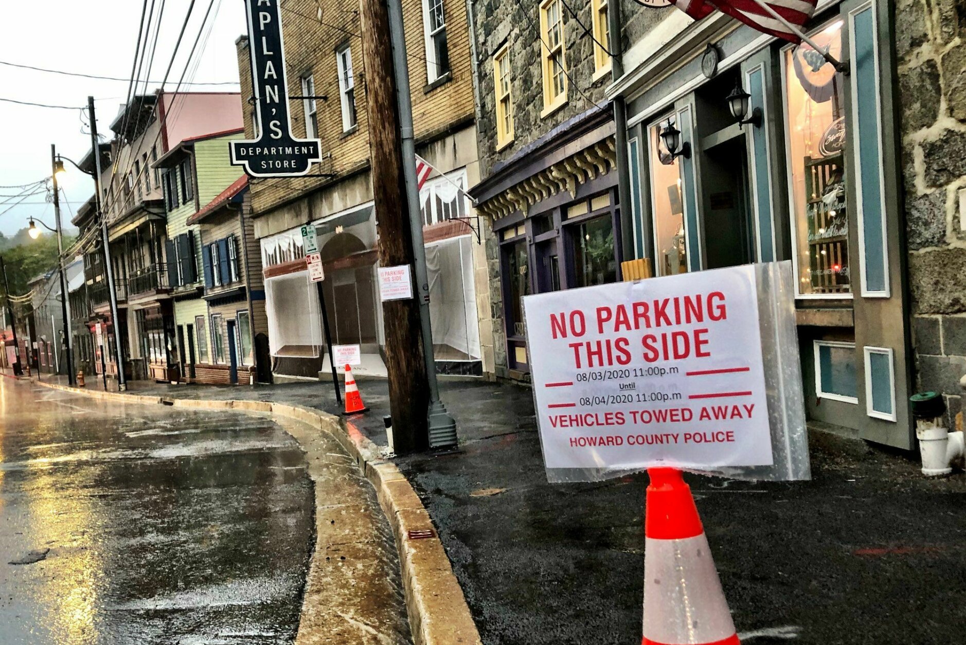
Clarification: The National Weather Service says what was suspected to be a tornado touchdown here in Leonardtown is still considered preliminary. An NWS survey team still needs to get an in-person look before confirming whether it was in fact a tornado @WTOP pic.twitter.com/xAFca244X7
— Michelle Basch (@mbaschWTOP) August 4, 2020


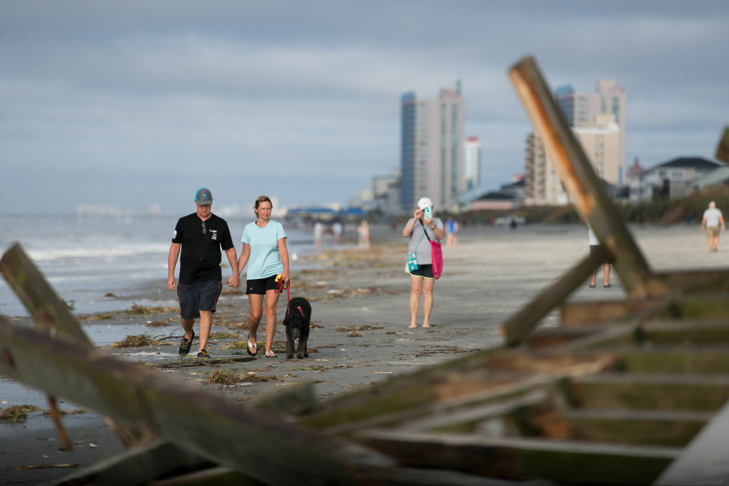
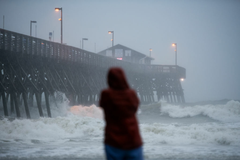
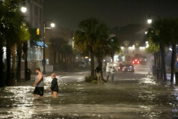
Isaias has passed out of the D.C. area, but high water and possible flooding, as well as the damage from heavy rain and winds, remain in the region.
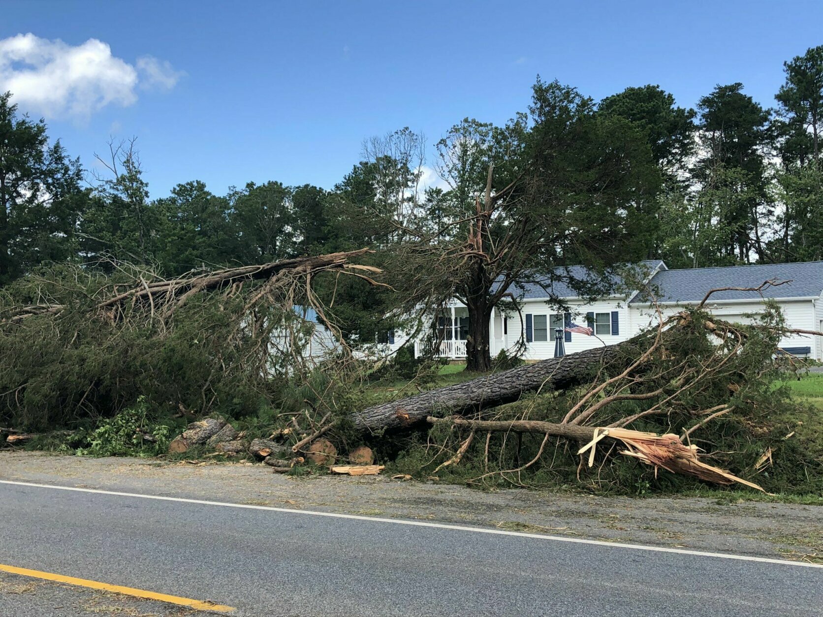
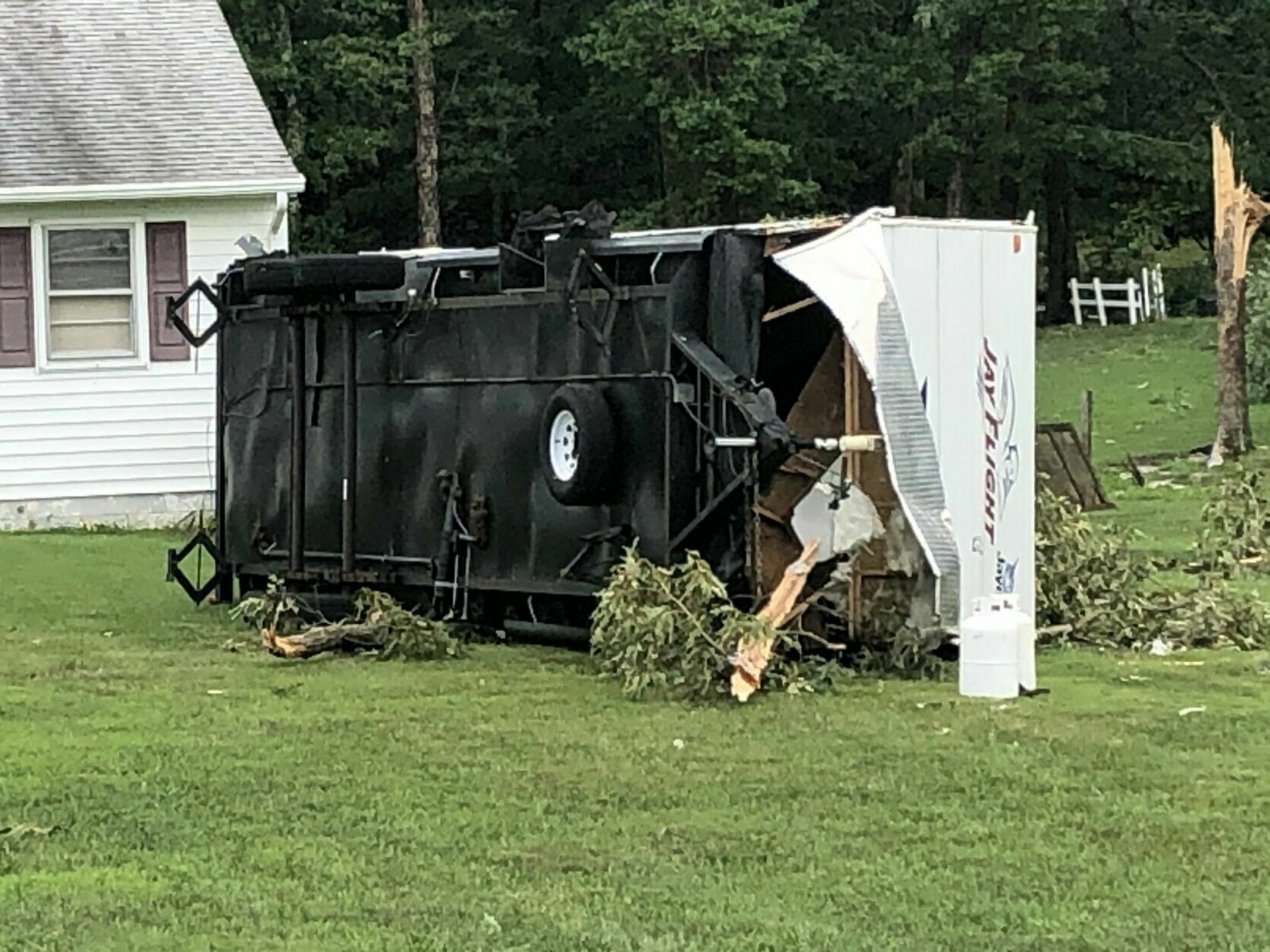
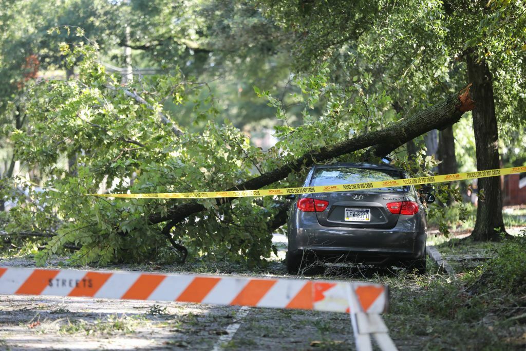
The storm damage was worst in southern Maryland, particularly in St. Mary’s County.
A driver was killed in Mechanicsville when a tree fell on their car at about 9:30 a.m. Tuesday, the sheriff’s office said.
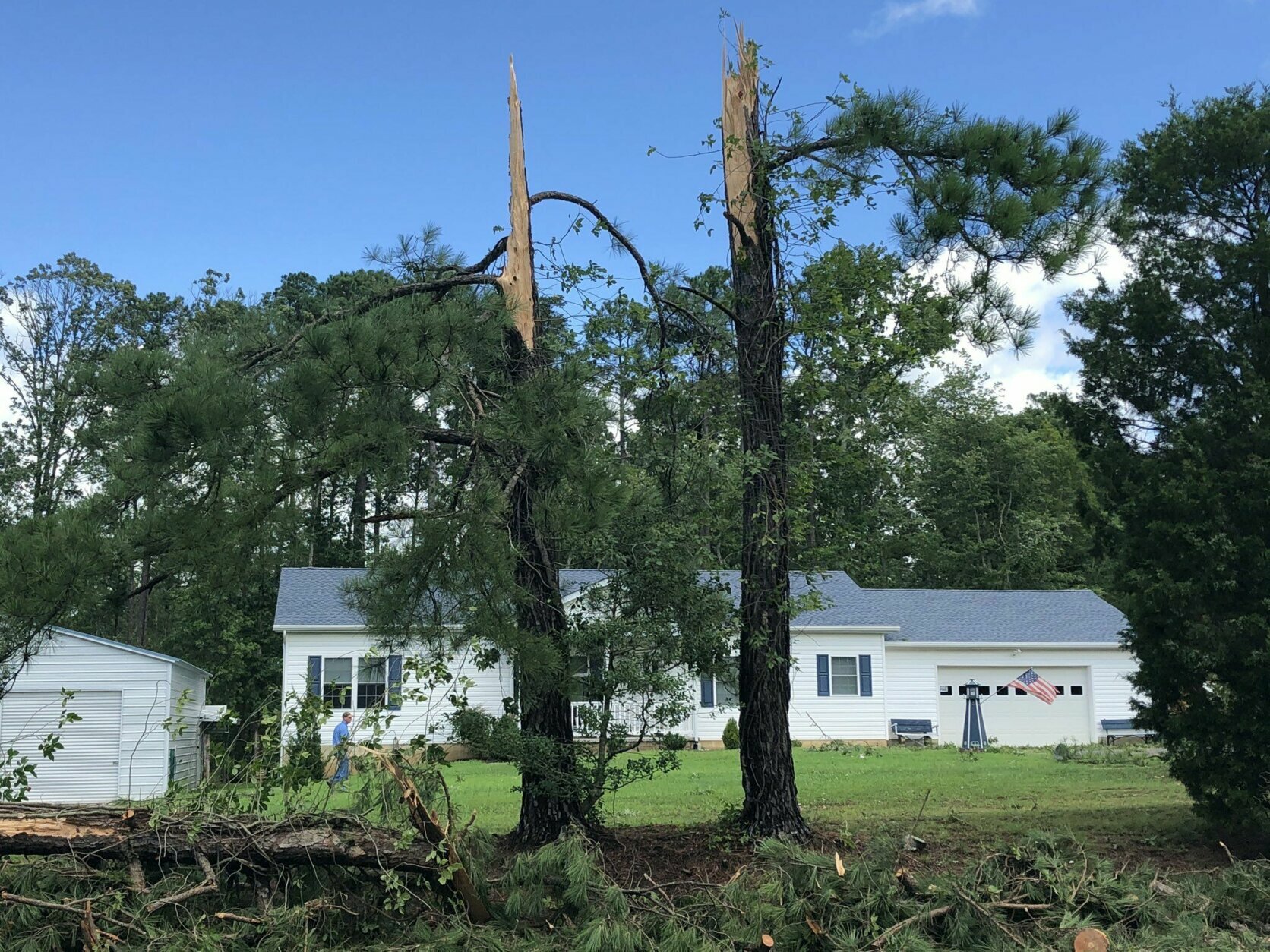
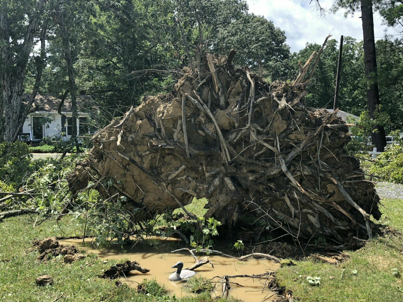
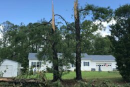
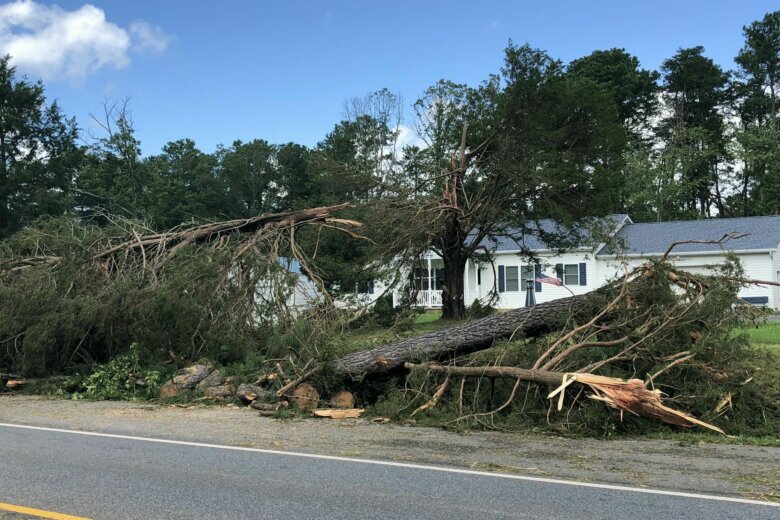
At least two tornadoes struck southern Maryland. A weather spotter with the National Weather Service said a tornado touched down in Leonardtown at about 6:45 a.m., and another possible tornado happened in the Plum Point area of Calvert County, said Chris Strong, a meteorologist with the weather service.
The weather service is still out surveying damage to determine the rating of these, and to see if there were any others, Storm Team4 meteorologist Amelia Draper said.
Tops of trees in Leonardtown were clipped off, and some were torn clean away, WTOP’s Michelle Basch reported.
Charlie Mills said he was awake and looking out the picture window of his house on Point Lookout Road at about 6:45 a.m. That gave him a perfect view when a tree fell on his roof, poking a hole in it.
“The wind came through and just knocked it all down,” he said. “Water’s been going in everything.” He suspects that about 12 trees on his property came down.
Forecasters are still warning of flooding in the District, Baltimore and the suburbs.
The National Weather Service said at about 1 p.m. that Rock Creek was at flood stage and “near peak,” and will recede during the afternoon, but that flooding is still a concern.
The weather service has a flood warning in effect for northwestern D.C. until 5:30 p.m., and a coastal flood warning from 3 p.m. Tuesday until 3 a.m. Wednesday for D.C., saying, “The unprotected area on the Southwest Waterfront at the DC Seafood Market is expected to flood.”
Thousands of people are without power.
Here’s what you need to know:
- It’s (almost) over: Heavy rainfall has left the area …
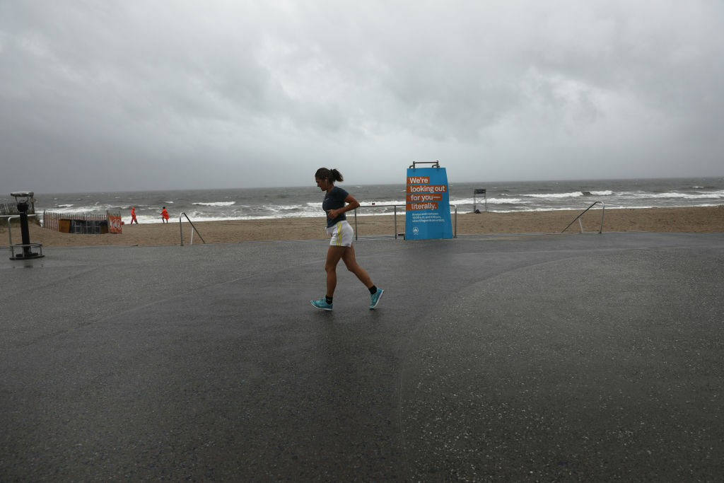
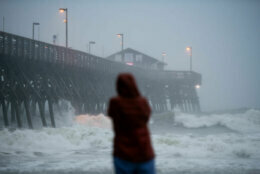
- … unless you’re on the coast: Isaias is pushing a large volume of water behind it, meaning coastal flooding of between 3 and 5 feet will continue to be an issue for low-lying areas of the Chesapeake and the Eastern Shore through Tuesday night.
- Flood woes and travel headaches: Torrential rain sent waterways over their banks near the District into Southern Maryland. Much of the region is still under a flood warning, with some rivers and small streams likely to keep rising for a while.
- Power outages: A Dominion Power spokeswoman told WTOP that power in most of Northern Virginia should have been back on at about 3 p.m., but could last days in other areas of the state.
- Listen to WTOP online and on the radio at 103.5 FM or 107.7 FM.
- Current traffic conditions
- Weather forecast
- Closings and Delays
- Sign up for WTOP alerts
‘Tornadic circulations’ in Southern Maryland
Some of the worst effects from the storms have come in St. Mary’s County, in Southern Maryland. A spotter has reported that a tornado touched down in Leonardtown.
Chris Strong, with the National Weather Service, told WTOP on Tuesday afternoon that the center of Isaias tracked over the tip of southern Maryland and the Eastern Shore, resulting in “a number of tornadic circulations … that we are checking out.”
He added that some places in Southern Maryland even got up to 9 inches of rain in the overnight and morning.
The weather service typically takes a few days to confirm reports of tornadoes, but Strong said they were looking at about five tracks in St. Mary’s and Calvert counties.
In St. Mary’s, the storm damage itself was making it difficult to get around to study, he said.
As the evening approaches, Strong said there were a “number of flood warnings, mainly east of 95” to keep aware of, and added, “Be very leery of low areas, because there’s a lot of flooding out there.”
Intense thunderstorms spawned at least nine suspected tornadoes overnight from Southern Maryland to the Hampton Roads area of Virginia.
Isaias is “booking it” up the East Coast at a speed of 30 to 35 mph, Storm Team 4 meteorologist Somara Theodore said, and should be near the Canadian border by the end of the day. But it dumped heavy rain in much of the D.C. region and spawned numerous tornadoes from Central Virginia through Southern Maryland, including 7.67 inches in Mechanicsville, Maryland.
Gallery: Isaias hits the Washington area
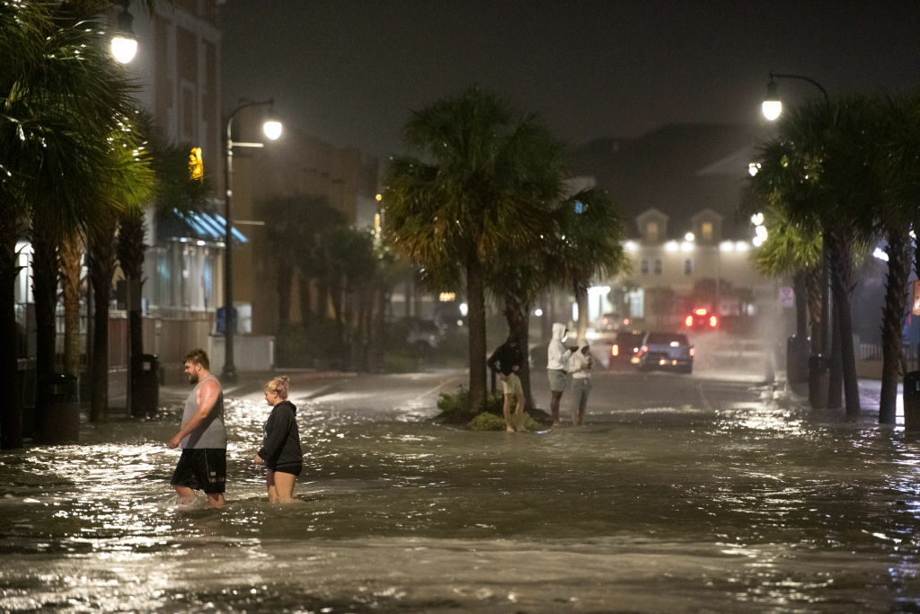
Submerged roads, swollen waterways
Tropical Storm Isaias — which made landfall in North Carolina last night as a hurricane with winds near 85 mph — continues to bring a flood threat to millions along the Interstate 95 corridor.
“It is a mess out there,” Sherry Christian, of the Maryland Department of Transportation, told WTOP on Tuesday morning.
Though she said, “We might even have a pretty sunset,” she still urged drivers to “take precautions and heed the warnings,” because high water and winds will continue.
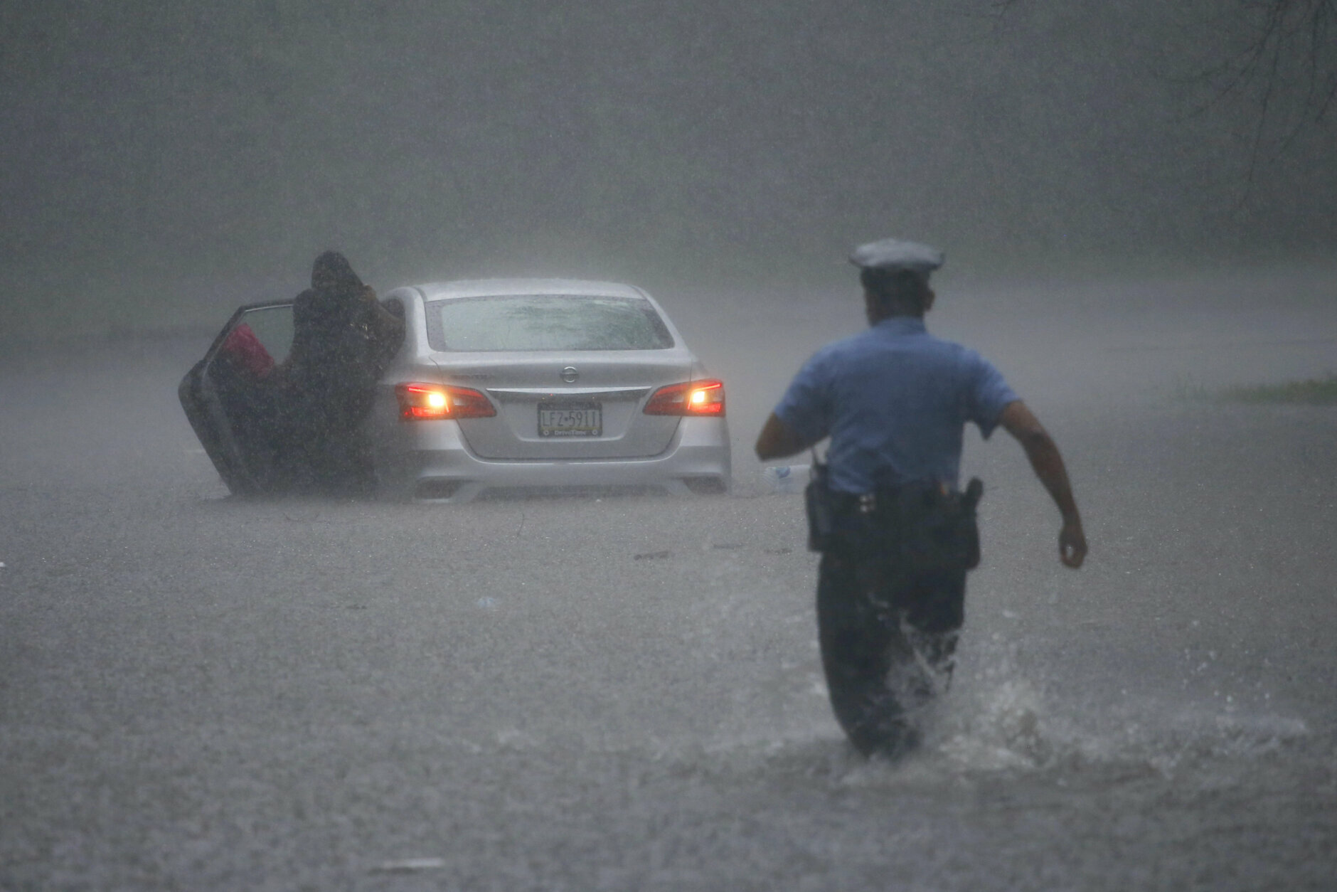
Maryland state troopers rescued two drivers from cars that were swept away as they tried to cross Brandywine Drive in La Plata, Maryland, on the border of Charles and Prince George’s counties. It took about 45 minutes to find one of the drivers, the police said in a statement.
By Tuesday afternoon, crews had 78 active weather-related events that included 37 roadway closures due to high water and 35 associated with debris, Maryland Department of Transportation State Highway Administration said in a news release.
At one time there were 18 weather related closures in St. Mary’s County, 19 in Cecil County and nine in Anne Arundel County.
D.C. and Northern Virginia had seen between 2 and 4 inches of rain by 10 a.m. Tuesday, according to radar estimates, with St. Mary’s and Calvert counties in Maryland eyeing the highest totals in the region with estimates of over 6 inches.
The National Weather Service had yet to release official rainfall totals.
The St. Mary’s River topped its banks to near-historic levels, forcing a closure on Md. Route 5 in Callaway.
Tiber River, which flows along Main Street is higher/faster than a few hours ago, but culverts, sewers are handling rain so far in historic (and flood-prone) Ellicott City. Stay @WTOP for weather updates. pic.twitter.com/jXYqrQ5USp
— Neal Augenstein (@AugensteinWTOP) August 4, 2020
Historic Ellicott City, Maryland, took no chances with Isaias, still recovering from a dual volley of devastating floods in the last few years. Crews labored to remove 12 tons of debris out of streams in the watershed over the weekend in preparation for Isaias’ deluge — though WTOP’s Neal Augenstein reported the community had averted significant flooding as of Tuesday morning.
WTOP’s Nick Iannelli was on the scene in Annapolis:
What’s the damage?
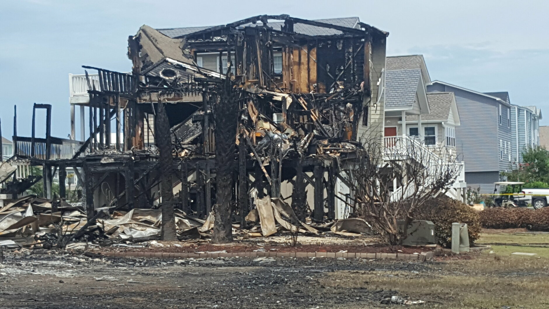
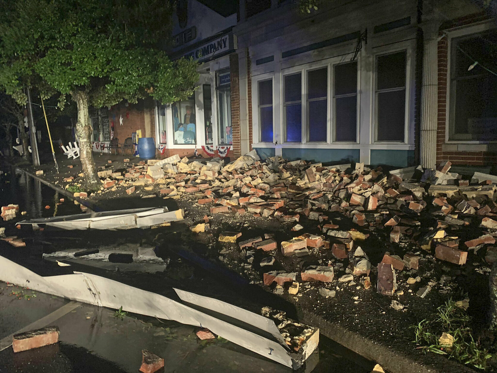
In Suffolk, Virginia, multiple homes were damaged by falling trees, and city officials received reports of a possible tornado. A fire station downtown sustained damage, including a broken window, and photos posted by city officials showed a pile of bricks lying next to a damaged business.
DOWNTOWN SUFFOLK DAMAGE: Storefronts along W Washington street took a hard hit during the storm. This is the Brandon House. Most of the front windows are blown out. A look at the damage coming up on #13newsnow pic.twitter.com/vv9oZt3KH1
— Allison Bazzle 13News Now (@13AllisonBazzle) August 4, 2020
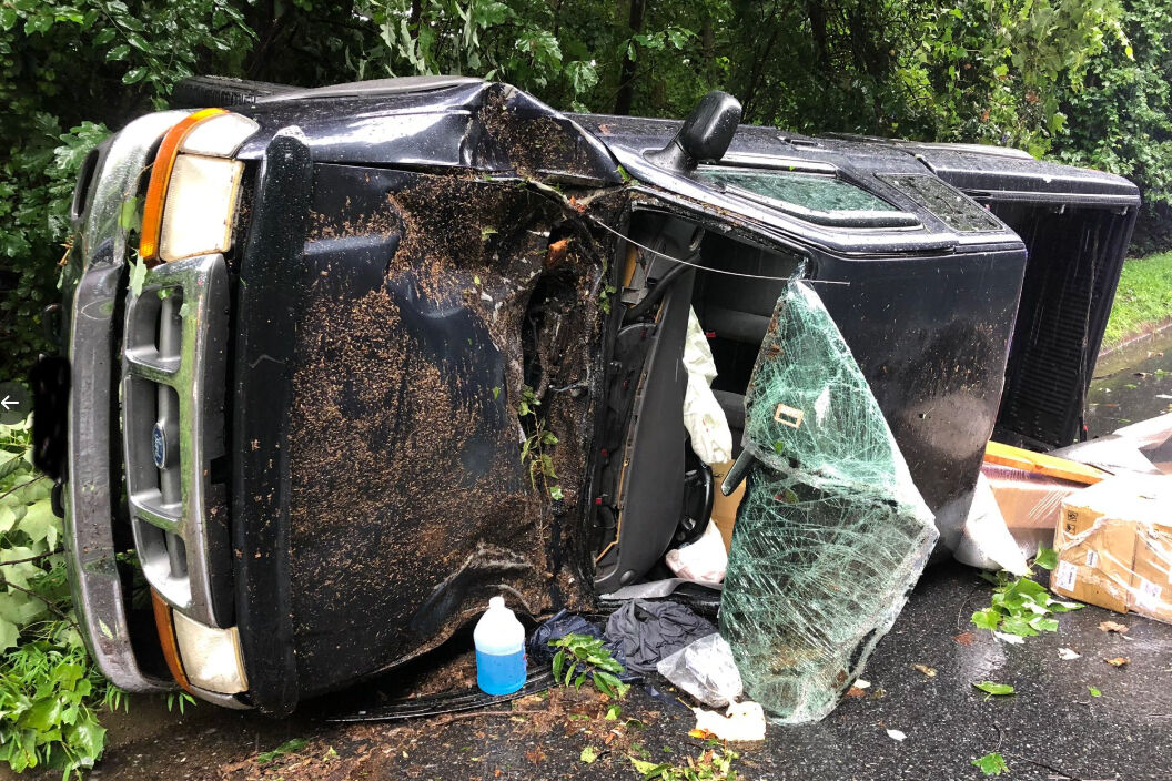
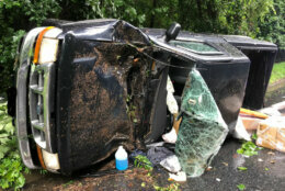
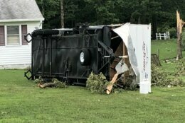
In Rockville, Maryland, Isaias’ winds brought a tree down on a moving vehicle on West Lake Drive near Tuckerman Lane. One person was transported to a hospital with injuries not considered life-threatening, Montgomery County Fire and Rescue spokesman Pete Piringer said, tweeting photos of an overturned truck:
ICYMI (~910a) On W. Lake Dr. near Tuckerman Lane, Single vehicle struck by a falling, @MCFRS_EMIHS transported 1 adult NLT, @mcfrs PE726, A726 responded (MCFRS move the tree out of roadway) https://t.co/PuPMudMEpI pic.twitter.com/1XzLgv5J8K
— Pete Piringer (@mcfrsPIO) August 4, 2020
D.C. officials were aware of at least 20 locations where trees had fallen. Crews in the District were working to direct traffic around high water on South Capitol Street and in Congress Heights.
“We’ve had them out since this morning, making sure that when we do see those trouble spots, we’re mitigating the flooding, closing roads and trying to get them reopened as quickly as possible,” said Christopher Rodriguez, director of D.C.’s emergency management agency, who added that power outages in the District have so far been low.
Thousands of outages have been observed in Northern Virginia. More than 115,000 customers are in the dark throughout the state, particularly from Richmond to Virginia Beach, who were among the first to face the brunt of Isaias in the overnight hours.
Impact on mass transit and roads
Maryland State Police said that from 5 a.m. to 4 p.m. Tuesday, they responded to 152 crashes, 117 call for road hazards — such as downed wires and trees — 25 disabled vehicles and 609 overall calls for service.
High winds stopped traffic on the Chesapeake Bay Bridge, but lanes reopened just past noon, and the MDTA dropped wind warnings at about 1:30 p.m.
Wind warnings/restrictions cleared from all MDTA bridges. #mdwx #mdtraffic pic.twitter.com/hT31d3QsDf
— MDTA (@TheMDTA) August 4, 2020
In D.C., Metro is limiting some access to riders as part of its severe weather plan. The Cleveland Park Metro station was closed Tuesday, since that station’s entrances are in an area prone to flash flooding. It was supposed to be closed all day, but reopened in the early afternoon.
The north entrance to the King Street Metro station in Alexandria is closed.
Riders are advised of the potential for weather-related delays and should anticipate service adjustments.
VRE is operating on an S schedule. All trains marked with an “S” in addition to Fredericksburg line trains 300 and 307 are running. Manassas line train 327, which is supposed to depart from Union station at 3:45 p.m., is canceled due to some equipment damage from striking a tree in the morning.
For the latest road and traffic conditions, see WTOP’s traffic page or listen to updates every 10 minutes online or on the air at 103.5 FM. Submit traffic tips by calling 866-304-WTOP or tagging @WTOPtraffic on Twitter.


Sand from Topsail Beach, NC covering cars like it's snow after #Isaias passed through last night. pic.twitter.com/pEESIf5Rx4
— Zack Green (@zackgreenwx) August 4, 2020


WTOP’s Michelle Basch, Valerie Bonk, Dan Friedell, Kristi King and The Associated Press contributed to this report.
Forecast
Tuesday night: Scattered showers and storms during the vening, then mainly clear and mild. Lows in the mid 60s to low 70s.
Wednesday: Mostly sunny and less humid as Isaias moves north. Highs in the mid-80s.
Thursday: Sunny, with a chance of showers and thunderstorms. Highs in the mid-80s.
Friday: Partly cloudy, with showers and thunderstorms likely in the afternoon. Highs in the mid- to upper 80s.