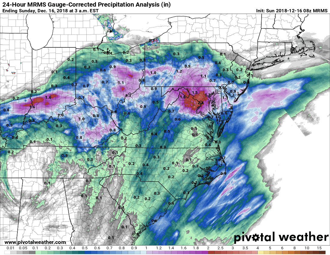


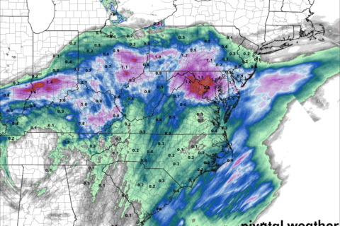

WASHINGTON — After a soggy start to the weekend that broke a daily record at Reagan National Airport, bringing more than 2 1/2 inches of rain, showers are finally tapering off Sunday evening.
- Listen to WTOP online and on the radio at 103.5 FM
- Current traffic conditions
- Weather forecast
Sunday’s rain was mostly moderate or scattered showers in the eastern suburbs and some of the heaviest rain has moved out of the region to the northeast. Water levels were starting to recede on streams and rivers, but flood warnings were still in effect for portions of the WTOP listening area.
But even as things dry up through the night, Storm Team4’s Somara Theodore warns that the wet roads could freeze overnight as some places will see temperatures in the low 30s. Puddles of rain can freeze, making for a slick morning commute, especially north and west of the District.
Watches and Warnings
A flood warning is in effect in parts of Prince George’s County until 6:30 a.m. Monday.
In Prince William County, the City of Manassas Park and the City of Manassas, a flood warning is in effect until 12:30 a.m. Monday.
Traffic troubles on area roads
WTOP’s Dave Dildine in the Traffic Center says many area roads are soggy, slow and slick. Dildine recommends drivers to take it slow on ramps and to keep headlights turned on.
For a full list of traffic incidents, including current road conditions and closures, see WTOP’s traffic page.
Saturday’s rainfall
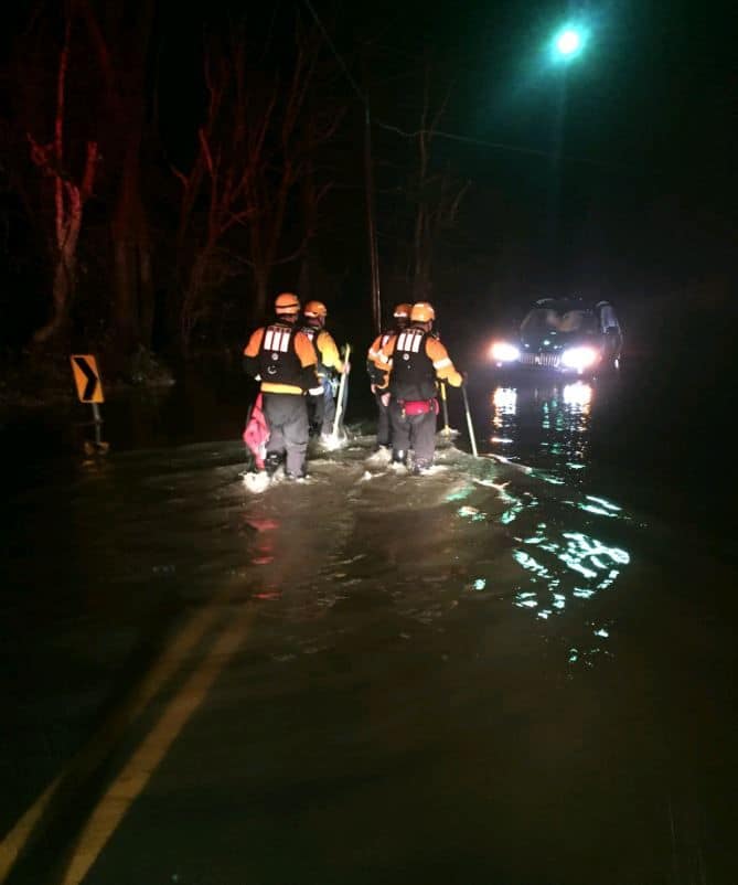
Over two inches of rain fell on parts of the region on Saturday, leading to water rescues as small streams burst out of their banks and flooded roadways in Maryland, D.C. and Virginia.
The National Weather Service said most of the capital region had seen between 1 and 2 inches of rainfall by Sunday morning, with some reports of over 3 inches north and west of D.C. It was more than enough to send D.C. soaring above a yearly rainfall record, making 2018 the wettest year the nation’s capital has seen in over a century.
In Montgomery County, a spokesman reported two vehicles were caught in high water between Georgia and New Hampshire avenues in the area of Brighton Dam Road and Bordly Drive. Water rescue crews helped four adults and two children from stranded vehicles.
Firefighters rescued a person trapped in floodwaters on Woodburn Road and Robey Avenue in Annandale, Virginia. They also responded to a water rescue in Fairfax Station on Moonpatterns Trail; in Vienna on Old Courthouse Road and Besley Road; and in Clifton on Chapel Road and Cold Point Road.
The weather service asked commuters to avoid driving through flooded roadways, the most common cause of flood-related deaths. Patchy fog was also developing in parts of Montgomery County late Sunday morning, creating another hazard for drivers.
Current conditions:
Forecast:
It will turn rather breezy late Monday, as a cold front approaches the area, NBC Washington meteorologist Steve Prinzivalli said. In the wake of the front, blustery northerly winds will bring cooler air back into the area with highs in the middle 40s — seasonable for the middle of December — under a partly sunny sky.
Sunday night: Clearing skies. Highs in the 30s and 20s. Fog possible.
Monday: Becoming windy and partly to mostly sunny. Highs around 50 degrees.
Tuesday: Breezy and sunny with cooler temperatures around 40 degrees.
Wednesday: Blustery and sunny with temperatures in the 40s.