By Matt Ritter, NBC Washington Storm Team 4
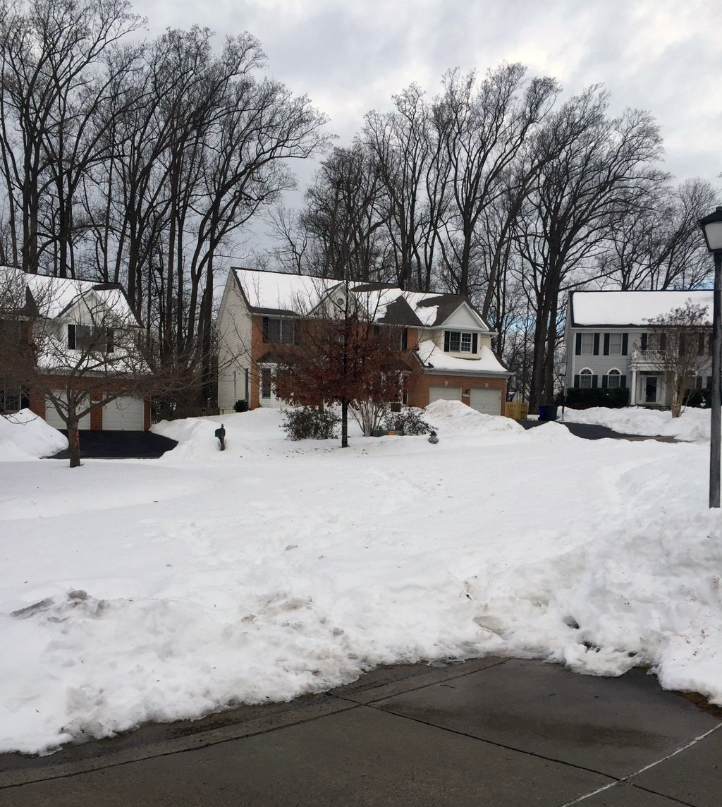
WASHINGTON — As the last snowflake fell in the Blizzard of 2016, NBC Washington Storm Team 4 meteorologists were already concerned about how quickly the snowpack could melt. The entire area had the equivalent of two to three inches of rain contained in the snowpack.
In general, rapid melting of snow can lead to flooding problems in city streets, creeks, streams — even rivers. When it looks like a soaking rainfall is also soon on the way, the flooding potential increases — and that’s what it looks like: There is some potential for a half-inch to an inch of rain on Wednesday.
Throughout the day Wednesday, a strong storm system heading toward the Great Lakes will pump up lots of warm air and moisture from the Gulf of Mexico, bringing the area some rainbands which could be heavy at times.
Based on forecaster experience and also the output of computer models, which are exclusively dedicated to determining stream and river levels, it appears as if there is a “high probability” of “minor flooding” from Wednesday through Friday, according to hydrologists at the Middle Atlantic River Forecast Center (MARFC) in State College, Pennsylvania. This means that there’s a good likelihood it will happen but also that it would be “minor,” which could also be interpreted as “typical areas.”
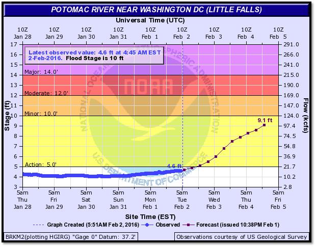
Below is an example of a hydrograph, a representation of observed river gauge levels and also the computer extrapolated forecast. This is for the gauge for the Potomac River near Little Falls in Montgomery County, Maryland. As of the time the image was saved, the stage was about 4.5 feet. The MARFC computer model brings the stage up to just over 9.1 feet by early Friday morning. That would put it within a foot of flood stage at an apparent crest, and that’s close enough to raise awareness of the flood potential.
That certainly takes it above the “Action Stage,” which one could think of as the notice to get ready and prepare. But prepare for what?
Luckily, when flooding occurs in the waterways it’s generally a case of history repeating itself. When water levels reach certain gauge heights, the nearby areas affected are the same and they’re affected the usual way, whether the flooding category is minor, moderate or major. We have the benefit of hindsight to know based on a stream or river forecast just who has to prepare for the rising waters.
The following demonstrates past flooding effects near the gauge in Little Falls:
- 17 feet: Water overflows the overlooks at Great Falls National Park and approaches the lower level of the visitor center. Most of the C&O Canal towpath downstream of Pennyfield is flooded.
- 15 feet: Most of the C&O Canal towpath from Pennyfield downstream is flooded.
- 14 feet: Significant portions of the C&O Canal towpath are flooded. The Blockhouse Point Park is flooded. Water reaches the retaining wall at Overlook 1 at Great Falls National Park but does not overtop it.
- 12 feet: The C&O Canal overflows at the Great Falls Tavern. Water covers the towpath in many areas.
- 11.5 feet: Water covers the towpath in multiple spots between the Washington Aqueduct Dam and Pennyfield Lock, mileposts 15 to 19 on the C&O Canal.
- 11 feet: Water covers the towpath between Swains Lock and Pennyfield Lock, mileposts 17 to 19 on the C&O Canal.
- 10 feet: Water begins to overflow the banks into low lying areas on the Maryland side of the river near Little Falls.
- 9 feet: Several trails on both sides of the river between Great Falls and the Chain Bridge are flooded and will be closed.
- 7 feet: Upper portions of the River Trail at Great Falls National Park begin to flood and will be closed.
- 5.5 feet: Water begins to affect portions of the Billy Goat Trail between Great Falls and Carderock. These trails may be closed.
- 5 feet: Portions of the Potomac Heritage Trail begin to flood.
- 4.5 feet: The river reaches danger level for boaters, as defined by the State of Maryland. Conditions for boating will be extremely hazardous.
- 3.5 feet: The river reaches caution level for boaters, as defined by the State of Maryland. Fast moving water and changing currents will be experienced.
(Data via Advanced Hydrologic Prediction Service/NOAA)
This next image shows the exact location of the gauge, notable historical crests (usually examples of “major” flooding), and some recent crests.
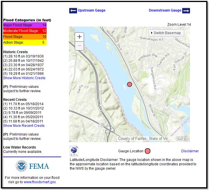
This is just one example. There are many dedicated, monitored and quality controlled gauges throughout the area. They all have their own intricacies like where the gauge is located to provide a reference point for flooding, and their own histories as to what near the banks gets inundated when the levels are at a certain gauge height.
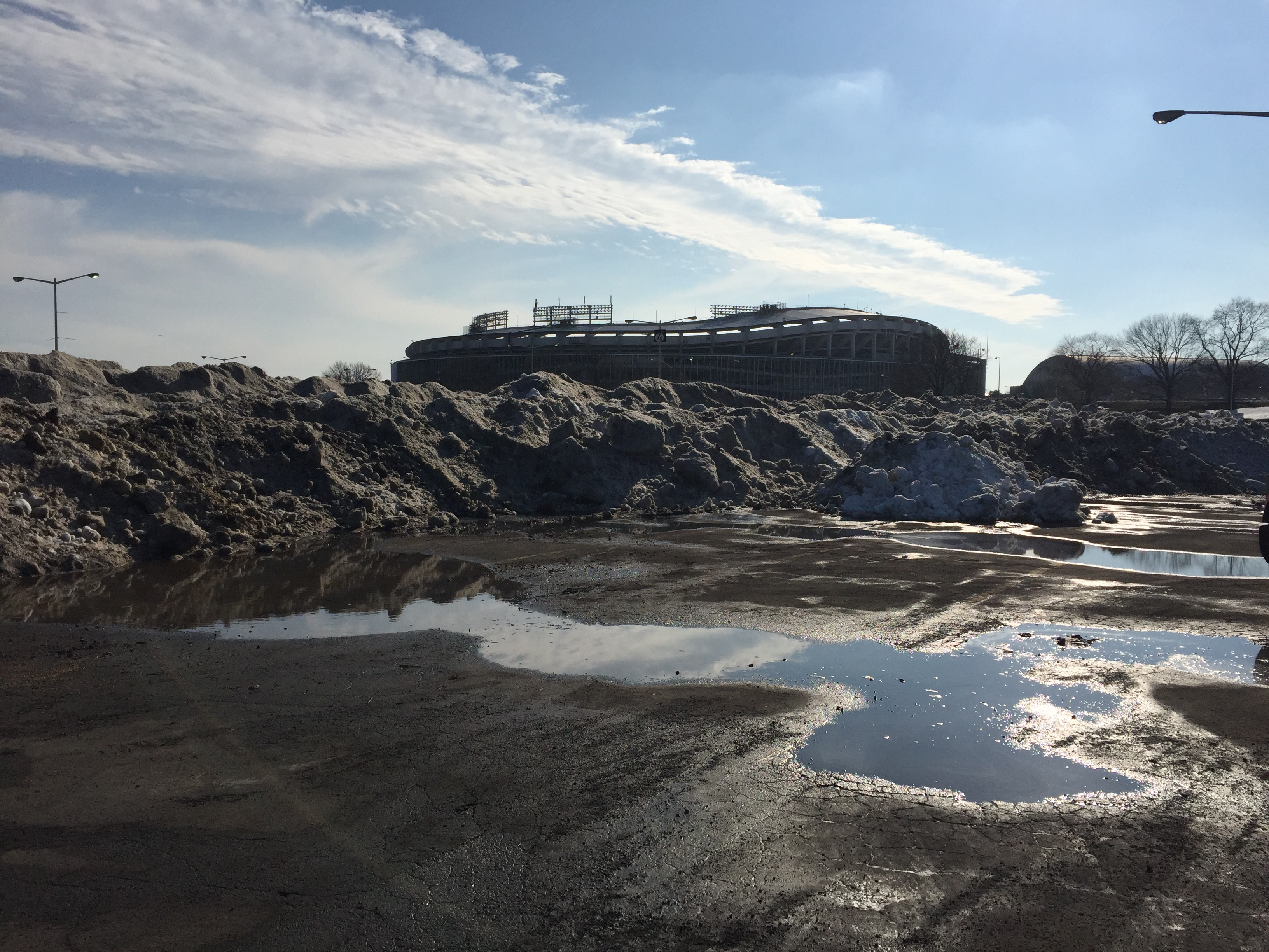
At this time, many gauges where the snowpack remains the thickest now are expected to be near the minor flood stages. If the rainfall on Wednesday ends up being more than an inch, the computer forecasts would be underdone. A couple of positives in our area’s scenario are that the ground is not completely frozen (which would lead to more rainwater and snowmelt going right into the streams and rivers) and that there is not a lot of ice to break up and jam (ice jams cause the river flow to back up and can cause life threatening flash floods on the banks). Basically, considering we’re little more than a week past a blizzard, this setup could be a lot worse.
All that being said, what still remains a concern is the potential for urban flooding. Snowmelt and rainfall runoff need to be able to drain somewhere, and if the drains are clogged, that water would just pool up and cover roadways.
A cold front will dry us out Wednesday night and high pressure will take over, bringing several days of dry weather. That will certainly not add to any flooding problems which occur.