WTOP/Dave Dildine
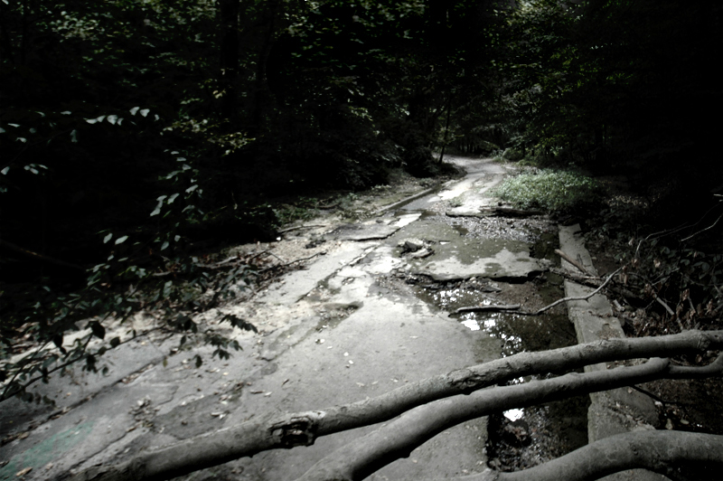
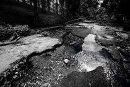
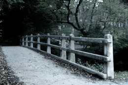
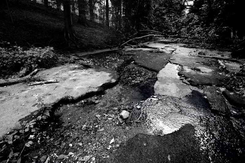
The remains of Klingle Road can be seen today, but they may be gone tomorrow. The 2010 Klingle Valley Trail Environmental Assessment cleared the way for a new route to be constructed through the valley. The District is transforming the old road into a multi-use trail that will connect it to the existing pedestrian and bicycle trails in Rock Creek Park. (WTOP/Dave Dildine)
WTOP/Dave Dildine
As the urban din diminishes after midnight, some claim that a faint drum beat can be heard below the bridge where a drummer boy is said to have fallen to his death around the time of the Revolutionary War. According to lore, the boy lost his balance, perhaps because of a gust of wind, and drowned in Rock Creek. Apparitions of the drummer boy and even a headless horseman are said to appear on the bridge when autumn winds howl out of the north and funnel through Rock Creek Valley. (WTOP/Dave Dildine)
WTOP/Dave Dildine
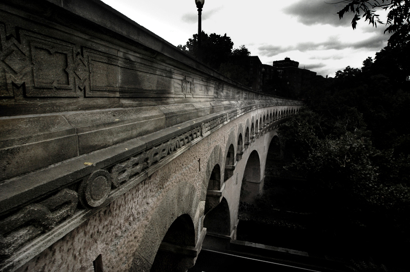
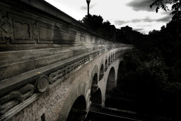
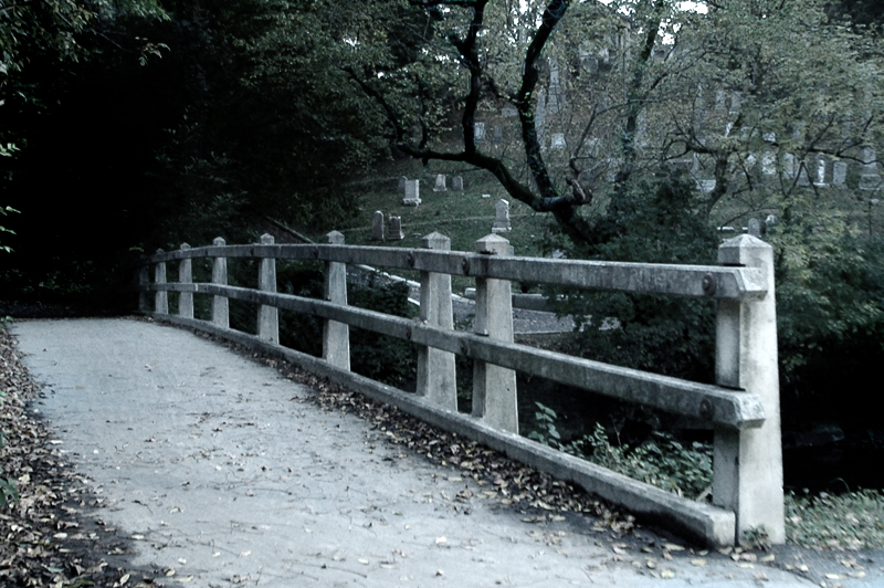
The Dumbarton Bridge, also known as the Buffalo Bridge, carries Q Street across Rock Creek. The structure has spanned the creek for nearly a century. The bridge's architects intentionally designed a curved structure to better conform to the valley's rim and Q Street's uneven approaches on either side of the creek. The thoroughfare is an oddity: It is the only curved bridge of its kind in the city. (WTOP/Dave Dildine)
WTOP/Dave Dildine
WTOP/Dave Dildine
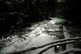
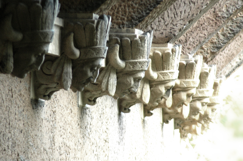
The bridge lies in the shadow of Oak Hill Cemetery and leads into one of Rock Creek Park's darkest corridors west of the creek. Shadows cast by the steep escarpment near the cemetery and a dense tree canopy laced with thick vines leads to damp, often foggy conditions along this section of the trail. (WTOP/Dave Dildine)
WTOP/Dave Dildine
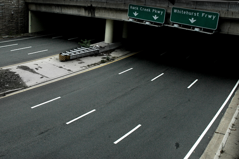
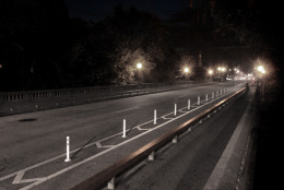
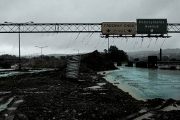
Today, the sunken freeway courses a mere eight-tenths of a mile through the West End, terminating abruptly near the Watergate Hotel at 27th Street NW.
As political and residential opposition to various freeway segments ballooned in the late 1960s, plans to extend the route into Virginia by merging it with the Whitehurst Freeway collapsed, leaving the extravagant road segment isolated from the arteries that it was intended to serve. As such, the eight-lane freeway feels disproportionately wide; even during rush hours, it is often under capacity. (WTOP/Dave Dildine)
WTOP/Dave Dildine

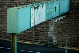
Adding to the Potomac Freeway's modern mystique is the incongruous signage near its entrances and exits. As if shunned, guide signs on the freeway's inbound approaches fail to name or number the route. Further adding to the road's deficiencies, there are no route markers along the freeway. Drivers often confuse the road with the E Street Expressway, a different route that spurs off the Potomac Freeway due east of the Kennedy Center. (WTOP/Dave Dildine)
WTOP/Dave Dildine
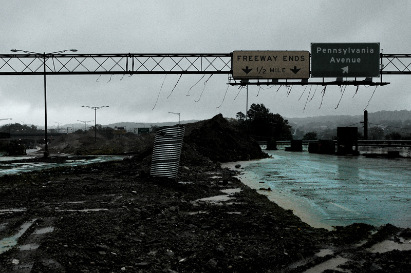
The master plan for the Anacostia Riverfront Initiative calls for a new boulevard to be constructed in place of the old freeway segment. But construction appears to have stalled. The sunken freeway, lined with towering piles of fill dirt, remains largely unchanged since it was shut down nearly two years ago. (WTOP/Dave Dildine)
WTOP/Dave Dildine