A teacher’s curiosity about the lives of formerly enslaved people in Montgomery County, Maryland, took her on a journey that would land her — and dozens of Wheaton High School students — in a heavily wooded area, searching for a historic burial ground.
The site is listed in official records as the “Avery Road Colored Cemetery.”
Wheaton High School teacher Lauren Zolkiewicz told WTOP, she had been researching the history of formerly enslaved Black people and several burial sites in Montgomery County, “when I found, just down the road from my house, this place called Avery Road Colored Cemetery which just so happened to pop up on Google maps.”
Zolkiewicz got in touch with county planning officials and eventually connected with Katie Gerbes, the comprehensive planning manager with the City of Rockville.
Gerbes explained, “We have some historical research which talks about a gentleman named Benjamin Franklin Smith,” who had been born into slavery and after Emancipation in 1884, bought an acre of land on Glen View Farm.
Smith went on to raise a large family on the land and the cemetery is believed to be nearby.
Zolkiewicz pitched an idea to her students to explore the history of the land, and, if it turns out to be the resting place of formerly enslaved people, to help document its history and preserve it for future generations, she said.
Her students were ahead of her.
“They were already coming up with ways that we could start clearing areas,” she said. With hopes of preserving the history “of not just slavery in Montgomery County, but also the history of these formerly enslaved individuals and how they thrived after Emancipation.”
The city of Rockville had also secured grant money and began collaborating with an archaeological firm, Goodwin & Associates.
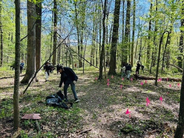
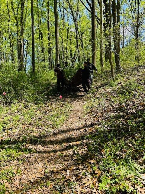
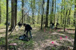
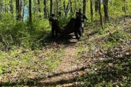
So far, the students have been out to the site twice.
The first time they showed up to the heavily wooded area near the Croydon Creek Nature Center in April, Zolkiewicz wondered if she’d asked too much of her students.
“There was waist-high, thick, thorny brush and I was like, ‘Oh, my goodness, I’m going to start to hear the complaints,’ but let me tell you, not one student complained the entire time,” she said.
Not only were the students hacking away at undergrowth, but they were having to haul it away on steep terrain.
While working on the site, the students did what high school students do; they reached for their phones.
But they weren’t snapping selfies. They were documenting their progress, cataloging what they discovered, and in some cases, bringing items to Zolkiewicz to see if they were important archaeological finds.
They raced up with stones checking to see if, “this could have been a headstone, or this could have been an artifact” said Zolkiewicz.
“We have about 30 areas flagged,” Gerbes said. “When we do our below-grade inspection, that will obviously confirm or rule out things.”
That below-grade check will not include digging, given the sensitivity of the site, she said.
“Unless there’s a reason to do so, we don’t disturb those sites” Gerbes said.
Instead, something called “ground penetrating radar” will be used, she said. That involves what looks like a lawn mower.
“As it goes over land, it sends a radar signal below ground,” Gerbes said.
The data collected can discern what type of material is underground, and how far underground the material is.
Another type of technology, magnetometry, will also be used in combination with the radar to “produce a map of what is underground. That is really the next step in this process” she said.
The next phase, said Gerbes, will likely take place over the summer.
Eventually, the hope is that all the data can be compiled, documented and educational materials programs related to the history of the site could be created.
Get breaking news and daily headlines delivered to your email inbox by signing up here.
© 2024 WTOP. All Rights Reserved. This website is not intended for users located within the European Economic Area.