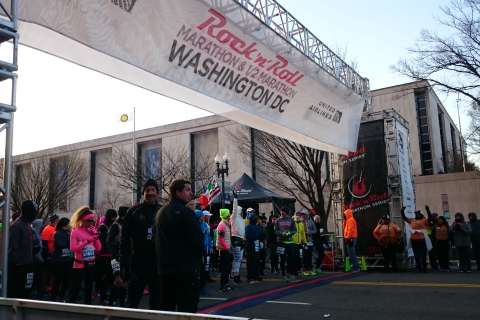
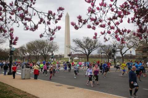
WASHINGTON — A series of scheduled street closures may catch some travelers in the District unaware, as the annual Rock ‘n’ Roll Marathon takes place Saturday.
About 24,000 runners are expected to take the streets for the sixth-annual marathon, half marathon and 5K events. The marathon started at 7 a.m., followed by the 5K at 8 a.m. at RFK Stadium. The half marathon started at 8:30 a.m.
Here’s how to best navigate what is forecast to be a sunny but chilly day in D.C.
Street closures
D.C. police said some street closures will begin as early as 2 a.m. All affected streets are expected to be reopened at around 3 p.m.
Both the marathon and half marathon routes will begin at the same location — Constitution Avenue Northwest and 14th Street Northwest. Those routes split at Constitution Avenue Northeast and 14th Street Northeast. (The final leg of the half marathon is illustrated by the blue line in the map above.)
Both routes will end near RFK lot 3.
Drivers in the area may experience delays, D.C. police said, and should consider alternative routes. They’re also advised to be mindful of heavy pedestrian traffic near the route, as there will be several stages with musical acts.
“These street closings are subject to change without notice based upon unanticipated events and prevailing conditions,” they added. Full list of street closures available here.
For more information, visit the marathon website. A full-size .pdf of the routes and stage locations, as well as the 5K route near RFK Stadium, is also available on the site.
The marathon and half marathon routes, as illustrated in the map above, begin as follows:
- Start on Constitution Avenue Northwest just east of 14th Street Northwest
- Right on Virginia Avenue Northwest
- Right on 18th Street Northwest
- Left on E Street Northwest (eastbound lanes)
- Left on 19th Street Northwest
- Right on Constitution Avenue Northwest
- Left on 23rd Street Northwest
- Enter Lincoln Memorial Circle
- Merge right onto Parkway Drive/Beach Volleyball courts
- Continue straight onto Rock Creek and Potomac Parkway
- Right at Virginia Avenue Northwest and merge onto I Street Northwest
- Continue on I Street Northwest to Potomac River Freeway
- Right onto Potomac River Freeway and continue south to horseshoe turn
- Continue north on Potomac River Freeway
- Exit left onto 27th Street Northwest
- Right onto Virginia Avenue Northwest
- Right onto Rock Creek Parkway
- Continue north on Rock Creek Parkway
- Merge left on Shoreham Drive Northwest
- Right on Calvert Street Northwest
- Merge right on Adams Mill Road Northwest
- Left on Columbia Road Northwest
- Right on Harvard Street Northwest
- Right on Fifth Street Northwest
- Merge onto Fourth Street Northwest
- Left on Bryant Street Northwest
- Right on North Capitol Street Northwest
- Left on K Street Northeast
- Right on Fourth Street Northeast
- Left on H Street Northeast
- Right on 13th Street Northeast
- Left on Constitution Avenue Northeast
(The full marathon and half marathon routes split here, and continue accordingly. …)
Rest of half marathon route:
- Left on North Carolina Avenue Northeast
- Merge onto C Street Northeast
- Merge right onto 22nd Street Northeast
- Turn right onto East Capitol Street Northeast
- Half marathon finish line (near RFK lot 3)
Rest of marathon route:
- Right on 14th Street Northeast
- Right on North Carolina Avenue Northeast
- Left on 13th Street Southeast
- Right on East Capitol Street Southeast
- Right on 11th Street Southeast
- Left on East Capitol Street Northeast
- Left on Third Street Southeast
- Right on E Street Southeast
- Left on South Capitol Street Southwest
- Cross the Douglass Bridge
- Turnaround on South Capitol Street Southwest north of Malcolm X Avenue Southwest
- Continue north on South Capitol Street Southwest
- Left on Douglass Bridge access road
- Right on Anacostia Drive Southeast
- Full loop around Anacostia Park Skating Pavilion on Anacostia Drive Southeast
- Left on Nicholson Street Southeast
- Left on Fairlawn Avenue Southeast
- Right on Pennsylvania Avenue Southeast
- Left on L’Enfant Square Southeast
- Left on Pennsylvania Avenue Southeast
- Right on Fairlawn Avenue Southeast
- Right on K Street Southeast
- Enter Randle Circle Southeast
- Left on Ft. DuPont Drive Southeast
- Left on Ft. Davis Drive Southeast
- Left on Ridge Road Southeast
- Left on Ely Place Southeast
- Right on Minnesota Avenue Southeast
- Right on East Capitol Street Northeast off-ramp
- Right on East Capitol Street Northeast
- Merge right onto C Street Northeast
- Left on 21st Street Northeast
- Left on 22nd Street Northeast
- Right on East Capitol Street Northeast
- Marathon finish line (near RFK lot 3)
Using Metro
Metro will open at 7 a.m. Race start times this year have been shifted to accommodate Metro’s round-the-clock track work.
Full marathon participants are discouraged from using Metro to make it to the start on time.
As for the expected 17,800 half marathon participants, they are encouraged to take Metrobus and Metrorail. The nearest Metro station to the starting line is Federal Triangle.
Riding the DC Circulator & amp; Streetcar
Due to road closures, the DC Circulator will run modified service on the two routes directly impacted by the race.
The National Mall route will begin service at 10 a.m.
The Woodley Park-Adams Morgan-McPherson Square route will detour, with no service at stops near Harvard Street Northwest. Buses will turn back at Florida Avenue Northwest between 7 a.m. and noon. The following stops on this route will have service during that time:
Woodley Park-Adams Morgan-McPherson Square Southbound
- Connecticut Avenue Northwest / 24th Street
- Adams Mill Road Northwest / Columbia Road
- Columbia Road Northwest / Ontario Road Northwest
- Mt. Pleasant Street Northwest / Irving Street
- Irving Street Northwest / 14th Street
Woodley Park-Adams Morgan-McPherson Square Northbound
- Columbia Road Northwest / 14th Street
- Columbia Road Northwest / Between 15th and 16th streets
- Columbia Road Northwest / Ontario Road
- Adams Mill Road Northwest / Columbia Road
- Connecticut Avenue Northwest / 24th Street
Normal service will resume at noon, or as road closures allow. The other four Circulator routes will run normal service.
DC Streetcar service will begin after the marathon traffic clears, at approximately 1 p.m.
For additional information, visit the DC Circulator or DC Streetcar sites.
Transportation for runners
Runners are advised to get to the starting line area about an hour before the start of the race.
Specific race corrals will take off every 60 to 90 seconds, and the last marathon corral will take off at about 7:10 a.m.
Shuttles will be offered from the finish line at RFK Stadium to transport the expected 4,000 marathon participants to the start line beginning at 5 a.m. Shuttles are free for participants only and must be reserved online. Spectators won’t be allowed to use the shuttle.
Parking will be available at RFK Stadium lots for $16.50, and must be purchased online. The purchase of a parking spot does not include a shuttle ticket.
The last shuttle leaves at 5:30 a.m.
Half marathon participants are encouraged to take Metrobus and Metrorail. The nearest Metro station to the starting line is Federal Triangle.


