Editor’s note: Some of the snowfall records herein were tied or broken by the Blizzard of 2016 which occurred after this article was published.
WASHINGTON — Twenty-eight years ago, an unexpected, early-season snowstorm brought nearly a foot-and-a-half of heavy snow to parts of Washington.
The Veterans Day snowstorm of 1987 turned out to be the city’s biggest November snowfall on record and also preceded an otherwise run-of-the-mill winter.
The unprecedented early-season winter storm, as impactful as it was, did not foreshadow the coming of a brutal winter. In February of that winter — typically D.C.’s snowiest month — virtually no snow fell.
Forecasting the weather months in advance is tough business and, for some, a slippery slope.
There is no telltale sign in autumn that signals a fair or ferocious winter to come. As various weather outlets craft their own predictions for what Old Man Winter will bring, each includes fair-warning on the limitations of long-range weather forecasting.
You can read more about the National Weather Service’s outlook here. StormTeam 4’s Winter Weather Outlook is available here.
The jury is still out on how harsh the coming winter will be to Washington but signs point to a wet, mild start. The past couple of winters have been long, with early- and late-season snowfall leading to higher than average seasonal totals.
Records from the National Weather Service show that for every snowy winter, the region sees two or three “easier” years. Records date back to 1884 for Washington, D.C., 1892 for Baltimore and 1962 for Dulles International Airport.
Record 1-Day Totals:
DC – 21.0 inches (Jan. 28, 1922)
BWI – 23.3 inches (Jan. 28, 1922)
IAD – 22.5 inches (Feb. 11, 1983)
Record 2-day Totals:
DC – 26.0 inches (Jan. 27-28, 1922)
BWI – 26.3 inches (Jan. 27-28, 1922)
IAD – 32.4 inches (Feb. 5-6, 2010)
Record 3-day Totals:
DC – 28.0 inches (Jan. 27-29, 1922)
BWI – 26.8 inches (Feb. 16-18, 2003)
IAD – 24.6 inches (Jan. 6-8, 1996)
Average Annual Snowfall
DCA – 15.4 inches
IAD – 20.1 inches
BWI – 22 inches
Rarely, in fact, does a winter’s worth of snow add up to the average amount. Records show that some winters were awash with rain while others saw coastal storms that delivered a year’s worth of snow in a matter of days. During the record-breaking “Snowmaggedon” winter, the region saw two such storms and many other significant snowfalls.
It is these extremes that factor into the region’s average annual snowfall.
Highest Seasonal Snowfall
D.C.
56.1 inches in 2009-2010
54.4 inches in 1898-1899
46.0 inches in 1995-1996
44.5 inches in 1921-1922
41.7 inches in 1891-1892
Dulles
73.2 inches in 2009-2010
61.9 inches in 1995-1996
52.8 inches in 2013-2014
50.1 inches in 2002-2003
44.6 inches in 1963-1964
BWI
77.0 inches in 2009-2010
62.5 inches in 1995-1996
58.1 inches in 2002-2003
51.8 inches in 1963-1964
51.1 inches in 1898-1899
Just four years ago, a slump in snowfall made for one of the top snowless winters on record. A mere 2 to 4 inches of snow fell by spring of 2012. The winter was also mild with temperatures about 5 degrees above average.
Snow was also scarce during the El Nino winter of 1997-1998. The abnormally warm expanse of water in the eastern Pacific Ocean is thought to have contributed to the dearth of snow across the East.
An El Nino event is expected to remain intact through this coming winter and will likely influence storms and precipitation in the Mid-Atlantic region.
Lowest Seasonal Snowfall
D.C.
0.1 inches in 1997-1998
0.1 inches in 1972-1973
2.0 inches in 2011-2012
2.2 inches in 1975-1976
2.5 inches in 1930-1931
Dulles
2.2 inches in 1972-1973
2.6 inches in 2001-2002
3.7 inches in 2011-2012
4.4 inches in 1980-1981
5.9 inches in 1997-1998
BWI
0.7 inches in 1949-1950
1.2 inches in 1972-1973
1.8 inches in 2011-2012
2.3 inches in 2001-2002
3.2 inches in 1997-1998
In a typical year, most of Washington’s snowfall occurs in late January and early February. The city averages 5.6 inches of snow in January and 5.7 inches in February.
The earliest measurable snowfall occurred on Oct. 10, 1979 when 0.3 inches to 1.3 inches of snow fell across the region. Measurable snow has fallen as late as mid- to late-April.
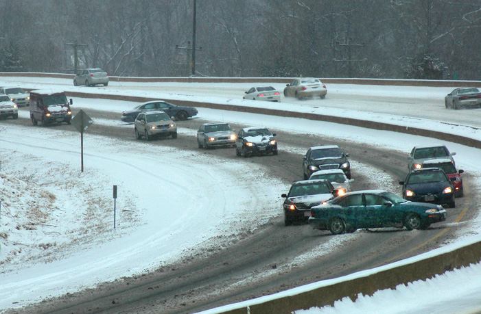
The frequency of snowfall varies and depends on the jet stream and the path that storms take as they cross the Mid-Atlantic. Many winters feature stormy periods when a succession of storms deliver the bulk of the season’s snowfall. The charts below list each of these events over the past five years.
It only takes one big storm to make a winter memorable. The top ten snow events for all three major area airports are listed below. The following snow totals were observed over three-day periods. In most cases, these totals reflect single-storm totals. In a few cases, a large storm was followed by a lighter snowfall.
Highest Storm Totals (3-day period)
D.C.
28.0 inches from Jan. 27 to Jan. 29, 1922
20.0 inches from Feb. 12 to Feb. 14, 1899
18.7 inches from Feb. 18 to Feb. 19, 1979
17.8 inches from Feb. 5 to Feb. 6, 2010
17.3 inches from Jan. 7 to Jan. 9, 1996
16.6 inches from Feb. 10 to Feb. 11, 1983
16.4 inches from Dec. 18 to Dec. 19, 2009
16.4 inches from Feb. 16 to Feb. 18, 2003
14.4 inches from Feb. 15 to Feb. 16, 1958
14.4 inches on Feb. 7, 1936
Dulles
32.4 inches from Feb. 5 to Feb. 6, 2010
24.6 inches from Jan. 6 to Jan. 8, 1996
22.8 inches from Feb. 10 to Feb. 11, 1983
21.7 inches from Feb. 15 to Feb. 17, 2003
18.0 inches from Dec. 18 to Dec. 19, 2009
16.3 inches from Feb. 18 to Feb. 19, 1979
15.4 inches from Dec. 30 to Jan. 1, 1971
14.1 inches from Mar. 13 to Mar. 14, 1993
13.3 inches from Feb. 12 to Feb 13, 2014
12.1 inches from Dec. 25 to Dec. 26, 1969
BWI
26.8 inches from Feb. 16 to Feb. 18, 2003
26.6 inches from Jan. 7 to Jan. 9, 1996
26.5 inches from Jan. 27 to Jan. 29, 1922
25.0 inches from Feb. 5 to Feb. 6, 2010
22.8 inches on Feb. 11, 1983
22.0 inches from Mar. 28 to Mar. 29, 1942
21.3 inches from Feb. 12 to Feb. 14, 1899
20.0 inches from Feb. 18 to Feb. 19, 1979
19.5 inches from Feb. 9 to Feb. 10, 2010
18.0 inches from Dec. 18 to Dec. 19, 2009