Workweek weather: Temperatures rise, dip; chances for rain

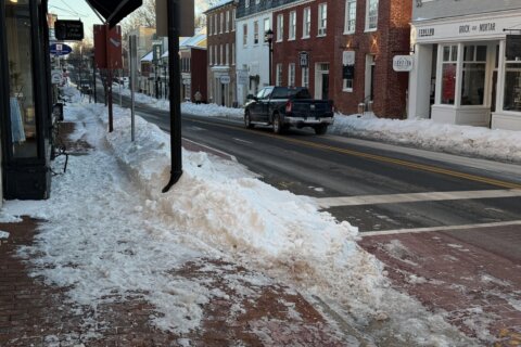
WASHINGTON — We’re coming off a weekend that involved being on both sides of a frontal boundary: Saturday was mostly sunny, warm and dry with southerly winds and Sunday was cloudy, cool and damp with easterly winds.

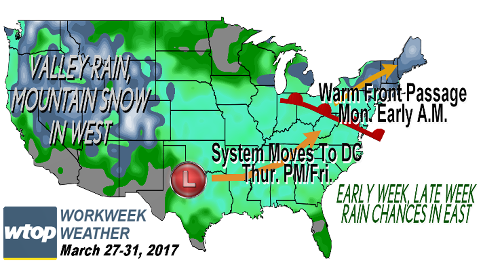
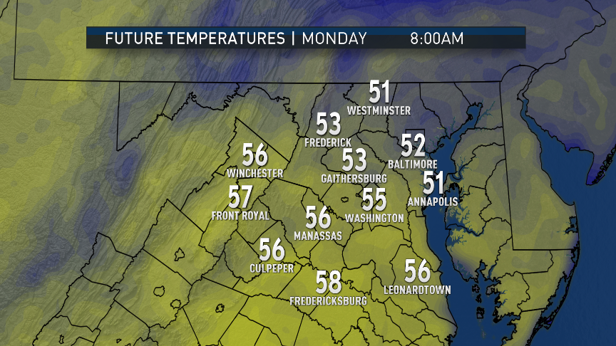
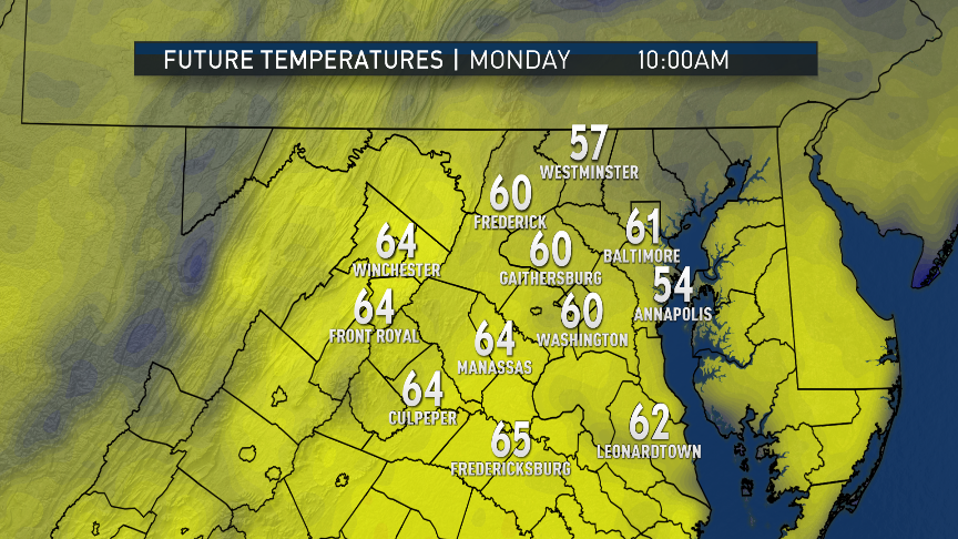
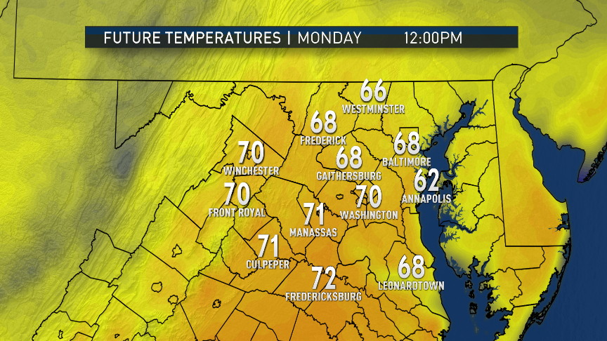
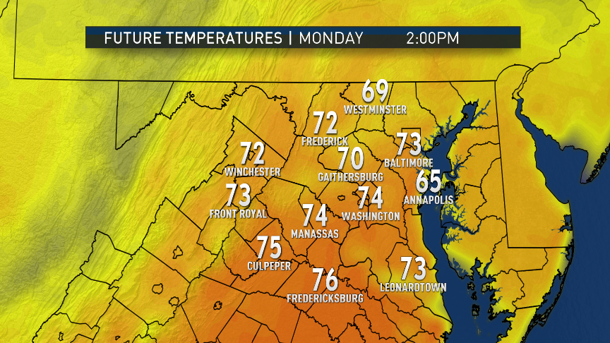
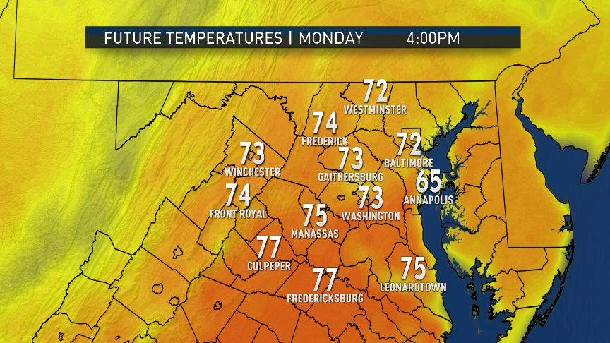
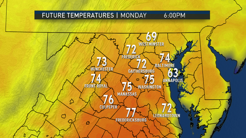
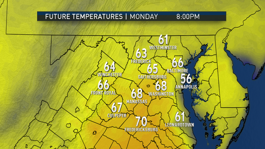
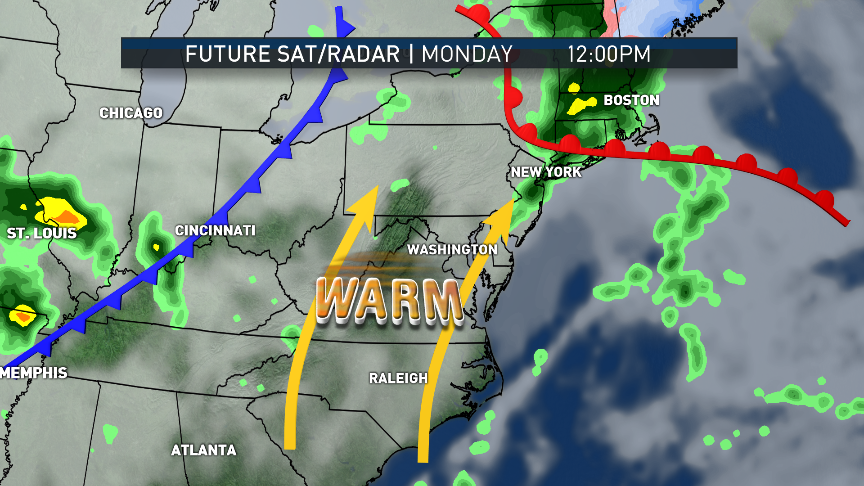
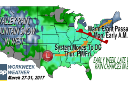
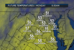
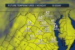
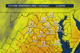
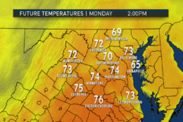
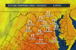
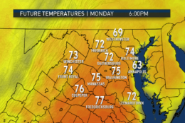
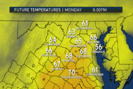
The same boundary will be racing north early Monday morning as a warm front followed by a much warmer afternoon. With the frontal passage, a few scattered showers will be possible. Heaviest amounts of rain will happen just too far to our northwest to benefit us much. Then, it’s going to feel like May with the return of the sunshine.

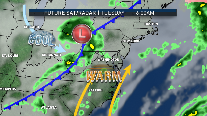
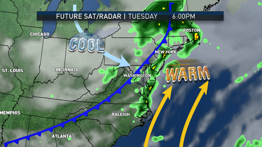
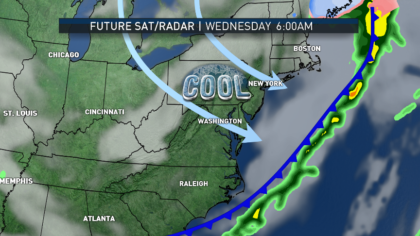
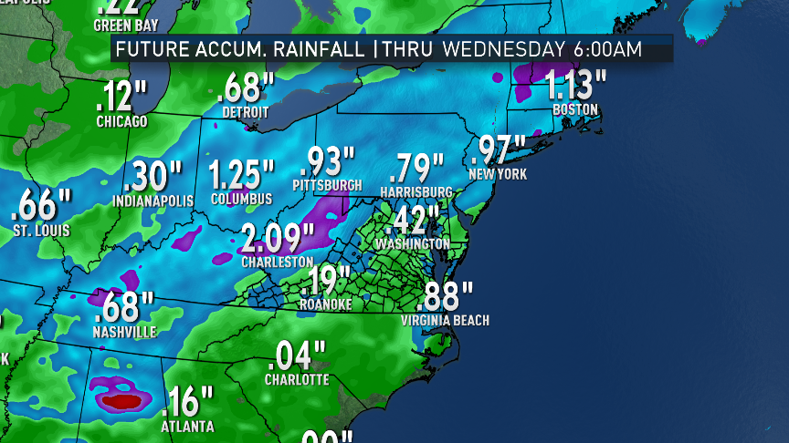
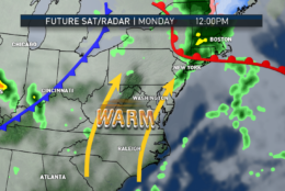
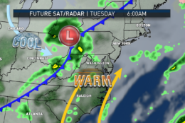
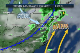
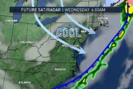
As low pressure rides the boundary to our west, there’s a better chance for some showers and even a thunderstorm or two along a cold front that will pass through here on Tuesday. Then, northwesterly flow behind the front will bring in relatively cooler and much drier air for the middle of the week.

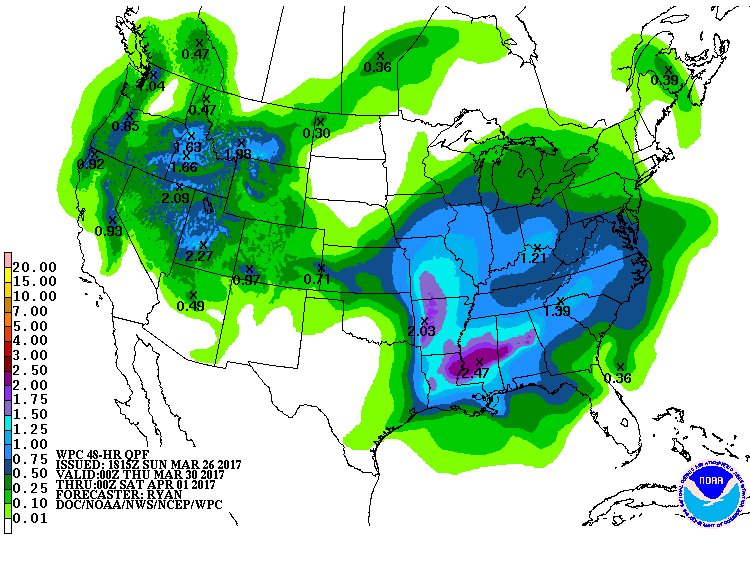
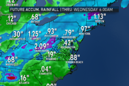
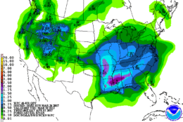
It looks like another storm system will form in the South and then head up the mountains, possibly bringing us some beneficial soaking rains as early as Friday, lasting into Saturday. Friday’s temperatures will depend on how fast and how far north that system’s warm front will be able to make it. There may be a large variance in temperatures from north to south that day.

So, if only for the rain, it looks like weather may have an impact on Friday afternoon’s exhibition game with the Red Sox at Nationals Park.

(WTOP/Storm Team 4)
(WTOP/Storm Team 4)
These images are output from the RPM computer model at two-hour time steps through most of Monday. Look at how rapid and profound the warmup may be.  (Data: The Weather Company. Images: Storm Team 4)
From Monday through most of Tuesday, we will be in the “warm sector” of the storm system, south of a warm front and out ahead of a cold front. That front will pass through late Tuesday. Several chances of showers will accompany the frontal passages. Wednesday will begin a cool down to more seasonable weather. These images are the simulated clouds and radar from the same run of the RPM computer model.  (Data: The Weather Company. Images: Storm Team 4)
How may it all add up? This is the accumulated rainfall projection for Sunday afternoon (when the model was run) through early Wednesday morning. The soaking numbers will just miss us to our northwest, but we could get a few tenths at least.  (Data: The Weather Company. Images: Storm Team 4)
Looking ahead to the end of the week, the numbers from the Weather Prediction Center for Thursday night into Friday evening show the potential impact of that next system. There’s reason to be optimistic for the needed rainfall that may be between half an inch and an inch, but yes, it may affect the Nationals game Friday afternoon. (Weather Prediction Center, NOAA)
(1/14)
(WTOP/Storm Team 4)

Daily weather highlights

MONDAY
-Morning showers, drizzle and patchy fog
-Temperatures rising rapidly as soon as the sun comes back out
-Unseasonably warm; feeling like the middle of spring

TUESDAY
-Already mild to start
-Unseasonably warm again
-Clouding over, scattered showers and possible thunderstorms arriving
-Turning sharply cooler in the evening and overnight

WEDNESDAY
-Strong, cool breeze out of the northwest
-Becoming mostly sunny
-Above-average temperatures but not by as much as the beginning of the week

THURSDAY
-Clear and chilly in the morning
-Partly to mostly sunny afternoon
-Seasonable high temperatures

FRIDAY
-Cloudy and seasonably cool
-Rain arriving by the end of the day
-Central Virginia and southern Maryland possibly warmer than D.C. and northern Maryland
-Umbrellas and ponchos may be needed for Nationals

Editor’s Note: The WTOP Workweek Weather Blog is intended as an in-depth yet plain language summary of the business week’s weather potential in the D.C. area along with an explanation of the contingencies and uncertainties that exist at the time of publication. For the latest actual Storm Team 4 forecast, check out the main WTOP Weather Page.

Federal News Network Logo
Log in to your WTOP account for notifications and alerts customized for you.

Sign up