


Dave Dildine, wtop.com
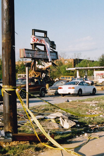
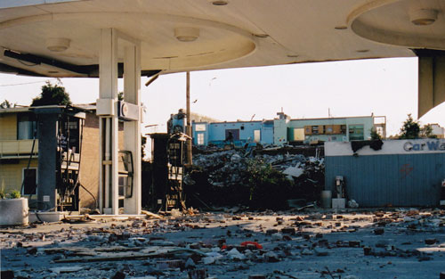
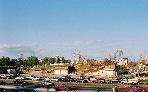
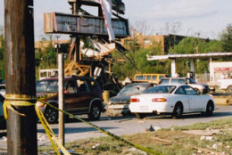
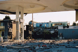
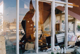
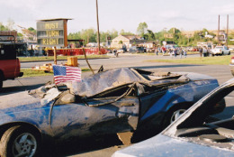
LA PLATA, Md. – Ten years ago, on a muggy Sunday evening, one of the strongest tornadoes ever recorded on the East Coast tore through lower southern Maryland. The April 28, 2002 twister produced significant damage in the town of La Plata, where numerous buildings and structures were completely leveled. The National Weather Service rated the tornado an F4 with wind speeds in excess of 207 miles per hour.
The tornado was responsible for three deaths, one in Charles County and two in Calvert County.
The supercell thunderstorm that produced the twister traveled 175 miles across northern Virginia and Maryland, including its nearly ten-mile-long trip across the Chesapeake Bay. The storm produced a brief tornado near Mount Jackson, Va. around 4:30 p.m. The storm barreled through Fauquier and Prince William Counties with hail and heavy rain. Shortly after crossing the Potomac River, a tornado touched down south of Marbury in Charles County. The tornado raced eastward, carving a 40-mile-long path through lower southern Maryland. In addition to La Plata, it caused damage in parts of southern Hughesville, Benedict, and Port Republic.
The National Weather Service recognized the potential for severe weather in the hours leading up to the storm. At 10:30 a.m. the Sterling forecast office issued a Hazardous Weather Outlook for the evening, saying “isolated tornadoes and large hail are possible.” The Storm Prediction Center in Norman, Ok. issued a tornado watch for parts of Virginia and Maryland at 3:29 p.m. An additional tornado watch went into effect for Eastern Virginia and Southern Maryland at 5:57 p.m.
A tornado warning was issued for the counties of Charles, Prince Georges, Calvert, and St. Mary’s at 7:02 p.m., as the tornado was roaring through La Plata, “AT 702 PM…EMERGENCY OFFICIALS REPORTED A TORNADO ON THE GROUND OVER LA PLATA IN CHARLES COUNTY MOVING EAST. THIS IS A DANGEROUS STORM. SEEK SHELTER IMMEDIATELY!”
Ten years later, much has been learned from storms such as the one that affected La Plata. Chris Strong, warning coordination meteorologist at the National Weather Service in Sterling, Va., says that the technology and knowledge of the science has evolved since then.
“Tornado detection capability has advanced quite a bit since the days of the La Plata tornado ten years ago,” he says.
Jared Klein, meteorologist at the National Weather Service in Sterling Va., says among the many improvements in severe weather forecasting has been the fine-tuning of weather warnings.
“One of the biggest changes has been going from county-based warnings to storm-based warning polygons,” Klein says. In the case of the La Plata event, the tornado warning was issued for a very large area and included millions of persons far-removed from the storm. Storm-based warnings, he said, “…don’t give unnecessary warning to people who are not in the storm’s path.”
Last month, the National Weather Service’s weather radar was outfitted with Dual-Pol technology. The upgrade gives forecasters an edge when tracking hail-producing thunderstorms and storms that may be producing real-time tornado damage.
Forecasters hope to continue improving storm warning lead time and severe weather awareness in the years to come. Ten years following the La Plata tornado forecasters like Klein remain optimistic. “Our understanding of tornadoes – and the science – has advanced since then,” he says.
Follow WTOP on Twitter.
(Copyright 2012 by WTOP. All Rights Reserved.)