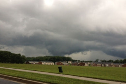
The D.C. area is now upgraded to a \"moderate
risk\" of severe
weather as widespread
thunderstorms hit.
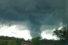
A cloud forms into a funnel shape near Anne Arundel County. (Photo courtesy Charles Hutton)
Photo courtesy Charles Hutton
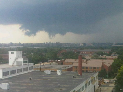
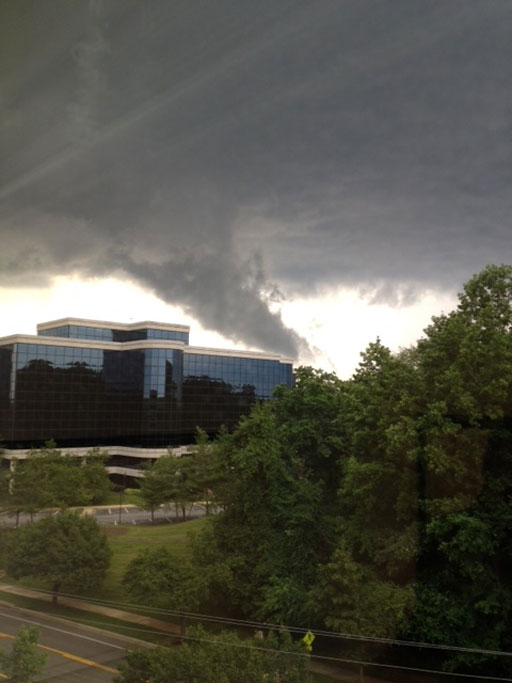
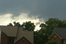
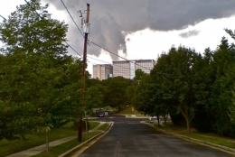
An ominous cloud forms near Alexandria, Va., on
Friday, June 1, 2012. (Courtesy Tony Kontos)
Courtesy Tony Kontos
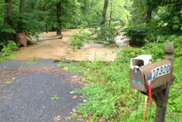
Along Clarksburg Road near Damascus, Md. on
Friday, June 1, 2012.(WTOP/John Aaron)
WTOP/John Aaron
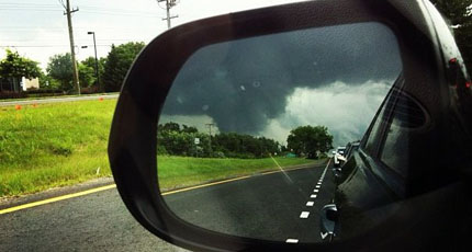
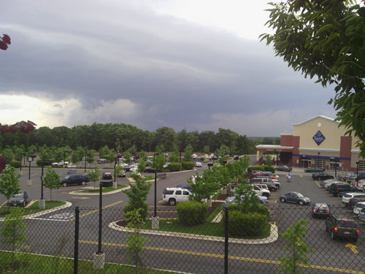
A storm forming near Sterling, Va., in Loudoun
County, Va. (WTOP/Jim Battagliese)
WTOP/Jim Battagliese
"Not looking good across the Potomac from
Nationals Park at 3:20," tweets WTOP's Craig Heist
from Nationals Park. (WTOP/Craig Heist)
WTOP/Craig Heist
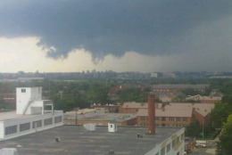
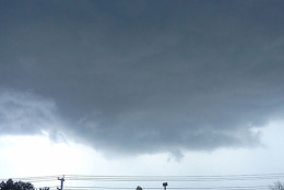
Rotational cloud North Northeast of BWI from
Linthicum looking east to Glen Burnie, Md. in Anne
Arundel County. (Courtesy Paul Vinette)
Courtesy Paul Vinette
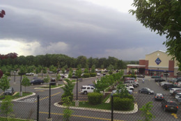
Clouds forming over Savage, Md. (Courtesy
prosef81)
"When I went out to get my chairs from the
backyard, I saw this ... It was rotating, took a
pic a went for cover," says a listener west of
Wiggly Rd. and Route 175 in Jessup, Md. (User
submitted)
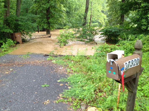
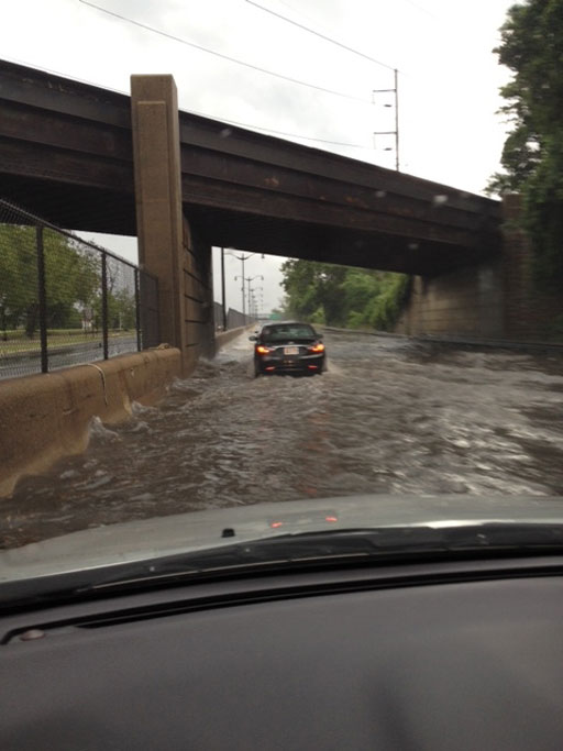
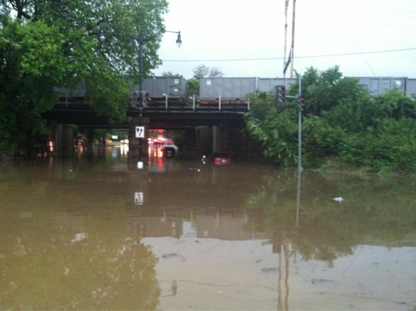
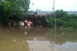
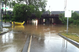
Flooded 295 North in Northeast D.C. (Courtesy
Brent Jaquet)
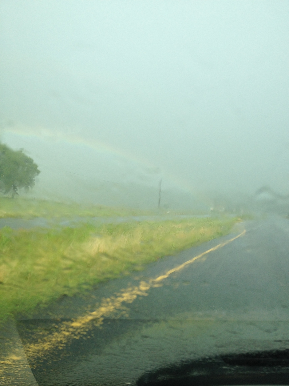
A rainbow appears over Goldvein, Va. on Friday,
June1, 2012.(Courtesy Cory Ashby)
Courtesy Cory Ashby
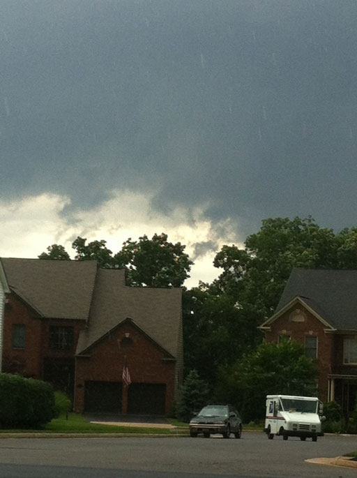
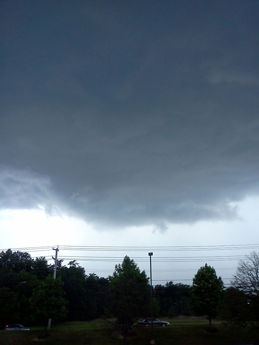
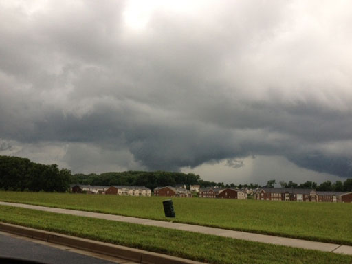
The view of the stormy skies from Bowie, Md., on
Friday, June 1, 2012.
(Courtesy user Claudia)
Courtesy user Claudia
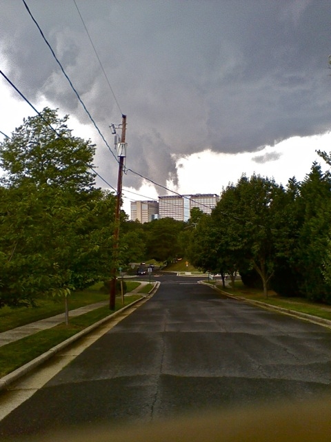
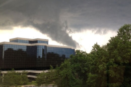
A storm cloud in Alexandria, Va. on Friday, June
1, 2012. (Courtesy Iver M. Olson II)
Courtesy Iver M. Olson II
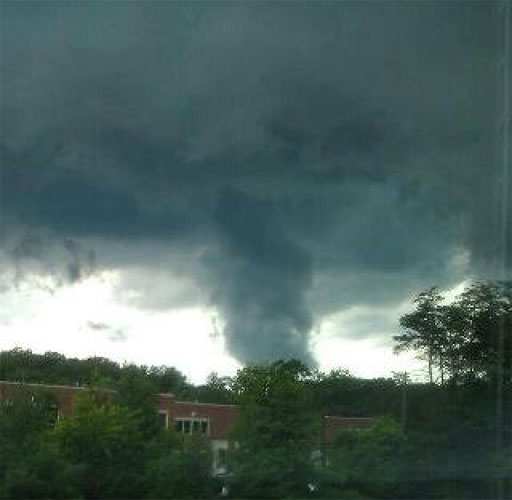
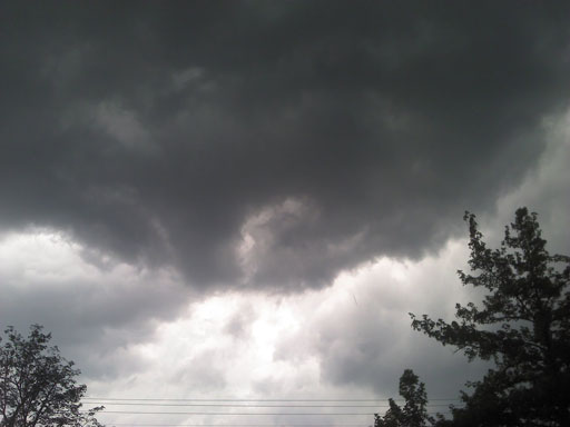
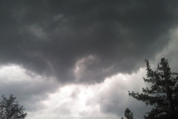
Funnel cloud near Greenbelt, Md. on Friday, June
1, 2012. (Courtesy Paul DePasquale)
Courtesy Paul DePasquale
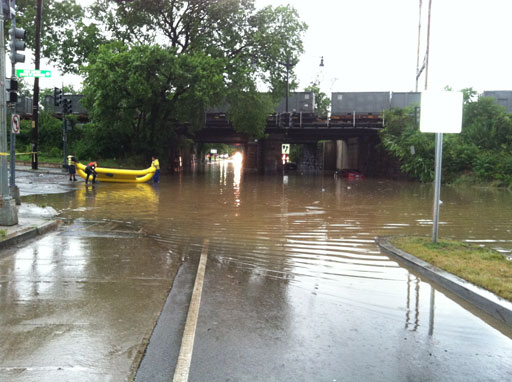
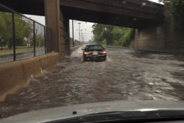
Three cars trapped underwater at Minnesota Avenue
and Nannie Helen Burroughs in Northeast D.C. All
passengers rescued safely. (WTOP/Mark Segraves)
WTOP/Mark Segraves
Crews rescue three drivers who were caught in high
water in Northeast D.C. on Friday, June 1, 2012.
(WTOP/Mark Segraves)
WASHINGTON – The D.C. area is now upgraded to a “moderate risk” of severe weather as widespread thunderstorms drop heavy rains, and warnings throughout the area.
The Twitter feed in this story will cover specific information related to flash floods, tornado warnings, and Metro and Union Station delays due to downed trees.
“I think we’re going to see severe Thunderstorm Watches that are hundreds of miles long,” says Doug Hill, ABC 7 chief meteorologist. “It’s a very large system. The entire listening area is going to see bad weather.”
The worst conditions are expected in northern and central Virginia, north-central Maryland and the western suburbs of Washington, D.C.
Rainfall beginning in the mid-afternoon is expected to grow increasingly heavier into the evening.
Clouds are expected to thicken quickly on Friday afternoon, with the worst weather expected between 5 p.m. and 10 p.m. Some forecasts say the area will see serious thunderstorms, hail and possible tornadoes.
“You have to make plans,” Hill says. “You don’t want to schedule a round of golf (Friday) afternoon or be outside without shelter to get to.”
The likelihood of severe weather is very high, but it’s impossible to pin down exactly where storms will hit the hardest, he says. He suggests area residents check for Thunderstorm Watches and make sure they’re somewhere where shelter and safety are nearby.
See anything? Let us know on Twitter using the hashtag #WTOPstorm.
After the system crosses the Chesapeake Bay, the storms should subside, Hill says.
Saturday is expected to be mild, with temperatures in the 70s, sun and a few clouds.
On Sunday, there is a 30 percent chance of showers.