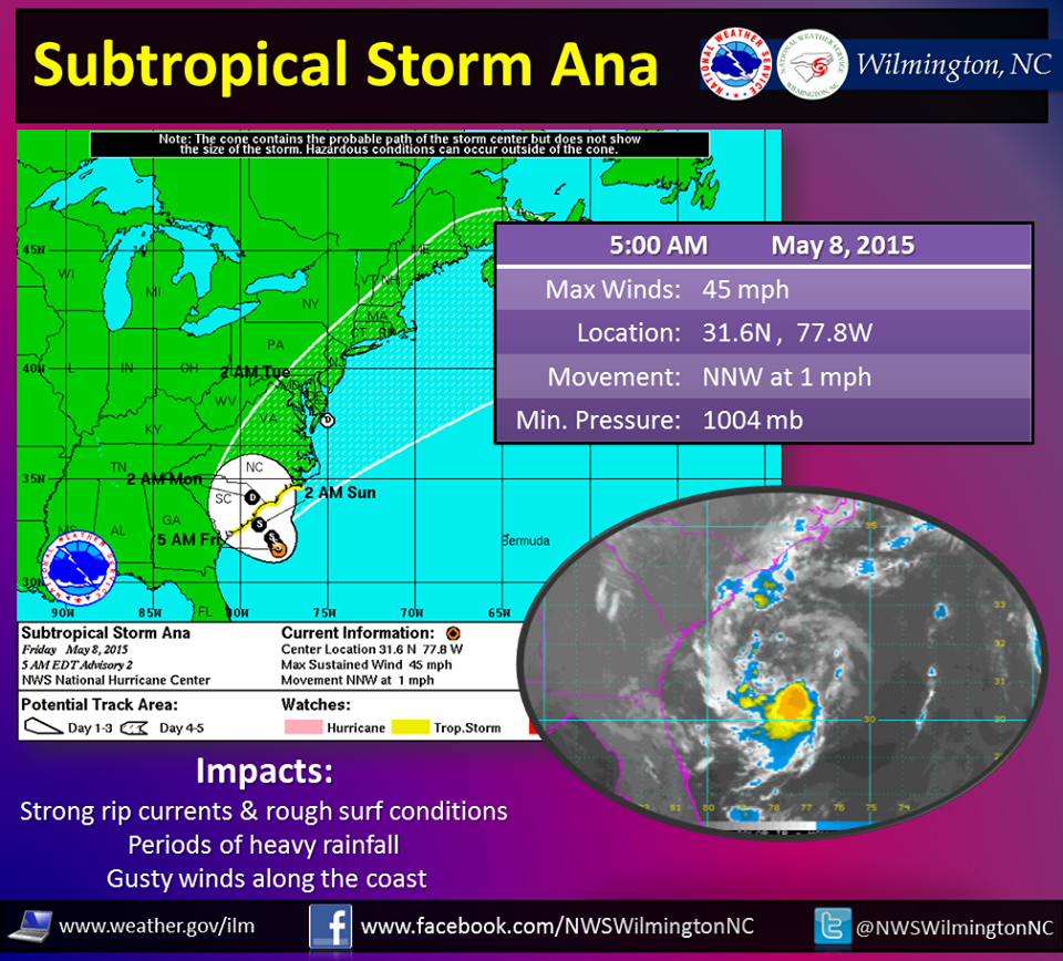
WASHINGTON — It was a little early, but at about 11 p.m. Thursday, the National Hurricane Center declared that we have the first named storm of the season in the Atlantic! I would like to introduce Subtropical Storm Ana — pronounced AH-nah.
Ana will just meander off the southeast coast for much of the weekend, until it starts to make its trek north by late Sunday into Monday. Although most of the activity associated with Ana will be around the coastline from the Carolinas to near Virginia Beach, we could still feel some indirect effects over this weekend.
First things first: Yes, May is early to have a named storm. There have been only 24 named storms that formed in May since 1851! The National Hurricane Center says that May tropical or subtropical storms occur about once every six years, the last one before Ana being Beryl in 2012. Hurricane season doesn’t officially begin in the Atlantic until June 1, lasting through Nov. 30 (in the it runs May 15 through Nov. 30). Anyway, storm is a little different: It’s subtropical, meaning it presents tropical and nontropical characteristics. The National Hurricane Center didn’t even start naming subtropical storms until 2002. Before that time they were simply issued a number or just called an “unnamed storm.”
Tropical vs. nontropical vs. subtropical
So a subtropical storm has characteristics of both tropical and nontropical storms. But what exactly does that mean? Well, tropical storms form over warm water. The warm water provides energy, giving the storm a warm core. Once that energy source is cut off (once it moves over land) the storm begins to weaken.
Nontropical storms are the ones we talk about more often. They are low-pressure systems created by differences in temperatures and more likely to be formed along a frontal boundary. Generally, the cores of these storms are cold in nature.
Subtropical storms, again, have characteristics of both. But subtropical systems have a chance to develop into tropical storms given time. They can begin as nontropical systems, but if they hang out over warm water long enough and start to gain energy from the warm water, they can transition into a tropical system.
So what does Ana mean for the D.C. area?
Humidity. Oh boy, is it going to be muggy out there for this weekend, as moisture increases from the south due to this storm. We will have periods of sun and periods of clouds for much of the weekend, with some foggy conditions in between. Temperatures will remain in the low to mid-80s, but again, the mugginess will make it feel slightly warmer.
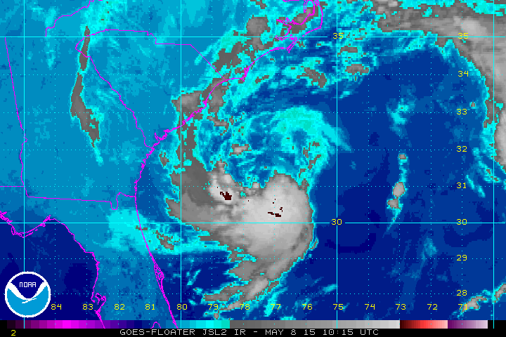
As of Friday morning, Ana was about 160 miles southeast of Myrtle Beach, South Carolina, drifting at times to the north-northwest at 2 mph. Winds associated with Ana are just around 45 mph. Ana will strengthen slowly Friday as it crosses Gulf-stream water, but it will weaken when it moves into colder water near the coastline of South Carolina on Sunday. The prediction is that it will reach the South Carolina coastline and make landfall Sunday as a very weak subtropical (or tropical) storm, or even a depression. Eventually it will move as a remnant low to the northeast, off the Virginia/Maryland coast, Sunday night into Monday before it moves out to sea on Tuesday morning.
The reason why the storm is nearly stalled off the southeast coast is exactly why our weather is so nice in the D.C. area today! Ana is blocked by an upper-level ridge that is influencing our weather here. That ridge will start to break down and move to the east by Saturday or Sunday, allowing for Ana to push to the northeast. Ana will also get help with a boost from an upper-level trough progressing eastward from the western U.S. to the Central Plains and into the Great Lakes.
With that being said, I can’t go completely cloudy or completely sunny for the weekend, between the influence of Ana and high pressure to the north. So I’m forecasting periods of both throughout the weekend — some areas will also have more clouds and some areas will have more sunshine at times; it just depends on your location. Also, with higher humidity levels and some instability, I think we have small chances of passing rain showers or a thunderstorm: Sunday will likely be the better chance, at 30 percent, with better upper-level support).
So keep an eye to the sky if you are headed out to the Susan G. Komen Race for a Cure on the National Mall, or even if you’ve decided to take mom out for a nice outdoor brunch. It will be muggy and warm, but hopefully we can all stay dry! Are you wondering when the rain is coming? Pollen will hopefully go away by the time we get to early next week, as a strong cold front brings chances of rain and storms!