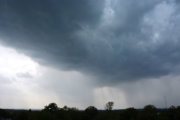
WASHINGTON — Are you ready for another messy commute? As if Mondays aren’t terrible enough, this upcoming Monday, we’ll have to watch for some areas of freezing rain falling around the region, right in time for the morning drive.
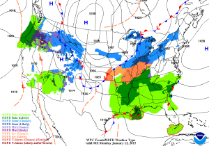
The National Weather Service has issued a freezing rain advisory for much of the WTOP listening area from 10 p.m. Sunday to 9 a.m. Monday. Forecasters are predicting less than a tenth of an inch of ice. The freezing rain is possible through the overnight hours and eventually become plain rain by Monday morning.
High pressure will increase our temperatures on Sunday before heading off the east coast. An area of low pressure will push out of the Great Lakes region that night, eventually moving into the New England area through Monday while dragging a cold front eastward along with it. There’s also a weak area of low pressure over Texas. The interaction between these pressures will allow for moisture to flow in from the Gulf and right into the Mid-Atlantic.
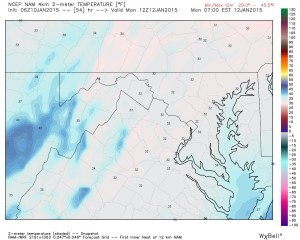
As moisture moves into the region, we will have to keep a close eye on temperatures at the surface. Daytime highs on Sunday should reach into the upper-30s with increasing clouds through the day.
Overnight, however, temperatures will fall below freezing and may stay there at the time precipitation begins. Since the low levels will still be on the cold side — and forecast to be below freezing in most places — and with warmer air above the surface due to a southwesterly flow aloft, we are mainly looking at a freezing rain event for our region.
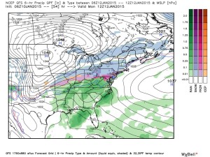
Any freezing rain will gradually turn to a plain cold rain as temperatures move up and top out in the upper-30s for Monday since there is no real source for cold air streaming into our region. The changeover to plain rain is expected through the mid-morning hours, but again, the freezing rain in the morning will definitely be a concern with minor icing on the roadways (not expecting that much in accumulation of ice).
Rain will gradually end Monday evening but the cold air returns. Tuesday’s highs will only reach into the upper 20s/lower 30s behind the cold front. So pack your patience once again for Monday morning, you may need it.
Follow @WTOP on Twitter and WTOP on Facebook.