D.C. is preparing for a hefty dose of snow this weekend.
A major winter storm is lining up for the D.C. region, with snow likely breaking out late Saturday and intensifying overnight. To prepare, the National Weather Service issued a winter storm watch through Monday.
Forecast models show a high chance of at least five inches, with double-digit totals possible in spots.
By Sunday, sleet and freezing rain could mix in — especially south of Route 50 and near Interstate 95. Bitter cold follows, with dangerous wind chills into early next week. Travel impacts could linger into Monday morning.
“We’re looking to get more snow than we’ve got in the previous years,” said Warnique West, D.C.’s “Snow Queen” and director of snow operations for the Department of Public Works.
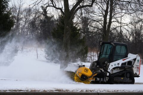
“Right now we’re prepping all of our equipment, making sure that it’s ready. We have notified our staff that we’re going to be here for maybe a few days at a time,” West said.
She’s following weather forecasts and projections for the incoming storm. Starting Thursday night, salt trucks will begin pretreating roadways in the District to help the snow melt once it starts falling. The Department of Public Works called it an “all hands on deck” situation, with approximately 200 city trucks augmented and some 100 contractors providing assistance.
She said the public can help her crews as they work to make the streets safe.
“When you see the plows coming, stay at least 100 feet back,” West said.
If the event becomes a snow emergency, no parking will be allowed on established emergency routes, and cars on those routes will be towed. West urged everyone to cooperate with city crews and move their cars out of the way.
She also asked for patience in terms of other services the Department of Public Works provides.
“We’re trying to do the best we can to not just get the streets cleared but see what we can do as far as getting some salt into the alleys, but crews still have to be safe trying to navigate these icy conditions,” she said. “So, if you could just have patience with us, we’re trying to pick up your trash, recycling and compost.”
D.C.’s neighbors in Maryland are also wasting no time getting ready.
Ahead of the storm, Maryland Gov. Wes Moore has declared a state of preparedness, which enhances the state’s ability to respond quickly to the hazards that heavy snow and ice could bring.
“I am directing the Department of Emergency Management to coordinate the comprehensive preparation of State government ahead of potential impacts related to the incoming weather system,” Moore said in a news release.
According to Moore’s office, the Maryland National Guard is preparing personnel and specialized vehicles across the state for a rapid response. Personnel and vehicles will be prepositioned in Western Maryland, Central Maryland and on the Eastern Shore, according to the governor’s office.
As far as Metro goes, impacts to bus service will likely be the most significant. Whitney Nichels, vice president of communications at Metro, said the transit agency has changed its process for service changes during snowstorms.
“We used to have kind of a light, moderate and severe system that we used to communicate changes to bus service and inclement weather,” she said. “Now, in an effort to restore service as quickly as possible, as soon as roads and streets become passable, we are now restoring bus service on an individual, route by route basis.”
Nichels said in recent years the D.C. region has not experienced a snowstorm that impacted rail service in a significant way. She also did not say what exactly it would take for that to happen, but highlighted some of the technology that safeguards rail service.
“We have special deicer trains that actually come through and release a deicing agent on the third rail to make sure that it doesn’t freeze and it stays warm and is able to keep the power running, which is critical,” Nichels said.
- Listen to WTOP online and on the radio at 103.5 FM or 107.7 FM.
- Current traffic conditions
- Weather forecast
- Closings and Delays
- Sign up for WTOP alerts
Forecast
THURSDAY
Partly cloudy, breezy
Highs:48-55
Winds: West 5-15, Gusts 25 mph
Milder afternoon highs in the 50s will be a welcome change after our recent cold snap. This will be a good day to prepare for the possible snowstorm heading our way for the upcoming weekend.
THURSDAY NIGHT
Partly cloudy
Lows: near 30
Winds: Calm
Winds will ease overnight under partly cloudy skies with temps just around 30.
FRIDAY
Partly cloudy
Highs:38-43
Winds: South 5-10 mph
The last day of the week with near normal temperatures, an Arctic cold front looks to move through the region during the weekend.
SATURDAY
Cloudy, late evening snow
Highs: near 20
Winds: North 5-10 mph
As of now, Saturday daytime looks dry but very cold, with highs around 20 degrees. That should give time to wrap up any pre-storm prep or last-minute shopping. The first flakes may show up Saturday evening, then snow becomes steadier and heavier overnight. If you’re heading out, travel conditions could go downhill pretty quickly.
SUNDAY
Snow, moderate to heavy at times
Highs: 20s
Winds: North 5-10 mph
A significant winter storm is expected to bring measurable snow to much of the D.C. region, and it’s going to stay cold with highs in the 20s.
Get breaking news and daily headlines delivered to your email inbox by signing up here.
© 2026 WTOP. All Rights Reserved. This website is not intended for users located within the European Economic Area.