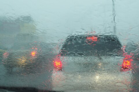
Temperatures dropped rapidly after Sunday’s snowstorm, officials are still urging drivers to be cautious due to the possibility of black ice on roadways.
WTOP Meteorologist Mike Stinneford said roads became slick due to any slush and standing water turned to ice.
Although a Winter Weather Advisory has been canceled, the concern for the rest of Sunday will be the cold and the wind. A Cold Weather Advisory will remain in effect until 1 a.m. Monday for part of central Virginia and Western Maryland.
And an extreme cold alert has been issued for Montgomery County from Sunday until Monday 3 p.m..
The Maryland Transportation Authority also said a Wind Warning was under effect for the Bay Bridge and the Gov. Harry W. Nice Memorial/Sen. Thomas ‘Mac’ Middleton Bridge Sunday, urging house trailers, vehicles with roof-mount racks, motorcycles and box trailers to use caution.
Those warnings are issued when wind speeds over the bridge are 30-39 mph for a continuous period of 10 minutes or more, or when wind gusts persistently exceed 30 mph over a period of 15 minutes.
“Blustery and very cold for the rest of the afternoon,” 7News First Alert meteorologist Matt Ritter said. “Wind chills will be in the single digits by this evening.”
He said this will be an issue for the for much of Sunday afternoon. Reports show 1 to 3 inches of snow fell along and north of Interstate 70 early Sunday.
Charlie Gischlar, the deputy director of communications with the Maryland State Highway Administration, is advising drivers to stay off the roads, when possible. But, if you do drive, take it slow on ice and snow, he told WTOP.
Looking to the Monday morning commute and beyond
Prepare for a possibly icy commute Monday morning, Gischlar said. But he added that Maryland roads will be prepared.
The state has about “100 trucks that have mobile infrared sensors so we can tell when a road’s about to freeze up. And we can go and strategically deploy the trucks and treat the roadways before they freeze,” he said.
Tim Serrano, manager for the Montgomery County Department of Transportation’s Storm Operations Center, said they are watching the roads and treating them for slick spots as the temperatures drop.
“As soon as the sun goes down, we know that the temperatures are going to fall well below freezing into the teens,” Serrano said. “We’re going to have crews available, monitoring those roads overnight, and we’ll be treating those roads as needed, and we’ll make sure to have a good presence out before the morning rush hour tomorrow as well. Just to address any icy conditions.”
It will remain cold out there as the day goes on: Temperatures are around or just above freezing, which means main roads may become slushy and some areas may become icy as temperatures fall below freezing over the next few hours, Stinneford said.
Pay special attention to bridges, overpasses, exit and entrance ramps, and untreated secondary roads, he said.
“Be very careful on elevated roadways,” said 7 News First Alert Meteorologist Mark Peña, warning about accumulating ice on the road.
“No matter how much snow you see, it’s not only going to stick around for the rest of Sunday but for most of Monday,” said Peña, adding that Sunday night will mark the coldest night of the season so far.
By Monday morning, temperatures will be in the teens as people head out the door, with wind chills close to zero.
Transportation agencies continue to urge drivers and pedestrians to use extreme caution, especially on secondary roads and sidewalks, where snow and ice may linger.
Temperatures will finally climb back above freezing by Tuesday.
Last week, a snowstorm hit the D.C. region in December for the first time since 2017.
The next time it snows, you may want a “Snowzilla Gauge” to measure the amount of snowfall. WTOP’s Traffic reporter Dave Dildine released the pet project, which is a 3-foot-tall, 6-inch-wide wooden snow stick that will measure winter storms in the D.C. area.
Dildine said the gauge also shows how often, based on snow history records, the region received an inch of snow, two inches, or a foot of snow, for example.
If you’re interested in purchasing a Snowzilla Gauge, email Dave at dave.dildine@wtop.com!
- Listen to WTOP online and on the radio at 103.5 FM or 107.7 FM.
- Current traffic conditions
- Weather forecast
- Closings and Delays
- Sign up for WTOP email alerts
- Get custom alerts with the WTOP app for Apple and Android phones
FORECAST
Mark Peña, 7 News First Alert Meteorologist
THIS EVENING:
Mostly clear
Temperatures: 20s; Wind Chills: 10s
Winds: Northwest 10-20 mph; Gusts: 30-35 mph
Mainly clear, bitterly cold night ahead.
TONIGHT: COLD ALERT
Mostly clear & cold
Lows: 18-22
Wind Chill: 5-10
Winds: Northwest 15-20 mph
A very cold night due to wind chills in the single digits. The bus stop and morning commute will be very cold and those outside should dress in many layers and cover exposed skin to protect from frostbite.
MONDAY: COLD ALERT
Partly sunny
Highs: 28-34
Wind Chill: 20s
Winds: Northwest 10-15 mph
Gusts: 20-25 mph
Morning temperatures in the single digits will only climb into the upper 20s to low 30s. Many neighborhoods will be sub-freezing all day long.
TUESDAY:
Mostly sunny
Highs: 32-36
Winds: West 5-10 mph
Sunny skies continue as temperatures finally warm above freezing for the first time since late Sunday.
WEDNESDAY:
Partly cloudy
Highs: 47-52
Winds: West 5 mph
Temperatures approach average for the first time in days, melting any left over snow.
CURRENT CONDITIONS
Get breaking news and daily headlines delivered to your email inbox by signing up here.
© 2025 WTOP. All Rights Reserved. This website is not intended for users located within the European Economic Area.