Some heavy rain and storms possible going through the afternoon and into the overnight. More widespread showers & storms around the region compared to yesterday bringing the chance for flash flooding. Not the best pool day. pic.twitter.com/buL4Xs5Ye0
— Lauryn Ricketts (@laurynricketts) June 10, 2018
Patchy dense fog has developed across portions of the region morning. Be alert for sudden reductions in visibility. Reduce speed,
— NWS DC/Baltimore (@NWS_BaltWash) June 10, 2018
use low beam headlights, & leave plenty of following distance
between you & the vehicle in front of you. The fog will
dissipate by mid AM.

WASHINGTON — Showers, storms and possible flooding are all in the forecast for the D.C. area on Sunday and into Monday morning.
Quick Links:
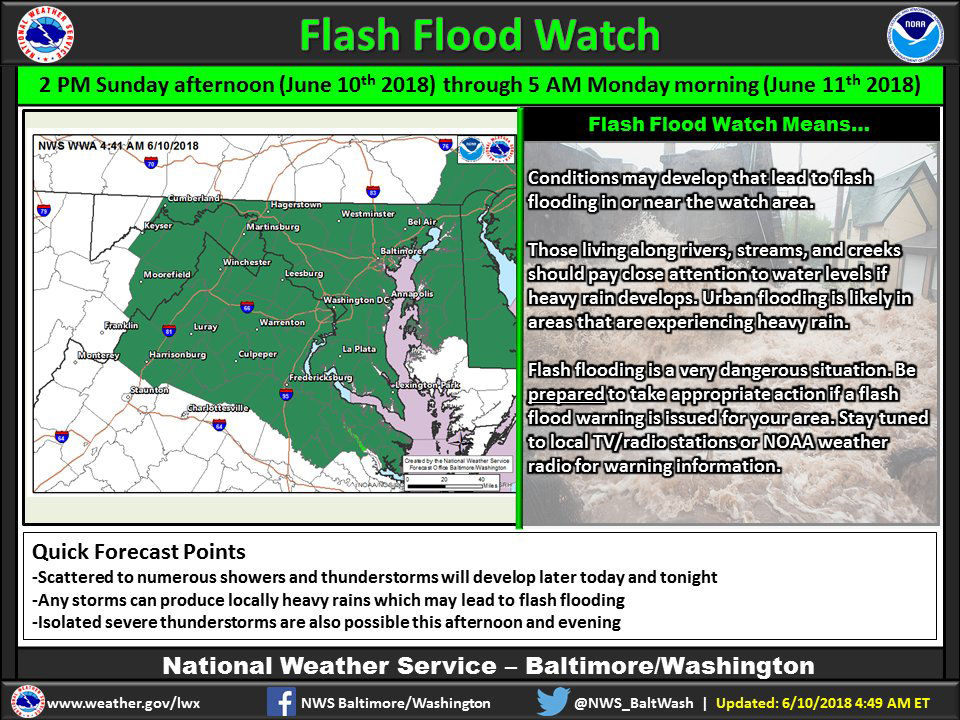
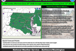
The National Weather Service has issued a flash flood watch for parts of the D.C. area that will be in effect until 5 a.m. on Monday.
A flash flood watch means that conditions may develop that lead to flash flooding.
Keep an eye to the sky again today! Thunderstorms are expected to develop later today and tonight, which may produce heavy rains, leading to flash flooding. Isolated severe thunderstorms are also possible this afternoon and evening. Check https://t.co/t54l4ELo2o for the latest. pic.twitter.com/F3mHzOQLlm
— NWS DC/Baltimore (@NWS_BaltWash) June 10, 2018
The weather service said multiple rounds of showers and thunderstorms are expected on Sunday afternoon into Sunday night that could produce 1 to 3 inches of rain on average.
Some areas might see higher amounts.
“Flash flooding is definitely a possibility,” said Storm Team 4 meteorologist Lauryn Ricketts. “We will have to closely monitor the flood threat for the second half of your Sunday.”
And in Howard County, where flooding devastated Ellicott City weeks ago, officials are taking proper precautions ahead of the heavy rain and lightning expected in the county around 4 p.m. Howard County officials have paused cleanup efforts and credentialing.
Due to impending weather, CREDENTIALING at @HoCoGov George Howard Building and CLEANUP OPERATIONS along Main Street, #EllicottCityMD will END TODAY, June 10 at 3:30 p.m. We are asking those working in this area to wrap up today’s cleanup efforts immediately. #ECStrong
— Howard County Gov’t (@HoCoGov) June 10, 2018
What to expect
Rickets said thunderstorms containing heavy rain should be expected through the overnight hours on Sunday into Monday.
The National Weather Service has issued a flash flood watch for the following areas until 5 a.m.:
Maryland
- Baltimore County
- Anne Arundel County
- Howard County
- Carroll County
A flash flood watch means that conditions may develop that lead to flash flooding, which is a very dangerous situation.
Previously, the National Weather Service had issued the flash flood watch for the most of the D.C. area, but the watch was cancelled for D.C., Virginia and parts of Maryland just after 2 a.m.
The weather service said on average rainfall amounts from 1 to 3 inches are expected, though some areas could see higher amounts.
Forecast
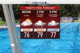
Temperatures peaked around 80 on Sunday. You can expect showers and storms with heavy rain through much of Sunday afternoon into the overnight. Highs will be in the 60s on Sunday night.
On Monday, the humidity will decrease with highs near 70 as showers continue.
The humidity returns on Tuesday. Highs will be in the lower to mid 70s, there could be a few showers but skies will be partly sunny.
Things get warmer on Wednesday with highs in the mid 80s. Wednesday will be more humid and there is a chance for storms.
Traffic
The rain could lead to slick roads, which could cause a lot of traffic headaches around the region.
For the most updated traffic report, visit WTOP’s traffic center. You can see a map of the latest traffic conditions below.