WASHINGTON — It’s a little early to know exactly where cloud cover will be a factor for viewing next month’s total solar eclipse but climate records do reveal a few hints.
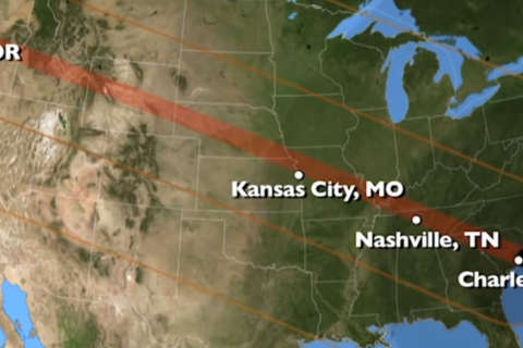
Using hourly climate data from more than 800 weather stations, researchers with the National Oceanic and Atmospheric Administration have mapped viewability percentages for the eclipse during the hours that the moon’s shadow will slide across the continent on August 21. The probabilities are based on data logged from 2001 to 2010.
The measurements reveal that viewers in the heartland and Intermountain West will have the best odds for clear blue skies. Along the total eclipse path, morning humidity in Oregon and afternoon pop-up storms in the Southeast yielded higher probabilities of cloud cover in those regions.
See the interactive map below. Skywatchers in locales with higher percentages are more likely to have a view unobstructed by clouds.
In Washington, the partial solar eclipse will occur during the mid-afternoon hours.
At 2:42 p.m. on August 21, the researchers found that there is a 35 percent chance of broken clouds and 25 percent chance of overcast conditions based on readings from Reagan National Airport.


