The. U.S. National Hurricane Center in Miami said at 5 a.m. Wednesday that Ian now has top sustained winds of 140 mph and is centered about 75 miles west-southwest of Naples, Florida.
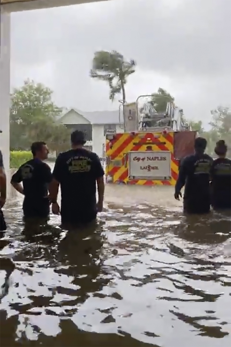
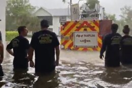
Tropical_Weather_63060 This image provided by the Naples Fire Rescue Department shows firefighters looking out at the firetruck that stands in water from the storm surge from Hurricane Ian on Wednesday, Sept. 28, 2022 in Naples, Fla. Hurricane Ian has made landfall in southwestern Florida as a massive Category 4 storm. (Naples Fire Department via AP)
Naples Fire Department via AP
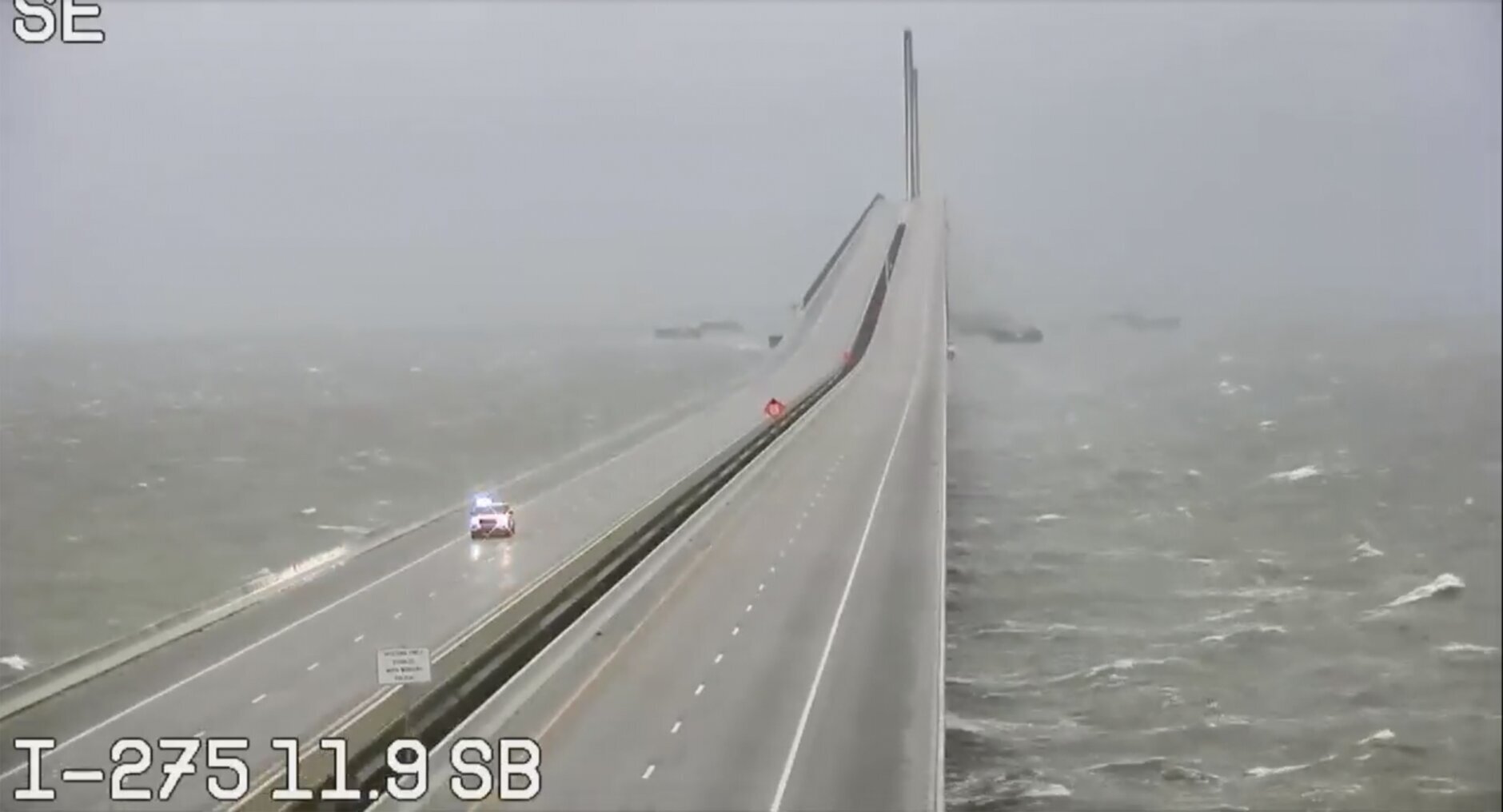
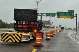
Tropical_Weather_79244 This image provided by FLDOT shows an emergency vehicle traveling on the Sunshine Skyway over Tampa Bay, Fla., on Wednesday, Sept. 28, 2022. Hurricane Ian rapidly intensified off Florida's southwest coast Wednesday morning, gaining top winds of 155 mph (250 kph), just shy of the most dangerous Category 5 status. (FDOT via AP)
FDOT via AP
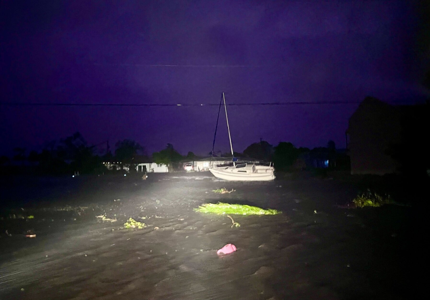
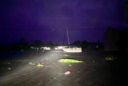
Tropical_Weather_67492 A displaced boat sits beside the roadway in the southeast corner of Cape Coral on Wednesday night, Sept. 28, 2022, as the winds of Hurricane Ian continue to strike the flood-soaked streets. (Douglas R. Clifford/Tampa Bay Times via AP)
Douglas R. Clifford/Tampa Bay Times via AP
Tropical_Weather_52050 Brianna Renas, 17, inspects a fallen palm tree outside her home in Cape Coral after riding out Hurricane Ian with her family on Wednesday, Sept. 28, 2022, in Cape Coral. (Douglas R. Clifford/Tampa Bay Times via AP)
Douglas R. Clifford/Tampa Bay Times via AP
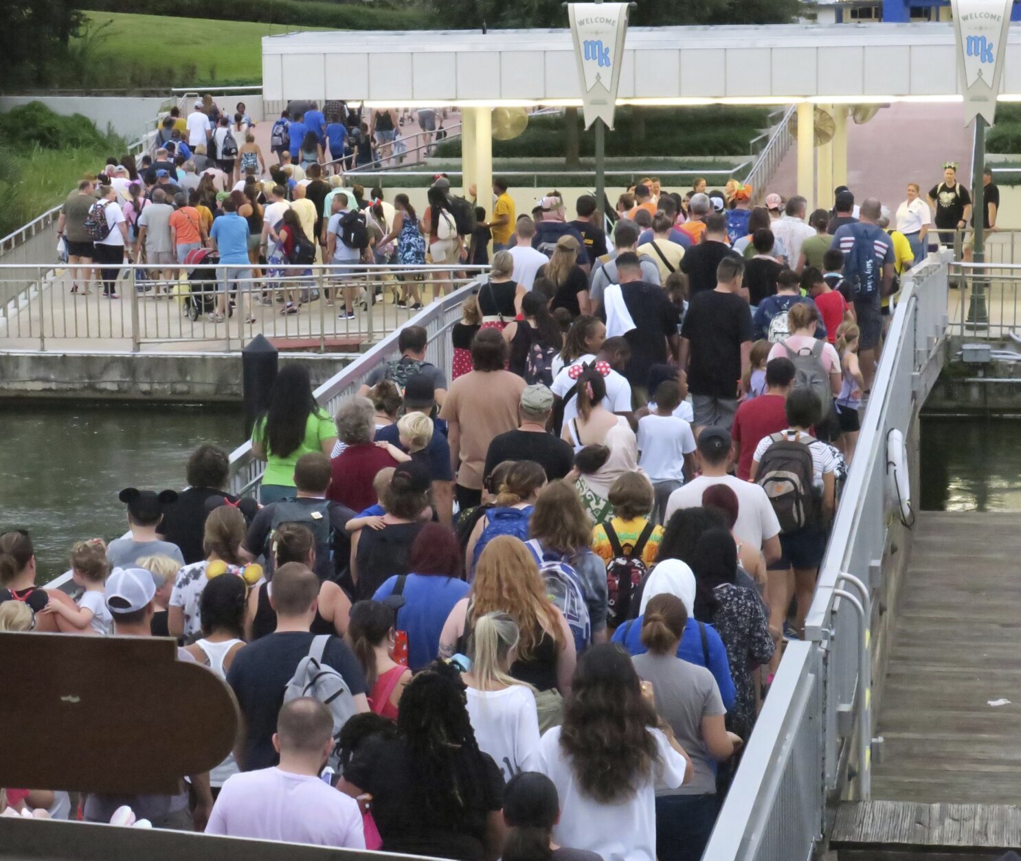
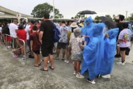
Tropical_Weather_Florida_95471 Guests wait for tram transportation at the Magic Kingdom at Walt Disney World after the park closed early to accommodate an evening special event, Tuesday, Sept. 27, 2022, in Lake Buena Vista, Fla. Disney World, Universal Orlando and SeaWorld Orlando all announced Tuesday that they will be closed Wednesday and Thursday due to the weather conditions caused by Hurricane Ian. (Joe Burbank/Orlando Sentinel via AP)
Joe Burbank/Orlando Sentinel via AP
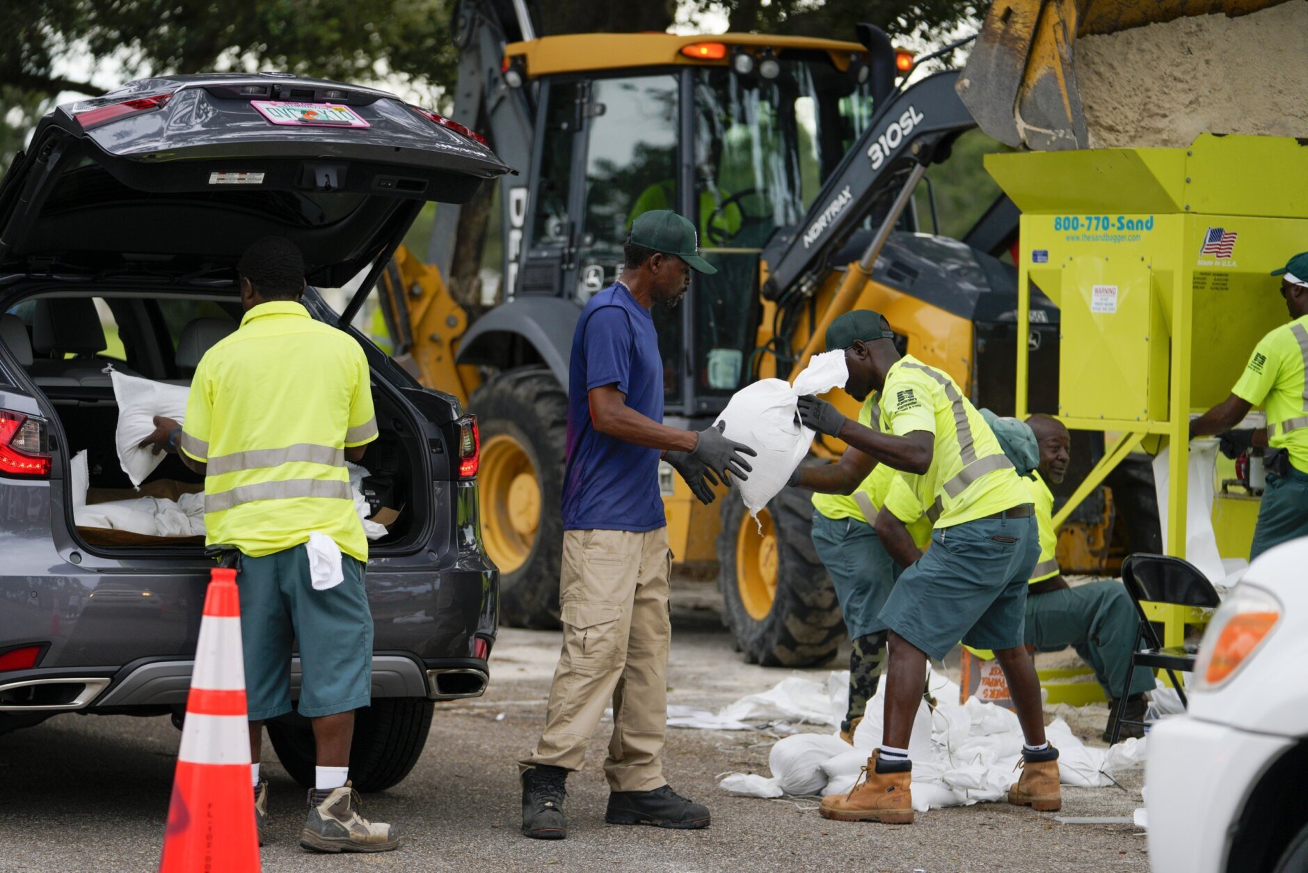
Tropical_Weather_Florida_72660 Eric Byrd hands a sandbag to Clifford Coston while working to fill people's trucks at a sandbag station at Northwest Park, Tuesday, Sept. 27, 2022, in St. Petersburg, Fla., as Hurricane Ian approaches. (Martha Asencia-Rhine/Tampa Bay Times via AP)
Martha Asencia-Rhine/Tampa Bay Times via AP
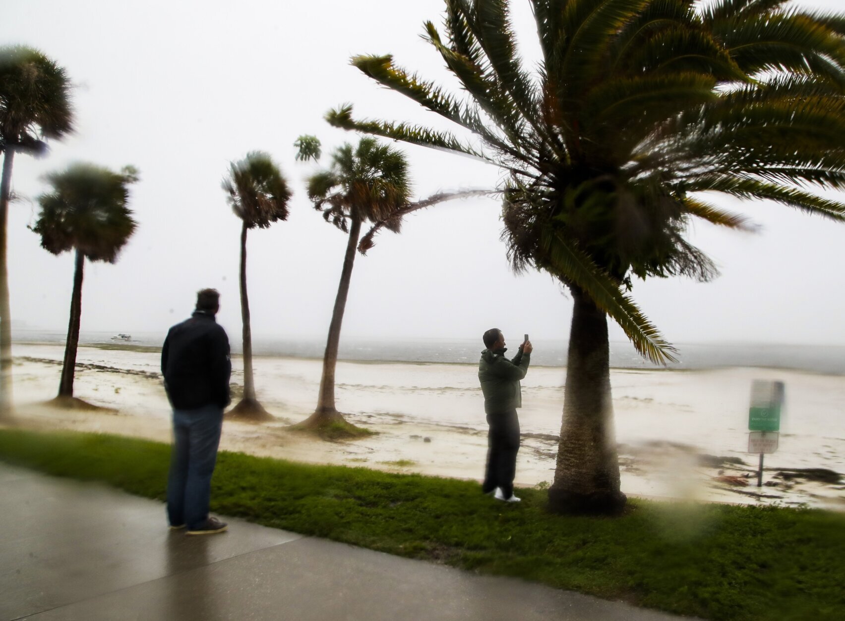
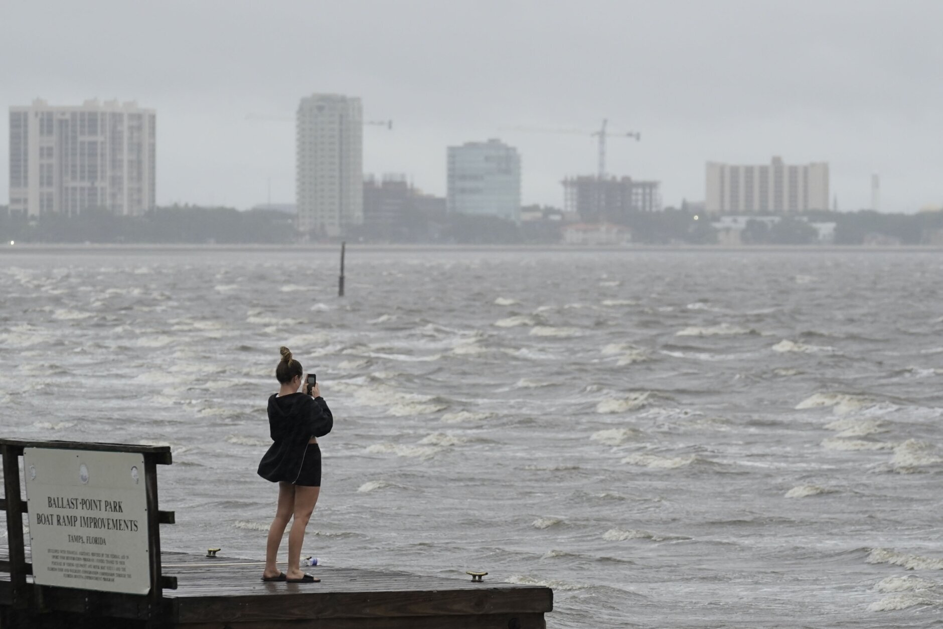
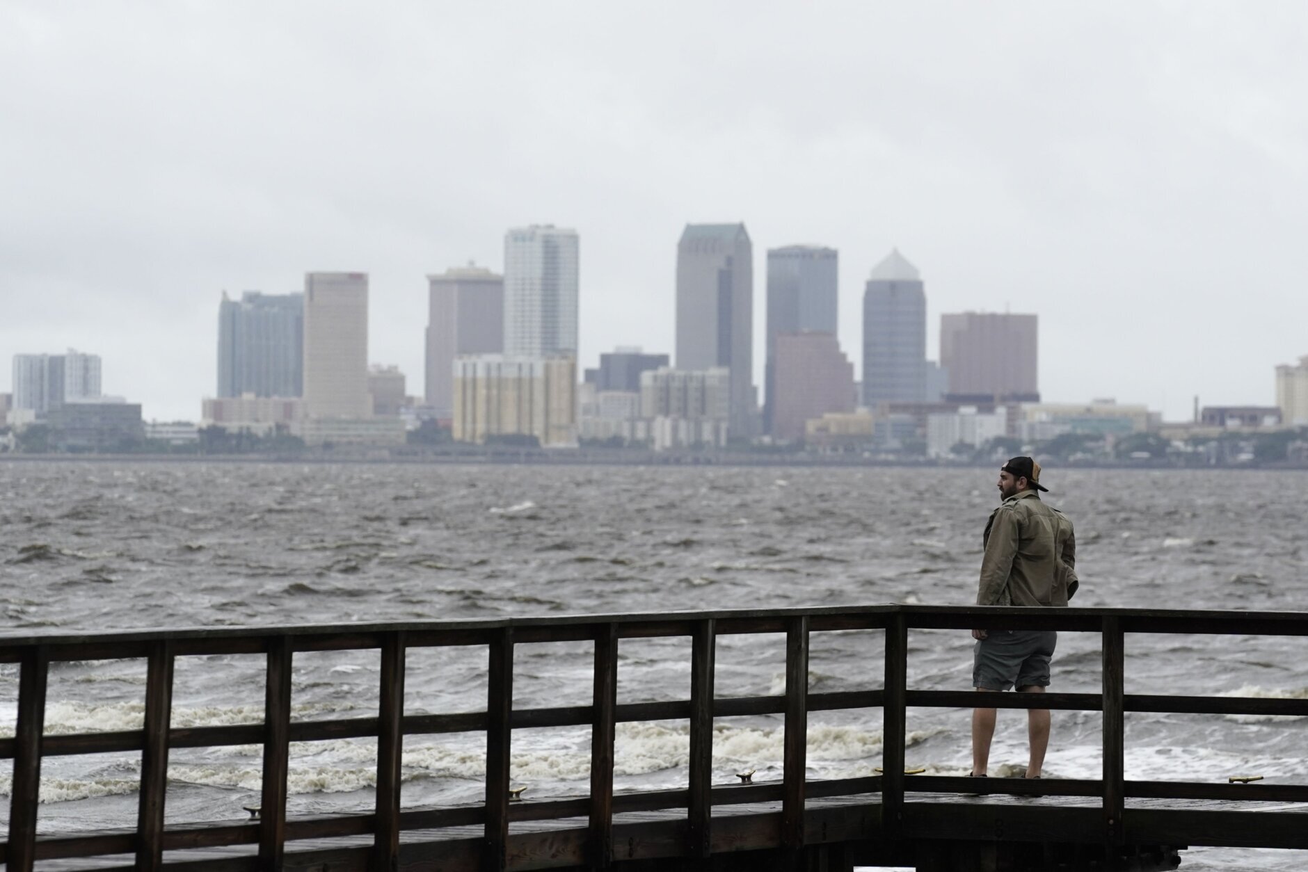
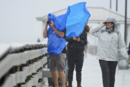
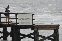
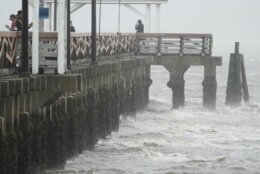
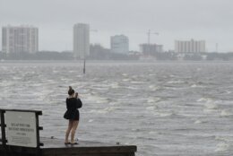
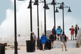
APTOPIX_Tropical_Weather_31251 Ash Dugney views Tampa Bay on the Ballast Point Pier ahead of Hurricane Ian, Wednesday, Sept. 28, 2022, in Tampa, Fla. (AP Photo/Chris O'Meara)
AP Photo/Chris O'Meara
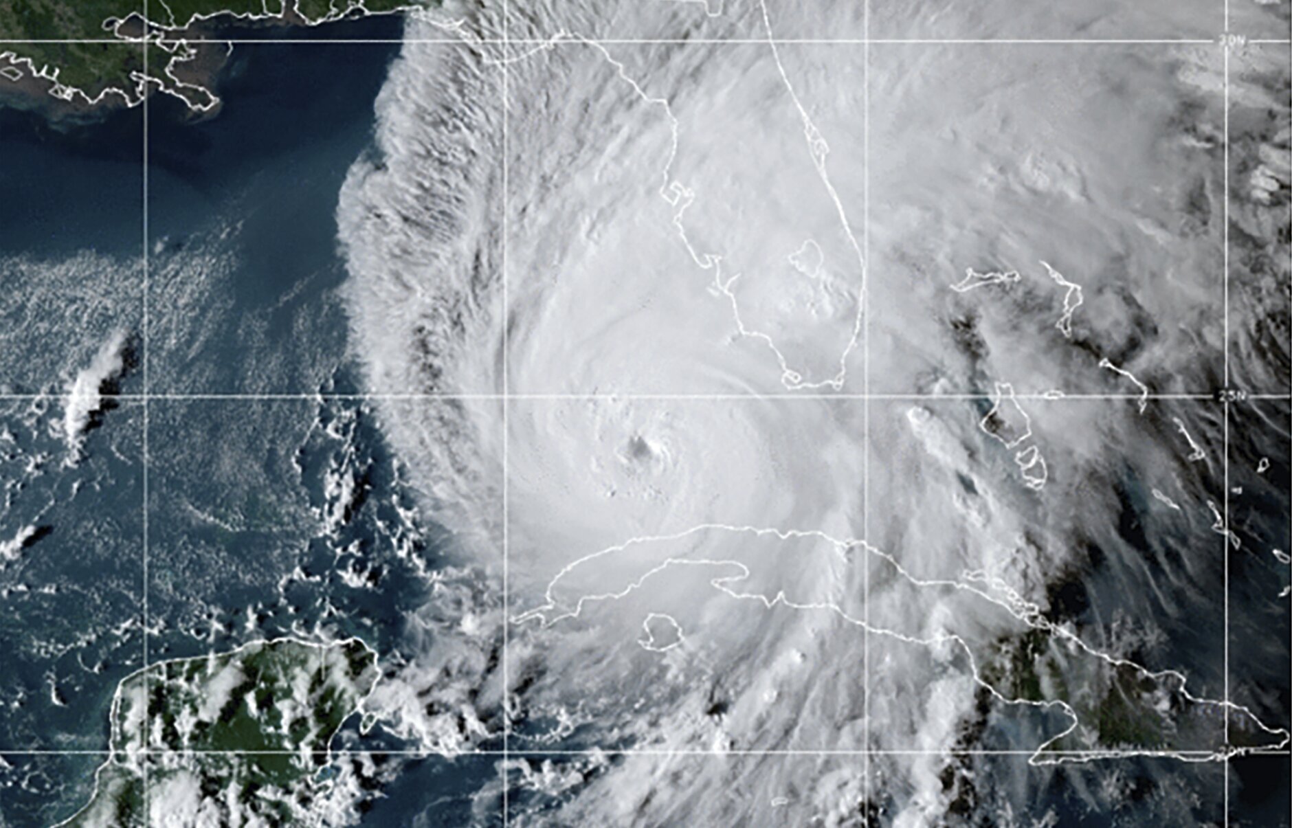
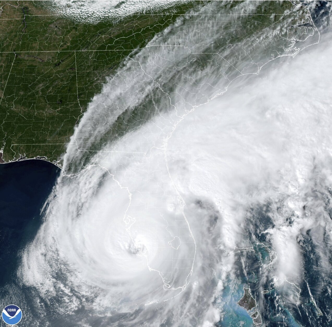
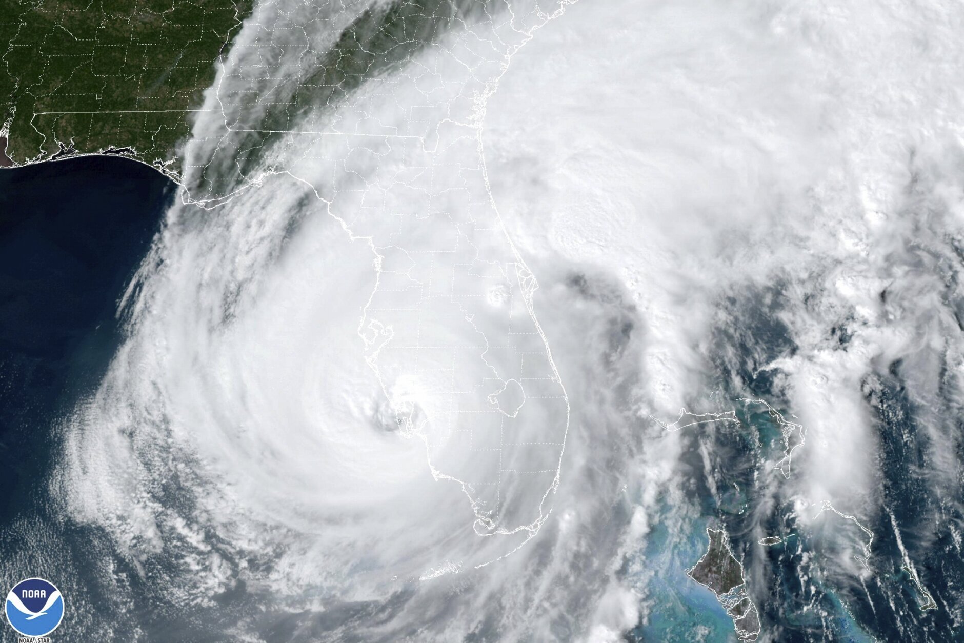
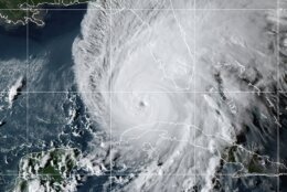
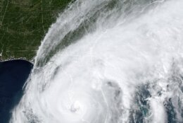
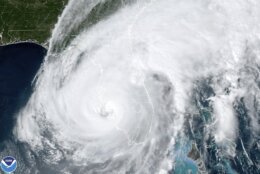
Tropical_Weather_Florida_06237 This GOES-East GeoCcolor satellite image taken at 10:10 p.m. EDT on Tuesday, Sept. 27, 2022, and provided by the National Oceanic and Atmospheric Administration (NOAA), shows Hurricane Ian over the Gulf of Mexico. Ian tore into western Cuba as a major hurricane Tuesday, knocking out power to the entire country and leaving millions people without electricity, before churning on a collision course with Florida over warm Gulf waters amid expectations it would strengthen into a catastrophic Category 4 storm. (NOAA via AP)
NOAA via AP
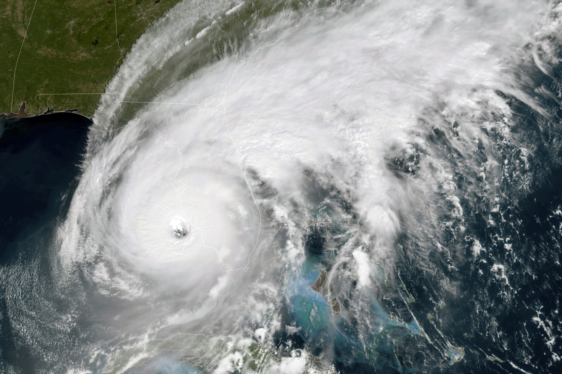
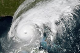
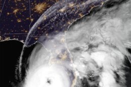
Tropical_Weather_Florida_68355 This GOES-East GeoColor satellite image taken at 12:01 a.m. EDT on Wednesday, Sept. 28, 2022, and provided by the National Oceanic and Atmospheric Administration (NOAA), shows the eye of Hurricane Ian approaching the southwest coast of Florida. Hurricane Ian's most damaging winds began hitting Florida's southwest coast Wednesday, lashing the state with heavy rain and pushing a devastating storm surge after strengthening to the threshold of the most dangerous Category 5 status. (NOAA via AP)
NOAA via AP
Tropical_Weather_Florida_68355 This GOES-East GeoColor satellite image taken at 12:01 a.m. EDT on Wednesday, Sept. 18, 2022, and provided by the National Oceanic and Atmospheric Administration (NOAA), shows the eye of Hurricane Ian approaching the southwest coast of Florida. Hurricane Ian's most damaging winds began hitting Florida's southwest coast Wednesday, lashing the state with heavy rain and pushing a devastating storm surge after strengthening to the threshold of the most dangerous Category 5 status. (NOAA via AP)
NOAA via AP
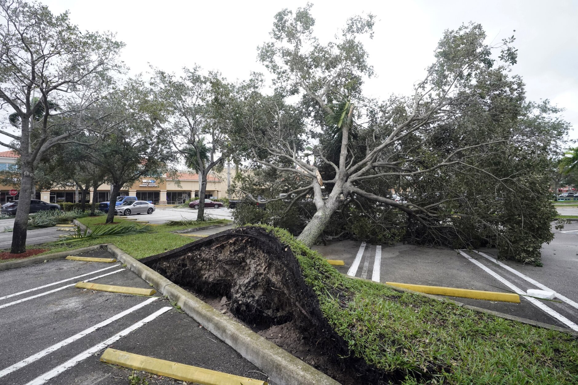
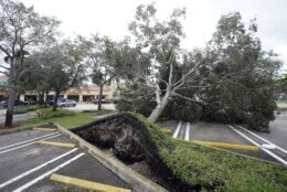
Tropical_Weather_Florida_47269 An uprooted tree, toppled by strong winds from the outer bands of Hurricane Ian, rests in a parking lot of a shopping center, Wednesday, Sept. 28, 2022, in Cooper City, Fla. (AP Photo/Wilfredo Lee)
AP Photo/Wilfredo Lee
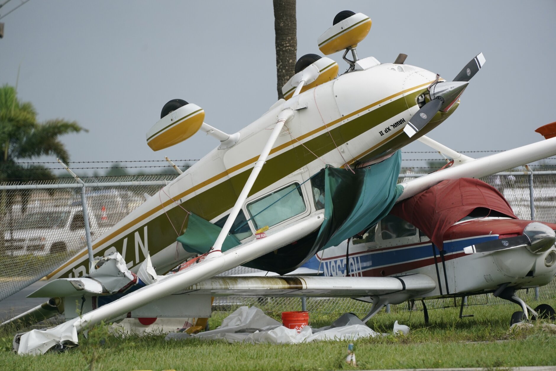
Tropical_Weather_83792 Airplanes overturned by a likely tornado produced by the outer bands of Hurricane Ian are shown, Wednesday, Sept. 28, 2022, at North Perry Airport in Pembroke Pines, Fla. Hurricane Ian rapidly intensified as it neared landfall along Florida's southwest coast Wednesday morning, gaining top winds of 155 mph (250 kph), just shy of the most dangerous Category 5 status. (AP Photo/Wilfredo Lee)
AP Photo/Wilfredo Lee
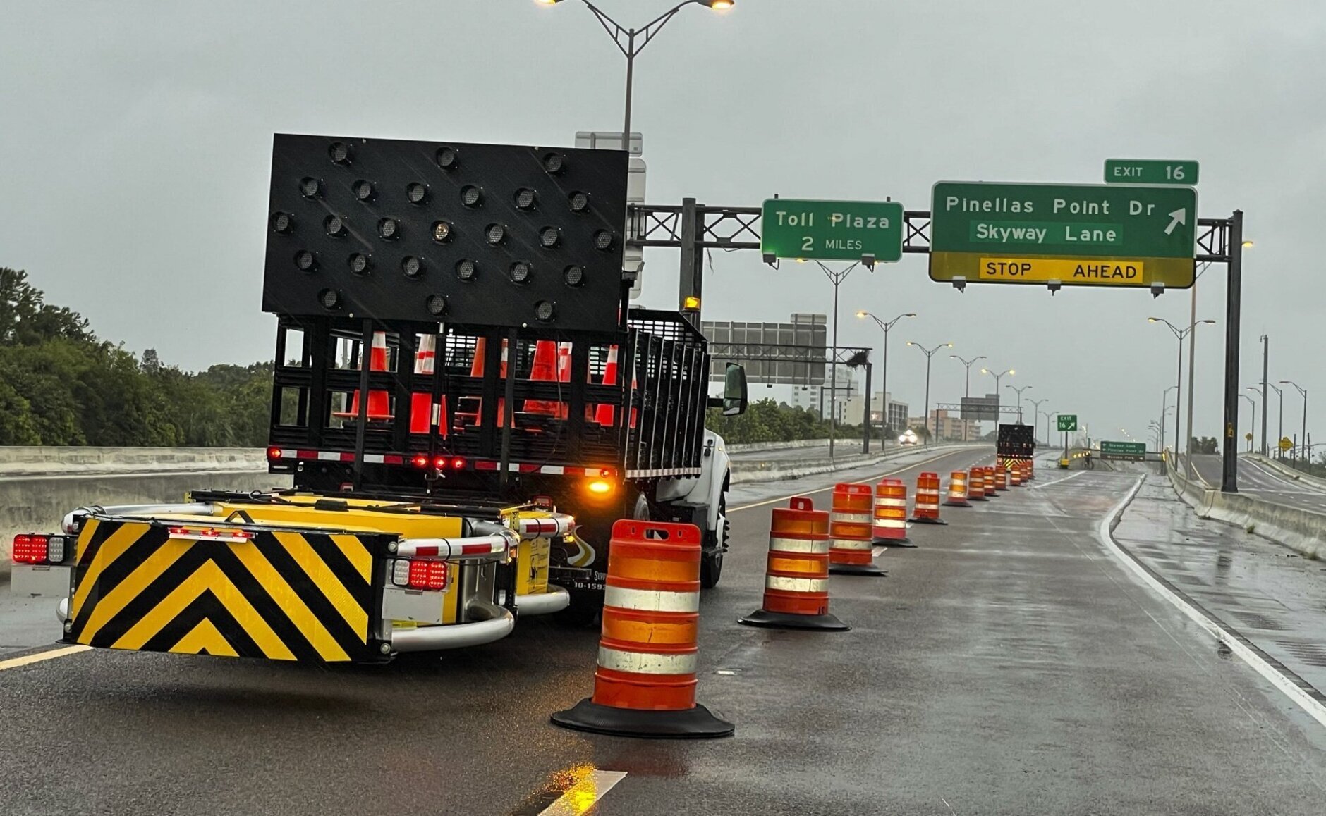
Tropical_Weather_06747 Access roads to the Sunshine Skyway bridge are blocked off as the span is closed due to high winds from Hurricane Ian on Wednesday, Sept. 28, 2022 in St. Petersburg, Fla. Hurricane Ian rapidly intensified as it neared landfall along Florida's southwest coast Wednesday morning, gaining top winds of 155 mph (250 kph), just shy of the most dangerous Category 5 status. (Dirk Shadd/Tampa Bay Times via AP)
Dirk Shadd/Tampa Bay Times via AP
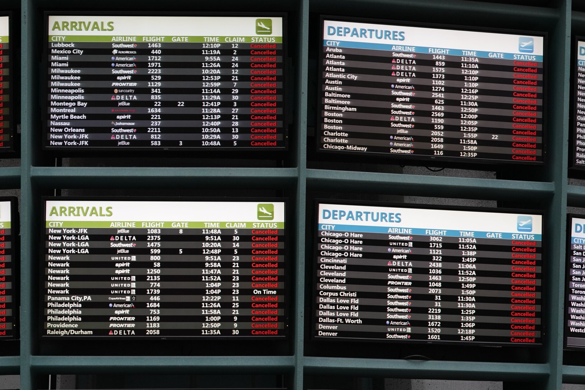
Tropical_Weather_05042 American Airlines check-in counters are closed at Orlando International Airport ahead of Hurricane Ian, Wednesday, Sept. 28, 2022, in Orlando, Fla. (AP Photo/John Raoux)
AP Photo/John Raoux
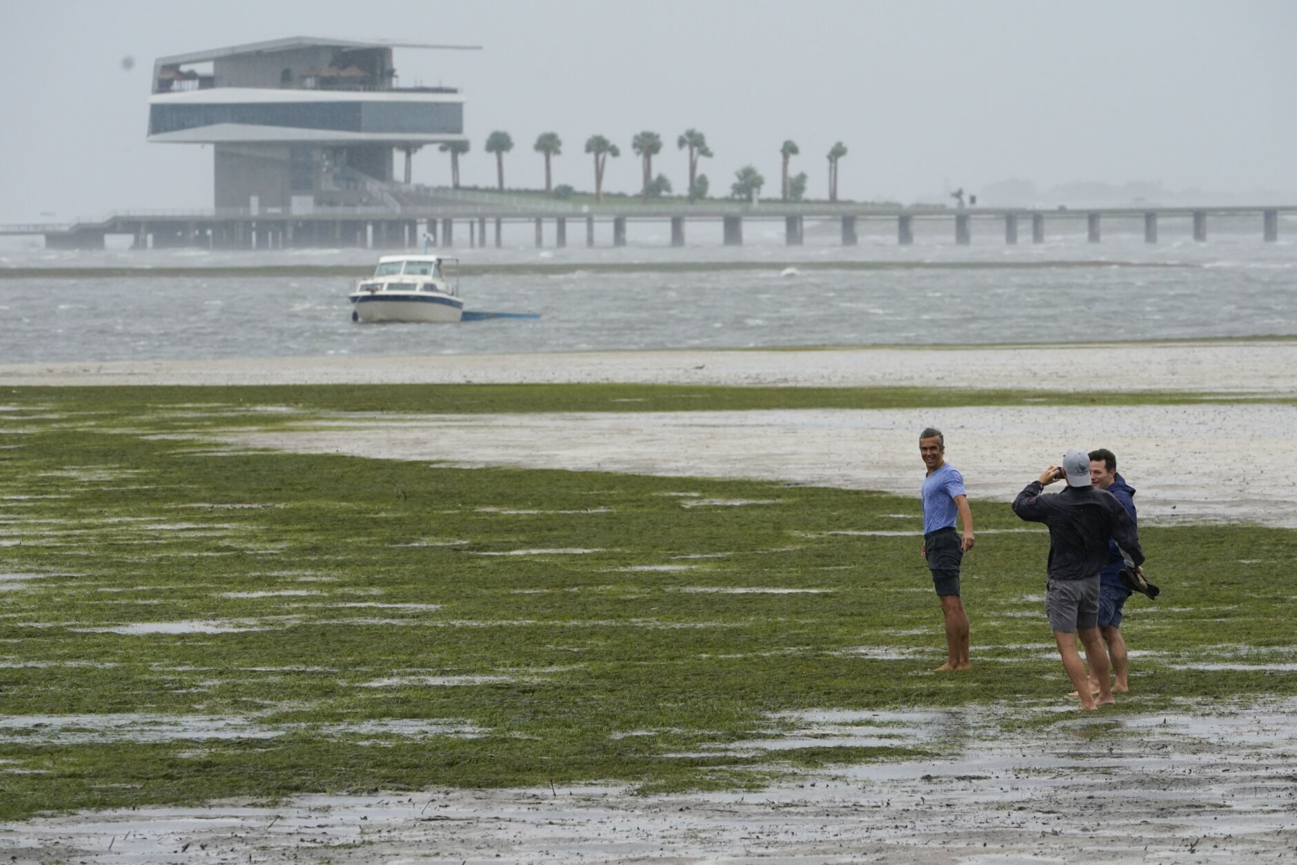
Tropical_Weather_25234 Bob Burnett, 77, looks on as his son Bobby Burnett, 42, takes pictures of the pier as Tampa Bay is draining in a reverse storm surge with Hurricane Ian expected to make landfall this afternoon on Wednesday, Sept. 28, 2022 in St. Petersburg, Fla. Hurricane Ian rapidly intensified as it neared landfall along Florida's southwest coast Wednesday morning, gaining top winds of 155 mph (250 kph), just shy of the most dangerous Category 5 status. (Dirk Shadd/Tampa Bay Times via AP)
Dirk Shadd/Tampa Bay Times via AP
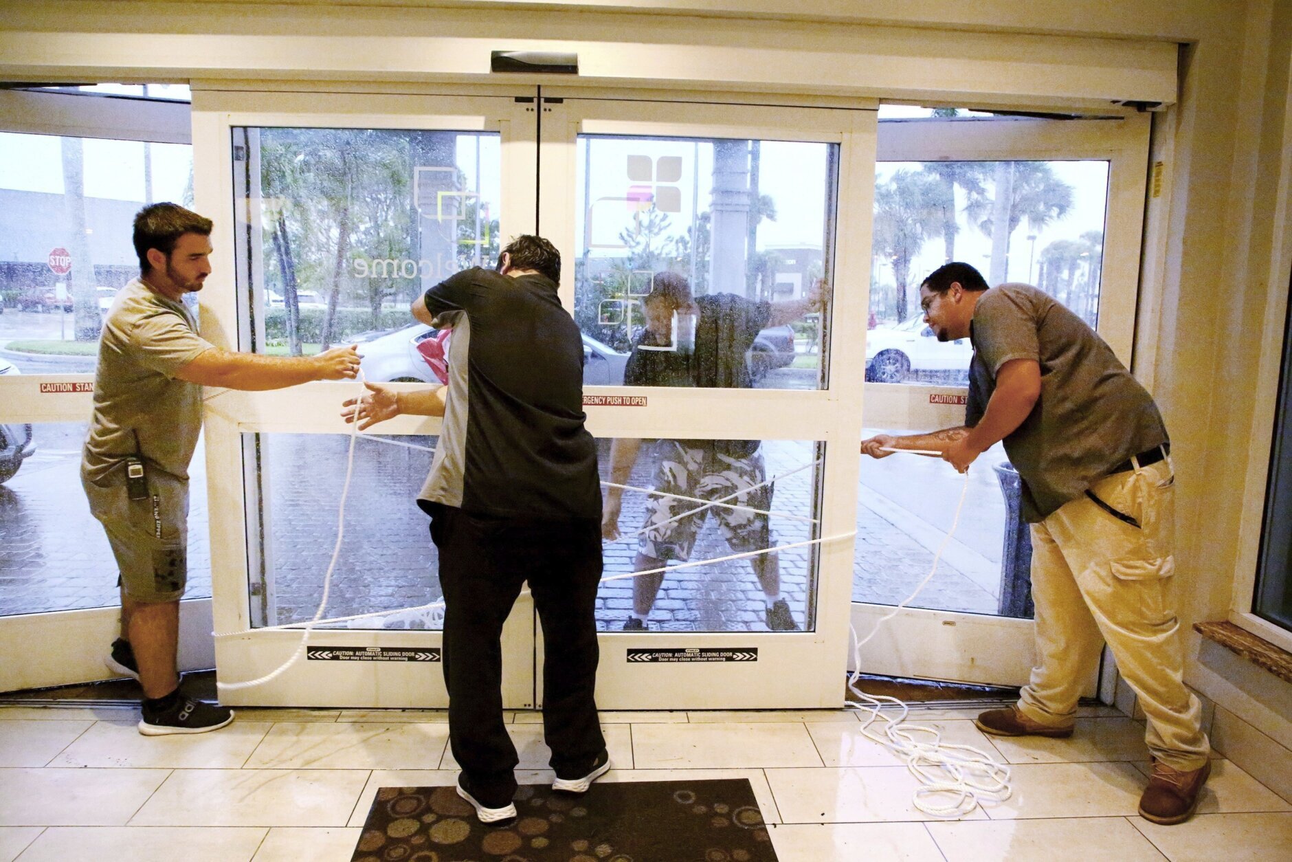
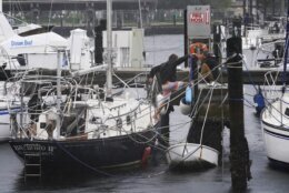
Tropical_Weather_73080 From left: Hilton employees Louie Fonseca, Frankie Monica, Bryan Kinbacher and Jaime Miranda use rope to secure the front door at the Hilton Garden Inn in Fort Myers, Fla. Hurricane Ian rapidly intensified as it neared landfall along Florida's southwest coast Wednesday morning, gaining top winds of 155 mph (250 kph), just shy of the most dangerous Category 5 status. (Douglas R. Clifford/Tampa Bay Times via AP)
Douglas R. Clifford/Tampa Bay Times via AP
APTOPIX_Tropical_Weather_83668 An airplane overturned by a likely tornado produced by the outer bands of Hurricane Ian is shown, Wednesday, Sept. 28, 2022, at North Perry Airport in Pembroke Pines, Fla. Hurricane Ian rapidly intensified as it neared landfall along Florida's southwest coast Wednesday morning, gaining top winds of 155 mph (250 kph), just shy of the most dangerous Category 5 status. (AP Photo/Wilfredo Lee)
AP Photo/Wilfredo Lee
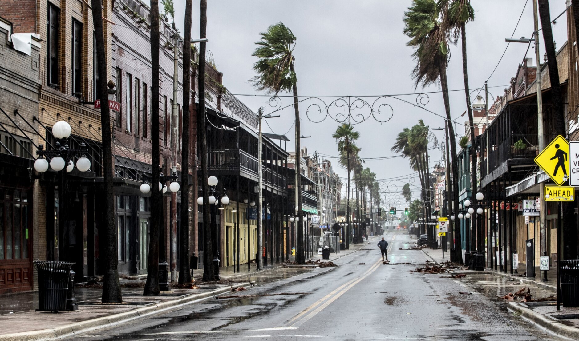
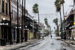
Tropical_Weather_Florida_70840 A man stands in the middle 7th Street in Ybor City on the rains soaked streets, a few hours before the high winds from Hurricane Ian hit Tampa, Fla., Wednesday, Sept. 28, 2022. (Willie J. Allen Jr./Orlando Sentinel via AP)
Willie J. Allen Jr./Orlando Sentinel via AP
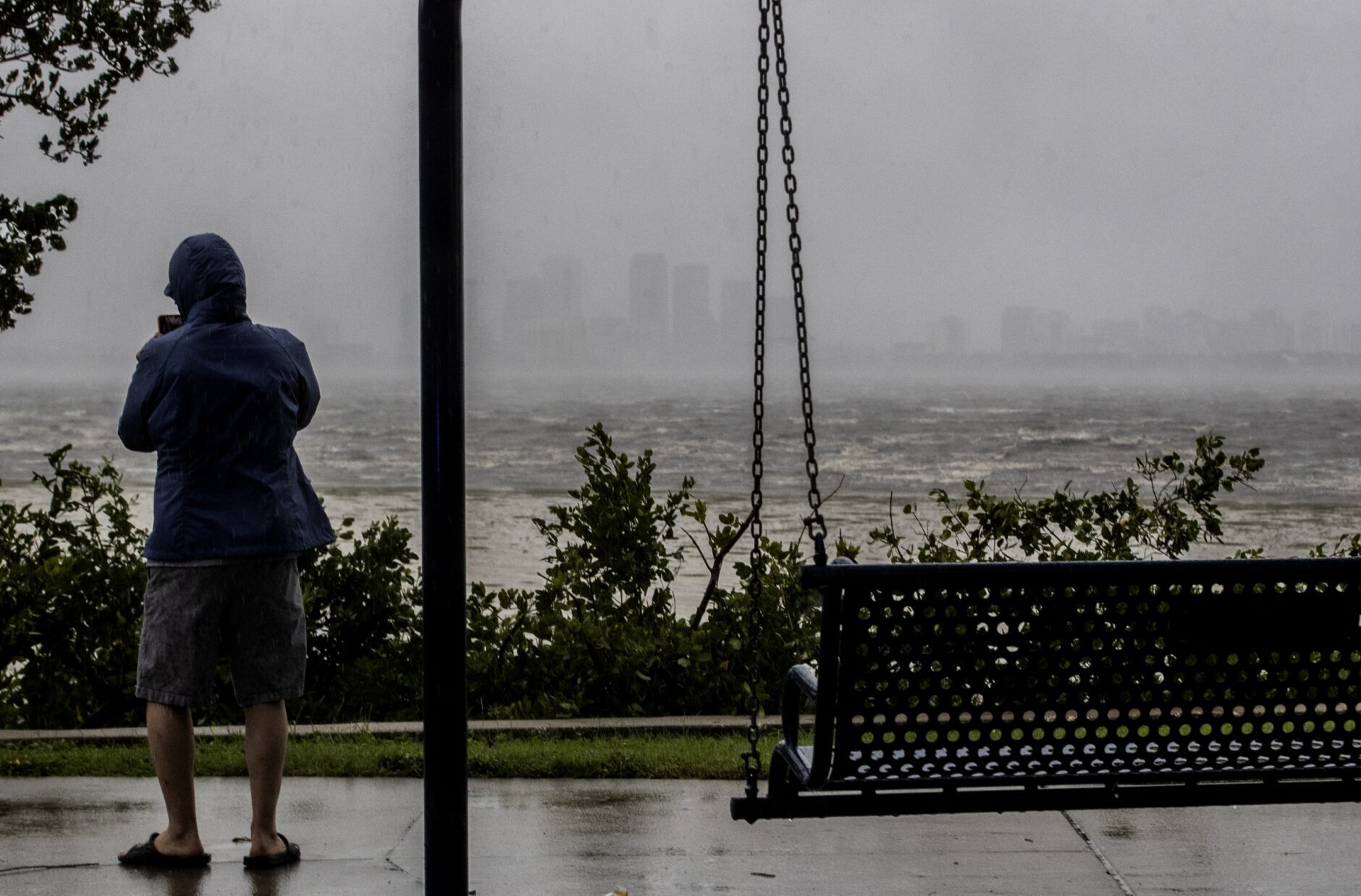
Tropical_Weather_Florida_93743 One sightseer witnesses the receding waters of Tampa Bay because of low tide and tremendous winds from Hurricane Ian with downtown in the distance in Tampa, Fla., Wednesday, Sept. 28, 2022. (Willie J. Allen Jr./Orlando Sentinel via AP)
Willie J. Allen Jr./Orlando Sentinel via AP
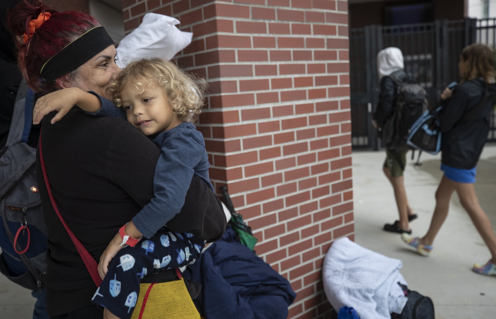
Tropical_Weather_76125 Celia Salazar holds her grandson Ricardo Salazar Jr. as they check into the emergency shelter at Largo High School as the Tampa Bay region prepares for the high winds and water from Hurricane Ian in Largo, Fla., Wednesday, Sept. 28, 2022. (Willie J. Allen Jr./Orlando Sentinel via AP)
Willie J. Allen Jr./Orlando Sentinel via AP
Tropical_Weather_Florida_82618 Disney character "Big Al," from Country Bear Jamboree, joins guests sheltering in place at their hotel at Disney's Wilderness Lodge in Lake Buena Vista, Fla., Wednesday, Sept. 28, 2022, as the first effects of Hurricane Ian are felt in Central Florida. Disney, along with Universal and SeaWorld, closed their Central Florida theme parks in response to the storm. (Joe Burbank/Orlando Sentinel via AP)
Joe Burbank/Orlando Sentinel via AP
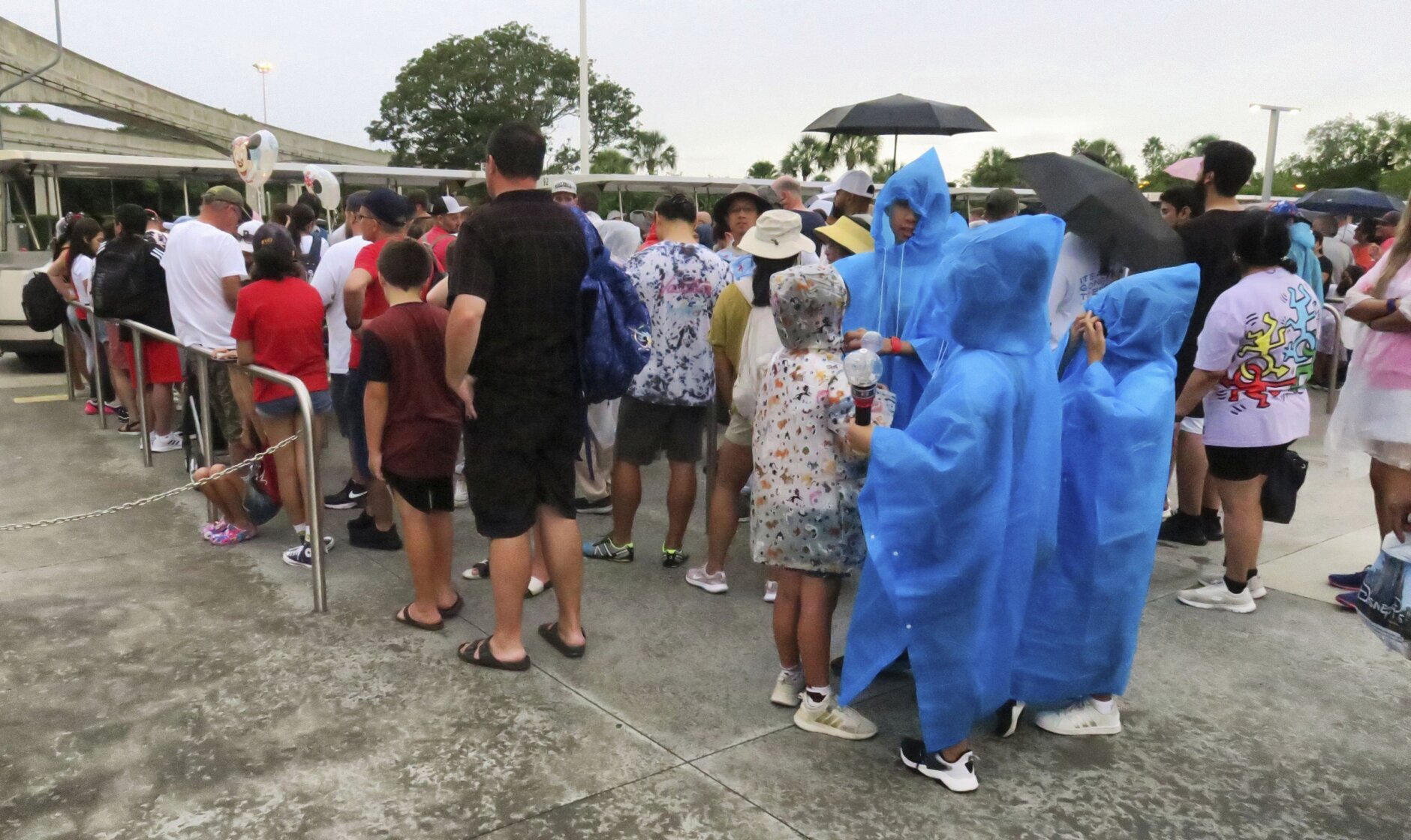
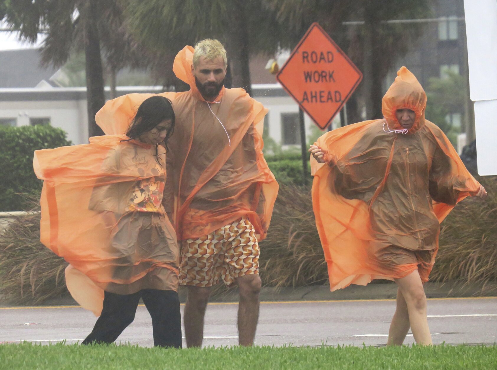
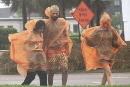
Tropical_Weather_Florida_83333 People in raincoats walk along International Drive in Orlando, Fla., Wednesday, Sept. 28, 2022, as the first effects of Hurricane Ian are felt in central Florida. (Joe Burbank/Orlando Sentinel via AP)
Joe Burbank/Orlando Sentinel via AP
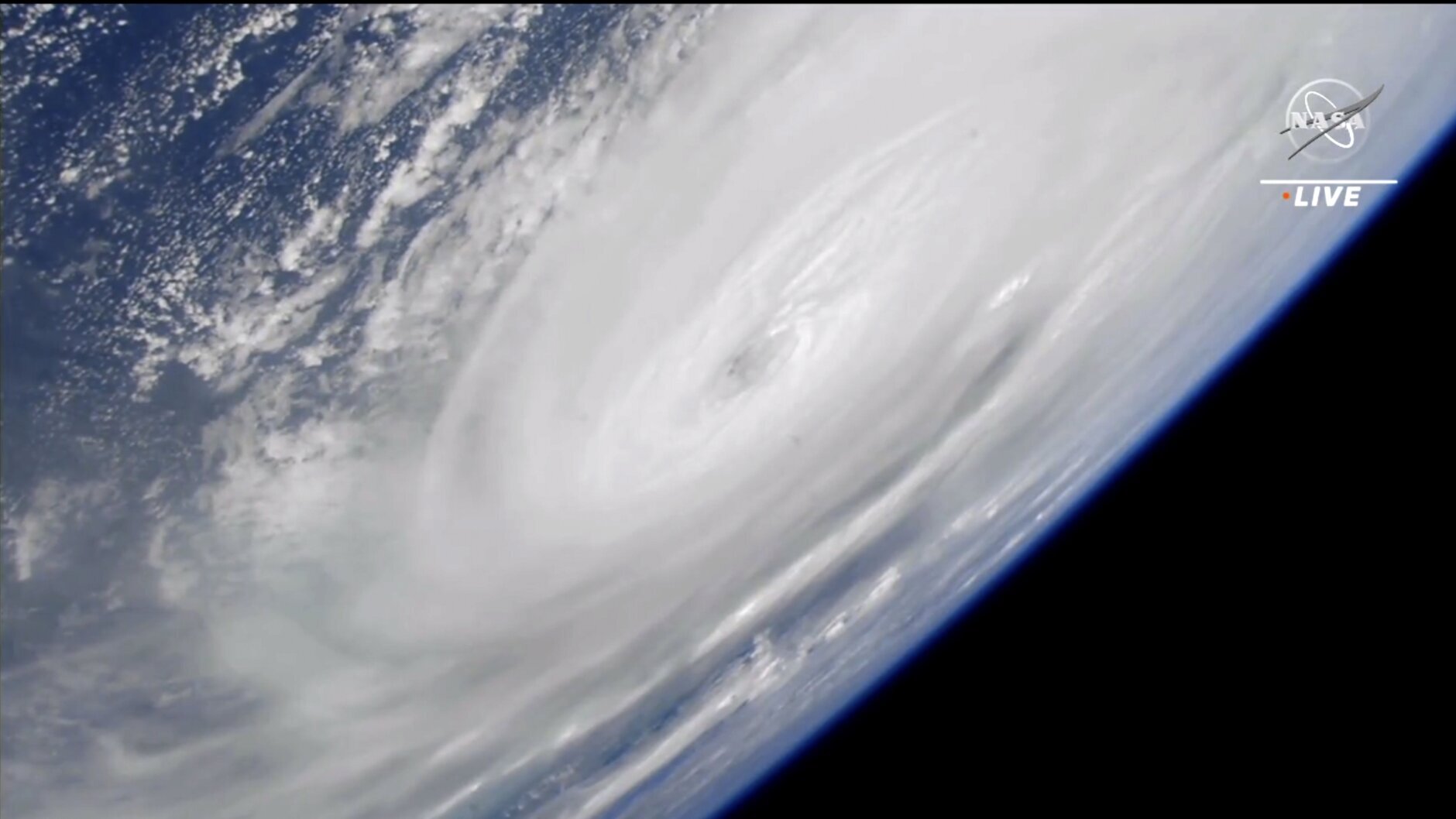
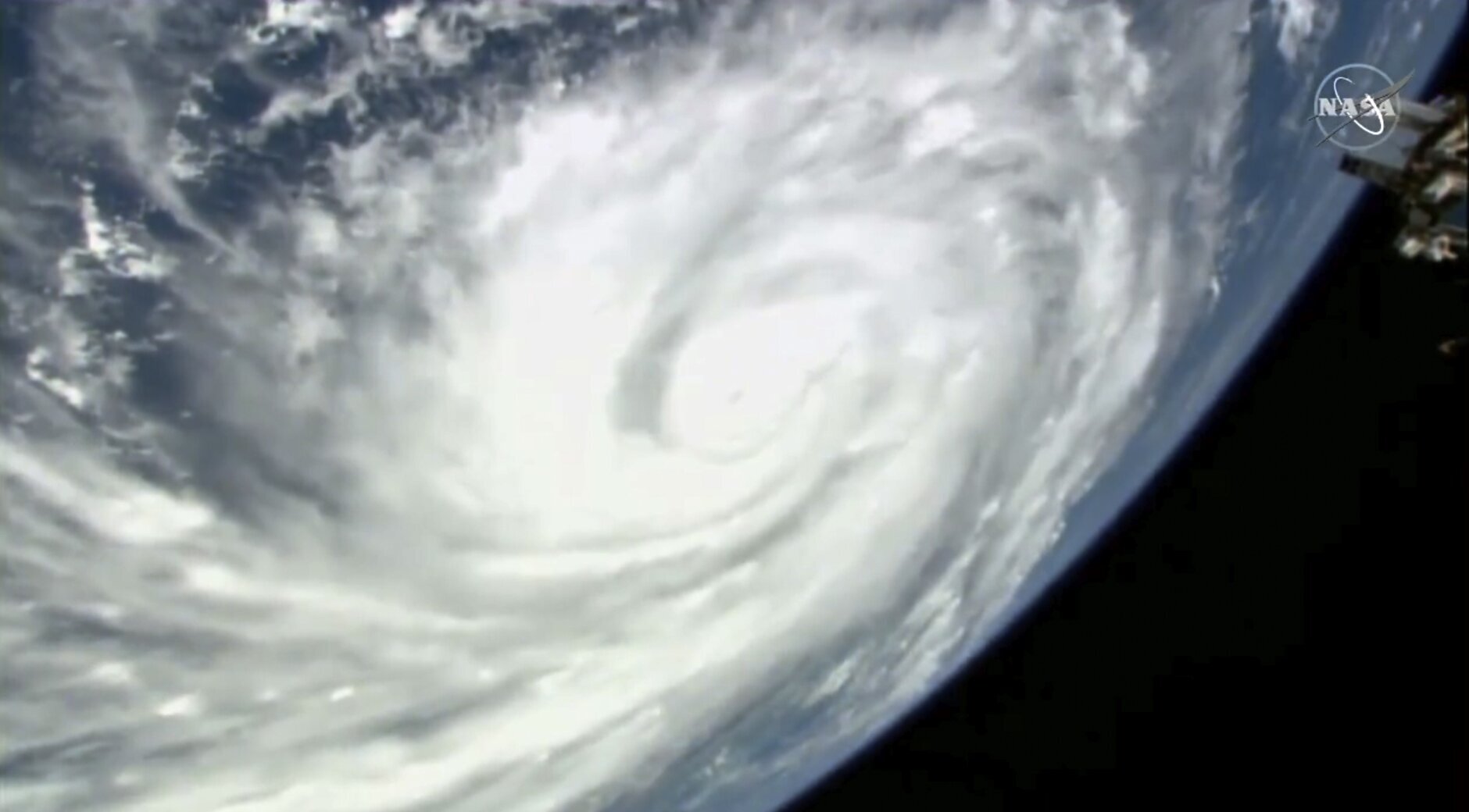
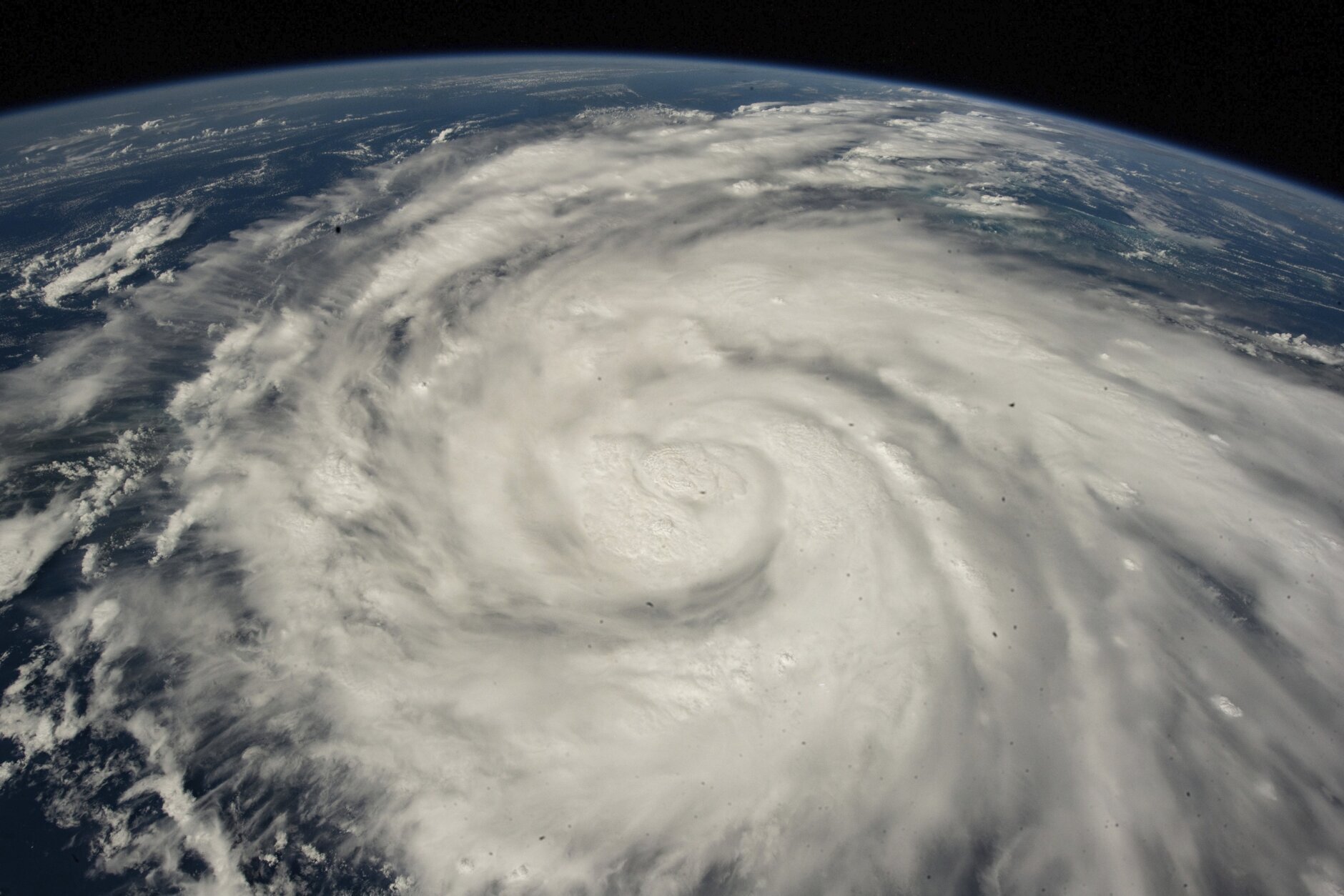
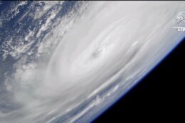
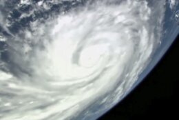
Tropical_Weather_88159 In this image made from a NASA livestream, Hurricane Ian is seen from the International Space Station on Wednesday, Sept. 28, 2022. Hurricane Ian made landfall in southwest Florida near Cayo Costa on Wednesday as a catastrophic Category 4 storm. (NASA via AP)
NASA via AP
Tropical_Weather_06747 Access roads to the Sunshine Skyway bridge are blocked off as the span is closed due to high winds from Hurricane Ian on Wednesday, Sept. 28, 2022 in St. Petersburg, Fla. Hurricane Ian has made landfall in southwestern Florida as a massive Category 4 storm.(Dirk Shadd/Tampa Bay Times via AP)
Dirk Shadd/Tampa Bay Times via AP
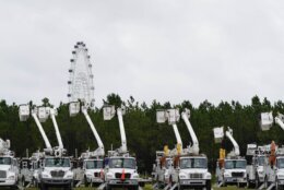
Tropical_Weather_46809 Utility trucks are staged near the Orange County Convention center, ahead of Hurricane Ian, Wednesday, Sept. 28, 2022, in Orlando, Fla. (AP Photo/John Raoux)
AP Photo/John Raoux
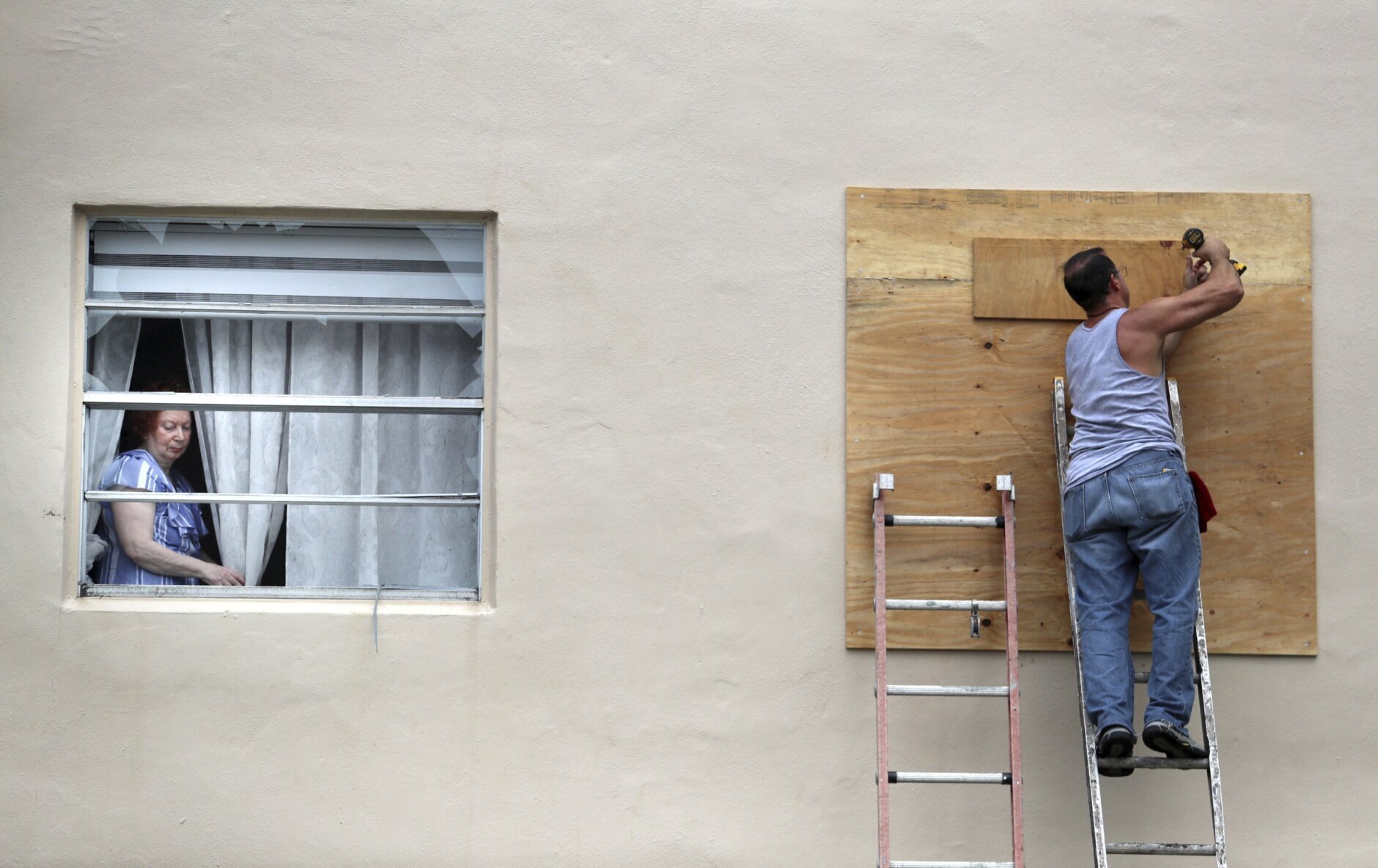
Tropical_Weather_32532 A King Point resident looks through her broken window as a man boards up a broken window from an apparent overnight tornado spawned from Hurricane Ian at Kings Point 55+ community in Delray Beach, Fla., on Wednesday, Sept. 28, 2022. (Carline Jean /South Florida Sun-Sentinel via AP)
Carline Jean /South Florida Sun-Sentinel via AP
Tropical_Weather_13694 King Point residents leave with their belongings after an apparent overnight tornado spawned from Hurricane Ian at Kings Point 55+ community in Delray Beach, Fla., on Wednesday, Sept. 28, 2022. (Carline Jean /South Florida Sun-Sentinel via AP)
Carline Jean /South Florida Sun-Sentinel via AP
Tropical_Weather_89324 This satellite image taken at 3:06 p.m. EDT and provided by NOAA shows Hurricane Ian making landfall in southwest Florida near Cayo Costa on Wednesday, Sept. 28, 2022, as a catastrophic Category 4 storm. (NOAA via AP)
NOAA via AP
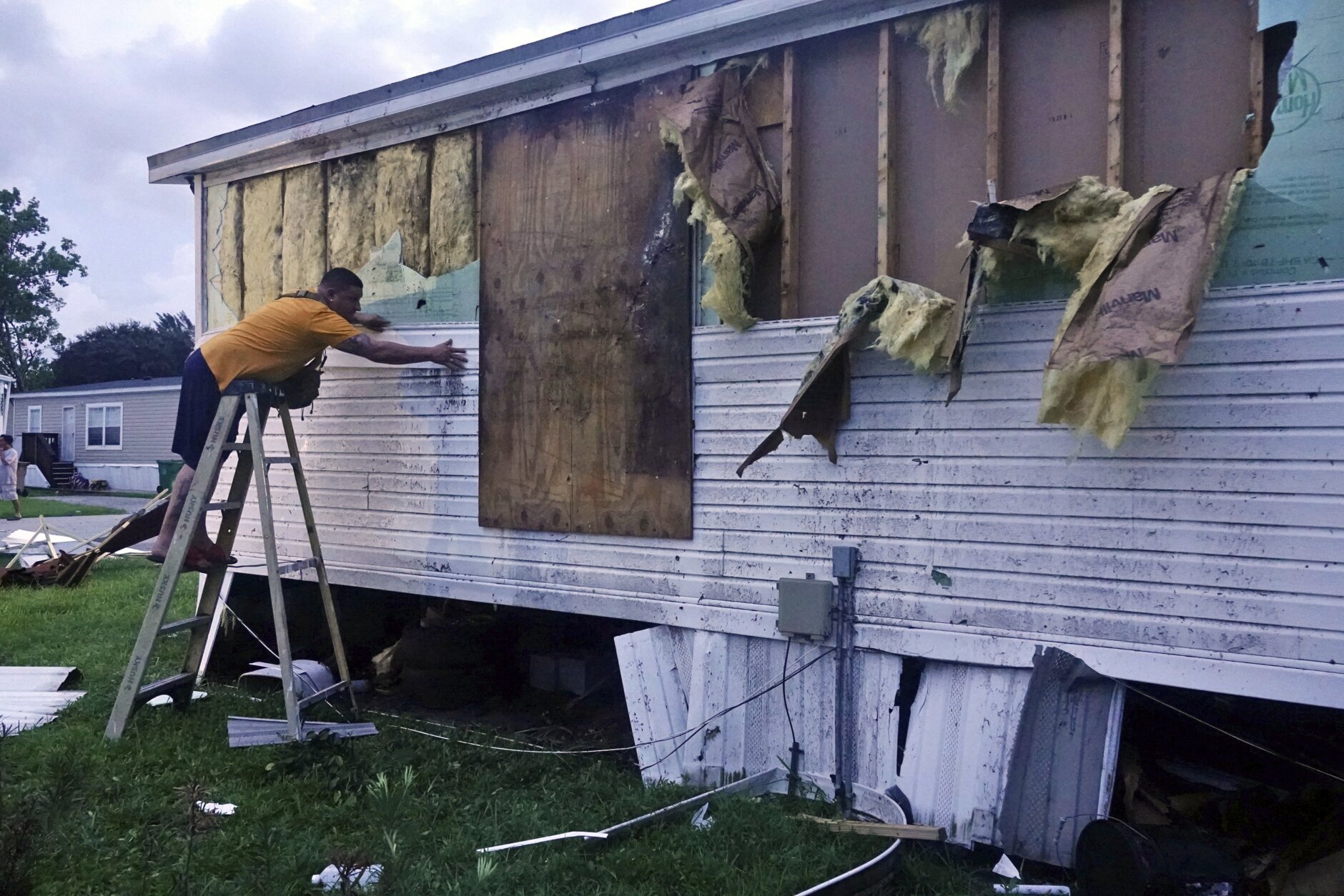
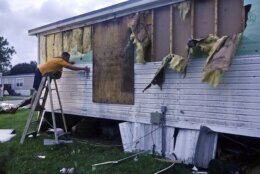
Tropical_Weather_59712 Ivan Mendoza begins to repair damage at his mobile home in Davie, Fla., early Wednesday, Sept. 28, 2022. Hurricane Ian rapidly intensified off Florida's southwest coast Wednesday morning, gaining top winds of 155 mph (250 kph), just shy of the most dangerous Category 5 status. (Joe Cavaretta/South Florida Sun-Sentinel via AP)
Joe Cavaretta/South Florida Sun-Sentinel via AP
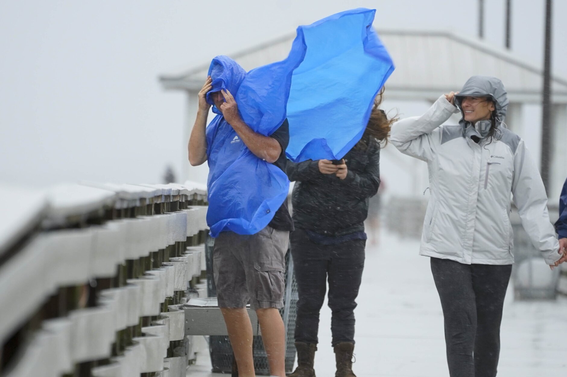
Tropical_Weather_42830 People walk on the Ballast Point Pier ahead of Hurricane Ian, Wednesday, Sept. 28, 2022, in Tampa, Fla. The U.S. National Hurricane Center says Ian's most damaging winds have begun hitting Florida's southwest coast as the storm approaches landfall. (AP Photo/Chris O'Meara)
AP Photo/Chris O'Meara
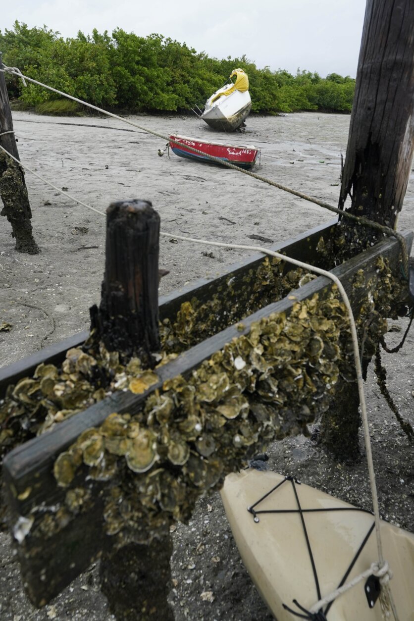
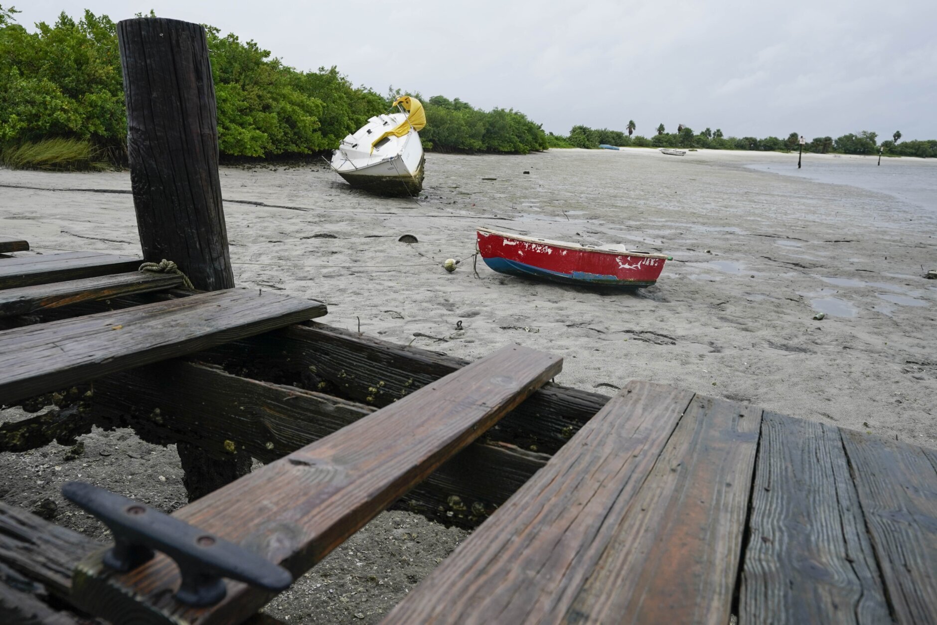
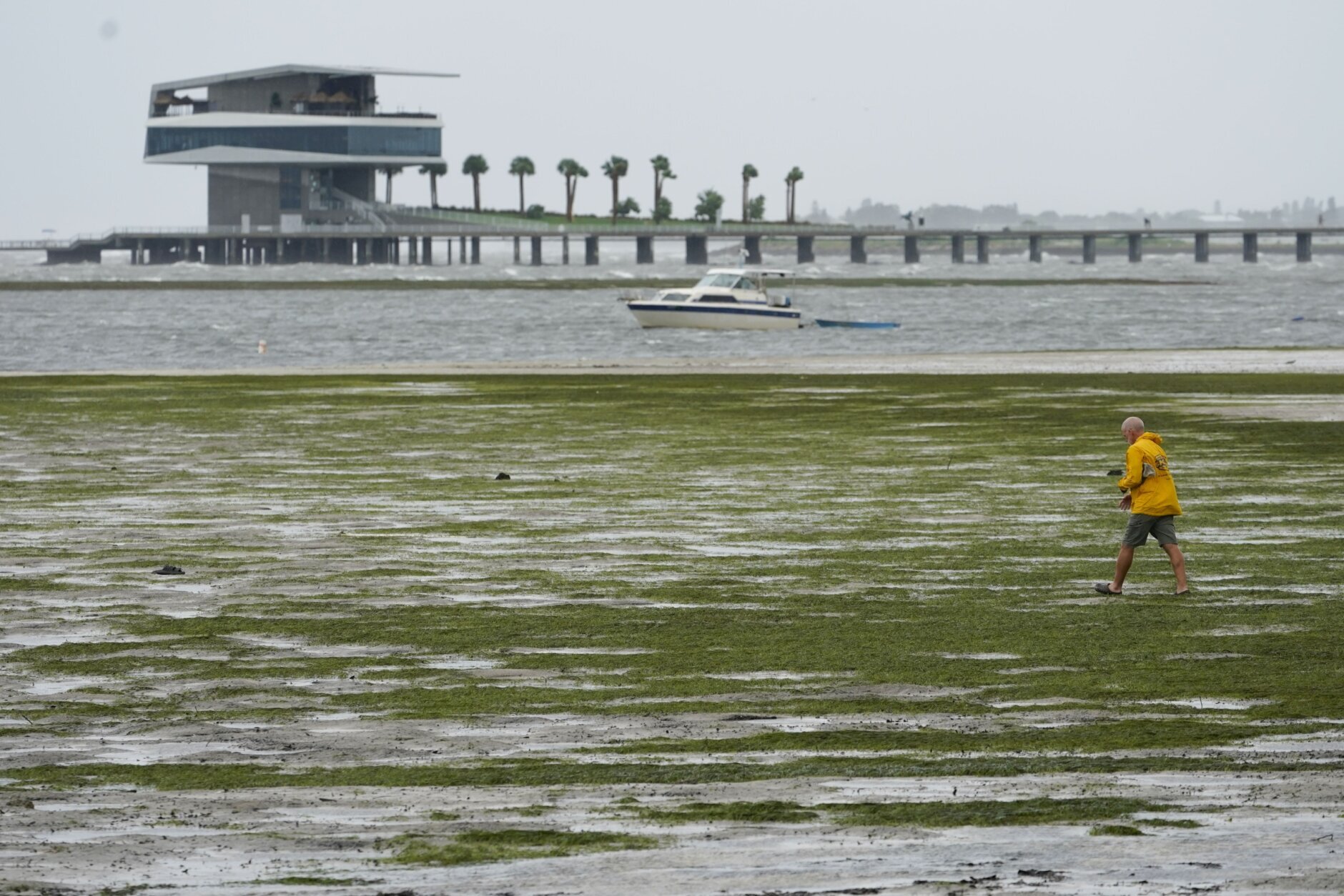
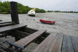
Tropical_Weather_63866 Boats in Tampa Bay lie in the mud as water is receding from the bay ahead of Hurricane Ian, Wednesday, Sept. 28, 2022, in Tampa, Fla. (AP Photo/Chris O'Meara)
AP Photo/Chris O'Meara
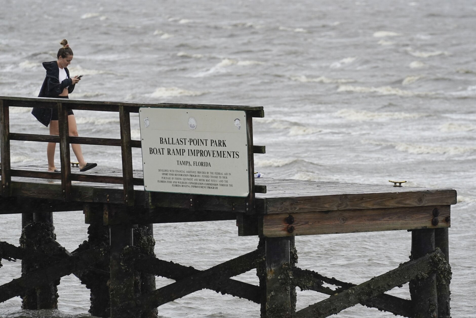
Tropical_Weather_93461 A woman looks at her phone on the Ballast Point Pier on Tampa Bay ahead of Hurricane Ian, Wednesday, Sept. 28, 2022, in Tampa, Fla. (AP Photo/Chris O'Meara)
AP Photo/Chris O'Meara
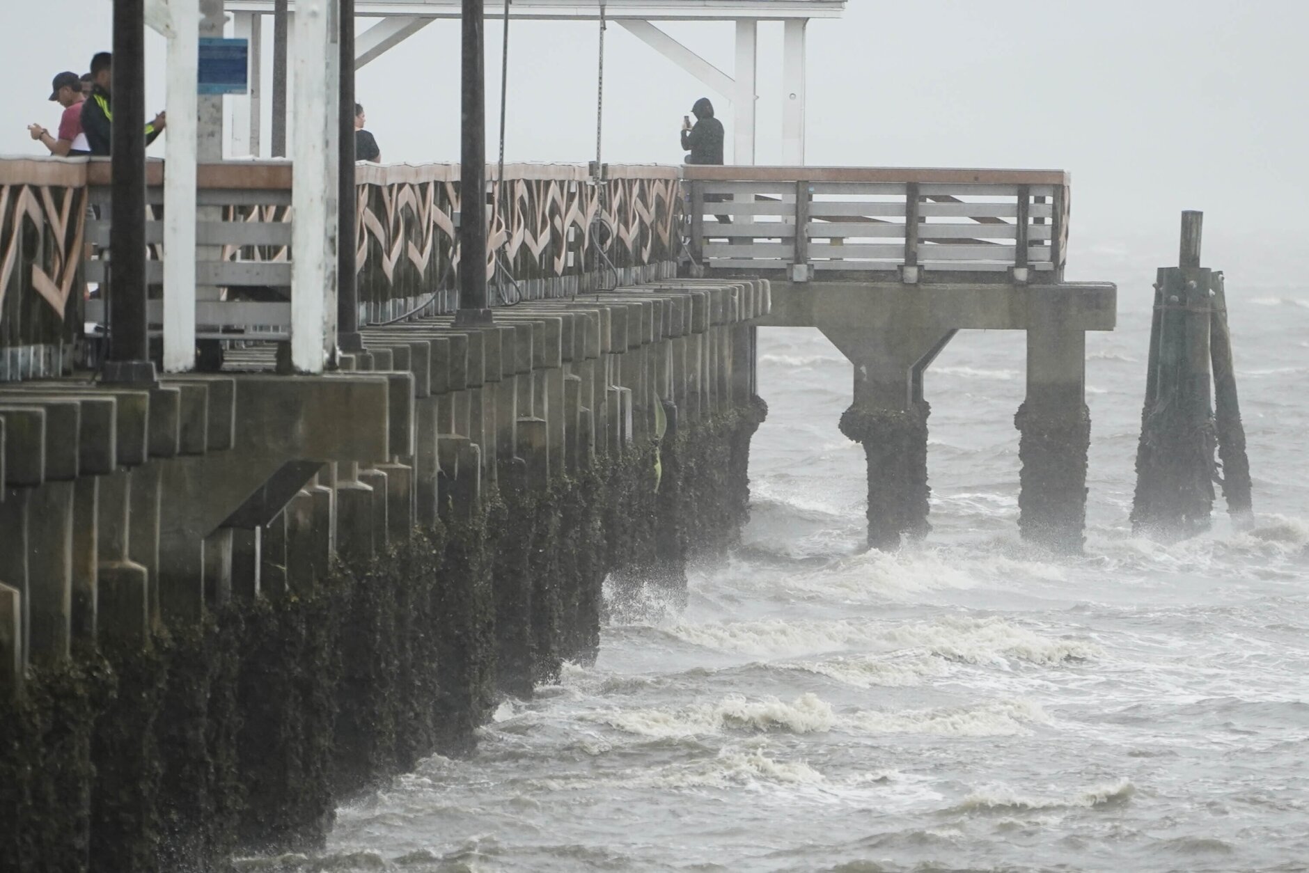
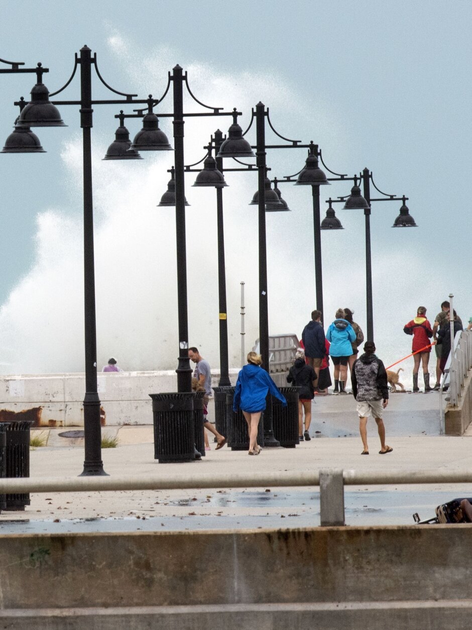
Tropical_Weather_43431 Waves crash along the Ballast Point Pier ahead of Hurricane Ian, Wednesday, Sept. 28, 2022, in Tampa, Fla. The U.S. National Hurricane Center says Ian's most damaging winds have begun hitting Florida's southwest coast as the storm approaches landfall. (AP Photo/Chris O'Meara)
AP Photo/Chris O'Meara
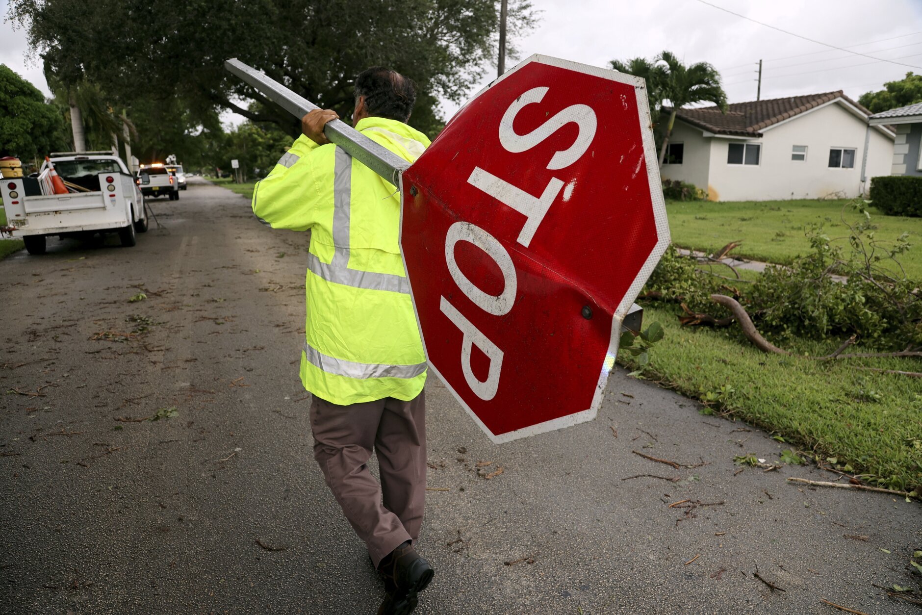
Tropical_Weather_18337 City of Hollywood employee Martin Lisi carries a snapped-off stop sign to his truck in Hollywood, Fla., on Wednesday, Sept. 28, 2022. Hurricane Ian rapidly intensified off Florida's southwest coast Wednesday morning, gaining top winds of 155 mph (250 kph), just shy of the most dangerous Category 5 status. (Amy Beth Bennett/South Florida Sun-Sentinel via AP)
Amy Beth Bennett/South Florida Sun-Sentinel via AP
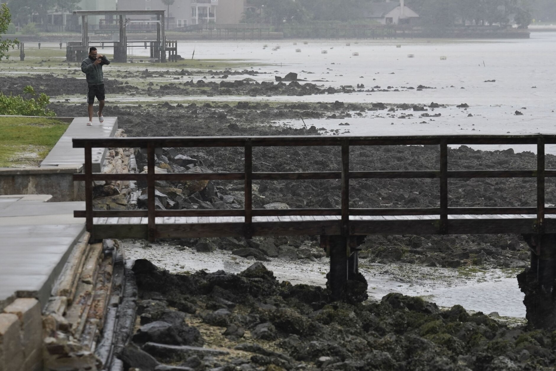
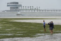
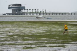
Tropical_Weather_27998 People walk where water is receding out of Tampa Bay due to a negative surge ahead of Hurricane Ian, Wednesday, Sept. 28, 2022, in Tampa, Fla. (AP Photo/Steve Helber)
AP Photo/Steve Helber
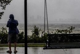
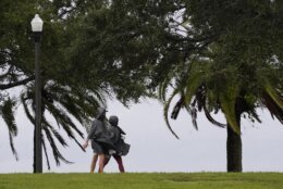
Tropical_Weather_56994 A couple walks along the waterfront that is seeing the effects of Hurricane Ian Wednesday, Sept. 28, 2022, in Saint Petersburg, Fla. (AP Photo/Steve Helber)
AP Photo/Steve Helber
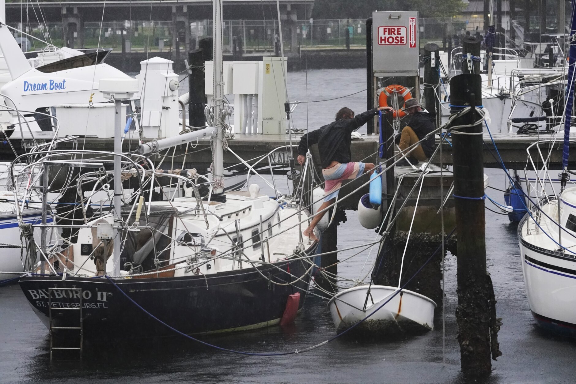
Tropical_Weather_56604 Boaters secure dock lines to secure a boat due to a low tide from the effects of Hurricane Ian Wednesday, Sept. 28, 2022, in Saint Petersburg, Fla. (AP Photo/Steve Helber)
AP Photo/Steve Helber
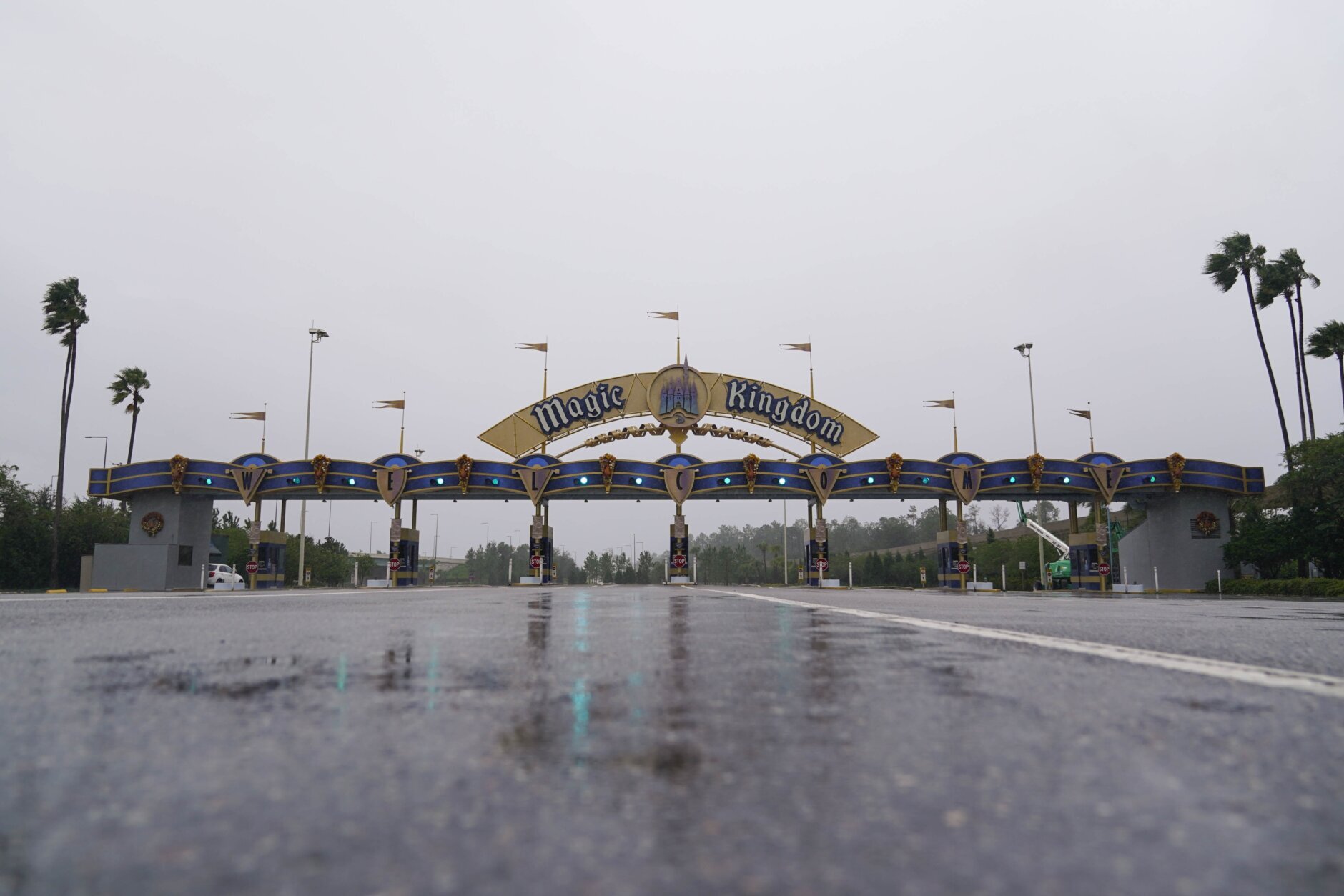
Tropical_Weather_54499 The entrance to the Walt Disney theme park is seen as the park is closed as Hurricane Ian bears down on Florida, Wednesday, Sept. 28, 2022, in Lake Buena Vista, Fla. (AP Photo/John Raoux)
AP Photo/John Raoux
Tropical_Weather_21979 Boats in Tampa Bay lie in the mud as water is receding from the bay ahead of Hurricane Ian, Wednesday, Sept. 28, 2022, in Tampa, Fla. (AP Photo/Chris O'Meara)
AP Photo/Chris O'Meara
APTOPIX_Tropical_Weather_38582 Zuram Rodriguez surveys the damage around her mobile home in Davie, Fla., early Wednesday, Sept. 28, 2022. Hurricane Ian rapidly intensified off Florida's southwest coast Wednesday morning, gaining top winds of 155 mph (250 kph), just shy of the most dangerous Category 5 status. (Joe Cavaretta/South Florida Sun-Sentinel via AP)
Joe Cavaretta/South Florida Sun-Sentinel via AP
Tropical_Weather_37429
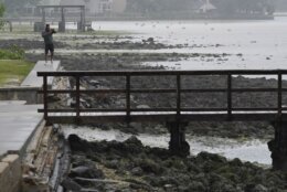
Tropical_Weather_59195 A man walks near Ballast Point Pier as water moves away from shore as Hurricane Ian begins to move into the area, Wednesday, Sept. 28, 2022, in , Fla. (AP Photo/Chris O'Meara)
AP Photo/Chris O'Meara
Tropical_Weather_31251 Ash Dugney views Tampa Bay on the Ballast Point Pier ahead of Hurricane Ian, Wednesday, Sept. 28, 2022, in Tampa, Fla. (AP Photo/Chris O'Meara)
AP Photo/Chris O'Meara
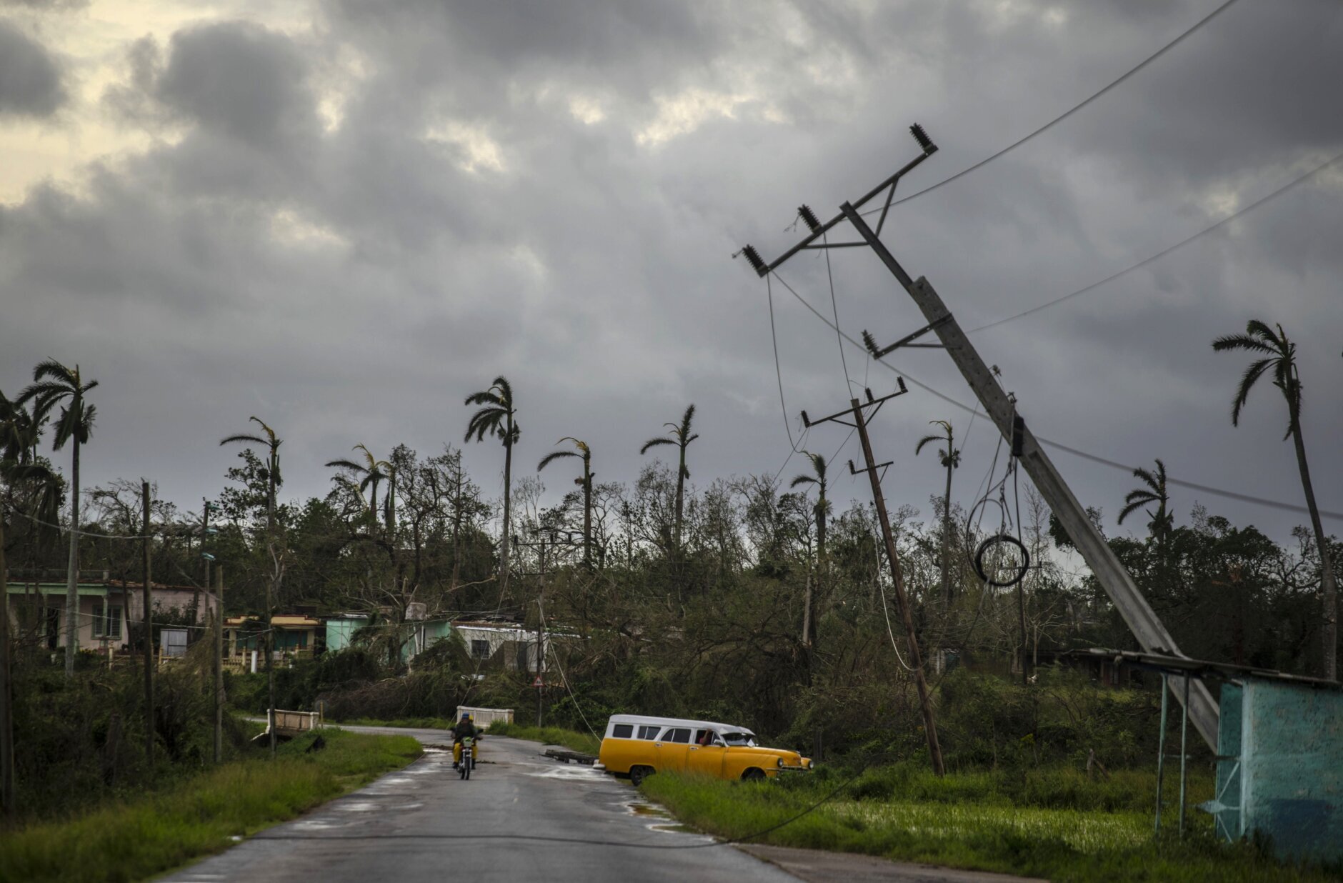
APTOPIX_Cuba_Tropical_Weather_27612 A classic American car drives past utility poles tilted by Hurricane Ian in Pinar del Rio, Cuba, Tuesday, Sept. 27, 2022. (AP Photo/Ramon Espinosa)
AP Photo/Ramon Espinosa
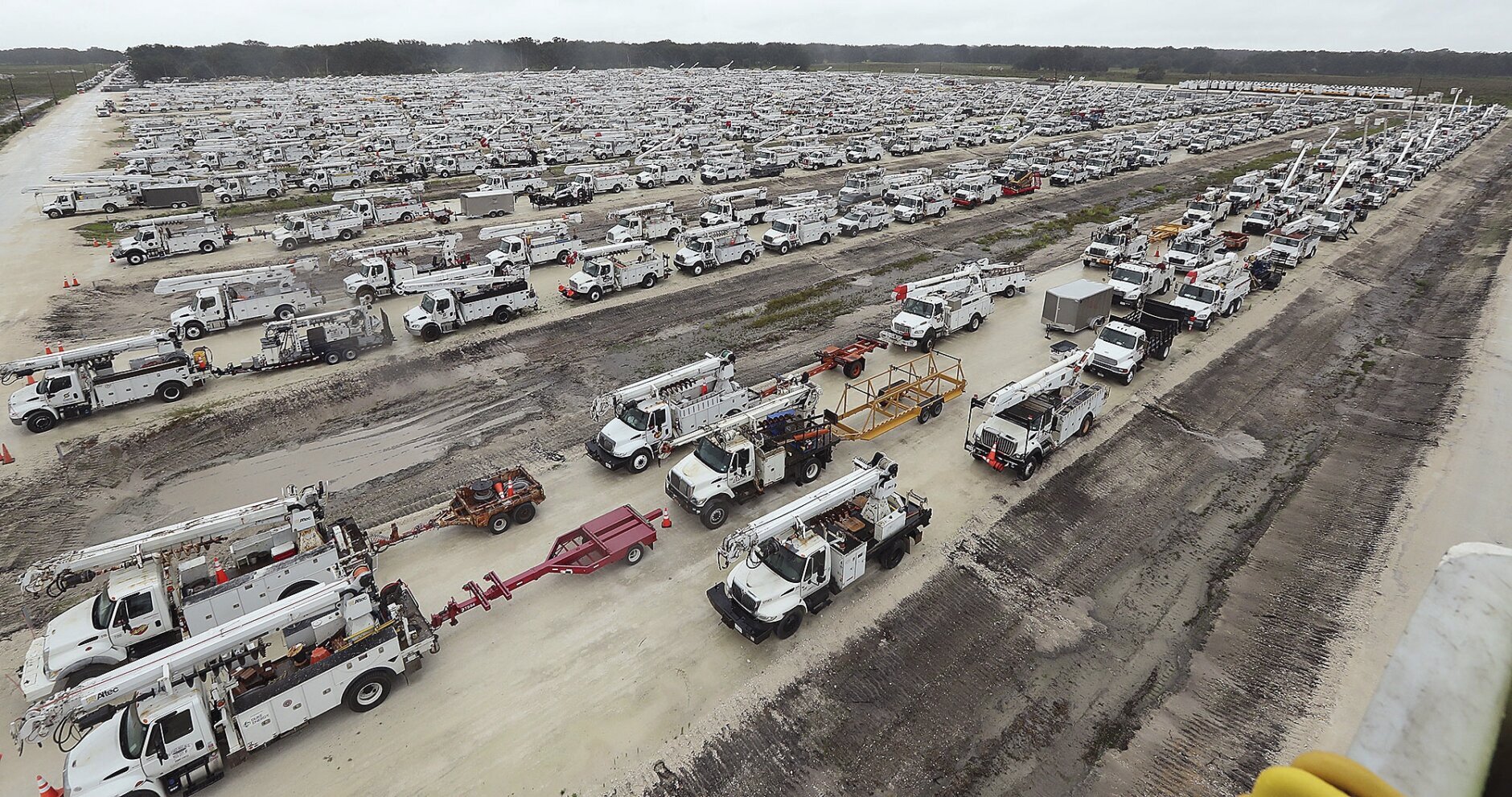
Tropical_Weather__20430 Utility trucks are staged in a rural lot in The Villages of Sumter County, Fla., Wednesday, Sept. 28, 2022. Hurricane Ian rapidly intensified as it neared landfall along Florida's southwest coast Wednesday morning, gaining top winds of 155 mph (250 kph), just shy of the most dangerous Category 5 status. (Stephen M. Dowell/Orlando Sentinel via AP)
Stephen M. Dowell/Orlando Sentinel via AP
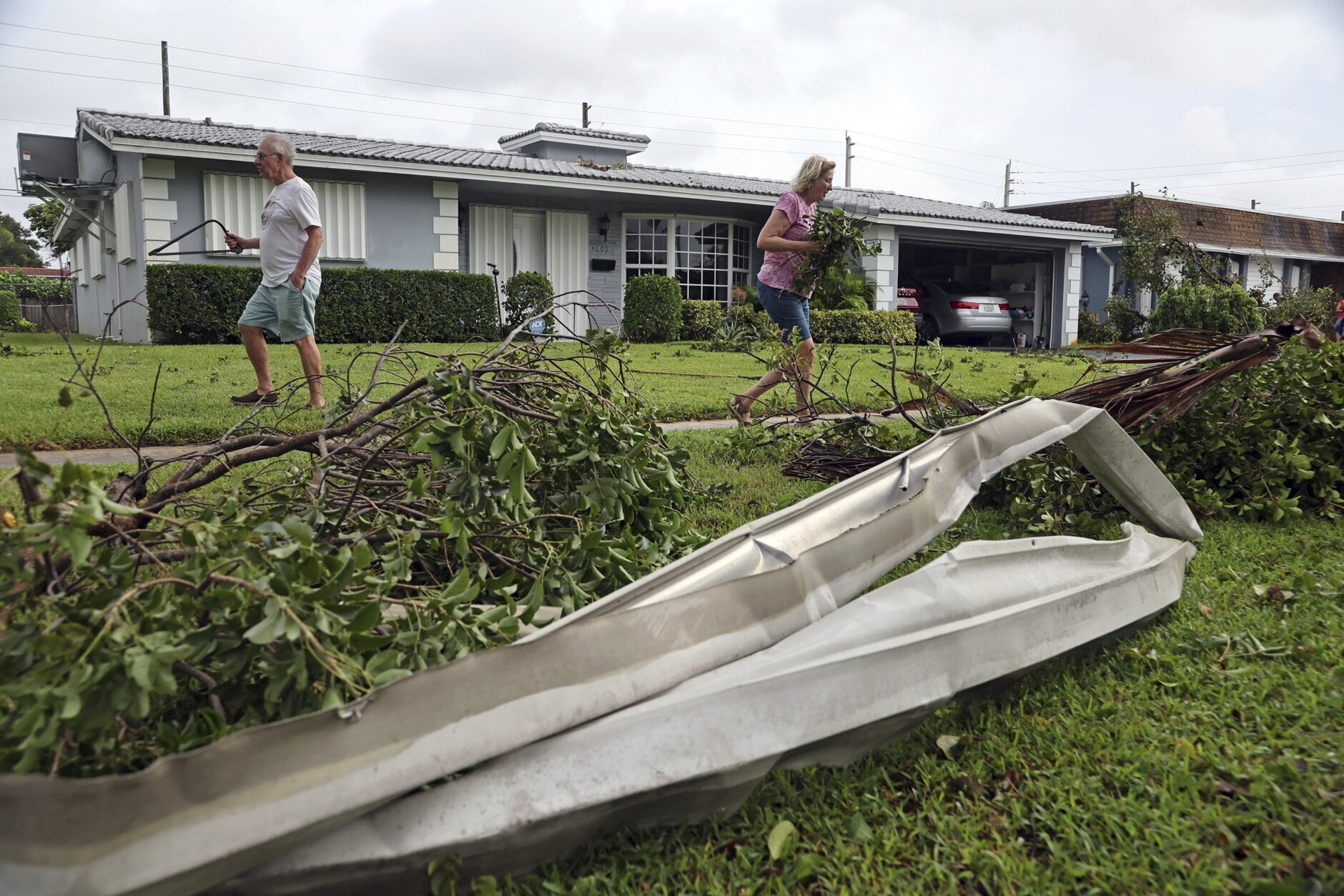
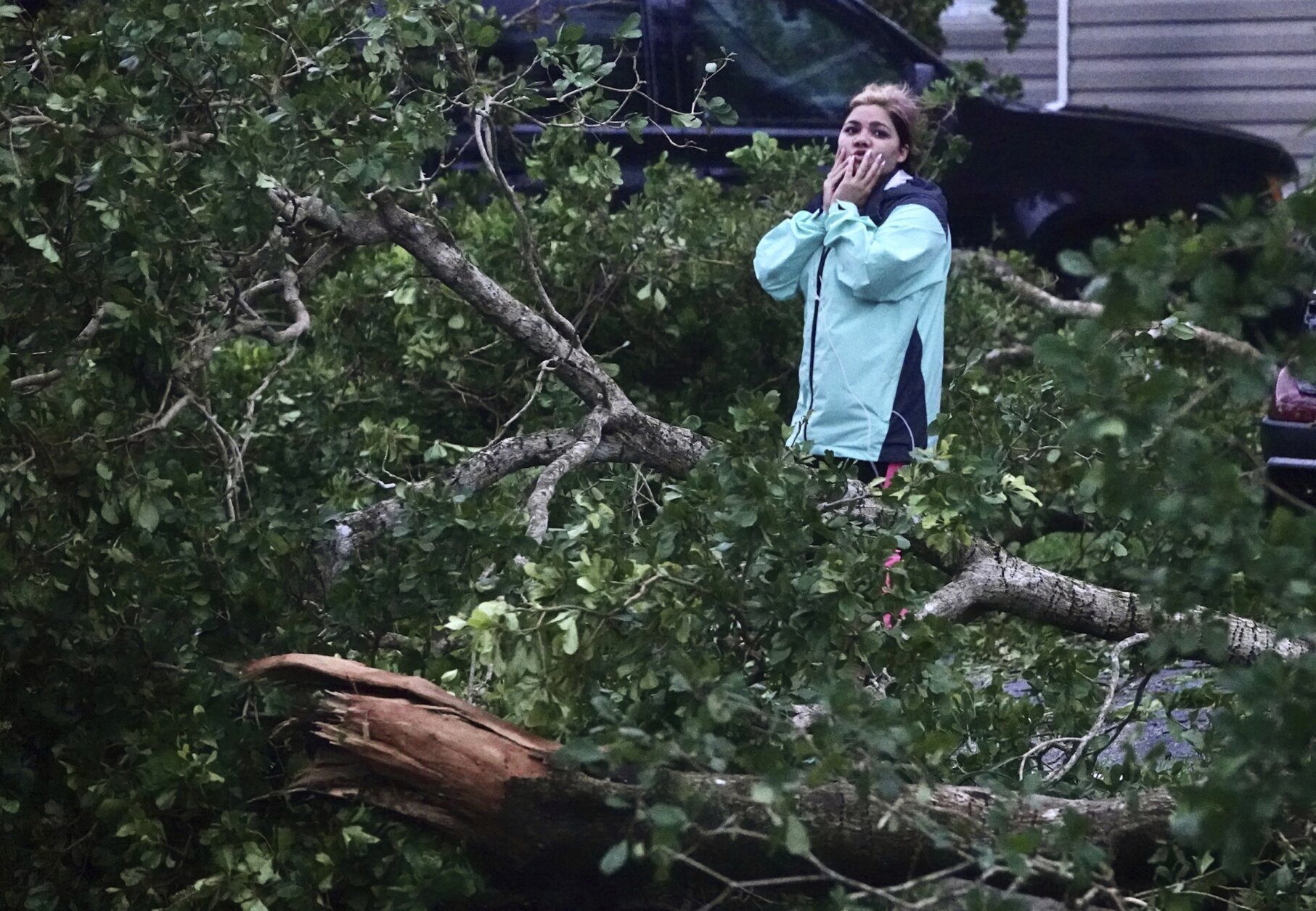
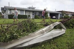
Tropical_Weather_19745 Gary and Sharon Adams clear their yard of debris in Hollywood, Fla., on Wednesday, Sept. 28, 2022, where residents say a tornado touched down overnight. Hurricane Ian has strengthened with maximum winds at 155 mph and is now expected to make landfall on the Southwest coast of Florida near Sarasota. (Amy Beth Bennett/South Florida Sun-Sentinel via AP)
Amy Beth Bennett/South Florida Sun-Sentinel via AP
Tropical_Weather_59624 Electronic screens are seen at the Orlando International Airport as the facility starts to cease operations ahead of Hurricane Ian, Wednesday, Sept. 28, 2022, in , Fla. (AP Photo/John Raoux)
AP Photo/John Raoux
Tropical_Weather_28986 This satellite image taken at 3:06 p.m. EDT and provided by NOAA shows Hurricane Ian making landfall in southwest Florida near Cayo Costa, Fla., on Wednesday, Sept. 28, 2022, as a catastrophic Category 4 storm. (NOAA via AP)
NOAA via AP
Tropical_Weather_63060 This image provided by the Naples Fire Rescue Department shows firefighters look out at the firetruck that stands in water from the storm surge from Hurricane Ian on Wednesday, Sept. 28, 2022 in Naples, Fla. Hurricane Ian has made landfall in southwestern Florida as a massive Category 4 storm. (Naples Fire Department via AP)
Naples Fire Department via AP
Tropical_Weather_04535 A traveler rests on a couch at the Orlando Airport prior to the facility being closed ahead of Hurricane Ian, Wednesday, Sept. 28, 2022, in Orlando, Fla. Travelers will be sent to a shelter as the airport will be closed. (AP Photo/John Raoux)
AP Photo/John Raoux
Tropical_Weather_52626 People walk where water is receding out of Tampa Bay due to a negative surge ahead of Hurricane Ian, Wednesday, Sept. 28, 2022, in Tampa, Fla. (AP Photo/Steve Helber)
AP Photo/Steve Helber
Tropical_Weather_52071 This image provided by NASA shows Hurricane Ian seen below the International Space Station as the storm was gaining strength south of Cuba and moving toward Florida at around 3pm ET on Monday, Sept 26, 2022. (NASA via AP)
NASA via AP
Tropical_Weather_Florida_08694 Guests depart the ferry boat transportation at the Magic Kingdom at Walt Disney World after the park closed early to accommodate an evening special event, Tuesday, Sept. 27, 2022, in Lake Buena Vista, Fla. Disney World, Universal Orlando and SeaWorld Orlando all announced Tuesday that they will be closed Wednesday and Thursday due to the weather conditions caused by Hurricane Ian. (Joe Burbank/Orlando Sentinel via AP)
Joe Burbank/Orlando Sentinel via AP
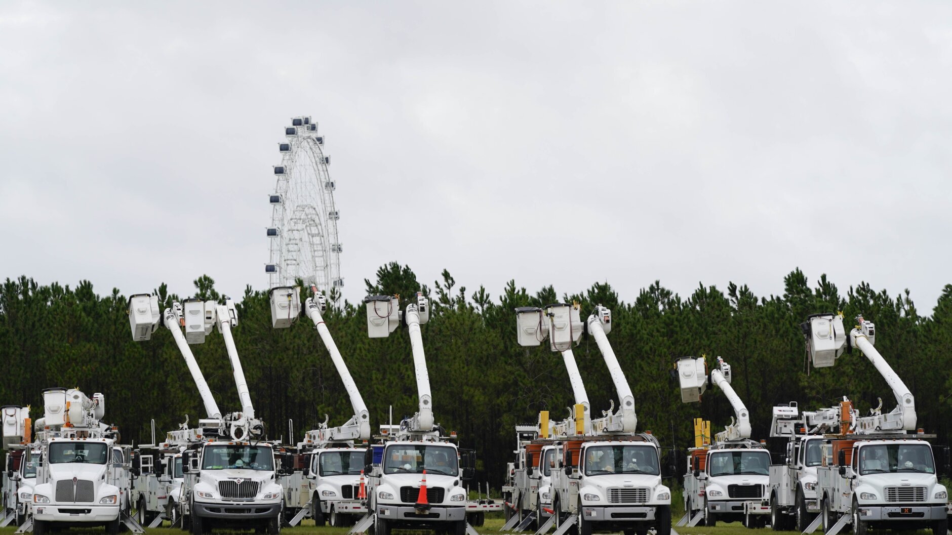
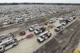
Tropical_Weather_57951 U.S. Air Force helicopters are gathered inside the Orange County Convention Center on Tuesday, Sept. 27, 2022. They were staging in preparation for Hurricane Ian, which is approaching Florida's west coast. (Stephen M. Dowell/Orlando Sentinel via AP)
Stephen M. Dowell/Orlando Sentinel via AP
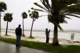
Tropical_Weather_Florida_36920 Tourists and residents stroll White Street pier, Tuesday, Sept. 27, 2022, in Key West, Fla. Hurricane Ian was forecast to strengthen even more over warm Gulf of Mexico waters, reaching top winds of 140 mph (225 kmh) as it approaches the Florida's southwest coast. (AP Photo/Mary Martin)
AP Photo/Mary Martin
Tropical_Weather_73080 From left: Hilton employees Louie Fonseca, Frankie Monica, Bryan Kinbacher and Jaime Miranda use rope to secure the front door at the Hilton Garden Inn in Fort Myers, Fla. Hurricane Ian has made landfall in southwestern Florida as a massive Category 4 storm. (Douglas R. Clifford/Tampa Bay Times via AP)
Douglas R. Clifford/Tampa Bay Times via AP
Tropical_Weather_04358 This satellite image provided by NOAA shows Hurricane Ian off Florida's southwest coast Wednesday, Sept. 28, 2022. The U.S. National Hurricane Center says Ian has rapidly intensified off Florida's coast, gaining top winds of 155 mph, just shy of the most devastating Category 5 hurricane status. (NOAA via AP)
NOAA via AP
Tropical_Weather_38582 Zuram Rodriguez surveys the damage around her mobile home in Davie, Fla., early Wednesday, Sept. 28, 2022. Hurricane Ian rapidly intensified off Florida's southwest coast Wednesday morning, gaining top winds of 155 mph (250 kph), just shy of the most dangerous Category 5 status. (Joe Cavaretta/South Florida Sun-Sentinel via AP)
Joe Cavaretta/South Florida Sun-Sentinel via AP
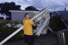
Tropical_Weather_53440 Ivan Mendoza surveys the damage at his mobile home in Davie, Fla., early Wednesday, Sept. 28, 2022. Hurricane Ian rapidly intensified off Florida's southwest coast Wednesday morning, gaining top winds of 155 mph (250 kph), just shy of the most dangerous Category 5 status. (Joe Cavaretta/South Florida Sun-Sentinel via AP)
Joe Cavaretta/South Florida Sun-Sentinel via AP
Tropical_Weather_59712 Ivan Mendoza begins to repair damage at his mobile home in Davie, Fla., early Wednesday, Sept. 28, 2022. Hurricane Ian rapidly intensified off Florida's southwest coast Wednesday morning, gaining top winds of 155 mph (250 kph), just shy of the most dangerous Category 5 status. (Joe Cavaretta/South Florida Sun-Sentinel via AP)
Joe Cavaretta/South Florida Sun-Sentinel via AP
Tropical_Weather_61284 This Satellite image provided by NASA on Sept. 26, 2022, shows Hurricane Ian pictured from the International Space Station just south of Cuba gaining strength and heading toward Florida. Hurricane Ian rapidly intensified off Florida's southwest coast Wednesday, Sept. 28, gaining top winds of 155 mph (250 kph), just shy of the most dangerous Category 5 status. (NASA via AP)
NASA via AP
Tropical_Weather_67904 This Satellite image provided by NASA on Sept. 26, 2022, shows Hurricane Ian pictured from the International Space Station just south of Cuba gaining strength and heading toward Florida. Hurricane Ian rapidly intensified off Florida's southwest coast Wednesday, Sept. 28, gaining top winds of 155 mph (250 kph), just shy of the most dangerous Category 5 status. (NASA via AP)
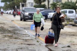
ST. PETERSBURG, Fla. (AP) — Hurricane Ian, one of the most powerful storms ever recorded in the U.S., swamped southwest Florida on Wednesday, turning streets into rivers, knocking out power to 2 million people and threatening catastrophic damage further inland.
A coastal sheriff’s office reported that it was getting many calls from people trapped in flooded homes. Desperate people posted to Facebook and other social sites, pleading for rescue for themselves or loved ones. Some video showed debris-covered water sloshing toward homes’ eaves.
The storm surge flooded a hospital’s lower level emergency room in Port Charlotte, while fierce winds tore part of its fourth floor roof from its intensive care unit, according to a doctor who works there.
Water gushed down from above onto the ICU, forcing staff to evacuate the hospital’s sickest patients — some of whom were on ventilators — to other floors, said Dr. Birgit Bodine of HCA Florida Fawcett Hospital. Staff members used towels and plastic bins to try to mop up the sodden mess.
The medium-sized hospital spans four floors, but patients were forced into just two because of the damage. Bodine planned to spend the night at the hospital in case people injured from the storm arrive there needing help.
“The ambulances may be coming soon and we don’t know where to put them in the hospital at this point because we’re doubled and tripled up,” she said. “As long as our patients do OK and nobody ends up dying or having a bad outcome, that’s what matters.”
The hurricane’s center made landfall near Cayo Costa, a barrier island just west of heavily populated Fort Myers. As it approached, water drained from Tampa Bay.
Mark Pritchett stepped outside his home in Venice around the time the hurricane churned ashore from the Gulf of Mexico, about 35 miles (55 kilometers) to the south. He called it “terrifying.”
“I literally couldn’t stand against the wind,” Pritchett wrote in a text message. “Rain shooting like needles. My street is a river. Limbs and trees down. And the worst is yet to come.”
A boat carrying Cuban migrants sank Wednesday in the stormy weather in waters east of Key West. The U.S. Coast Guard initiated a search and rescue mission for 23 people and managed to find three survivors about two miles (three kilometers) south of the island chain, officials said. Four other Cubans swan to Stock Island, just east of Key West, the U.S. Border Patrol said. Air crews continued to search for possibly 20 remaining migrants.
The Category 4 storm slammed the coast with 150 mph (241 kph) winds and pushed a wall of storm surge accumulated during its slow march over the Gulf. More than 2 million Florida homes and businesses were without electricity, according to PowerOutage.us. Nearly every home and business in three counties was without power.
The storm previously tore into Cuba, killing two people and bringing down the country’s electrical grid.
About 2.5 million people were ordered to evacuate southwest Florida before Ian hit, but by law no one could be forced to flee.
News anchors at Fort Myers television station WINK had to abandon their usual desk and continue storm coverage from another location in their newsroom because water was pushing into their building near the Caloosahatchee River.
Though expected to weaken to a tropical storm as it marches inland at about 9 mph (14 kph), Ian’s hurricane force winds were likely to be felt well into central Florida. In the hours since landfall, top sustained winds had gradually dropped to 90 mph (150 kph), making it a Category 1 hurricane crossing the peninsula. Still, storm surges as high as 6 feet (2 meters) were expected on the opposite side of the state, in northeast Florida.
Sheriff Bull Prummell of Charlotte County, just north of Fort Myers, announced a curfew between 9 p.m. and 6 a.m. “for life-saving purposes,” saying violators may face second-degree misdemeanor charges.
“I am enacting this curfew as a means of protecting the people and property of Charlotte County Prummell said.
Jackson Boone left his home near the Gulf coast and hunkered down at his law office in Venice with employees and their pets. Boone at one point opened a door to howling wind and rain flying sideways.
“We’re seeing tree damage, horizontal rain, very high wind,” Boone said by phone. “We have a 50-plus-year-old oak tree that has toppled over.”
In Naples, the first floor of a fire station was inundated with about 3 feet (1 meter) of water and firefighters worked to salvage gear from a firetruck stuck outside the garage in even deeper water, a video posted by the Naples Fire Department showed. Naples is in Collier County, where the sheriff’s department reported on Facebook that it was getting “a significant number of calls of people trapped by water in their homes” and that it would prioritize reaching people “reporting life threatening medical emergencies in deep water.”
Ian’s strength at landfall tied it for the fifth-strongest hurricane when measured by wind speed to strike the U.S. Among the other storms was Hurricane Charley, which hit nearly the same spot on Florida’s coast in August 2004, killing 10 people and inflicting $14 billion in damage.
Ian made landfall more than 100 miles (160 kilometers) south of Tampa and St. Petersburg, sparing the densely populated Tampa Bay area from its first direct hit by a major hurricane since 1921.
Flash floods were possible all across Florida. Hazards include the polluted leftovers of Florida’s phosphate fertilizer mining industry, more than 1 billion tons of slightly radioactive waste contained in enormous ponds that could overflow in heavy rains.
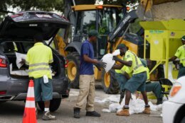
The federal government sent 300 ambulances with medical teams and was ready to truck in 3.7 million meals and 3.5 million liters of water once the storm passes.
“We’ll be there to help you clean up and rebuild, to help Florida get moving again,” President Joe Biden said Wednesday. “And we’ll be there every step of the way. That’s my absolute commitment to the people of the state of Florida.”
The governors of Virginia, Georgia, South Carolina and North Carolina all preemptively declared states of emergency. Forecasters predicted Ian will turn toward those states as a tropical storm, likely dumping more flooding rains into the weekend, after crossing Florida.
___
Associated Press contributors include Christina Mesquita in Havana, Cuba; Cody Jackson and Adriana Gomez Licon in Tampa, Florida; Freida Frisaro in Miami; Anthony Izaguirre in Tallahassee, Florida; Mike Schneider in Orlando, Florida; Seth Borenstein and Aamer Madhani in Washington; Bobby Caina Calvan in New York; Andrew Welsh-Huggins in Columbus, Ohio; Jay Reeves in Birmingham, Alabama, and Alina Hartounian in Phoenix, Arizona.