Picture this: Metro stops at BWI Marshall Airport and Dulles International Airport. An Adams Morgan station. A more robust train system connecting the entire region.
Sounds dreamy, right?
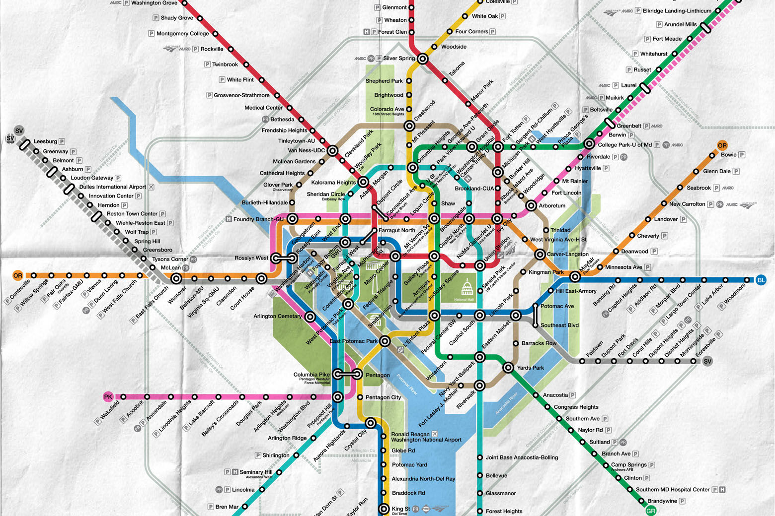
A Reddit user has created an epic fantasy Metrorail map, drawing up three new lines and adding extensions to nearly every existing route.
The imaginary pink line would take passengers from BWI Marshall in Baltimore, all the way to Annandale, Virginia. The gold line would circulate near some of D.C.’s biggest tourist attractions, including the monuments and the National Arboretum. The Pink or Orange lines could bring people to Georgetown. Stop in Shirlington, Adams Morgan, Navy Yard and the National Harbor without getting off the Teal line.
This map shows access to suburban neighborhoods, hospitals, historic sites, government buildings and so much more in the D.C. area.
The designer of the map, under the username u/twoninehigh, said it was crafted to “capture the branding and spirit of WMATA without hurting the design of the map too much.”
It is supposed to be a semi-realistic expansion of the current Metro system. A geographic Google Map was even mocked up.
There has been a lot of buzz on Reddit and Twitter in response to the map.
“This is a thing of beauty. Fantasy is right,” one user said.
Some said it would help alleviate the brutal Interstate 95 traffic. Another said it would be nice to take the Metro out to breweries in Leesburg, Virginia.
However, many questioned the costs and logistics of construction, and said it would likely not be feasible.
So, “step back, doors closing” on this dream.


