
WASHINGTON — Out of the cold snap and into the downpour … and then back into the cold. The brief respite from the cold that came on Thursday morning will steadily give way to more cold temps throughout the afternoon and into the evening.
WTOP Weather Center
Current Conditions and Weather Radar
WTOP Traffic Center
Sign up for WTOP Alerts
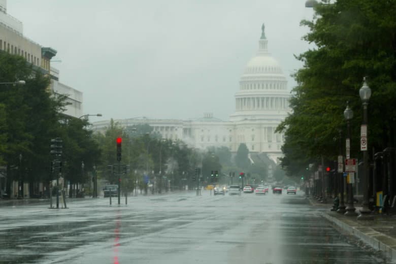
While temperatures Thursday were considerably warmer to start than they have been in the last few days, heavy rain and winds pushed into the area along with the improved temps.
Temperatures will steadily drop throughout the day before settling in the 30s overnight. Starting around 2 p.m., the mercury will begin its retreat and overnight temperatures could dip below freezing.
A flood watch will be in effect until 3 p.m. on Thursday in D.C., Maryland and Virginia. In Maryland, the flood watch applies to Anne Arundel, Carroll, Howard, Montgomery, Charles, Frederick, Baltimore, Prince Georges and Harford. In Virginia, the flood watch extends to Arlington, Alexandria, Loudoun, Fairfax, Fauquier, Prince William, Spotsylvania, and Stafford.
Big drop coming fast. Temperatures are around 60° now but will fall into the 30s by 6pm. Strong South winds now will becoming from the Northwest this afternoon bringing the January chill back. More bitter cold by the middle of next week. pic.twitter.com/NXmJ6FSzd7
— Chuck Bell (@ChuckBell4) January 24, 2019
Heavy rains moved in during the morning hours on Thursday, drenching the already soaked region. By the end of the day, total rainfall amounts could be around 1 inch in most places, with some isolated areas seeing as much as 2 inches. The National Weather Service said the risk for flooding is increased because the ground is frozen and already saturated.
Moderate to locally heavy rain will pass through the Washington and Baltimore Metropolitan areas through early this afternoon. See map for details. pic.twitter.com/sFuVVzO6As
— NWS DC/Baltimore (@NWS_BaltWash) January 24, 2019
According to Storm Team4 meteorologist Chuck Bell, we had our friends to the south to thank for the blast of warmer weather this morning.
“Another wild ride from Mother Nature today so batten down the hatches,” said Bell. “Strong South winds have caused temperatures to rise into the mid/upper 50s overnight. Areas of moderate to heavy rain have also moved in so expect a very “April-like” feel for the first half of the day.”
Forecast
A flood watch for most areas east of US-15 until 3 p.m.
THURSDAY: Rainy and windy, especially this morning. Mild this morning. Falling temperatures through the afternoon and evening. Temperatures in the upper 40s and mid 50s now, falling through the 40s and into the 30s this evening.
THURSDAY NIGHT: Becoming mostly clear. Windy and cold. Some refreeze of standing water. Lows: mid 20s to low 30s.
FRIDAY: Mostly cloudy. Blustery and cold. A few scattered flurries. Highs: mid 30s to near 40.
SATURDAY: Partly sunny. Seasonably chilly. Highs: low 40s.
SUNDAY: Mostly cloudy. Highs: mid to upper 40s.