5am: Patchy dense fog has developed in sheltered river valleys of eastern WV, as well as northern MD including along parts of I-68 and I-70 between Frederick and Cumberland. Take it slow this morning and be alert for sudden reductions in visibility.
— NWS DC/Baltimore (@NWS_BaltWash) June 24, 2018

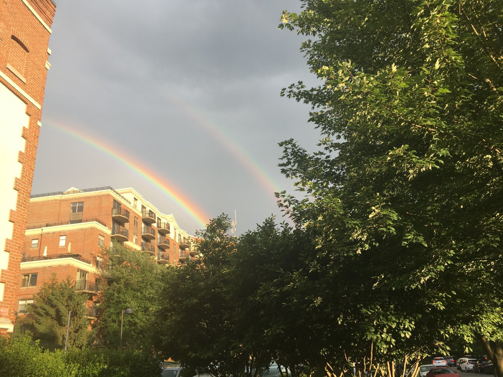
Double rainbow. #ALLCAPS #WTOP pic.twitter.com/7EXXqGBR6I
— h_casey (@h_casey) June 24, 2018

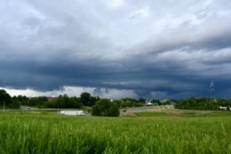


WASHINGTON — Clean up is underway after storms and showers hit the D.C. area and brought flooding to parts of Northern Virginia and no shortage rainbows.
The National Weather Service has issued an area flood warning for central Prince William County and the city of Manassas in Northern Virginia until 11:15 a.m.
The weather service said as of 5:15 a.m., the stream gauge on Broad Run near Bristow indicated minor flooding was imminent along the stream as a result of the heavy rain on Saturday.
Some of the locations that might experience flooding include Linton Hall, Bull Run, Manassas, Gainesville and Nokesville.
Piper Lane near Manassas Airport and surrounding trails near Broad Run in Bristow are expected to flood.
A flood warning is also in effect for the Potomac River at Edwards Ferry affecting Montgomery County, Maryland, and Loudoun County, Virginia.
As of 5 a.m., the river was at flood stage, but is expected to fall below flood stage later on Sunday morning.
The river is at 15 feet, which means water could wind up reaching the boat ramp and lower parking area at Edwards Ferry and begin to inundate areas near Whites Ferry.
A flood warning has been canceled for the Rappahannock River at Fredericksburg, for the city of Fredericksburg and Stafford County.
Saturday’s torrential rainfall occurred with the storm and led to warnings of flash flooding from the National Weather Service.
Storm Team4 meteorologist Steven Prinzivalli said that the worst of the storms was the line pushing through Prince William County that generated straight-line wind damage — there were reports of downed trees in the area.
Major flooding for the Rappahannock River at Fredericksburg this eve. Forecast is for a crest at 27 feet around 7 pm. Water will reach several buildings near the river, along with multiple parking lots. Click https://t.co/PNvJPd6VZU for forecast updates, including river flooding.
— NWS DC/Baltimore (@NWS_BaltWash) June 23, 2018
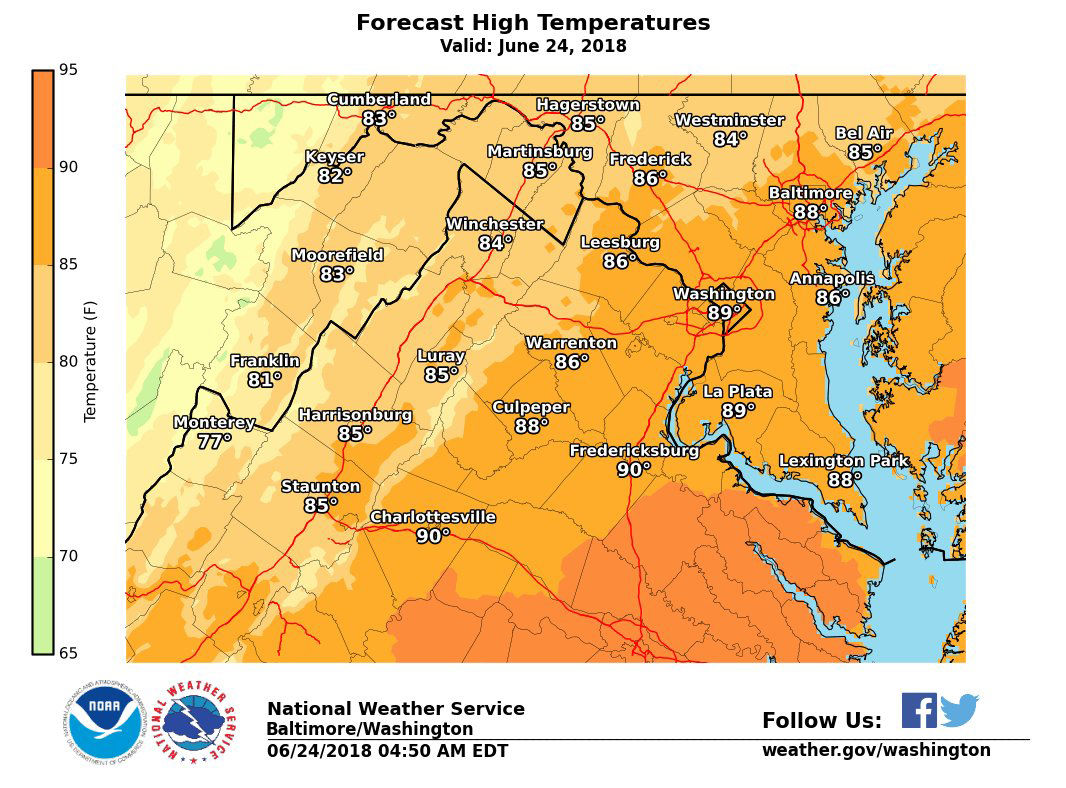
Weather Forecast:
Sunday: Mix of sun and clouds; storms possible; Highs in the 90s.
Monday: Mostly sunny; lows in the 80s.
Tuesday: Mostly sunny and beautiful; Highs in the mid 80s.