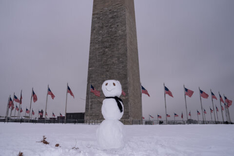
If it seems too soon in the season for snow in the D.C. region, think again because it could be on its way.
Thursday night a surge of cold air will bring temperatures down to just the upper 10s and lower 20s — low enough to set the stage for an expected accumulation of snow Friday.
A low-pressure system will arrive in the mid-Atlantic after it moves across North Carolina and southern Virginia, making it cold enough for any drizzle or rain to fall as snow, according to 7News First Alert meteorologists.
This system brings the potential for a dusting of snow up to about 1 inch in D.C.
Slightly higher snowfall is expected in areas south and east of the District. Around 2 inches of snowfall is forecast from Culpeper, Virginia, to Waldorf, Maryland.
- Listen to WTOP online and on the radio at 103.5 FM or 107.7 FM.
- Current traffic conditions
- Weather forecast
- Closings and Delays
- Sign up for WTOP email alerts
- Get custom alerts with the WTOP app for Apple and Android phones
Before groaning about pulling out your snow shovel already, remember: The last measurable snowfall in D.C. in the month of December was back in 2017, with 2 inches at Reagan National Airport, according to 7News.
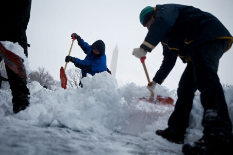
Snow or no snow, it will be very cold Friday, with wind chills pushing temperatures down into the 10s and 20s all day.
The National Weather Service is forecasting snow to start between 4 a.m. and 7 a.m. on Friday with steady activity between 7 a.m. and 1 p.m. Snow is expected to taper off in the afternoon.
The steep temperature drop means any snow that falls will stick around until temperatures warm back to the 40s Saturday afternoon.
Bundle up — D.C. Mayor Muriel Bowser activated the city’s first Extreme Cold Alert of the season Thursday. The alert is in effect starting at 8 p.m. Thursday and lasting until 9 a.m. Friday.
The mayor has also activated the District Snow Team, which will be salting streets on major D.C. roadways beginning Thursday night.
Road conditions could be slick Friday morning, according to the National Weather Service. Stick with WTOP Traffic for the latest on roadway conditions.
Closings and delays
See the full list on WTOP’s Closings and Delays page.
Culpeper County Public Schools was the first school district in the D.C. area to announce a change to its operations, saying Thursday afternoon it would open schools on a two-hour delay Friday due to the forecast. The school district said it would send a follow-up by 7:30 a.m. Friday if conditions worsen and it needed to close schools entirely.
Shortly after, Spotsylvania County Public Schools said all its schools and offices would be closed Friday.
Full forecast
THURSDAY EVENING: Mostly cloudy by late evening
Temps: 28-36
Winds: Northwest 5-15 mph
THURSDAY NIGHT/OVERNIGHT: Mostly cloudy to cloudy
Lows: 22-29
Winds: North 5 mph
FRIDAY: WINTER ALERT (morning), COLD ALERT (for the day), and cloudy with morning snow showers (most done falling by noon)
Highs: 30-35
Winds: Southeast 5-10 mph
SATURDAY: Partly sunny
Highs: 41-45
Winds: Southwest 5 mph
SUNDAY: Mostly cloudy
Highs: 41-46
Winds: South 5 mph
Current weather
Get breaking news and daily headlines delivered to your email inbox by signing up here.
© 2025 WTOP. All Rights Reserved. This website is not intended for users located within the European Economic Area.