D.C. is not taking chances even with just flurries in the forecast for the region overnight into Tuesday morning.
The potential flurries are headed to D.C. late Monday night as cold and windy weather moves in.
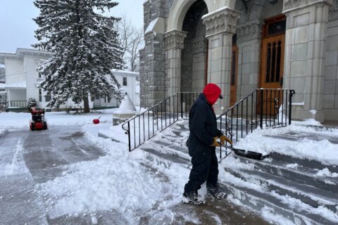
The District said it has crews on standby beginning at 11 p.m. Monday, to address any icy conditions that might develop.
Monday afternoon saw wind chills in the 30s. The trend could continue into Tuesday and bring a chance of light snow into the region.
Some areas of Virginia and Maryland are expected to get some snow, while in D.C., it will mostly be slush and possibly some ice.
“Maybe just a little bit of some light snow at the onset, but this is mainly going to be a cold rainstorm with about a half inch of liquid precipitation expected and most of the precipitation will be tapering off after lunchtime tomorrow,” 7News First Alert Meteorologist Eileen Whelan said.
Whelan said it’s not going to be a “blockbuster” snowstorm, but it could cause some slick driving conditions Tuesday morning for the D.C. area.
The National Weather Service has issued winter weather advisories in effect from 1 a.m. until 1 p.m. Tuesday for Frederick County in Maryland, and Loudoun, Fauquier and Culpeper counties in Virginia.
“Those will be the areas that will feature maybe some ice and snow accumulation, so it could make for some slick roadways,” Whelan said. “We will see a little light snow at the onset here in D.C. overnight after about 2, 3 a.m., but by about 6 a.m. we’ll see that mix to sleet and eventually just a cold rain.”
These images show when wintry precipitation is expected to start/end. pic.twitter.com/oHFSs78Bvc
— NWS Baltimore-Washington (@NWS_BaltWash) December 1, 2025
Parts of northwest Montgomery and Howard counties are also on alert for potential snow with an advisory in effect from 5 to 10 a.m. Tuesday.
The Maryland State Highway Administration will be pretreating all interstates and major routes in the Maryland suburbs of D.C., as well as Baltimore, Harford, Frederick, Carroll and Howard counties and expect to be completed by Monday evening in advance of the onset of the storm, a spokesperson told WTOP.
The Virginia Department of Transportation began pretreating roads on Sunday night and will begin mobilizing snowplows on Monday night.
D.C. activated its Cold Alert, which open its hypothermia shelters for those experiencing homelessness. To find a shelter, visit the District Department of Human Services website.
School closings and delays
Visit WTOP’s Closings and Delays page for an up-to-the-minute list.
Loudoun County Public Schools will open on a two-hour delay Tuesday, with administrative offices opening on time, the school system announced.
Culpeper County Public Schools was the first school district in the D.C. region to announce it will open two hours late Tuesday due to the forecast.
Fauquier County Public Schools made the same decision not long after, announcing all its schools and administrative offices would open two hours late Tuesday.
School officials in Stafford County and Prince George’s County said they’re monitoring the situation before making a decision on school opening, with Prince George’s County Public Schools saying school leaders would convene at 4 a.m. Tuesday to determine if an adjustment was needed.
Stafford County Public Schools said it would notify families in the morning if a change to operating status is made.
Montgomery County Public Schools also shared its inclement weather protocol on social media on Monday, in advance of the first potential winter weather of the season.
- Listen to WTOP online and on the radio at 103.5 FM or 107.7 FM.
- Current traffic conditions
- Weather forecast
- Closings and Delays
- Sign up for WTOP email alerts
- Get custom alerts with the WTOP app for Apple and Android phones
Full forecast
MONDAY EVENING: Partly to mostly cloudy
Temperatures: 40s to 30s
Winds: North 10-15 mph
Clouds are set to increase this evening ahead of our next weather maker, which won’t bring wet weather to the metro until after midnight. Sunset is at 4:47 p.m. Dry weather is expected for the evening rush.
MONDAY NIGHT: Cloudy with rain, snow or wintry mix late
Lows: 28-34
Winds: Southeast 5 mph
Clouds thicken overnight with snow developing at the onset for everyone after 2 a.m. A mixed bag of rain, sleet and even a burst of snow will move in from southwest to northeast. Temperatures will hover around freezing, so slick roads will be possible. While this may be disruptive for some travel, this is not a blockbuster storm.
TUESDAY: Morning wintry mix with afternoon rain
Highs: 36-42
Winds: North 5-10 mph
Budget extra time for the morning commute, as a wintry mix will set up along the I-95 corridor with snow likely along and west of Highway 15. The I-95 corridor may see a very brief period of wintry mix. Farther west, wintry weather will transition to a cold rain by mid-morning melting any accumulations. Rain will end from west to east by late afternoon.
WEDNESDAY: Mostly sunny
Highs: 40-45
Winds: Northwest 5-10 mph
Sunshine returns as chilly air sticks around with below-average highs in the low to middle 40s.
THURSDAY: Partly cloudy
Highs: 40-45
Winds: Northwest 5-10 mph
Skies will be mostly to partly cloudy ahead of a strong cold front that will bring colder temperatures for the upcoming weekend.
FRIDAY: Mostly cloudy
Highs: 30s
Winds: Southeast 5-10
The latest forecast trends call for a mainly dry day. However, a weather maker may clip the region just to the south and east, bringing a chance for wintry mix.
CURRENT CONDITIONS
Get breaking news and daily headlines delivered to your email inbox by signing up here.
© 2025 WTOP. All Rights Reserved. This website is not intended for users located within the European Economic Area.