WASHINGTON — Well, a lot has changed overnight. The track of Hurricane Matthew has shifted once again, as expected, and the scenario is what we were hoping for around the WTOP listening area. As for areas along the southeastern portion of the United States (including Florida, South Carolina and Georgia), the projection doesn’t look good.
As of 11 a.m., Matthew’s winds are at 120 mph, making a Category 3 hurricane just about 100 miles south of the Bahamas, heading towards the island. It will continue to gain strength once it moves Ito the open waters of the Atlantic.
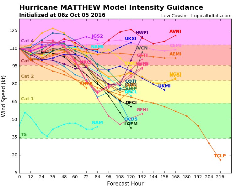
While the most current track seems to spare our region, coastal Florida will have major impacts from Hurricane Matthew. By Thursday and into Friday, Matthew should pass along the Florida coast as a Category 4 with winds of 130 mph at times.
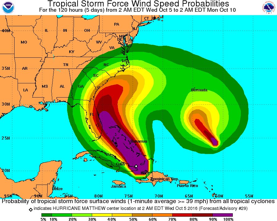
Even if Matthew doesn’t make a direct hit on Florida, hurricane-force winds are extending about for about a 40-mile radius out of the storm, and even a little shift in track to the left or the right could have huge effects for our coastal friends. For now, this is a dangerous situation for those areas, many of which have hurricane warnings posted.
Although this is the latest track, it is still subject to change as we are several days out. The picture will become clearer today and tomorrow.
The only wildcard is now looks to be Tropical Storm Nicole. It’s out in the Atlantic with no immediate threat to any land, but some guidance suggests that Matthew could absorb Nicole as it moves north, or that it could almost bounce off Nicole and move back to the south before heading toward the Florida coast for the second time.
Just keep an eye out. Although Matthew is trending a little further out to sea, I wouldn’t take this as gospel quite yet. Things can still change and we need to be conscious of that.
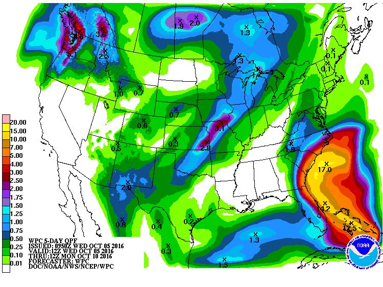
As for our forecast, the front that will move through on Saturday seems like it will help force Matthew to the south of our region. The only other change we have now would bring some showers into the region on Friday ahead of the frontal system. That could prove to be troublesome for the Nationals’ first playoff game, but it looks like anything we see would be on the lighter side.
Again, this is a fluid situation, and we will continue to update you as it unfolds and new information becomes available.