WASHINGTON — What a roller coaster of a week! I think we can all agree that we have had enough dreary days and are ready for some sunshine.
We started with temperatures in the 70s Monday and Tuesday, and barely made it out of the 40s with rain on Wednesday and Thursday. Well, get ready for a spread in temperatures Friday, but thankfully much warmer.
Temperatures
Believe it or not, humidity as well as temperatures will be on the increase Friday. A warm front will lift from the North Carolina/Virginia border through the first part of the day. In the wake of this front, winds will increase from the south and southwest (gusting up to 25 mph at times after lunch), bumping up our humidity as well as temperatures.
Temperatures will range from mid 70s if you are south of D.C. (closer to Central Virginia — mid 70s, in NOVA/D.C. region around 70 degrees and mid to upper 60s north of D.C.). There could be some spotty sunshine around the region mainly west, but mostly clouds are forecast for Friday.
Dewpoints, or the measure of moisture in the air, should reach around 60 degrees! With a dewpoint in the 50s, you will feel some humidity in the air.
Timing
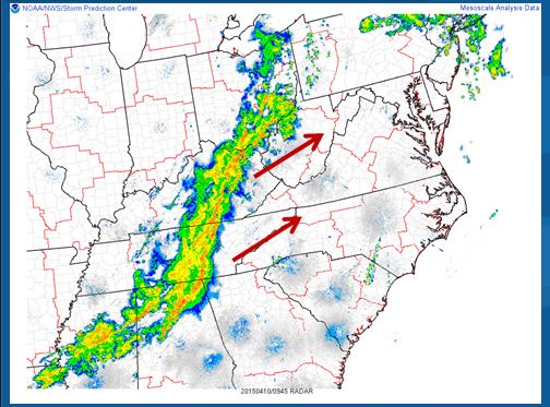
A line of storms ahead of a cold front will swing through our region during Friday afternoon and early evening. The line of storms (should weaken slightly for areas west of the Blue Ridge) will move into the Shenandoah Valley, Eastern West Virginia panhandle between 1 p.m. and 2 p.m. This line could become strong as it treks east, giving a chance for some severe weather east of I-81. Rain and storms will move across Northern Virginia and the greater D.C. metro area between 3 p.m. to 5 p.m., and through southern Maryland by 6 p.m./7 p.m. Everything should be well east by 8 p.m. with rapid clearing taking place from the west to the east. If you are headed out to Camden Yards for the Orioles home opener — watch for a delay! There’s a good chance of that happening.
Severe threat
Considering that the listening area will heat up in the wake of the warm front, instability will creep up as well. While the best chance for severe weather is south and east of the D.C. metro areas (as outlined by the Storm Prediction Center in the graphic below in yellow), we will have to monitor the entire region for any cells that could reach severe criteria. I am really thinking this will be any locations east of the Blue Ridge Mountains/east of I-81.
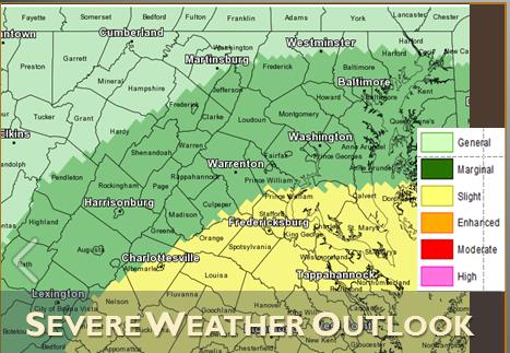
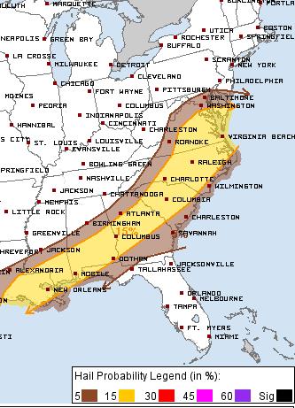
If we do have severe weather, expect damaging winds (winds of 58 mph or higher) and possible hail (severe criteria takes hail size 1-inch or more and I believe that will be isolated in our area). The Storm Prediction Center gives locations south of D.C. about a 15 percent chance of seeing severe winds/hail.
After the storms & through the weekend
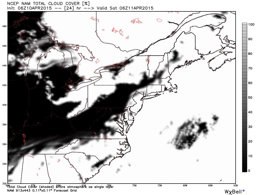
Skies will rapidly clear as the front passes through Friday night. After midnight, I expect most of our region to see a starry sky as high pressure builds in from the west.
We are expecting clear skies lasting through the weekend. There will be sunshine on Saturday, with a gusty northwest wind in the afternoon making it feel a touch cooler although temperatures will be in the mid to upper 60s. Hopefully, the cherry blossoms petals can stick despite the wind! Also, make sure to take some allergy medication as the pollen will be floating around in the wind. Sunday looks like the best day as winds lighten and the sun will still be shining. Temperatures on Sunday will just be a few degrees warmer then Saturday. It will be a good-looking weekend after Mother Nature showed her moody side this week.