WASHINGTON — Winter started officially at 6:03 p.m. EST on Sunday. Although it felt like winter on Monday, it is going to feel more like spring as we head into the holiday. So you might want to trade in the winter weather coat for a spring-like rain jacket and an umbrella for this Christmas Eve.
A deep area of low pressure will push north from the Gulf of Mexico Tuesday night through Wednesday night. This low will travel up the spine of the Appalachian, through the Ohio Valley and into the Great Lakes region. The low will aid in warmer temperatures spreading across the Mid-Atlantic and eventually traveling into the northeast as it pushes a warm front through these areas on Wednesday.
This is all ahead of a strong associated cold front that will eventually sweep through early Thursday, taking the rain and the balmy temperatures with it.
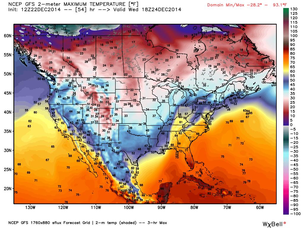
A strong southerly wind associated with this low pressure will help push temperatures into the low 60s for Wednesday. Our average temperature for this time of year is in the mid-40s! Temperatures on Christmas Eve area expected to reach at least 15 degrees above normal.
Since temperatures are so warm, we are only expecting rain across the region — and possibly a lot of it on Wednesday. Precipitable water values are fairly high with this storm, given the time of year.
Precipitable water is basically the amount of water contained in a vertical column, just above the surface (if it were all precipitated out) or the available moisture in the atmosphere for generating rain.
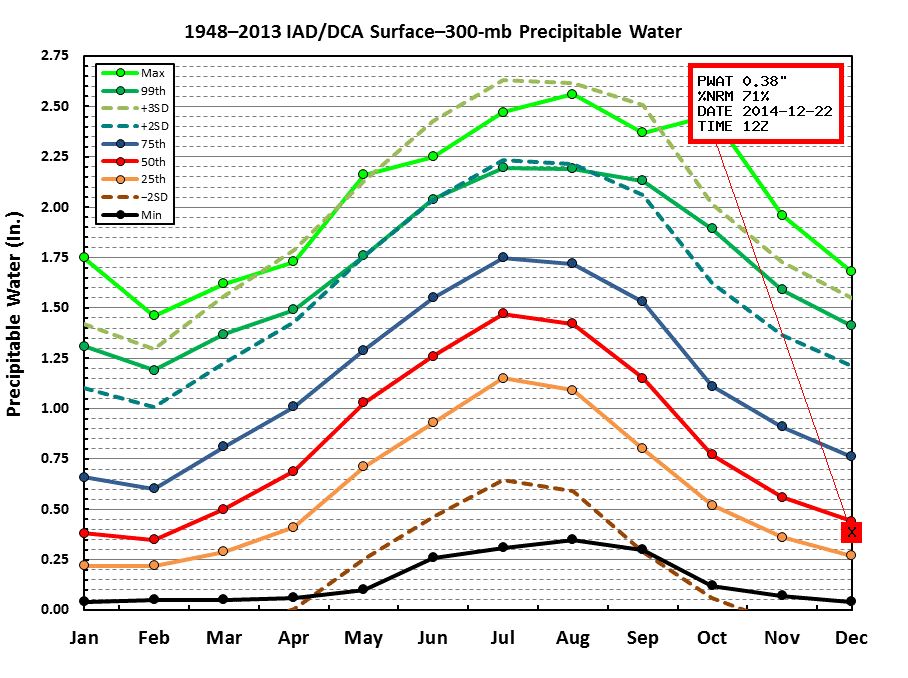
The above graphic shows where we stand as of the morning hours on Monday for precipitable water. It is currently only at 0.38 of an inch however, as this system draws moisture in form the Gulf. We are looking at some pretty high precipitable water values well over the 75th percentile.
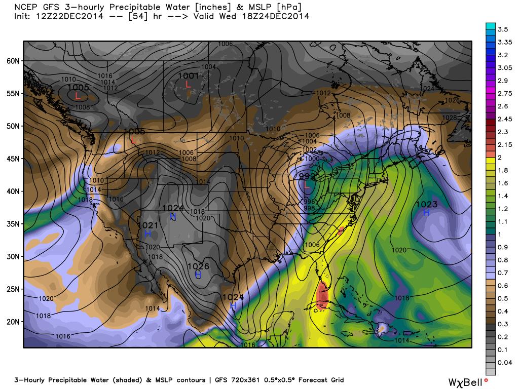
The graphic above shows large precipitable water values all up and down the East Coast on Wednesday afternoon and well over 1.2 inches in the D.C. region. Therefore, we could get a good dose of rain in spots, especially if we get some heavy bands that set up across the region on Wednesday.
If you are traveling, again, it looks like rain and some gusty winds through the Ohio Valley and to the north. This area of low pressure is not as intense as it has looked in the last couple days but it does intensify well north through Canada. Therefore, this could limit the development of the low level jet (the flow bringing the deep moisture from the Gulf just above the surface) which in turn may limit rainfall totals up and down the east coast but still will cause some travel headaches.
Rain will spread across the region for D.C. region Tuesday overnight into Wednesday morning and continue to move northward in New England through the first part of Wednesday. Temperatures from New York to Boston will in the mid-50s to around 60 degrees.
Even Maine will be fairly warm with temperatures in the mid-40s. Rain will be heavy and winds gusty at times so I expect there will be some problems if you are traveling north (even though it will just be a plain rain in many locations).
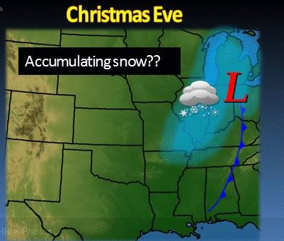
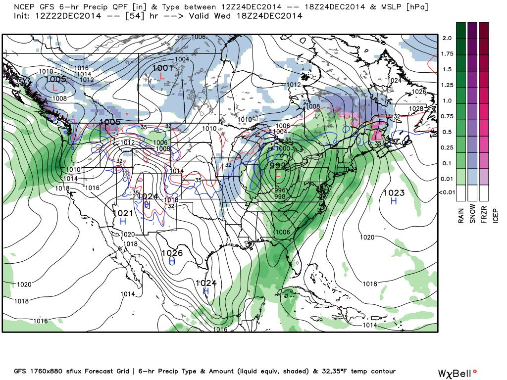
There will be some snow however, and that will mainly be across Chicago through Indiana and up through Michigan. However, most of these areas will start of as rain with a changeover to snow by Christmas Eve night. There could even be some accumulating snow in the area shaded in blue. But mainly a few inches or so and, again, that won’t be until Christmas Eve night.
By early Christmas morning, the strong cold front will sweep through the region bringing dry air with it. We will gradually dry out on Thursday getting some sunshine by Thursday afternoon. Winds will be strong on Thursday though, rolling out of the west from 10-20 mph with gusts up to 30+ mph. Temperatures on Christmas day will still be a little on the warm side, in the lower to mid-50s.
More seasonable temperatures will return on Sunday though after another cold front passes through the area. This could bring some precip for the weekend, so make sure to keep an eye on the weather if you are headed home from holiday travel next weekend!
Follow @WTOP on Twitter and WTOP on Facebook. You can also follow Lauryn Ricketts on Facebook.