Hidden beneath the waters of the Potomac River are dozens of sunken ships known as a "ghost fleet" that sailed from the Revolutionary War to after World War I.
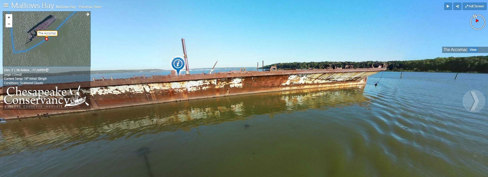
The website now offers 360-degree views of the “ghost fleet.”
(Courtesy of the Chesapeake Conservancy)
Courtesy of the Chesapeake Conservancy
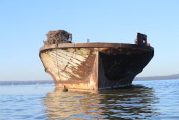
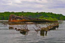
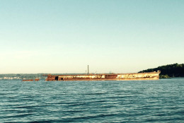
The Accomac, at Mallows Bay.
(Kyle Smith for the Chesapeake Conservancy)
Kyle Smith for the Chesapeake Conservancy
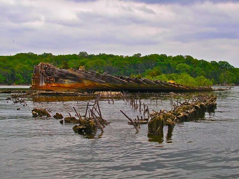
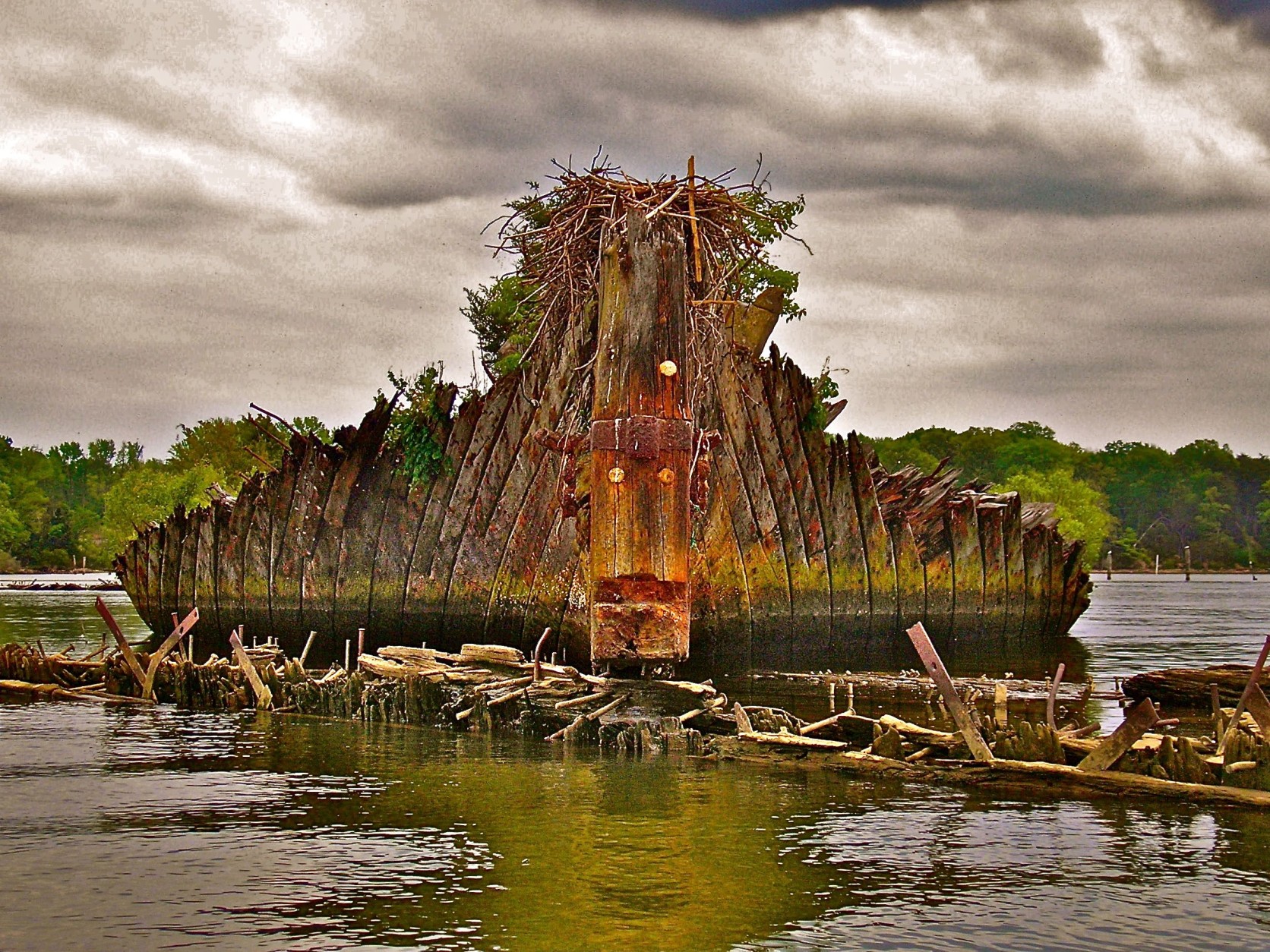
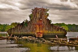
The remains of the Benzonia sit on top of the Caribou’s stern on Mallows Bay along the Potomac River in Charles County, Maryland.
(Courtesy Chesapeake Conservancy/Donald Shomette)
Courtesy Chesapeake Conservancy/Donald Shomette
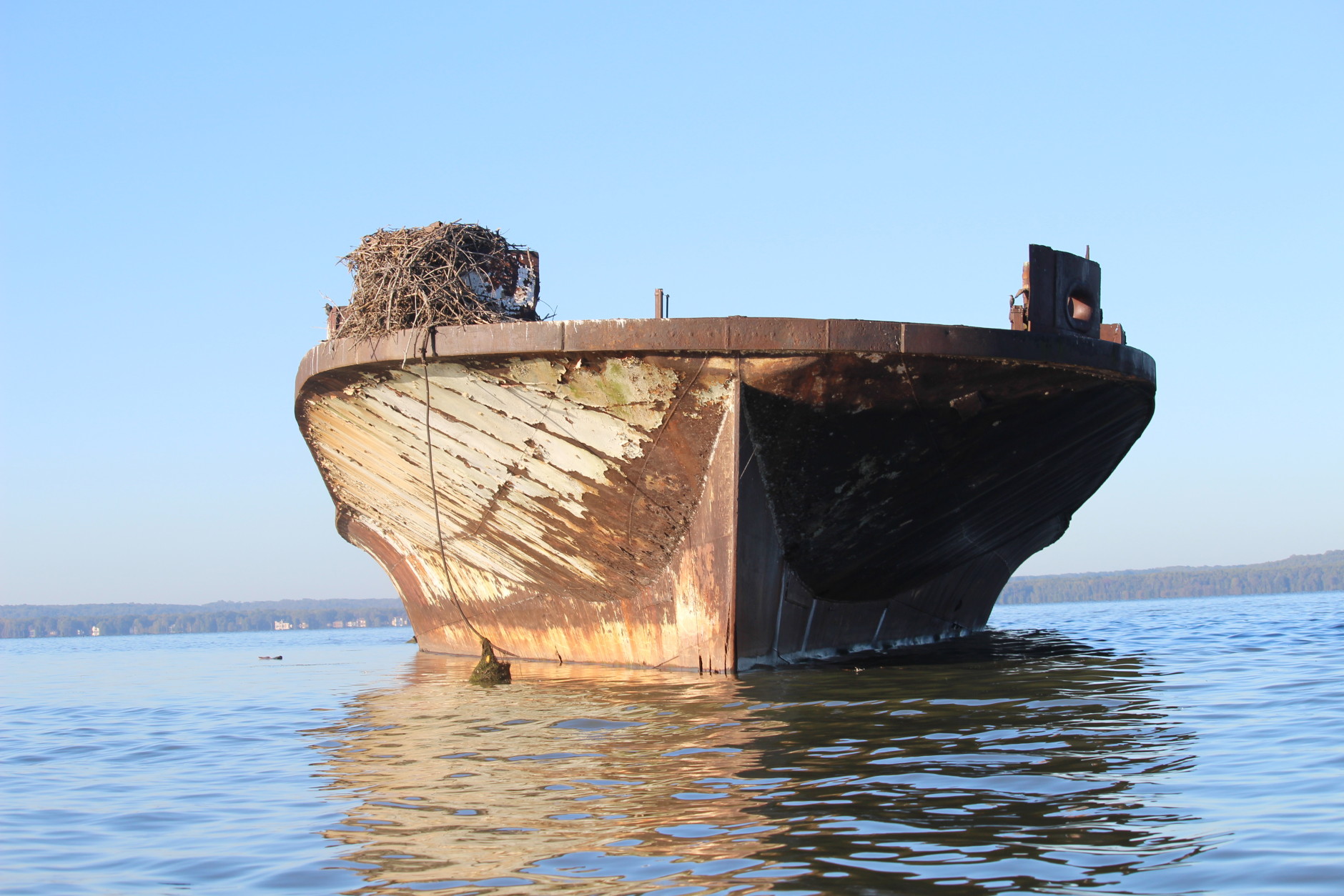
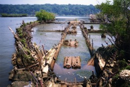
The remains of a ship lie in the waters of Mallows Bay, along the Potomac River, in Charles County, Maryland.
(Courtesy Chesapeake Conservancy/Donald Shomette)
Courtesy Chesapeake Conservancy/Donald Shomette
The Benzonia stern sits on top of the Caribou’s stern in Mallows Bay, Maryland.
(Courtesy Chesapeake Conservancy/Donald Shomette)
Courtesy Chesapeake Conservancy/Donald Shomette
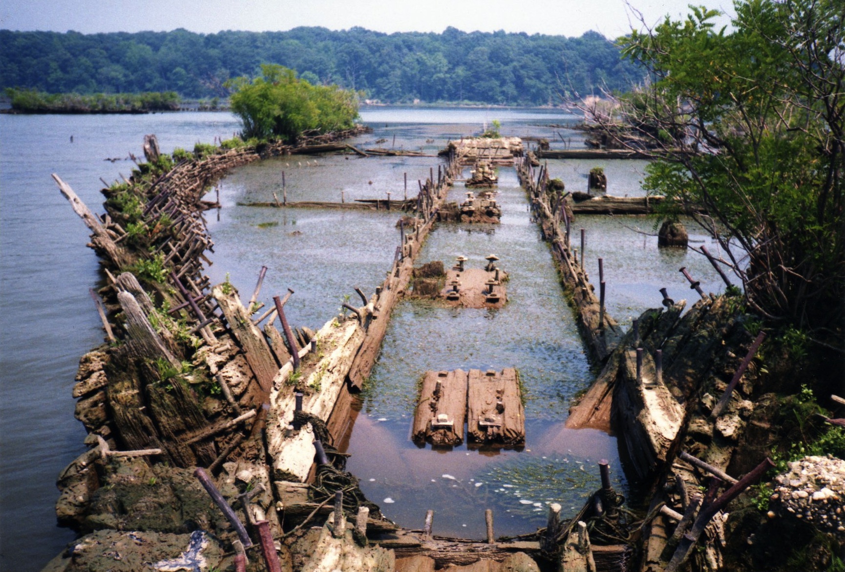
The outline of a ship is seen in Mallows Bay, Maryland. More than 100 sunken ships in the bay have created a unique ecosystem of birds, fish and other wildlife.
(Courtesy Chesapeake Conservancy/Donald Shomette)
Courtesy Chesapeake Conservancy/Donald Shomette
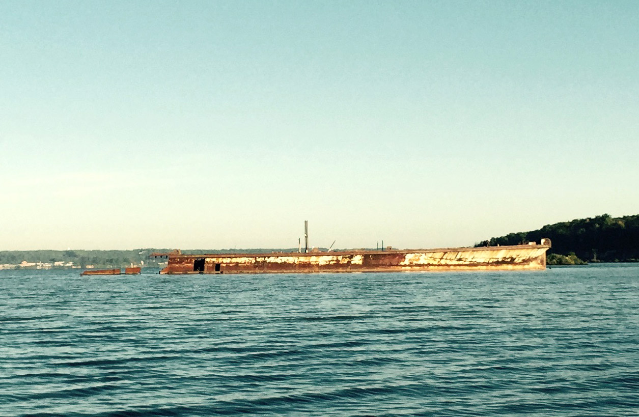
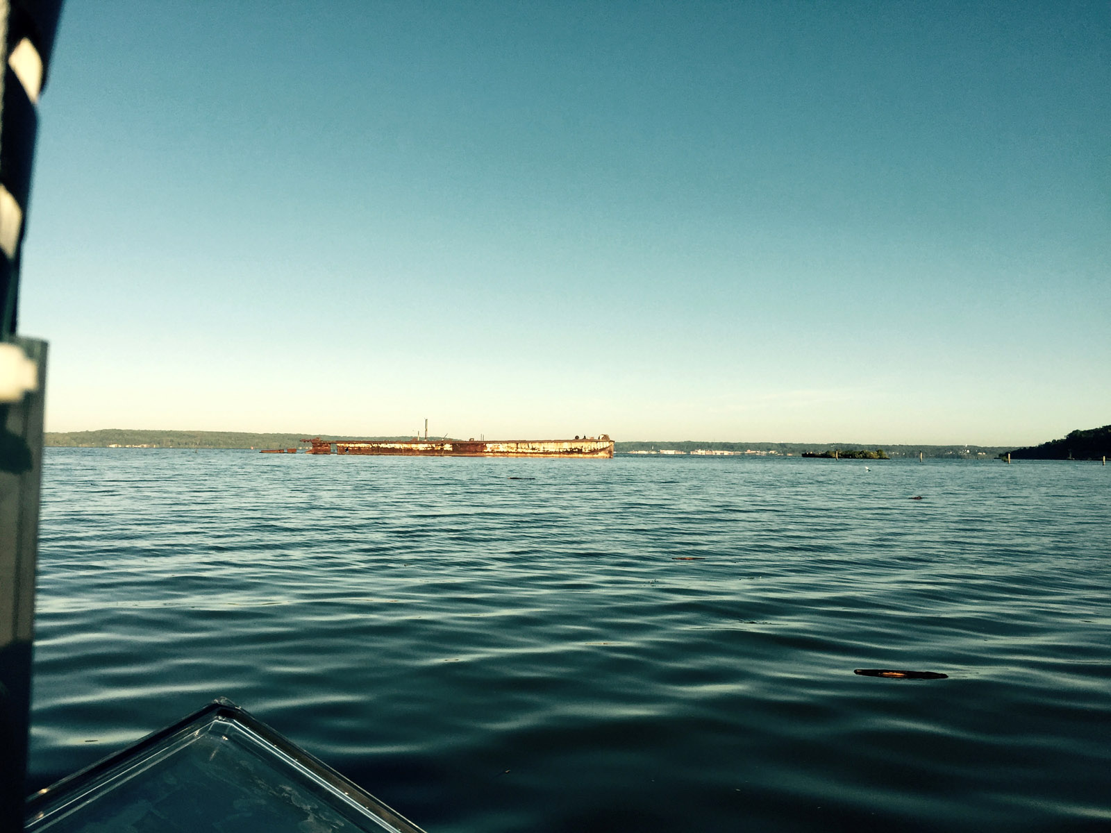
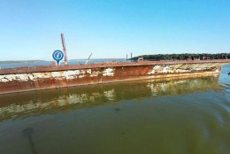
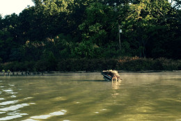
The rusty hull of a sunken ship rises out of the waters of Mallows Bay along the Potomac River Tuesday.
(WTOP/Max Smith)
WTOP/Max Smith
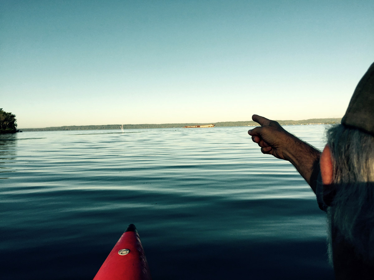
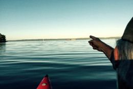
Donald Shomette points to the distant hull of a rusting ship off the shore of Charles County, Maryland, in Mallows Bay.
(WTOP/Max Smith)
WTOP/Max Smith
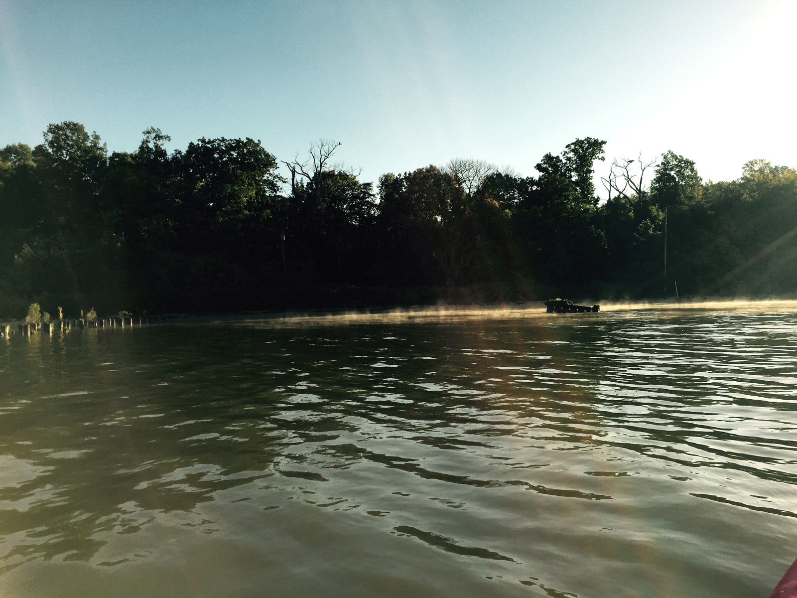
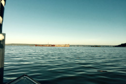
The rising hull of a sunken ship can be seen in the distance off Mallows Bay in Charles County, Maryland.
(WTOP/Max Smith)
WTOP/Max Smith
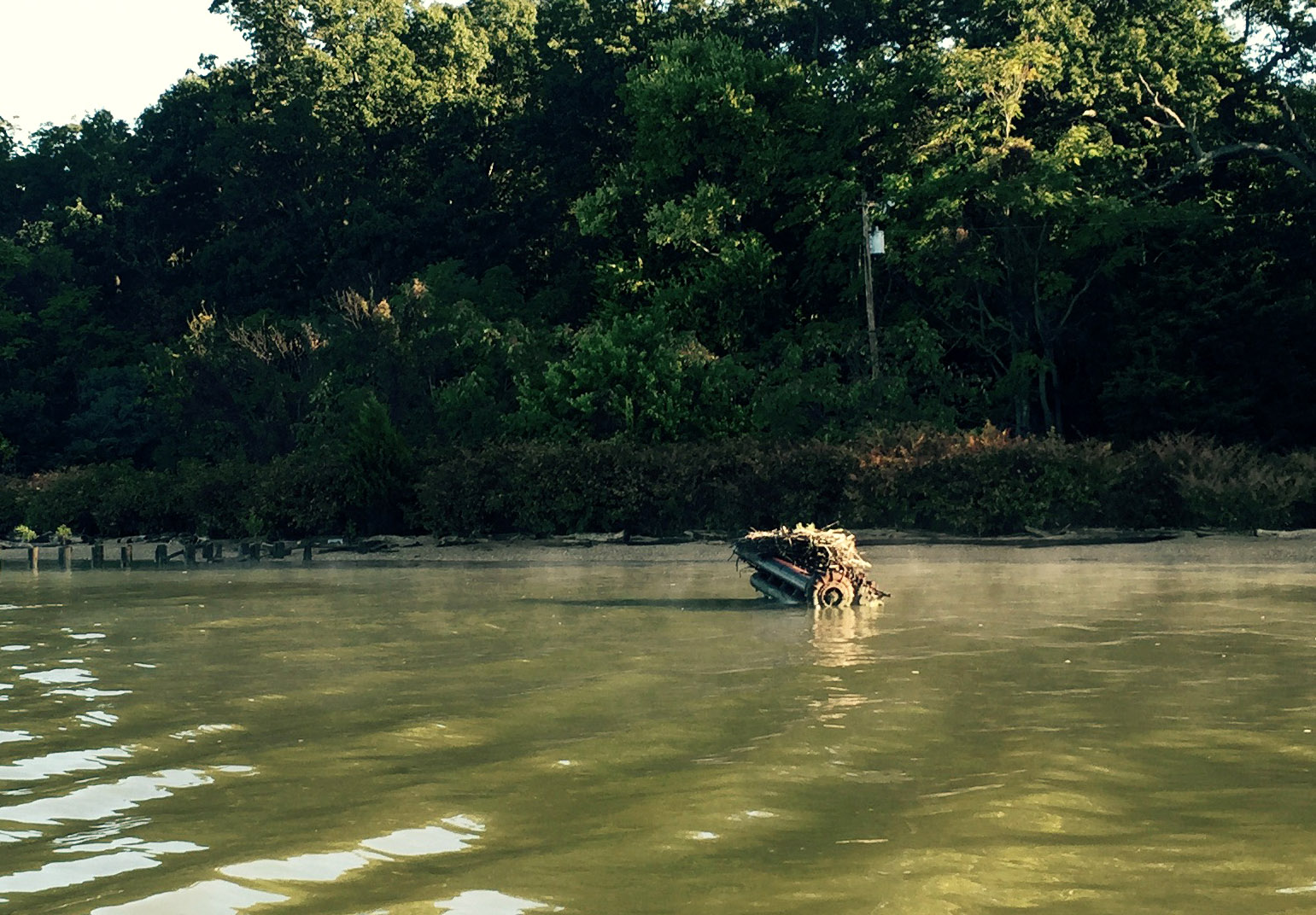
An engine of a vessel rises from the mist Tuesday morning on Mallows Bay, Maryland.
(WTOP/Max Smith)
WTOP/Max Smith
This photo shows a closeup of part of a ship’s engine rising through mist Tuesday morning in Mallows Bay, Maryland.
(WTOP/Max Smith)
WTOP/Max Smith
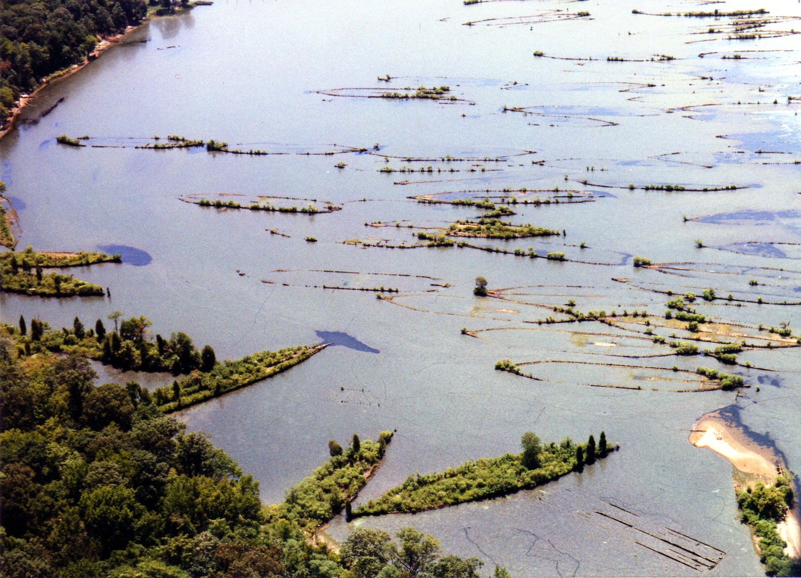
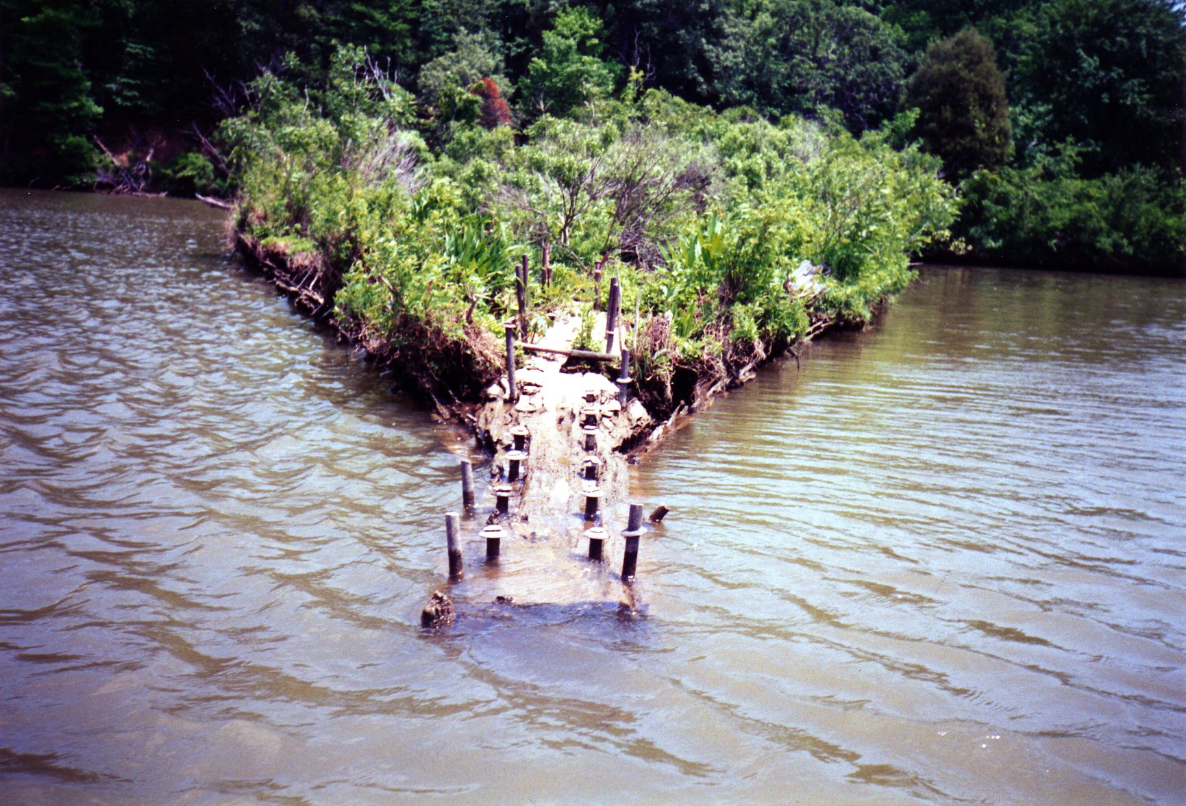
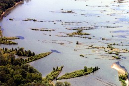
An aerial view of the northern part of Mallows Bay shows dozens of sunken ships that have formed what appear to be ship-shaped islands of vegetation in Mallows Bay.
(Courtesy Chesapeake Conservancy/Donald Shomette)
Courtesy Chesapeake Conservancy/Donald Shomette
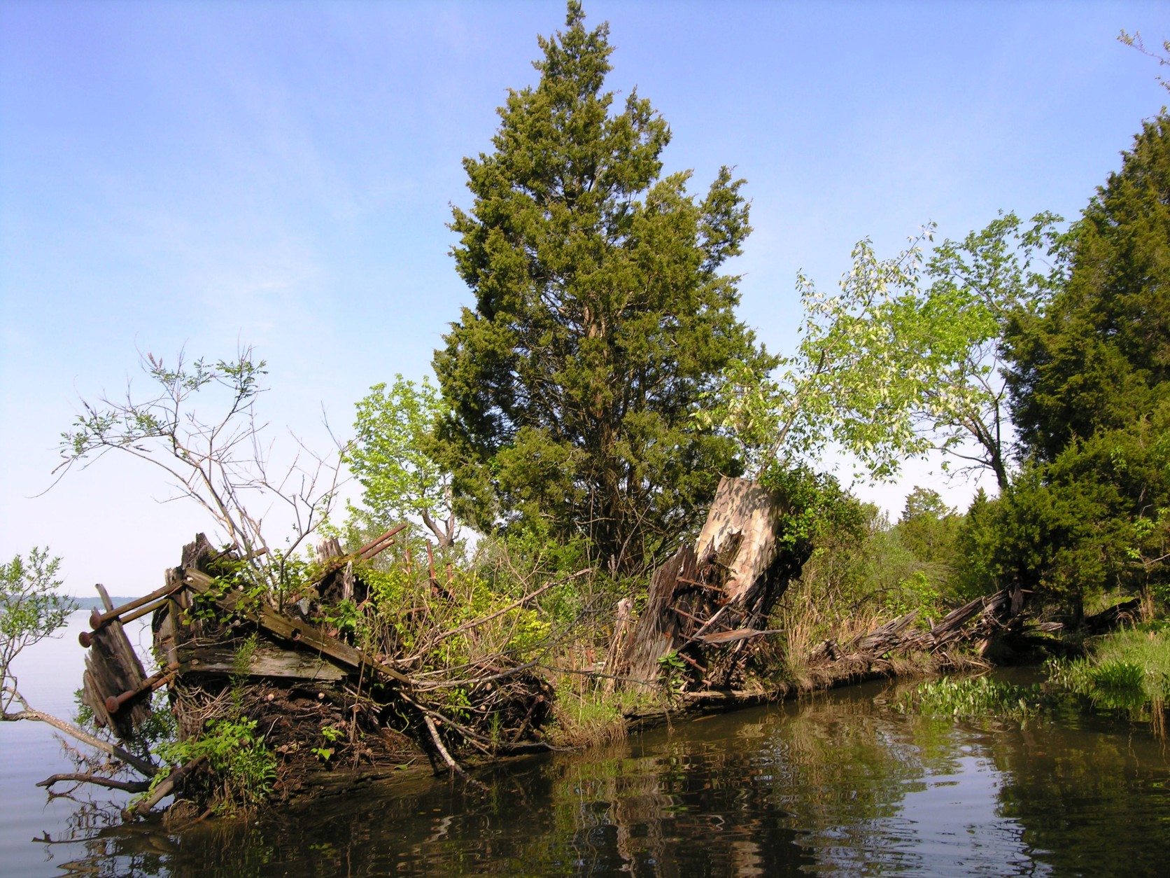
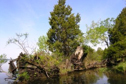
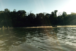
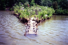
Dozens of tall trees grow out of the remains of a ship sunk in the waters of Mallows Bay, Maryland.
(Courtesy Chesapeake Conservancy/Donald Shomette)
Courtesy Chesapeake Conservancy/Donald Shomette
(Courtesy Chesapeake Conservancy/Donald Shomette)
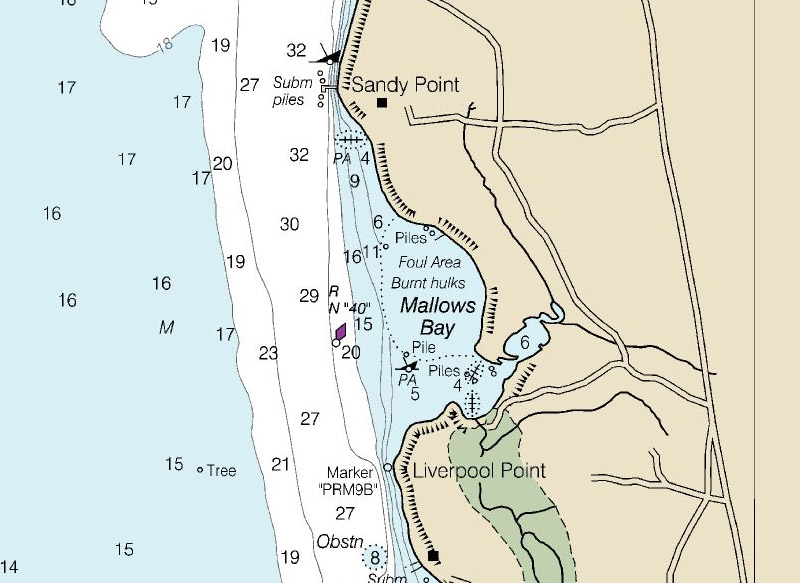
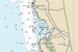
This nautical chart from NOAA warns boaters that Mallows Bay is a “foul area” with “burnt hulks.” The waters here are generally less than 10 feet deep with submerged pilings in between the sunken ships. Click here to see the full chart for the Potomac River through Charles and Prince William counties.
(Courtesy NOAA Office of Coast Survey)
NANJEMOY, Md. — Hidden beneath the waters of the Potomac River are dozens of sunken ships known as a “ghost fleet” that sailed from the Revolutionary War to after World War I, and now, thanks to the Chesapeake Conservancy, the public can experience these underwater ships and the unique ecosystem that has grown around them from their desktops.
The conservancy has teamed up with Terrain360, a Richmond, Virginia, company, to take panoramic shots of Mallows Bay and the more than 100 shipwrecks located there, piecing them together to create a virtual tour of the bay that you can find here.
The bay, tucked along the shores of the Potomac River in Charles County, Maryland, is home to the largest collection of historic shipwrecks in the Western Hemisphere. But the sunken ships have also created a marine habitat full of fish, birds and other wildlife, which the conservancy hopes to protect.
Visitors to the bay will spot an engine rising from the mist. Trees growing from the hull of a sunken ship seem to form an island that’s shaped like a ship. And the rusty hull of another ship can be seen rising above the waterline further out from the shore. Nearby is a menhaden fishing boat dating to the 1940s that was used during World War II.
On a recent trip, Terrain360’s Ryan Abrahamson sat on a small, custom-made pontoon boat and tapped a touch screen, controlling the camera’s fisheye lens sitting high above the water’s surface on a pole.
The company used six cameras to take photos every 50 feet in order to create the panoramic shots.
The company has already created similar virtual tours of the Susquehanna River, which — like the Potomac — also feeds into the Chesapeake Bay, and plans to captures images of the entire Chesapeake Bay shoreline next summer.
Don Shomette, who wrote a book on Mallows Bay, says more than 80 ships were scrapped and then sunk in the years following World Wars I and II. Another vessel lying in the watery graveyard was used by the Coast Guard and once could be spotted tied up at Alexandria.
While there is no financial treasure here, the ships represent a treasure trove of history, Shomette says.
The National Oceanic and Atmospheric Administration advanced an application to name the area of the bay and adjacent river as a national marine sanctuary, which would preserve and protect the 14-square-mile area.
The sanctuary would be one of the smallest in the nation. On the Virginia side, it would stretch from near Aquia Creek to Quantico.