A few inches of snowfall will blanket the D.C. area this weekend right as whipping winds return and temperatures plummet below freezing.
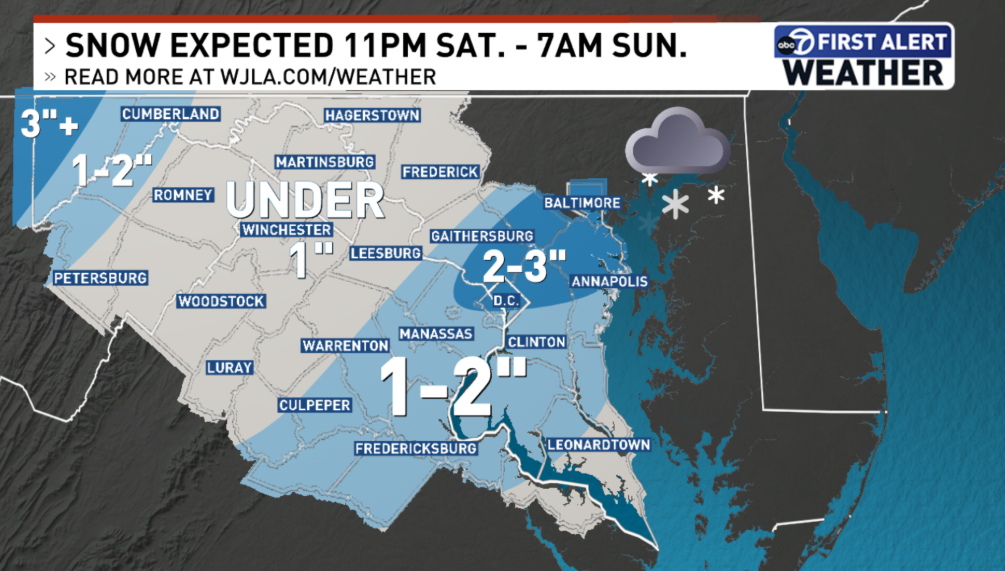
The National Weather Service has issued a Winter Weather Advisory from 8 p.m. Saturday to 7 a.m. Sunday as most parts of the D.C. region are expected to see 1 to 3 inches of snowfall by Sunday morning. Lighter snow totals are expected south and west of the District.
D.C. is already prepping for the incoming snowfall.
Crews started brining operations on elevated services Friday night. D.C. snow plows start treating major roads on Saturday at 5 p.m., according to a news release from the mayor’s office.
Even though Saturday will be dry throughout the day, rain and snow showers will come during the night and quickly turns to all snow after midnight, 7News First Alert Meteorologist Jordan Evans said.
Combined with bitterly cold temperatures, the wintry weather could make for icy roads.
“If you plan to be (outside), take it slow and allow some extra time,” Evans said. “This will not be a blockbuster snow event, but still, enough to cause some slick travel.”
As for Sunday, in addition to the leftover snow, there will be more cold air as wind chills will be in the teens and temperatures in the 20s.
Northwest winds are expected to blow through at 15 to 25 mph, with gusts up to 30 mph Sunday.
The cold weather will continue on Monday as you head back to work as temperatures will be in the upper 20s to low 30s.
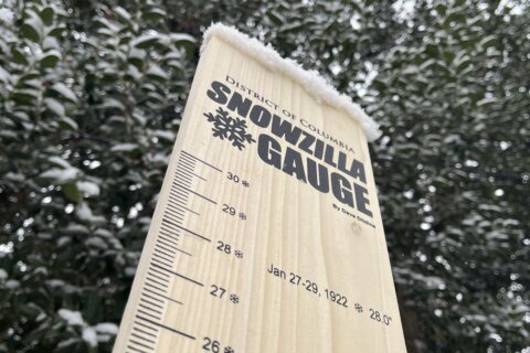
The upcoming round of wintry weather comes after the first snow of the season dropped about 1 to 3 inches throughout the D.C. area last week. That snow stuck to the roads and then melted within a few days.
- Listen to WTOP online and on the radio at 103.5 FM or 107.7 FM.
- Current traffic conditions
- Weather forecast
- Closings and Delays
- Sign up for WTOP email alerts
- Get custom alerts with the WTOP app for Apple and Android phones
FORECAST
SATURDAY:
Mostly cloudy
Highs: 45-51
Winds: Southwest 5-10 mph
The daytime remains dry with highs in the 40s and relatively light winds. An approaching weather-maker will bring added clouds by early evening and a spotty wintry mix during the evening. The timing for accumulating snow to begin is after 11 p.m. as colder air works into the area.
SATURDAY NIGHT: WINTER ALERT
Snow showers
Lows: 25-30
Wind Chill: 20s
Winds: North 10-20 mph
Rain may mix with snow at the onset of precipitation, then change to all snow as colder air moves in behind the cold front. Expect slick roads and sidewalks and snow to accumulate on the grass and untreated surfaces first. It is recommended to delay or avoid travel in the early morning hours.
SUNDAY: AM WINTER ALERT, PM COLD ALERT
AM snow showers, PM cold and windy
Highs: 28-32
Wind Chill: 10s & 20s
Winds: Northwest 15-25 mph
Gusts: 35-40 mph
Expect an inch or two of snow on the ground as the sun comes up. Leftover snow showers are possible, mainly east of I-95 during the morning hours. Cold air quickly moves in behind the Arctic front and temperatures will fall into the 20s throughout the day.
SUNDAY NIGHT: COLD ALERT
Mostly clear and cold
Lows: 18-22
Wind Chill: 5-10
Winds: Northwest 15-20 mph
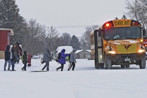
A very cold night due to wind chills in the single digits. The bus stop and morning commute will be very cold and those outside should dress in many layers and cover exposed skin to protect from frostbite.
MONDAY: COLD ALERT
Partly sunny
Highs: 28-34
Wind Chill: 20s
Winds: Northwest 10-15 mph
Gusts: 20-25 mph
Morning temperatures in the single digits will only climb into the upper 20s to low 30s. Many neighborhoods will be sub-freezing all day long.
CURRENT CONDITIONS
WTOP’s Ciara Wells, Jessica Kronzer, Gaby Arancibia and Tadiwos Abedje contributed to this report.
Get breaking news and daily headlines delivered to your email inbox by signing up here.
© 2025 WTOP. All Rights Reserved. This website is not intended for users located within the European Economic Area.