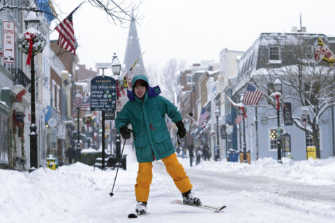
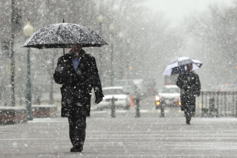
Listen live to WTOP online and on 103.5FM for traffic and weather updates on the 8s. You can share photos of the first snowfall of the year on the WTOP app or by tagging WTOP News on X, Instagram and Facebook.
This video is no longer available.
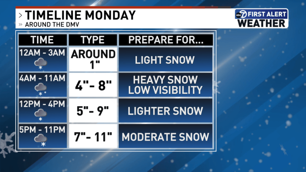
Already, around half a foot of snow has fallen across the D.C. region Monday with even more snowfall forecast later in the day. Here’s what you need to know.
The D.C. area is under a winter storm warning through 1 a.m. Tuesday, as heavy snow and below-freezing temperatures struck the D.C. region Monday morning.
“We also saw a little bit of sleet mixing in across the area, as well through that first round, therefore, there is some crustiness to the pure snow accumulation that we have already on the ground which could make shoveling a little more treacherous,” said WTOP meteorologist Lauryn Ricketts.
Some light snow and sleet will fall for several hours before the second round of heavy snowfall is expected to arrive in the late afternoon.
Snowfall totals
Estimates of snowfall totals from the National Weather Service, as of 3 p.m.:
- Garrett Park, Maryland: 6.1 inches
- Herndon, Virginia: 5 inches
- Ellicott City, Maryland: 5.1 inches
- Culpeper, Virginia, 7.5 inches
- Londontowne, Maryland, 8.1 inches
- Chesapeake Beach, Maryland: 10 inches
- Anacostia, D.C.: 7.7 inches
- Franconia, Virginia: 7.8 inches
Later snowfall is likely to mix with sleet and freezing rain before much of the snowstorm finishes up by midnight.

Monday’s weather maker could bring highest snowfall in years
Given the growing snow totals, 7News First Alert Chief Meteorologist Veronica Johnson said the storm could mark the region’s biggest snow event in years.
“The last time we had 11 inches was on Jan. 23 of 2016. … That storm delivered a total of 17.8″ of snowfall that ended the following day,” Johnson said Sunday evening.
Brace for possible outages
Johnson said there is a 90% chance much of the D.C. area will see somewhere between 6 and 9 inches of snowfall — the last time the area saw half a foot of snow was in January 2022.
Temperatures on Monday will remain below freezing, staying in the upper 20s with wind speeds between 5 mph and 10 mph. Johnson said the area could be facing some road closures and power outages toward the evening hours.
Once the snow wraps, expect chilling winds to stick around.
“I really think it’s late Monday, early Tuesday when we can see our higher number of power outages because of the winds,” Johnson said. “Our winds could be gusting around 35 to 40 miles per hour”
Forecasters said highs will remain in the 20s through the end of the week.
Looking ahead, meteorologists are eyeing another system that could bring snowfall to the D.C. area on Saturday.
Closures continue across DC, Maryland and Virginia
Multiple school districts and government offices across the region announced closings, delays and other scheduling modifications in anticipation of the snowstorm. Monitor the latest changes on WTOP’s Closings & Delays page.
D.C. Mayor Muriel Bowser declared a snow emergency through the end of Tuesday. The decision activates several snow-related emergency powers, including the right to tow any cars parked along emergency snow routes during the storm.
To avoid getting your vehicle removed, check out the marked routes on the D.C. government website.
In addition, D.C. residents with animal emergencies should reach out to the Brandywine Valley SPCA.
In Maryland, Gov. Wes Moore declared a state of emergency that took effect Sunday and is set to last through at least Monday.
“Keeping Marylanders safe is our top priority. Please stay off the roads during this storm. Prepare your home and family and charge your communications devices in case you lose power” according to a news release from Moore’s office.
“Immediate actions are being taken to safeguard Marylanders. Law enforcement agencies are increasing staffing, with support standing by as needed, while public health, human services and utilities agencies continuously prepare for possible impacts from the storm,” his office said.
In Virginia, Gov. Glenn Youngkin took similar steps and declared a state of emergency. Officials with the Virginia Department of Transportation advised travelers to stay off the roads.
“I’m encouraging all Virginians, visitors, and travelers to stay alert, monitor the weather forecast, and prepare now for any potential impacts,” Youngkin said.
- Listen to WTOP online and on the radio at 103.5 FM or 107.7 FM.
- Current traffic conditions
- Weather forecast
- Closings and Delays
- Sign up for WTOP email alerts
- Get custom alerts with the WTOP app for Apple and Android phones
Traffic and travel concerns
Officials have declared emergencies in the District, Maryland and Virginia following statements from the National Weather Service that traveling by car “could be very difficult.”
“Roads, and especially bridges and overpasses, will likely become slick and hazardous,” the National Weather Service said.
Metro officials announced a change to their plans for Metrobus and rail services around the D.C. area, moving to a “severe snow plan due to deteriorating conditions and impassible roads on several routes.”
“Under this plan, 42 out of 193 bus routes will operate. As road conditions change throughout the day, service may be reduced further or added back as needed,” WMATA said Monday morning.
More information on which routes are impacted and the services available are listed on the WMATA severe weather page.
D.C. Department of Transportation Director Sharon Kershbaum told WTOP crews in the District have been working throughout the early hours of the morning to treat and clear snow-covered roads around the city.
“Please if you don’t need to travel don’t travel. Stay home. … If you do need to travel drive safely, drive slowly,” Kershbaum said.
Virginia Department of Transportation spokesperson Alex Liggitt also said the department is advising people in the Commonwealth to avoid travel on Monday, if possible.
“If you do not need to be out there — if you’re a nonessential worker — just please stay off the roads and really give our crews plenty of time to get out there and get as many hours in without anyone out there,” Liggitt told WTOP.
Liggitt said the lack of drivers will allow snowplows and emergency officials to continue treating area roadways without worrying about crashes and disabled drivers.
“That really helps us out, without any other incidents going on on the roads,” he said.
If you absolutely have to drive, officials suggest bringing a winter storm kit packed with tire chains, booster cables, a flashlight, blankets “and anything else that would help you survive in case you become stranded.”
The Fairfax Connector bus service in Fairfax County, Virginia, said Monday morning that it suspended operations due to the weather and “will reassess service levels later this morning.”
The Maryland Transit Administration is also encouraging passengers on area buses, trains and other forms of public transit to wear weather appropriate clothes and allow more time for travel Monday morning.
“We also encourage passengers to check out the service alerts on the MTA website,” the agency said Sunday.
Charlie Gischlar, deputy director of communications for the Maryland Department of Transportation’s State Highway Administration, told WTOP on Monday morning that the state has “about 2,600 pieces of equipment” deployed across Maryland to maintain roads during the storm.
He said patience is key.
“If you are on the roadways, we will get to it. It is kind of slushy between the lane markers, so just be safe. Of course, we always recommend just try to ride it out at home today. Let us get out in front of it so we’re not stuck in their traffic with everybody else,” Gischlar said.
He said each plow driver has their own route and that it takes about 30 to 45 minutes to get back to the same spot on their route again, “because they have to go and get more salt, get more brine, fill up with some gas and diesel, that type of thing.”
As soon as this storm moves on, Gischlar said “we’re going to continue to be out patrolling for any icy spots, because the pavement temperatures are below freezing, same with the air temperature. So anything that looks frozen has a potential to freeze up. So we’re going to try not to let that happen.”
If you become disabled or there’s an incident on a Maryland roadway, he recommends getting as far off the road as you can.
“Activate your hazard beams, your hazard lights, stay in your vehicle and dial #77 to the nearest state police barracks and they’ll get us to come out and help you,” Gischlar said.
LATEST FORECAST
MONDAY EVENING: More snow moving in late afternoon. Another few inches possible.
Temps: 20s
OVERNIGHT: Snow moves out. Winds increase.
Temps: 20s/teens
Winds: NW 10-20mph Gust 30mph
TUESDAY: Becoming sunny, blustery
Temps: 20s
Winds: NW 10-20mph gusts to 30mph
Wind chills: Teens
WEDNESDAY: Sunny and brisk
Temps: 20s
Winds: NW 10-20mph gusts to 30mph
Wind chills: Teens
THURSDAY: Mostly Sunny, windy
Temps: 20s
Winds: NW 10-20mph gusts to 30mph
Wind chills: Teens
CURRENT CONDITIONS
POWER OUTAGES:
Get breaking news and daily headlines delivered to your email inbox by signing up here.
© 2025 WTOP. All Rights Reserved. This website is not intended for users located within the European Economic Area.


