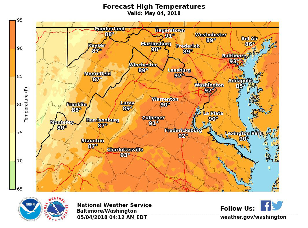
WASHINGTON — Ninety-degree temperatures returned for the third straight day, marking the D.C. area’s first official heat wave of the year.
Heat relief is on the way: Cooler weather rolls in for the weekend.
It’s official … our first heat wave of the year. Heat wave = 3 consecutive days of 90 or higher. This hasn’t happened this early since 1960. Updates to weekend rain chances and temperatures on News 4 now! pic.twitter.com/X3XRCbLJkB
— Amelia Draper (@amelia_draper) May 4, 2018
On Friday, all three D.C.-area airports reached 90 degrees: for BWI Marshall and Dulles International airports, that meant tying with records set in 2001 for May 4, and for Reagan National Airport, that meant just falling short of the 93-degree record set in 1928.
BWI Marshall recorded a high of 92 degrees on Thursday, which broke the previous record for May 3 set back in 1913. On Wednesday, Reagan National hit 91 degrees, which broke the previous record high for May 2 of 89 degrees back in 1930.
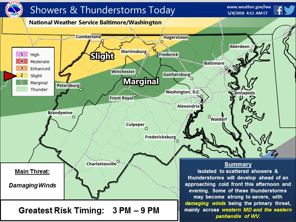
Rain is in the forecast for the weekend, which will bring some relief with it as well.
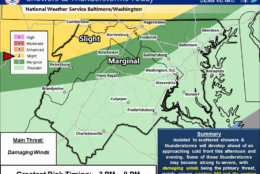
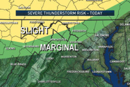
Storm Team 4 meteorologist Sheena Parveen said there is a slight chance for some thunderstorms rolling in on Friday night.
“Areas around northern Maryland are at a slight risk for a few severe storms to move in, but that won’t be until later on Friday,” Parveen said.
A cool down is expected for the weekend: Storm Team 4 meteorologist Amelia Draper said that will lead to periods of rain on Saturday and Sunday, but not a complete washout.
Parveen said the temperatures will stay in the 70s starting next week, with dry weather expected through next Friday.
Forecast
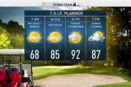
Friday night: Isolated showers/storms possible during the evening; mostly cloudy and comfortable.
Lows: Upper 50s to mid 60s
Saturday: Showers chance increasing during the day; otherwise, cloudy and cooler.
Highs: Around 70
Sunday: Some light showers at times; otherwise, cloudy and cool.
Highs: 60s
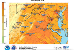
A cold front will cross the area overnight. Extensive cloud cover will keep temperatures on the mild side tonight with 50s in the west and 60s in the east. #DCwx #MDwx #VAwx #WVwx pic.twitter.com/6CfiydSkSs
— NWS Baltimore-Washington (@NWS_BaltWash) May 4, 2018
A very warm start this morning! Then we're around 90 again this afternoon. If we hit 90, that will make this an official heat wave! Later today though, a chance for t'storms then BIG changes for the weekend. Wake up with us! @nbcwashington pic.twitter.com/txnmmCGvUI
— Sheena Parveen (@SheenaParveen) May 4, 2018
Rain chances around Metro DC today are fairly low, but there are higher chances North and West of DC. There's even a SLIGHT RISK of severe storms from 4-8pm for the Northern Shenandoah Valley. Stay weather aware today. #Working4You pic.twitter.com/iwATljpBjE
— Chuck Bell (@ChuckBell4) May 4, 2018