The USGS has released pre- and post-Sandy images
of the coastline, showing how the storm shifted
land in addition to ravaging man-made structures.
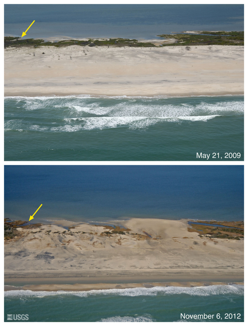
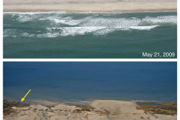
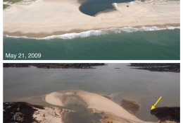
Assateague Island, Md.: This view is looking
northwest along the Maryland shore, according to
the NSGS. Storm waves and surge overtopped the low
dunes in this location and overwash moved sand
across the island and into the bay. The yellow
arrow in the image points to the same feature.
(Courtesy of U.S. Geological Survey)
Courtesy of U.S. Geological Survey
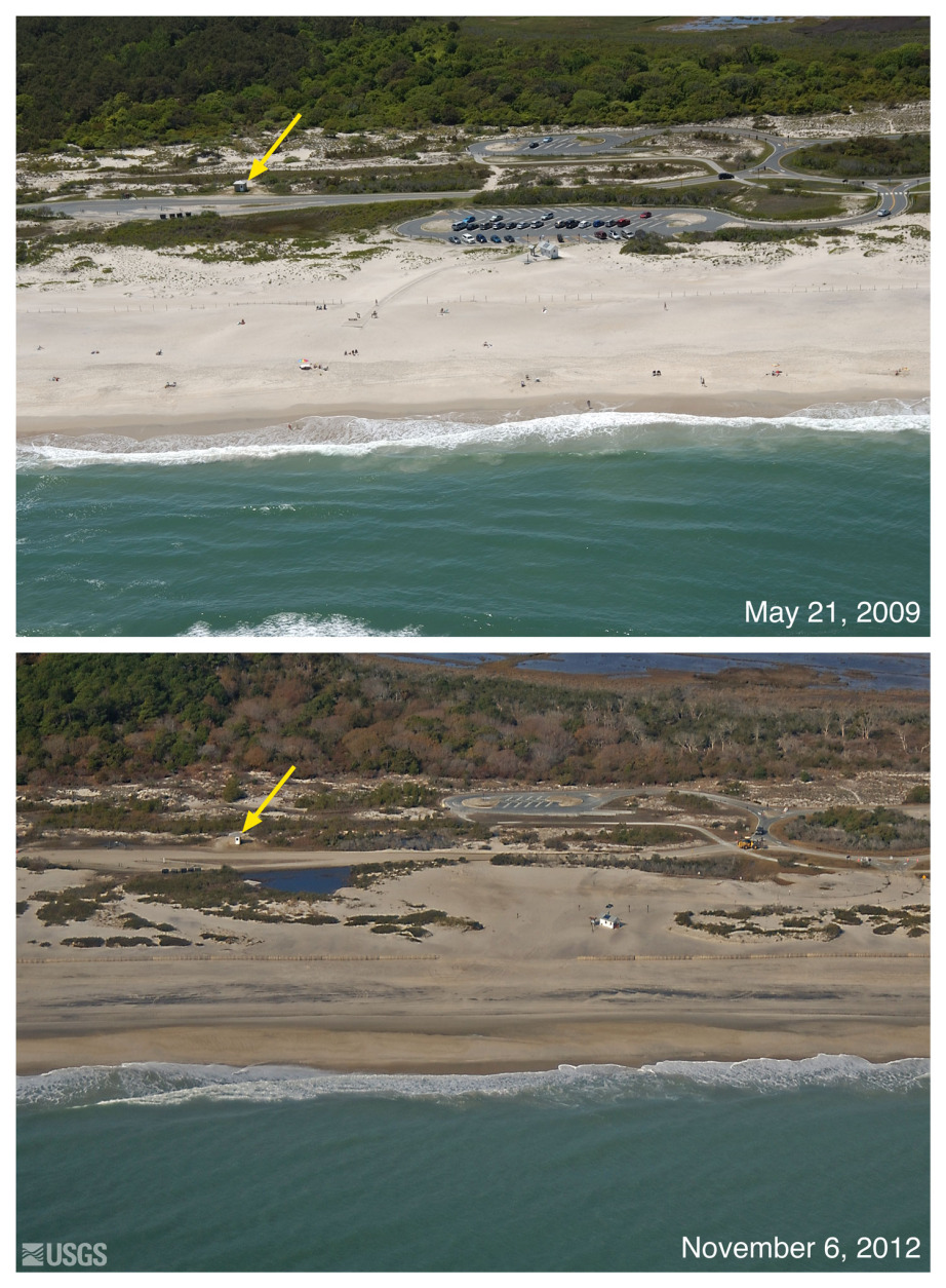
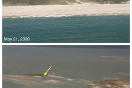
Assateague Island, Md.: The view is looking
northwest along the Maryland shore, according to
the NSGS. Storm waves and surge moved sand as
overwash over and through low dunes at this
location, depositing sand in the parking lot. The
yellow arrow in the image points to the same
feature. (Courtesy of U.S. Geological Survey)
Courtesy of U.S. Geological Survey
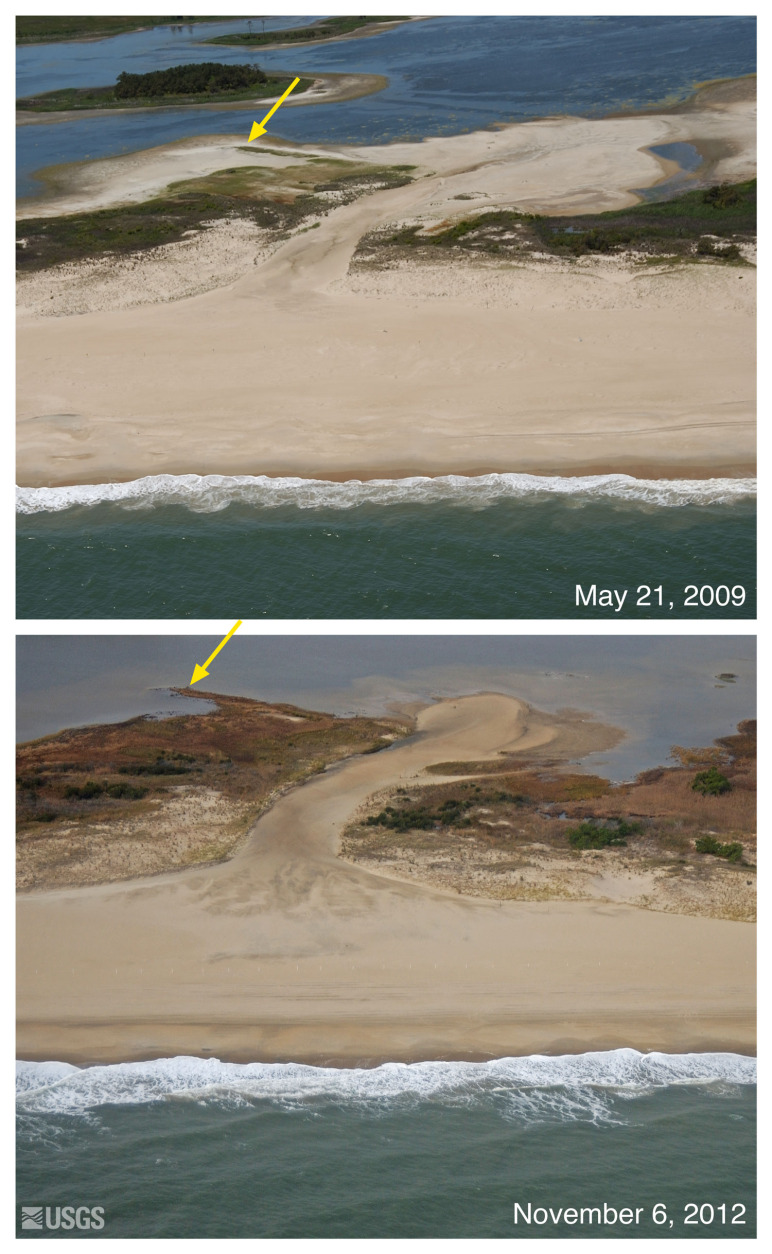
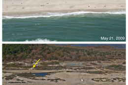
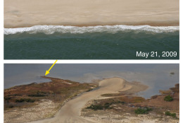
Gordon Pond Wildlife Area, Del.: The view is
looking west along the Delaware shore, according
to the NSGS. Storm waves and surge reactivated
overwash through what appears to be a previous
breach or channel. An overwash fan was deposited
in the pond behind the dune. Erosion channels
such as these are often reactivated during storm
events. The yellow arrow in the image points to
the same feature. (Courtesy of U.S. Geological
Survey)
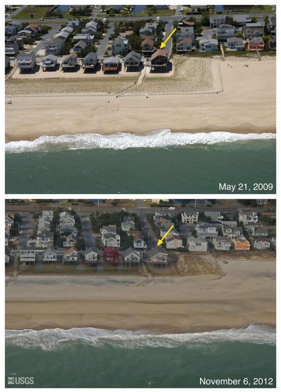
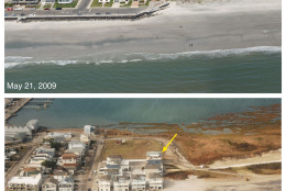
South Bethany, Del.: The view is looking west
along the Delaware shore, according to the NSGS.
Storm waves and surge may have eroded the low
dune seen in the upper image (the area fenced
off and planned with grass). Standing water
beneath the houses in the bottom image indicates
that a low berm was built in front of the
houses. The yellow arrow in the
image points to the same feature.(Courtesy of
U.S. Geological Survey)
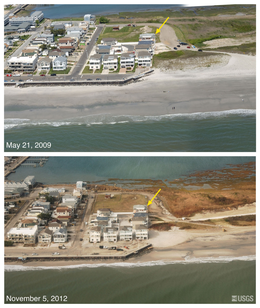
Brigantine, N.J.: The view is looking northwest
along the New Jersey shore, according to the
NSGS. Storm waves and surge eroded the beach and
exposed the seawall. Overwash of the seawall is
indicated by sand deposited on the street. Low
dunes on the eastern flank of the seawall were
eroded. The yellow arrow in the image points to
the same feature.(Courtesy of U.S. Geological
Survey)
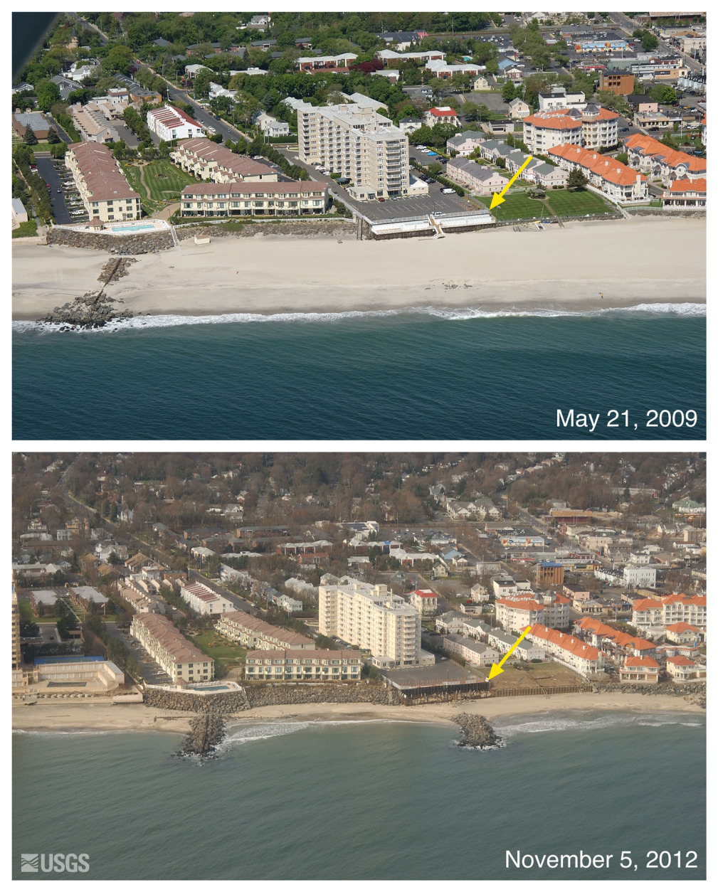
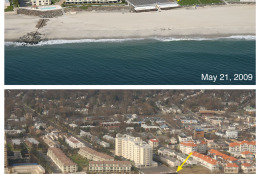
Long Branch, N.J.: The view is looking west
along the New Jersey shore, according to the
NSGS. Storm waves and currents removed sand from
the beach exposing erosion control structures,
including rock walls, concrete walls, and groins
that protrude seaward perpendicular to the
beach. The yellow arrow in the image points to
the same feature.(Courtesy of U.S. Geological
Survey)
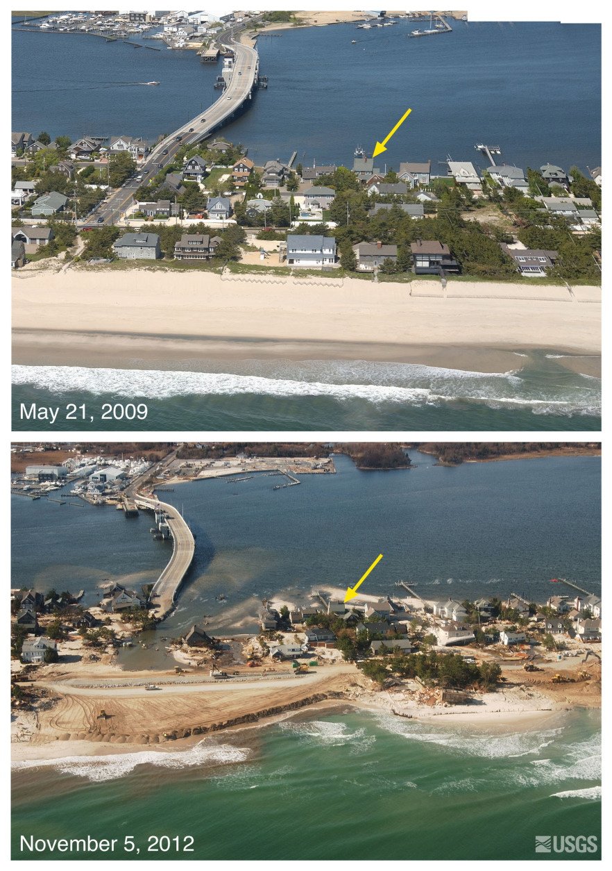
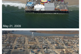
Mantoloking, N.J.: The view is looking west
along the New Jersey shore, according to the
NSGS. Storm waves and surge cut across the
barrier island at Mantoloking, N.J., eroding a
wide beach, destroying houses and roads, and
depositing sand onto the island and into the
back-bay. Construction crews with heavy
machinery are seen clearing sand from roads and
pushing sand seaward to build a wider beach and
protective berm just days after the storm. The
yellow arrow in the image points to the same
feature. (Courtesy of U.S. Geological Survey)
Courtesy of U.S. Geological Survey
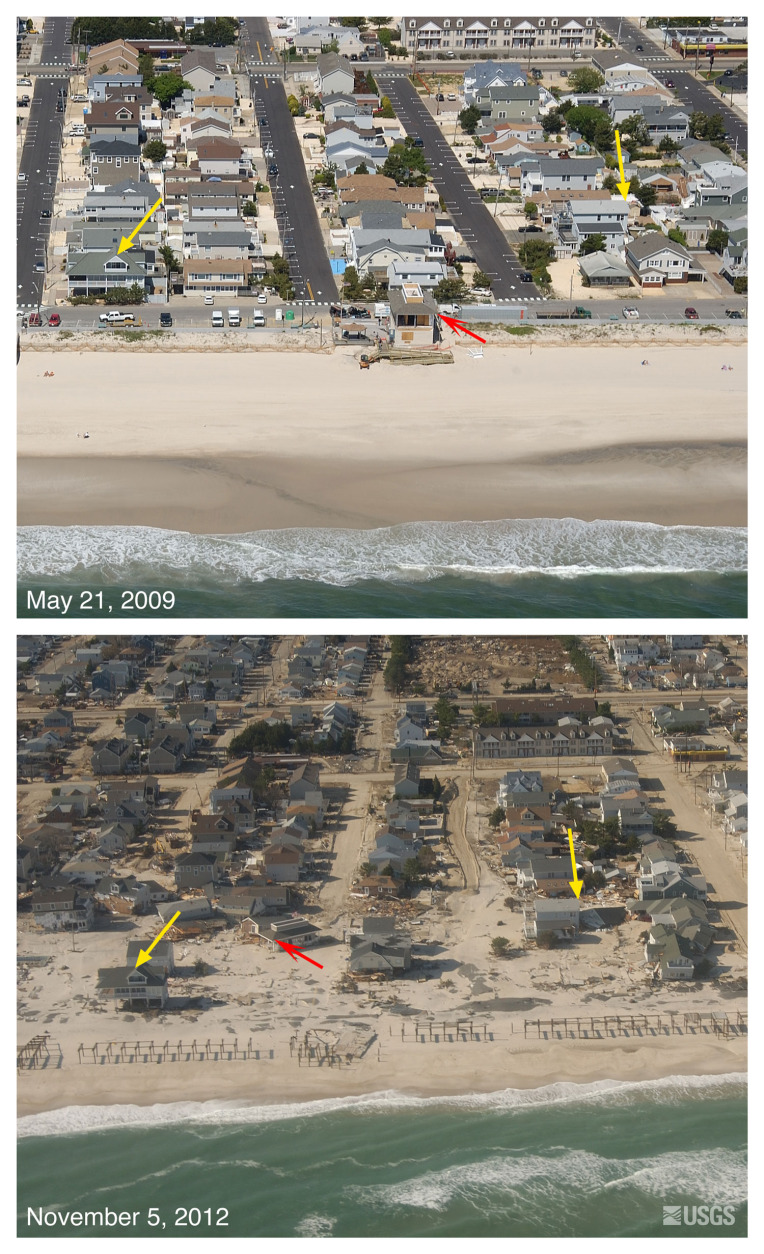
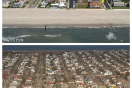
Seaside Heights, N.J.: The view is looking west
along the New Jersey shore, according to the
NSGS. Storm waves and surge destroyed the dunes
and boardwalk and deposited the sand on the
island, covering roads. The red arrow points to
a building that was washed off of its foundation
and moved about a block away from its original
location. The yellow arrow in the image points
to the same feature. (Courtesy of U.S.
Geological Survey)
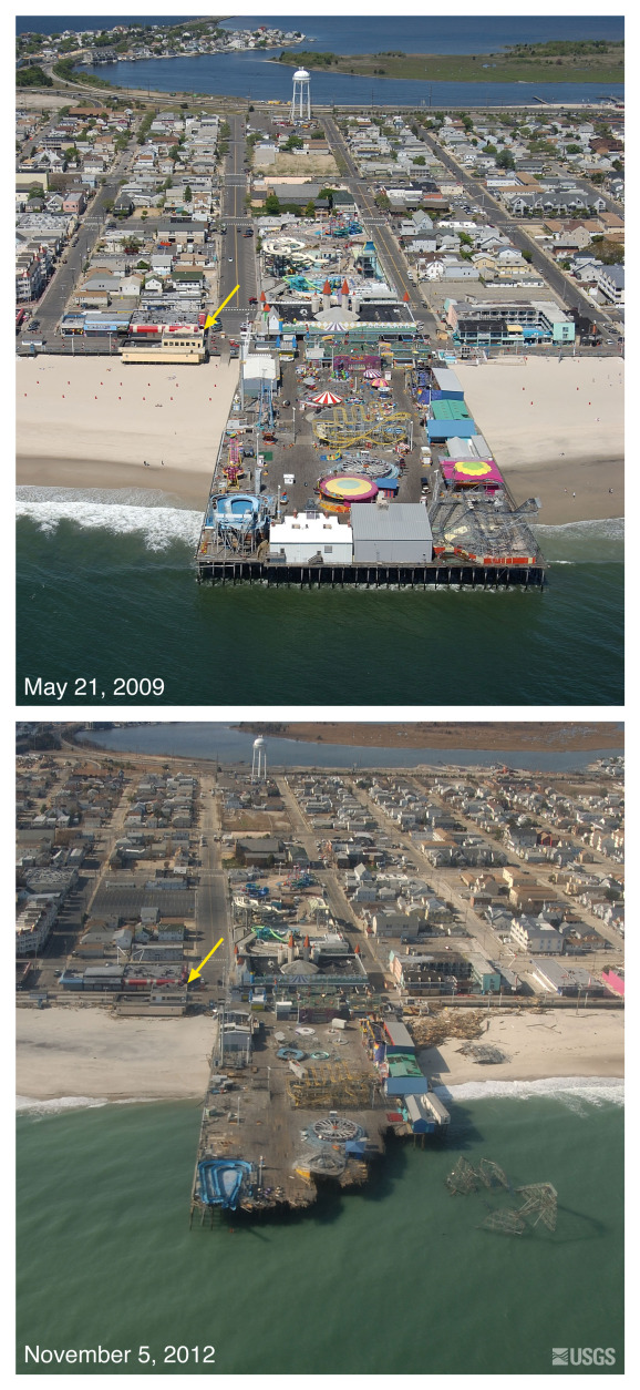
Seaside Heights Pier, N.J.: The view is looking
west along the New Jersey shore, according to
the NSGS. Storm waves and surge eroded the
beach, destroyed the seaward edge of the pier
and deposited the roller coaster superstructure
in the ocean. Sediment deposited on the island
is visible in the background and indicates that
overwash occurred here. The yellow arrow in the
image points to the same feature.(Courtesy of
U.S. Geological Survey)
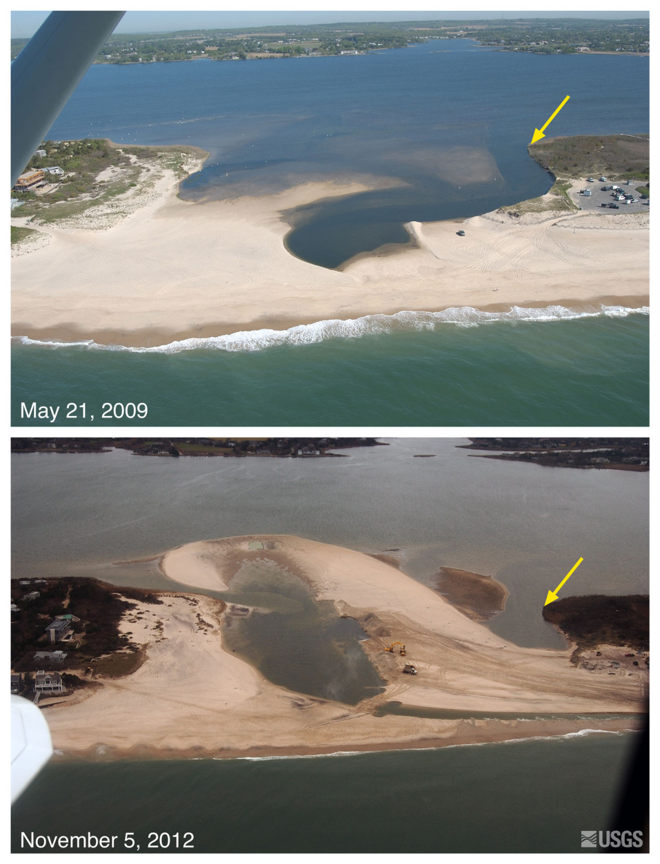
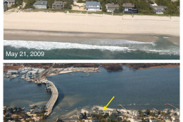
Bridgehampton, N.Y.: The view is looking
northwest across the south shore of Long Island
towards Mecox Bay, according to the NSGS. This
location is very narrow and periodically opens
during large storms. Large volumes of material
were transported into Mecox Bay when it breached
during the storm. One week after the storm, the
breach was being closed by mechanical means. The
yellow arrow in the image points to the same
feature. (Courtesy of U.S. Geological Survey)
Courtesy of U.S. Geological Survey
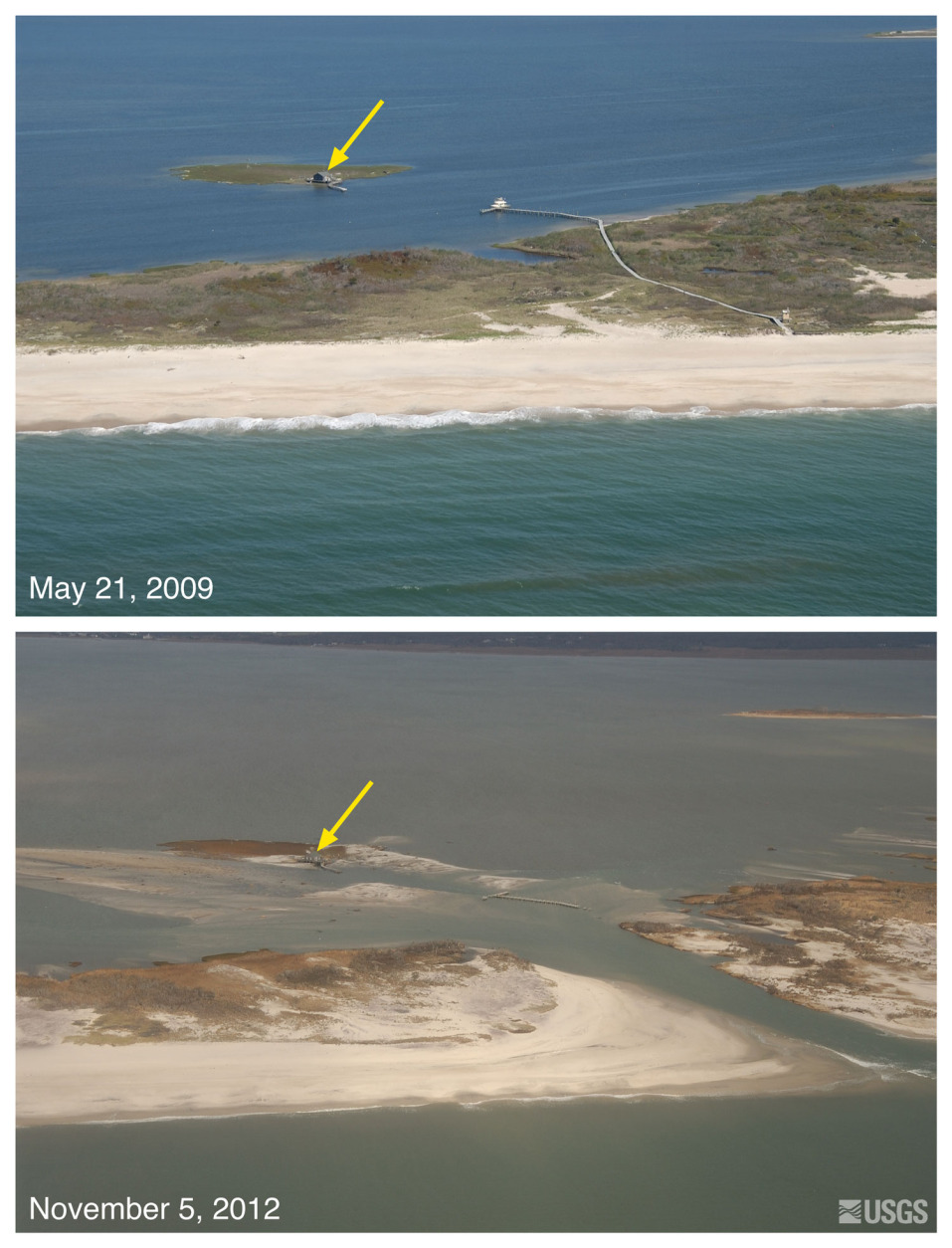
Pelican Island and Fire Island, N.Y.: The view
is looking northwest across Fire Island towards
Great South Bay, according to the NSGS. This
location is within Fire Island National Seashore
near Old Inlet, a very narrow portion of the
island that has experienced breaching in
previous large storms. The island breached
during Sandy, creating a new inlet. Despite the
breach, the fishing shack indicated by the
yellow arrow remained standing. (Courtesy of
U.S. Geological Survey)
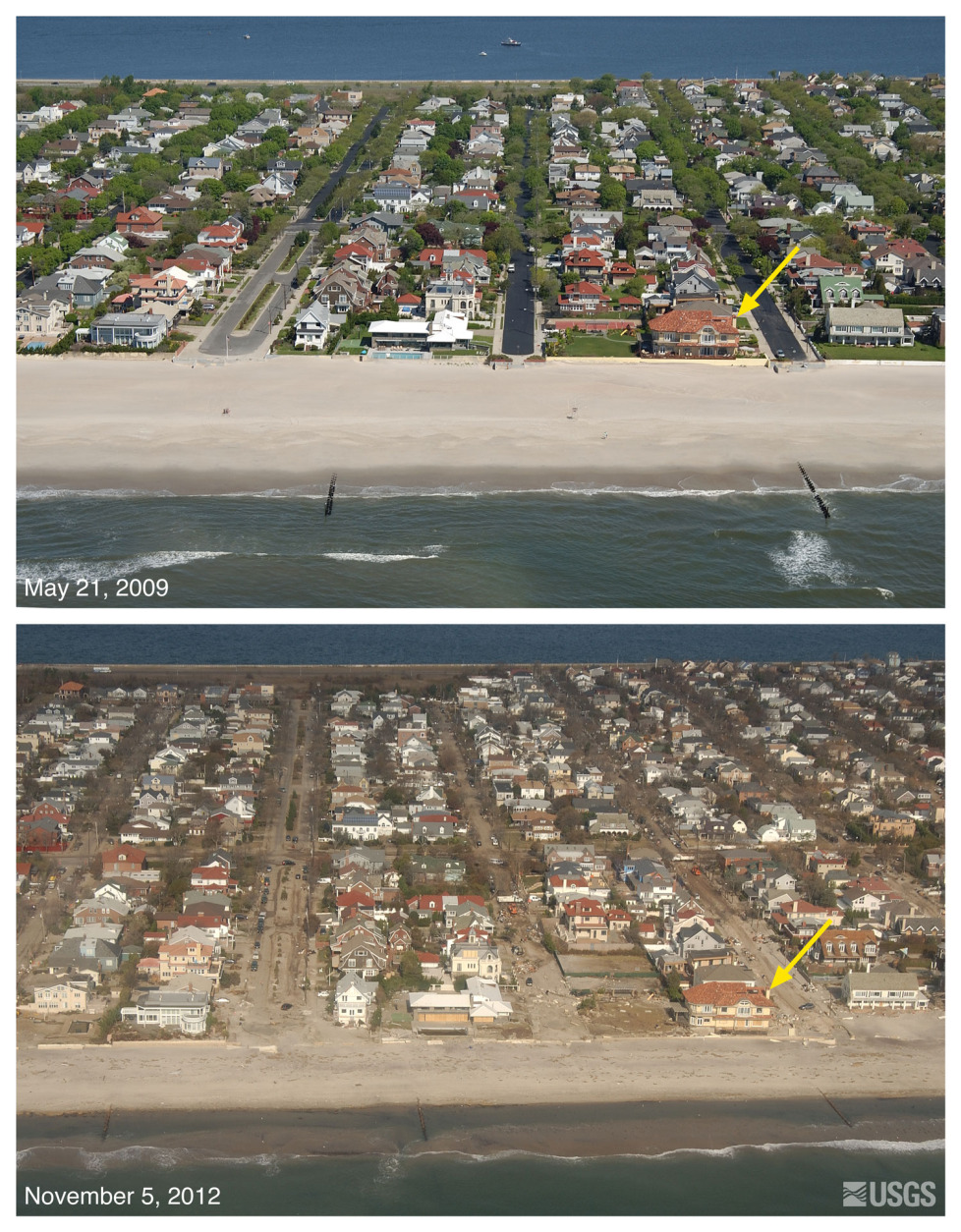
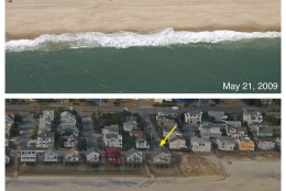
Neponsit, N.Y.: The view is looking northwest
across Rockaway Peninsula, adjacent to New York
Harbor, according to the NSGS. Sand was washed
from the beach into the streets and towards the
bayside of the island. Several rows of ocean-
facing houses were destroyed or damaged. The
yellow arrow in the image points to the same
feature. (Courtesy of U.S. Geological Survey)