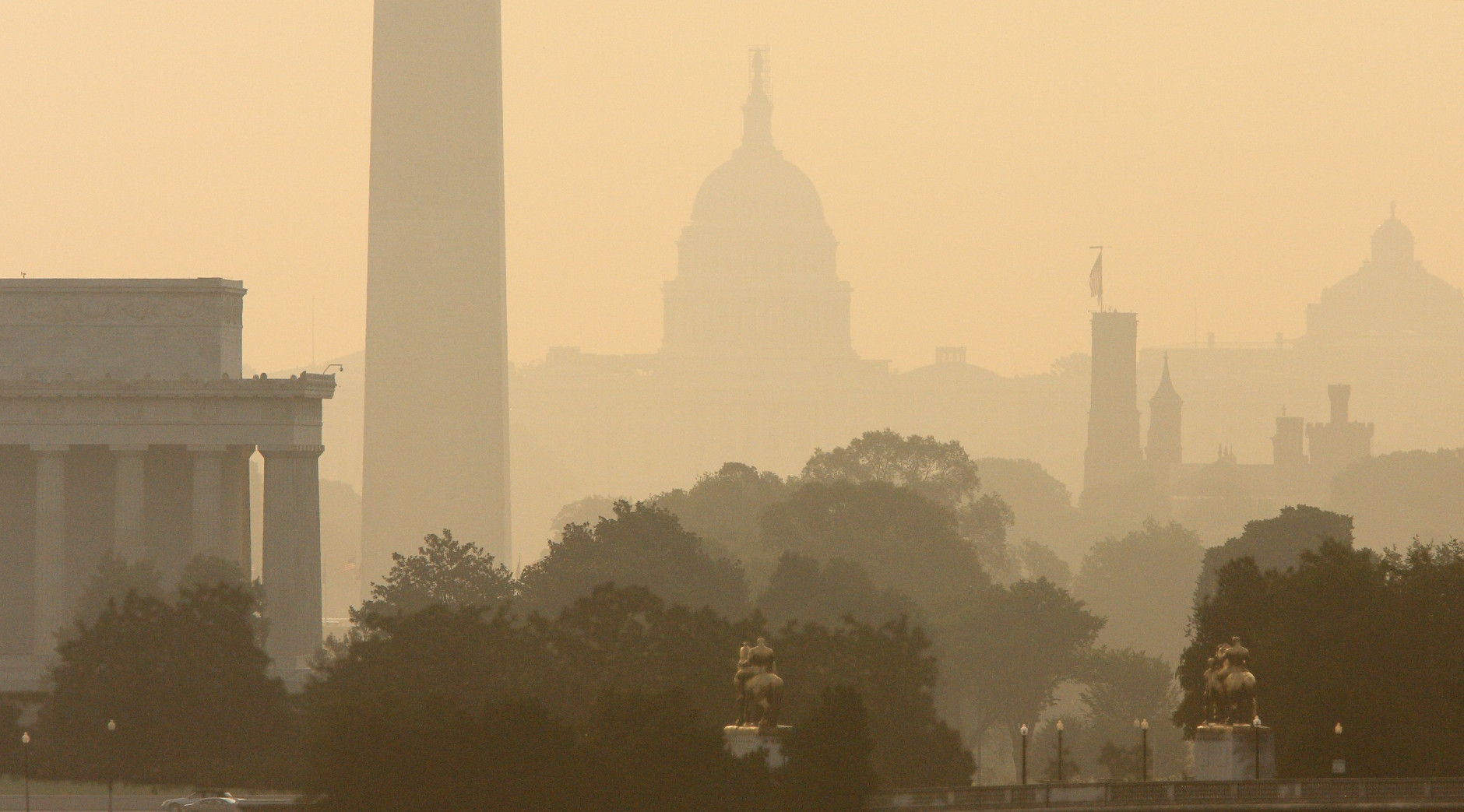
In 2015, Washington was blindsided by snow, raked by high winds, parched by a near-drought and spoiled by above-average temperatures. A year that began in an icy cold assault draws to a close with an exceptionally mild, tranquil temperament. As the year ends, WTOP is counting down the top 15 local weather events of 2015.
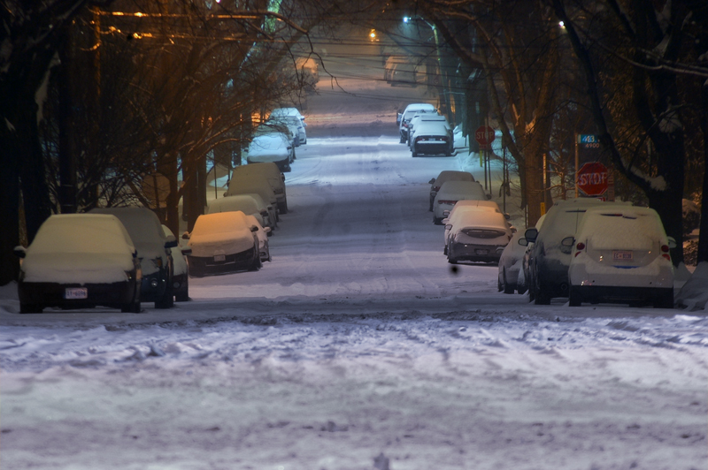
15) Old Man Winter smothered by El Niño
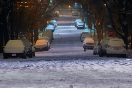
The final weeks of 2015 remain mild and snow-less in Washington, in large part thanks to the regional effects of an abnormal warm pocket of water in the eastern Pacific Ocean.
Many local forecasters, including those at the National Oceanic and Atmospheric Administration’s Climate Prediction Center, believe that El Niño will cause the warmer-than-usual weather to continue into 2016.
(WTOP/Dave Dildine)
WTOP/Dave Dildine
14) Warmth continues into November
Unusually warm weather continued through autumn. After the eighth-warmest September on record and the driest October since 2008, November 2015 entered the books as the sixth-warmest on record in Washington. It was the warmest November since 1985, with the average temperature at 53.7 degrees, about 4 degrees above average.
Washington basked in a record high of 80 degrees on Nov. 6, one of the latest occurrences of 80 degrees in D.C. since reliable record-keeping began.
(AP/J. David Ake)
AP/J. David Ake
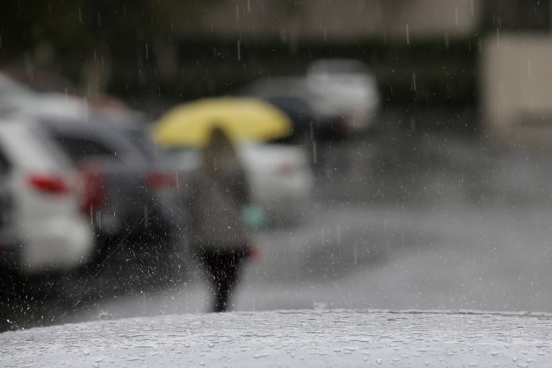
13) From deluge to deficit by August
The surplus of early summer rain all but evaporated by August. Grassy lawns turned to straw and trees relinquished their leaves early as the region entered a dry spell by late summer.
By the end of August, a scant 1.16 inches of rain had fallen in Washington. It was the driest August since 2006. The August rainfall total of 1.09 inches at Dulles Airport was far from the 2.44-inch average for the month.
(AP/J. Scott Applewhite)
AP/J. Scott Applewhite
12) July heat wave
The hottest day of the year was July 19 when the temperature reached 98 degrees at Reagan National Airport. At Dulles, the high was 94 degrees. The third week of July is typically the hottest of the year, when average daytime highs are near 90 degrees. The longest heat wave of the season ran from roughly July 24 to Aug. 4.
Highs at Reagan National Airport were at or above 90 degrees for 13 days in a row. The heat wave was punctuated with an exclamation mark on Aug. 4 when highs in Washington reached 96 degrees. The readings for the city may have been compromised by faulty equipment.
The National Weather Service says the thermometer at the airport – the official observation site for the District of Columbia – was showing readings that were slightly too high before it was replaced in mid-August. For the third summer in a row, D.C. failed to reach 100 degrees.
(Getty Images)
Getty Images
11) June “monsoon” brings near-record rainfall
The bombardment by summer storms in June left the region drenched. The 11.94 inches of total rainfall observed at Reagan National Airport made June 2015 the second-wettest June on record for the District of Columbia.
Daily rainfall records fell courtesy of soaking storms on June 1, June 20 and June 27. It was Baltimore’s wettest June of all time, with a 13.09 inch rain tally at Baltimore-Washington Thurgood Marshall Airport.
(WTOP/Dave Dildine)
WTOP/Dave Dildine
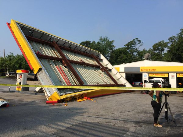
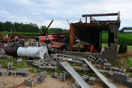
10) June went out like a lion
The parade of summer storms culminated with the most widespread storm damage of the season in the final moments of June 2015.
The storms enveloped the immediate D.C. metro area around midnight, downing scores of trees and causing widespread power outages. Winds up to 74 mph were recorded by an automated weather station in Seat Pleasant, Md. A 51 mph gust was observed at Reagan National Airport.
The Storm Prediction Center cataloged three dozen reports of wind damage. In Bowie, the canopy of a gas station was toppled by the strong winds. Trees were downed at numerous locations throughout the District of Columbia.
(WTOP/Kristi King)
WTOP/Kristi King
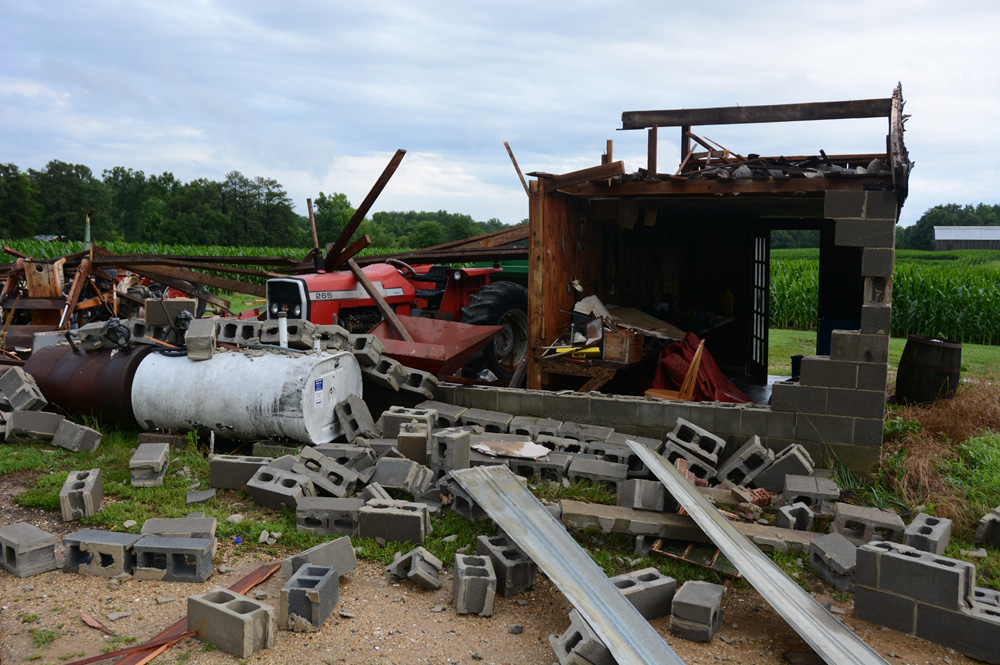
9) St. Mary’s County Tornado
For the second Saturday in a row, severe weather struck the WTOP listening area on June 27. The most intense storm crossed the Potomac River during the mid-afternoon, spawning two tornadoes that tore across southeastern Charles County and northern St. Mary’s County.
A tornado touched down south of the Governor Harry Nice Bridge, downing numerous trees along Morgantown Road. Several homes sustained shingle and roof damage. As the first tornado weakened, a long-track tornado began racing across Southern Maryland, snapping trees and fraying nerves along a 16-mile-long path through St. Mary’s County.
The second tornado was on the ground for over 30 minutes as it tracked northeastward from Maddox to Oakville with the most significant damage reported in the small town of Clement, Maryland. Numerous trees were felled by the twister. A small outbuilding was destroyed along Horse Shoe Road. North of Route 234, an old barn was flattened. The tornado was rated an EF-1 with winds up to 90 mph. No injuries were reported.
(WTOP/Dave Dildine)
WTOP/Dave Dildine
8) June 23: More severe storms
Parts of the region were again punished by gusty, damaging thunderstorms late on Tuesday, June 23. The line of storms with high winds crashed through the metro area around 7 p.m.
Tens of thousands of power customers were left in the dark. A 79-year-old driver was killed near Poolesville, Maryland, when a tree and power lines were brought down by the high winds on his pickup truck.
In Arlington, Virginia, a fire broke out at an apartment building following a suspected lightning strike. In Greenbelt, Maryland, an apartment fire was also blamed on lightning.
(WTOP/Dave Dildine)
WTOP/Dave Dildine
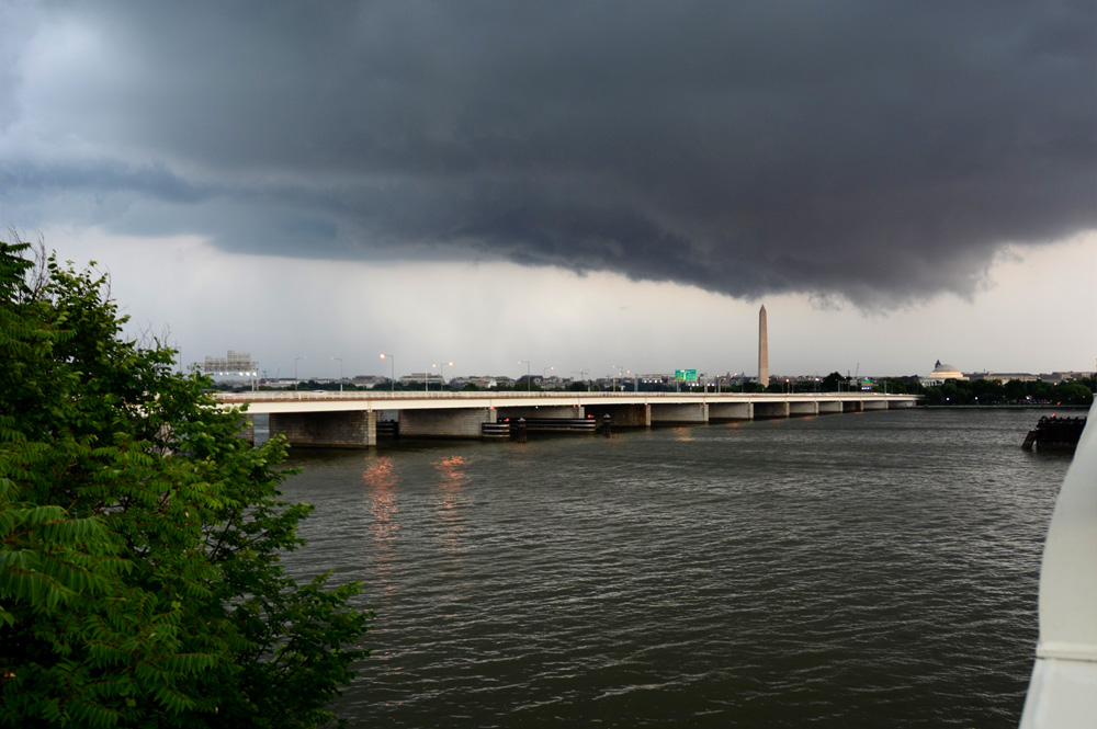
7) June 20: Severe storms
A eruption of storms led to 64 reports of severe weather across the region on Saturday, June 20. Wind directions in the lower levels of the atmosphere allowed many of the storms to rotate as they churned northward across the nation’s capital.
An ominous, UFO-shaped cloud moved north along Interstate 395 from Springfield, Virginia, through the District during the afternoon. The storm did not produce any significant damage. Stronger storms developed later that evening. Sporadic wind damage was reported across the region, mainly to trees and power lines. In Manassas, damage consistent with a weak tornado was reported near the intersection of Route 28 and Godwin Drive. A scoreboard and a dugout at a ball field were blown over.
The National Weather Service determined that a weak tornado touched down near Tuscarora, in Frederick County, Maryland. The brief-lived tornado with winds estimated around 65 mph caused minor property and tree damage along its 1.5-mile path.
(WTOP/Dave Dildine)
WTOP/Dave Dildine
6) June 18: Storms and falling hail
An active weather pattern began on Thursday, June 18, when afternoon thunderstorms produced large hail in a few suburbs. Hail stones larger than golf balls were reported in Chantilly and quarter-sized hail was observed in Fairfax City. Ping-pong ball-sized hail was reported near Damascus.
A microburst downed countless trees in a small area of southern Reston. Four houses sustained significant damage from felled trees; at least two were rendered uninhabitable. The stormy period continued throughout the remainder of the month, with daily doses of drenching rain and some damage.
(AP/Jae C. Hong)
AP/Jae C. Hong
5) April showers
On Monday, April 20, warm, unstable air set the stage for afternoon thunderstorms. A tornado watch was issued for the region by mid-afternoon. Quarter- and half-dollar-sized hail fell in parts of Fairfax County.
Some minor tree damage was reported in southern Maryland. A wall cloud was observed in Charles and Calvert counties. The storms produced a dazzling lightning show as daylight faded.
(WTOP/Dave Dildine)
WTOP/Dave Dildine
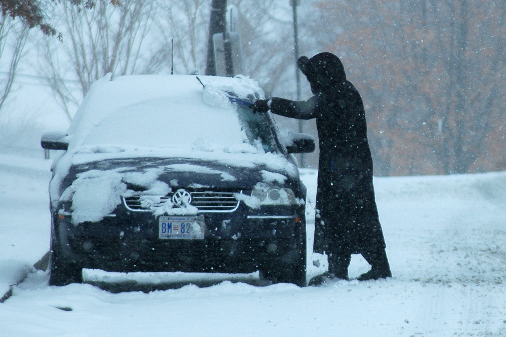
4) In March, winter’s grand finale
Many winters in Washington feature little to no March snow. Those dreaming of an early spring were crestfallen this year when the season’s biggest snowstorm struck on March 5. As the snow tapered off by late afternoon, nearly a half foot of snow had fallen in the inner suburbs and more than a foot in parts of Maryland.
The 9.5 inches that fell at Dulles Airport broke the record for the date. At Reagan National Airport, 4.8 inches fell, also setting a new daily record.
(WTOP/Dave Dildine)
WTOP/Dave Dildine
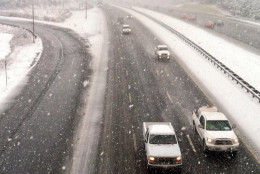
3) Feb. 21 weekend snow snag
One of the season’s heftier snowstorms produced a heavy period of snow during the third Saturday in February. The rate of snowfall caused extreme traffic backups that formed by early afternoon.
Despite the storm’s being well forecast, many daytime drivers decided to tempt fate and ended up stranded for hours on snow-choked roads. Some drivers reported being stuck on the Capital Beltway, between Interstate 270 and the Dulles Toll Road, for over six hours.
The snow ended as a light wintry mix late Saturday evening. At Reagan National Airport, 2.6 inches of snow fell. Much more fell elsewhere, including 8.9 inches at Dulles Airport. Up to a foot was reported in upper Montgomery County and western Loudoun County.
(WTOP/Dave Dildine)
WTOP/Dave Dildine
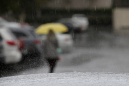
2) February’s bitter cold, snow
A brief but fierce snow squall barreled over the region late on Valentine’s Day. The sudden burst of strong winds and blizzard-like conditions caused a flash freeze on area highways and sidewalks, just as couples were ending their Saturday date nights.
The squall and an arctic cold front passed through quickly, but ushered toward Washington a frigid and snowy pattern that fostered another 6 to 12 inches of snow over the next week. Bone-chilling cold followed the passage of an arctic front; temperatures remained in the single digits and teens for several days in a row.
The temperature at Dulles Airport plunged to 0 degrees on the morning of Feb. 20. By most measures, it was the coldest weather the region had experienced in decades.
(WTOP/Dave Dildine)
WTOP/Dave Dildine
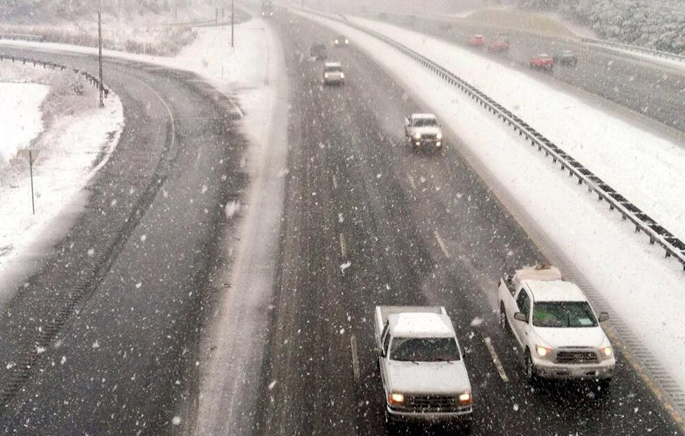
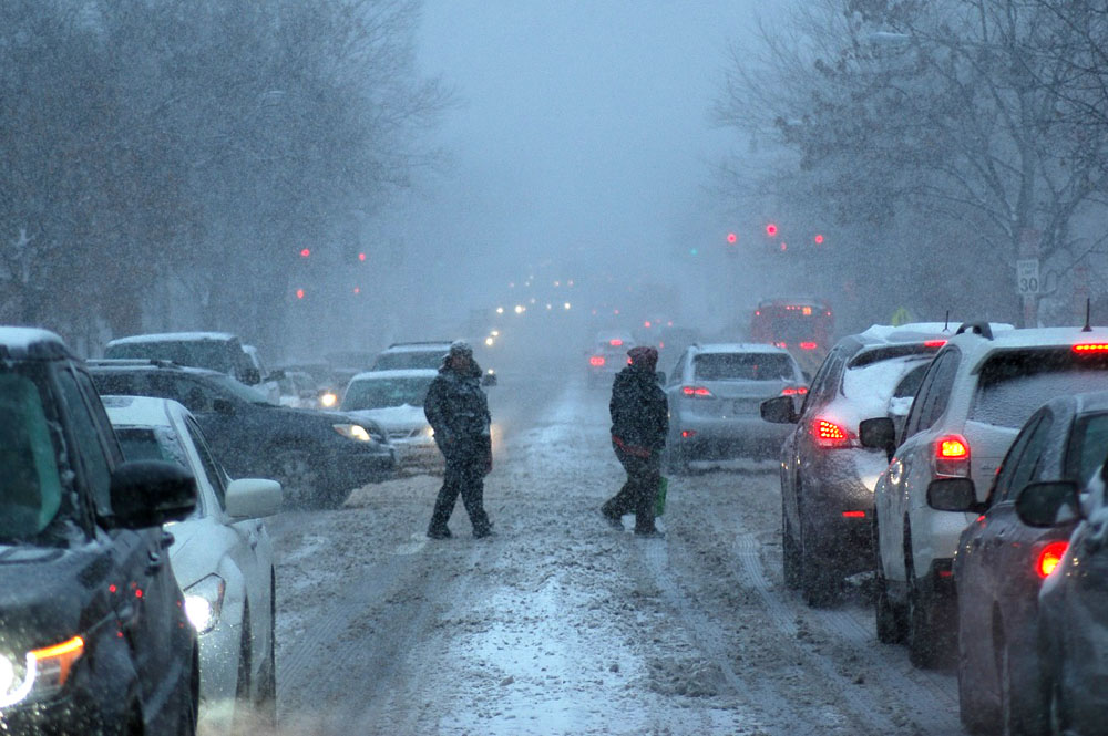
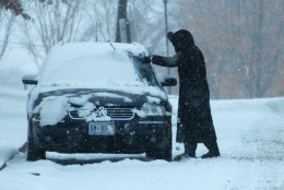
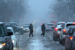
1) Jan. 6: The commute from hell
The region’s first bout with winter weather, on Jan. 6, was perhaps the most traumatizing snowstorm of the season for millions of morning commuters. On that fateful Tuesday morning, a period of heavy snow coincided with the height of morning rush hour. Several school systems made a late call to close after thousands of parents and students had already hit the roads.
The National Weather Service upgraded winter weather advisories to winter storm warnings by 9 a.m., but by then, thousands of drivers were already marooned. In all, 3 to 5 inches fell in about a six-hour window.
D.C. was reminded once again that it doesn’t take a big storm – just heavy fall rates and bad timing – to cause a big disruption.
(WTOP/Dave Dildine)
A native to the Washington area, Dave Dildine is no stranger to the region's complex traffic and weather patterns. Dave joined WTOP in 2010 when the station launched its very own in-house traffic service. You can hear him "on the 8s and when it breaks" from 2 p.m. to 7 p.m. on weekdays.