WASHINGTON — Let’s talk about snow. Yes, I would love to see a white Christmas, but after an extremely mild November and December, you probably know it’s not happening. Maybe the tougher question is: “Are we ever going to get cold enough to wear my new winter coat this season?”
Well, let’s dive deeper, shall we? Here are the Christmas Day extremes for D.C. and Baltimore:
Christmas Day Climate for D.C. since 1871
- Normal daily high temperature: 44 degrees
- Normal daily low temperature: 30 degrees
- Warmest high temperature: 1964, 72 degrees
- Warmest low temperature: 1987, 49 degrees
- Coldest high temperature: 1983, 14 degrees
- Coldest low temperature: 1983, 3 degrees
- Most precipitation: 1945, 1.41 inches
- Most snow: 1962, 5.4 inches
Past 5 Christmases
- 2014: High 61/Low 46, Cloudy overnight clearing to sunshine
- 2013: High 33/Low 22, Mostly sunny and cold
- 2012: High 51/34, Mostly cloudy and somewhat mild
- 2011: High 48/Low 34, Mostly sunny and seasonable
- 2010: High 36/Low 32, Cloudy with morning flurries
Christmas Day Climate for Baltimore since 1871
- Normal daily high temperature: 43 degrees
- Normal daily low temperature: 26 degrees
- Warmest high temperature: 1964, 72 degrees
- Warmest low temperature: 1964, 48 degrees
- Coldest high temperature: 1983, 12 degrees
- Coldest low temperature: 1983, 0 degrees
- Most precipitation: 1945, 1.41 inches
- Most snow: 1909, 9.3 inches
Past 5 Christmases
- 2014: High 61/ Low 35 Clearing to sunshine
- 2013: High 32/Low 18, Chilly with sunshine
- 2012: High 48/Low 30, Mostly cloudy and seasonable
- 2011: High 48/Low 24, Mostly sunny and seasonable
- 2010: High 34/Low 29, Cloudy with light snow in the AM
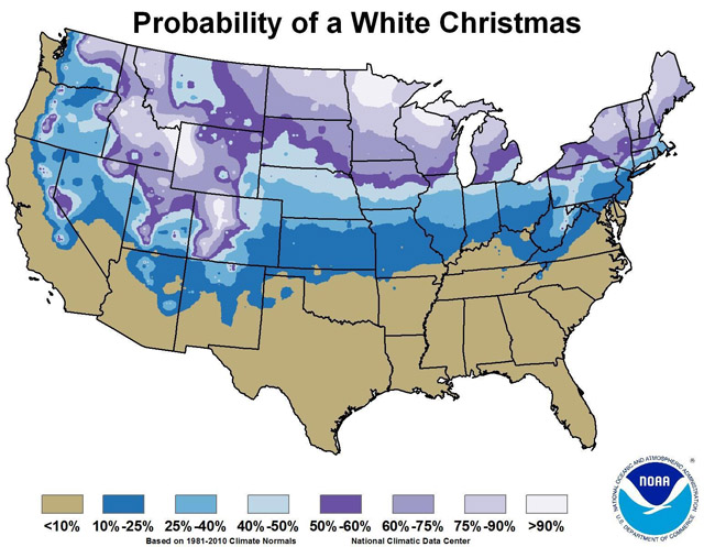
This map, put together by the National Climatic Data Center (NCDC), shows that historically there is about an 11 percent to 25 percent chance that there will be at least an inch of snow on the ground on Dec. 25.
Specifically, there’s a 15 percent chance of that scenario for most of the WTOP listening area — unfortunately. The data map above is based on the historic probabilities measured throughout the last three decades — 1981/2010.
NCDC says, “This data set contains daily and monthly normal of temperatures, precipitation, snowfall, heating and cooling degree days, frost/freeze dates and growing degree days calculated from observations at approximately 9,800 station operated by NOAA’s National Weather Service.”
Our local National Weather Service Office has done some incredible research in this category, finding that since 1888 there were only 19 occurrences with measurable snow on the ground already from a previous snowstorm or measurable snow fell on Christmas Day. That on average is about once every six or seven years or 15 percent.
“So you are telling me there is a chance!”
But precipitation (not necessarily snow) is easier to come by in the Greater Washington and Baltimore areas on Christmas Day. The National Weather Service in Sterling says that “fifty-one Christmases have had measurable precipitation. That translates to about a 36% probability of measurable precipitation, or roughly one in every three years.”
And it looks like if we see anything, it could be rain, because of how warm we’re going to be.
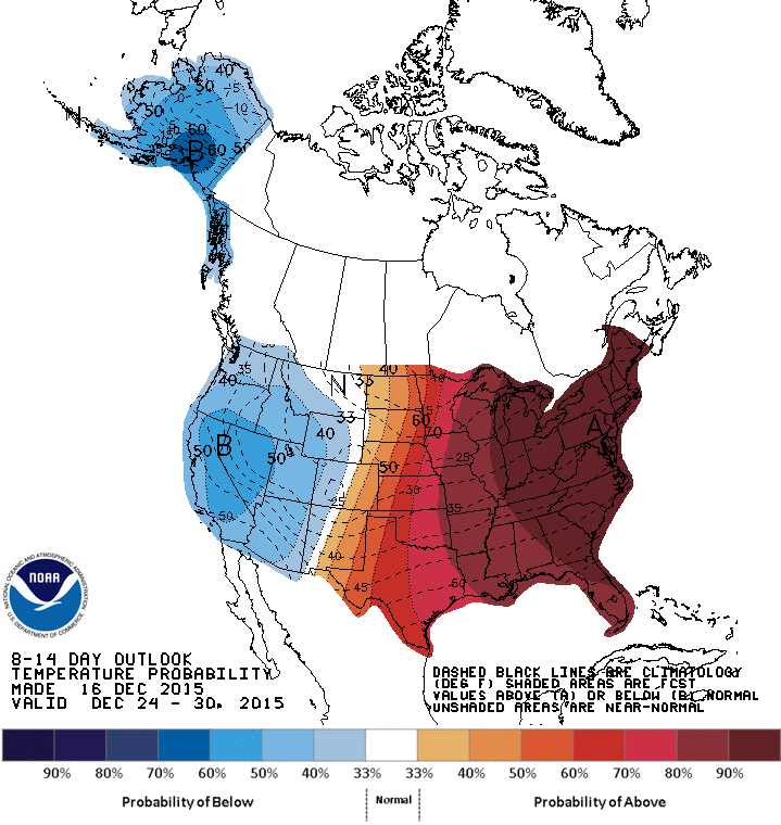
After a cold snap this weekend, temperatures will begin to rebound as high pressure that is building to our south over the weekend begins to drift offshore. This means southerly winds will once again bring in warm air for an extended amount of time — through the week of Christmas. Temperatures will start to rise on back into the 50s by Monday, with daytime highs back in the 60s by midweek!
That means we could challenge some records once again — this time for the warmest Christmas on record:
Warmest Christmases: Washington, D.C.
- 72 degrees, 1964
- 70 degrees, 1982
- 69 degrees, 1965
- 68 degrees, 1932
- 65 degrees, 1889
Warmest Christmases: Baltimore
- 72 degrees, 1964
- 70 degrees, 1982
- 67 degrees, 1932
- 67 degrees, 1893
- 67 degrees, 1889
Since it doesn’t look like a white Christmas around the mid-Atlantic this holiday — where does one go to find snow?
It’s not looking good.
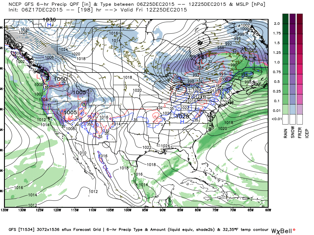
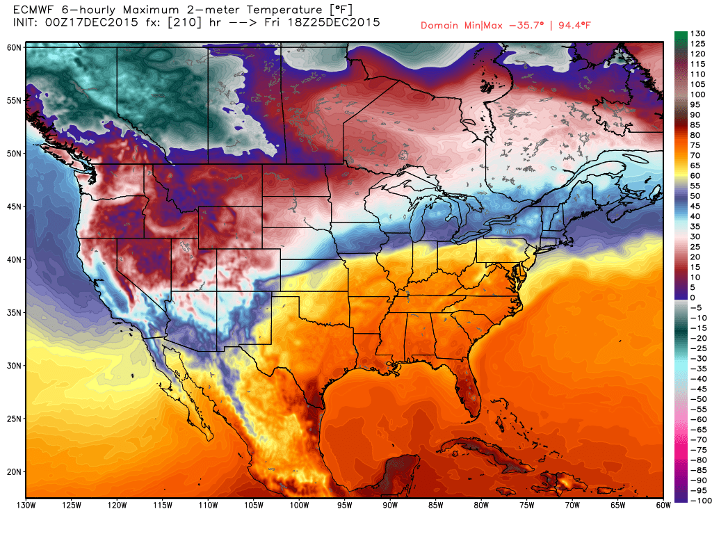
In an El Nino year, we tend to be pretty warm, which gives us less conducive conditions for snow. If you need to find snow for a white Christmas, you need to head west into the Pacific northwest and the Rockies; otherwise, you may be out of luck.
And to add insult to injury, looks like it could be pretty wet around here for traveling the week of Christmas, with clearing conditions for us by Christmas Day. Keep an eye on the forecast but plan for possibly record-breaking temperatures — a far cry from a white Christmas.