Brutal winds are plaguing the area Wednesday, causing temperatures to plummet — and it’s going to get worse overnight before it gets better.
Wind gusts up to 25 mph have been hitting the region steadily. With highs only in the upper 20s to lower 30s, wind chills have been in the teens, and it’s going to feel that way all day long.
- Listen to WTOP online and on the radio at 103.5 FM or 107.7 FM.
- Current traffic conditions
- Weather forecast
- Closings and delays
- Sign up for WTOP alerts
Those winds will settle down overnight into Thursday, and the area is expected to stay dry, but temperatures will bottom out, leaving the D.C. region in the teens and low 20s until getting to around 40 during the day Thursday.
Friday marks the first chance for wet weather.
“By Friday, rain and a wet snow are possible,” NBC Washington Meteorologist Lauryn Ricketts told WTOP. “And it’s going to mix with the rain.”
But there’s good news.
“We’re not expecting any accumulation,” Ricketts said. “Even north and west, maybe a little bit on the grass, but we’re not expecting any problems out there for your Friday.”
The possible mix should switch over to a cold rain by afternoon and temperatures will be in the 40s.
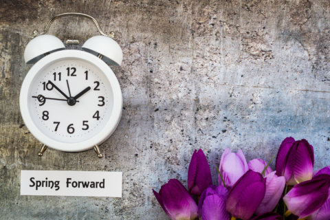
The rain blows out for Saturday, making it the best day of the weekend, with clouds but temperatures in the 50s. As Daylight Saving Time begins Sunday, so does some more rain, which will make it difficult to enjoy the seasonably warm temperatures in the 60s.
For this time of the year, normal highs are in the low 50s and normal lows are in the low 30s, making this week about 20 degrees colder than usual. It’s not likely, however, that the weather will set any records. According to the National Weather Service, record lows for both March 6 and 7 came in the late 1800s, with lows reaching 10 and 13 degrees for those days about 130 years ago.
The warmer days ahead mean the National Park Service should begin updating its cherry blossom forecast regularly. Right now, the blossoms are at Stage 1 of 6.
Forecast:
WEDNESDAY NIGHT: Clear to partly cloudy. Cold. Lows in the mid teens to lower 20s
THURSDAY: Partly sunny and not as cold. Highs in the upper 30s to lower 40s
FRIDAY: A chance of rain…rain may be mixed with wet snow in the morning. Highs in the upper 30s to lower 40s
SATURDAY: Mostly cloudy and warmer. Highs around 50
SUNDAY: Morning rain, then clearing and breezy. Highs in the mid 60s