

WASHINGTON — National Trails Day falls on the first Saturday of June every year, bringing together hikers, bikers and climbers to some of the best trails across the country. The greater D.C. region is surrounded by miles of trails, from well-traveled paths through local parks to hidden gems that cross state lines.
Click through the gallery for paths to hike on National Trails Day.
Washington, D.C. 20007
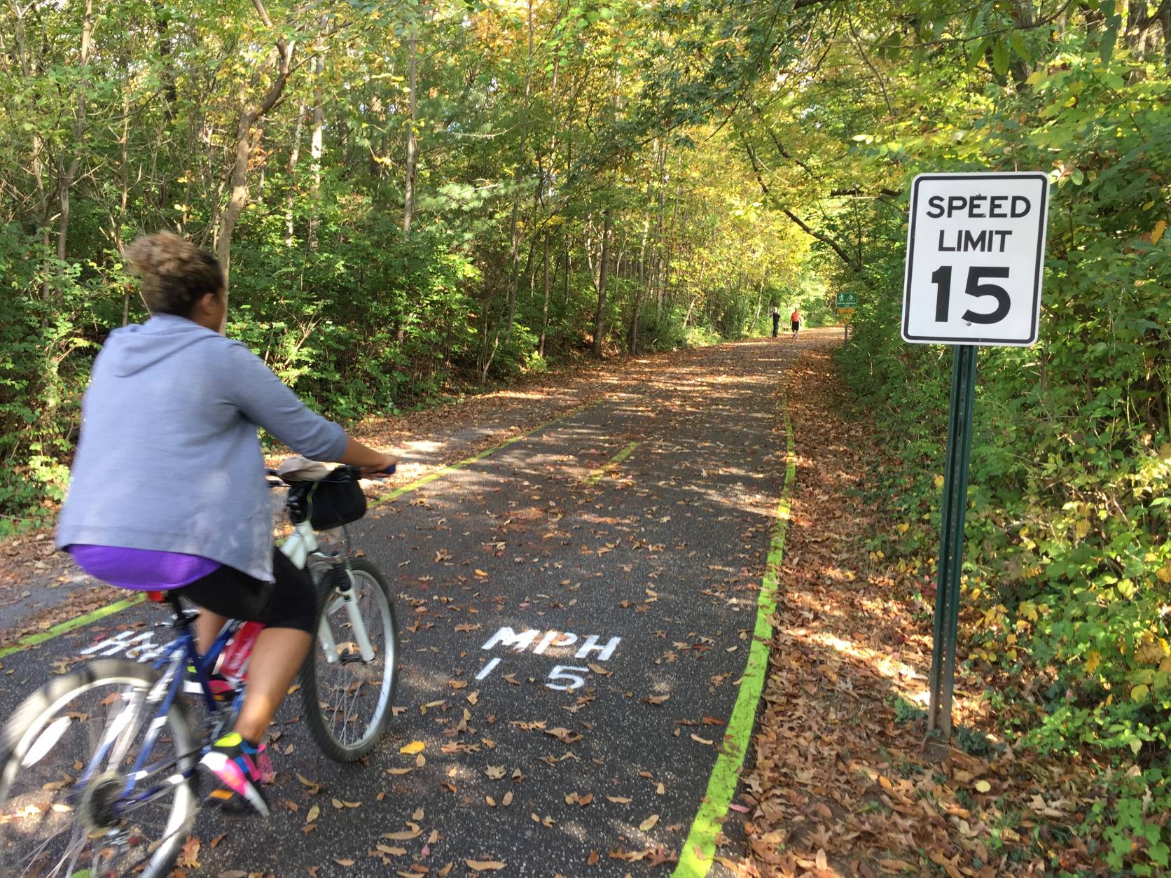
between Francis Scott Key Bridge and Key Bridge The Capital Crescent Trail’s claim to fame is being one of the most popular trails in the United States. Stretching from Georgetown in D.C. to Silver Spring, Maryland, the off-road trail passes through seven bridges and two tunnels, crossing several major roadways. If you don’t consider yourself an avid hiker, this packed trail is also suitable for bikers, roller bladers and runners. Find more information on the Capital Crescent Trail website. (WTOP/Kristi King)
WTOP/Kristi King

Washington, D.C. 20015 As part of the U.S. National Park System, Rock Creek Park manages more than 1700 acres throughout Northwest and Northeast D.C. Key sites include Dumbarton Oaks Park, Meridian Hill Park, Old Stone House and Fort Stevens, to name a few. Hike one of the two main trails that run north-south through the park — the Western Ridge Trail or the Valley Trail — or any of the connector trails that run east-west through the park. Find more information on the National Park Service website. (AP Photo/Jacquelyn Martin)
AP Photo/Jacquelyn Martin

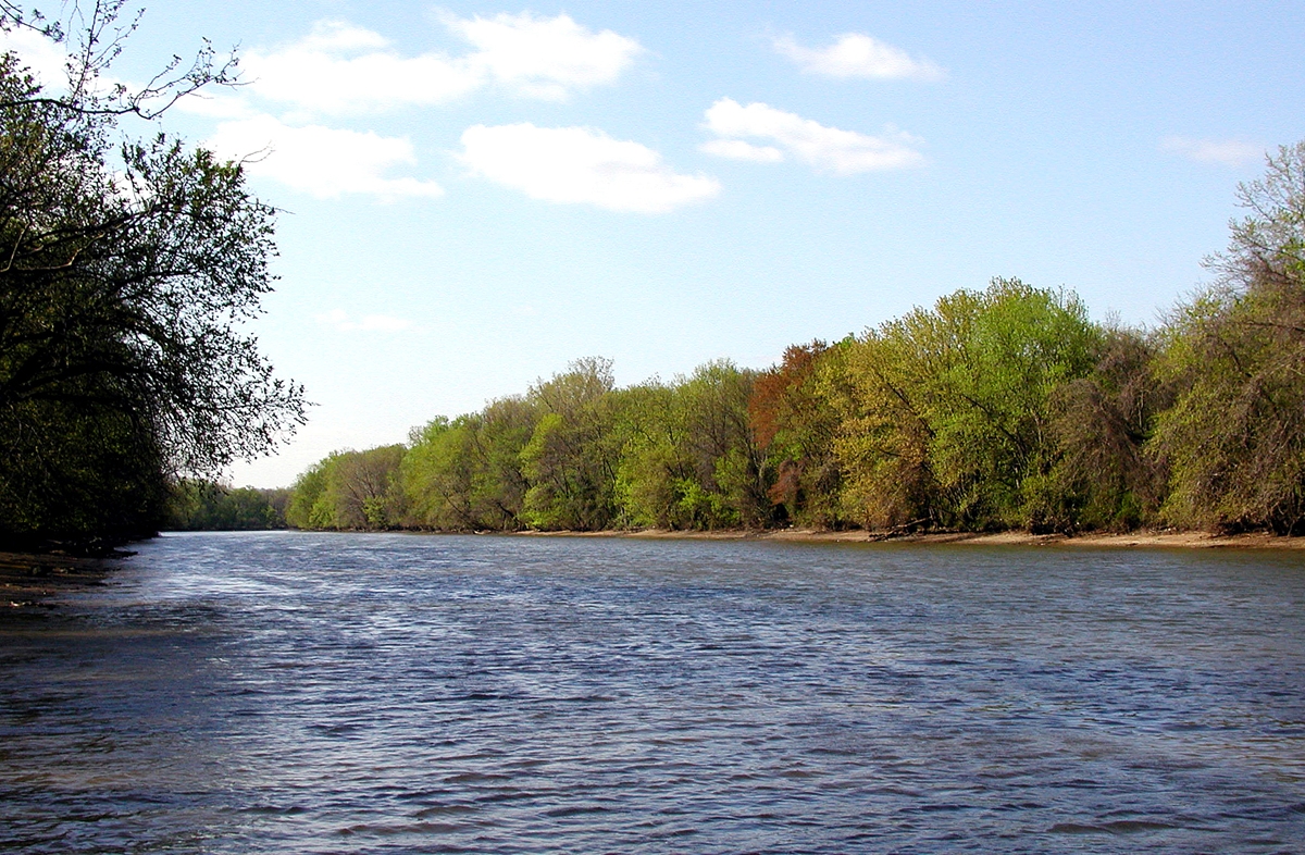
Hagerstown, Md. 21740 More commonly known as the C & O Canal Towpath, this 184.5-mile trail extends from D.C. to West Virginia to Cumberland, Maryland. The canal, located along the north bank of the Potomac River, became a National Historic Park in 1971. It’s a fan favorite among local hikers, joggers and bicyclists, both for its wealth of stunning scenery and treasure trove of historical and recreational sites nearby. Don’t miss the Billy Goat Trail, one of the most beloved but challenging hikes within the C & O Canal Historic Park. The C & O Canal Trail is open all 365 days of the year from sunrise to sunset, weather permitting. Find more information on the National Park Service website. (AP Photo/Gerald Herbert)
AP Photo/Gerald Herbert

northbound lanes between Roosevelt Bridge and Key Bridge
Arlington, Va. 22209 The island and national memorial is located in the Potomac River, a gift to the American people by the Theodore Roosevelt Association in memory of the former president. The carefully designed landscape is accessible by a footbridge from Arlington, Virginia. With no cars or bikes permitted on the island, hikers have miles of trails through uplands, swamps and forests all to themselves. The island is open to the public all year round from 6 a.m. to 10 p.m. Find more information on the National Parks website. (WTOP/Dave Dildine)
WTOP/Dave Dildine
Washington, D.C. 20002 Kingman Island is best known for its Bluegrass and Folk Festival, an annual event meant to raise awareness for one of D.C.’s last natural preserves. But the island, which sits just off the Anacostia Riverwalk Trail, is an easily accessible day hike destination. Take Metro Blue or Orange lines to Stadium-Armory, and hop on a shuttle bus to explore the marshy landscape. In addition to hiking, visitors can enjoy biking, fishing, boating and birding on the island. Find out more on the Kingman and Heritage Islands Park website. (Courtesy Anacostia Watershed)
Courtesy Anacostia Watershed

Triangle, Va. 22172 Located a little over 30 miles from D.C., Prince William Forest Park offers one of Northern Virginia’s most extensive trail networks. Often overlooked as a hiking destination, the park is a 15,000-acre refuge with around 37 miles of trails. As you hike within the park, discover little-known facts about the area, such as the fact that it was used as a spy training facility during World War II, or that a pyrite mine was in operation near the Cabin Pyrite Mine Trail between the 1880s to 1920s. The park is open daily from sunrise to sunset. Find more information on the National Park Service website. (AP/J. Scott Applewhite)
AP/J. Scott Applewhite
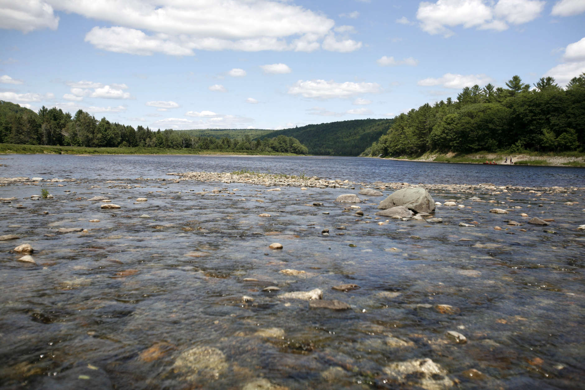
Maryland 21797 Almost 40 miles of the Appalachian Trail is in Maryland, with the rest of the 2,000-plus miles spanning across several states from Georgia to Maine. While hiking the entire length of the trail can take anywhere between four months to six years, visitors can also opt for short day hikes or overnight backpacking trips. Find more information on the Maryland Department of Natural Resources website or on the National Park Service website. (AP/Pat Wellenbach)
AP/Pat Wellenbach


Below is a map of the best hiking trails in the area.